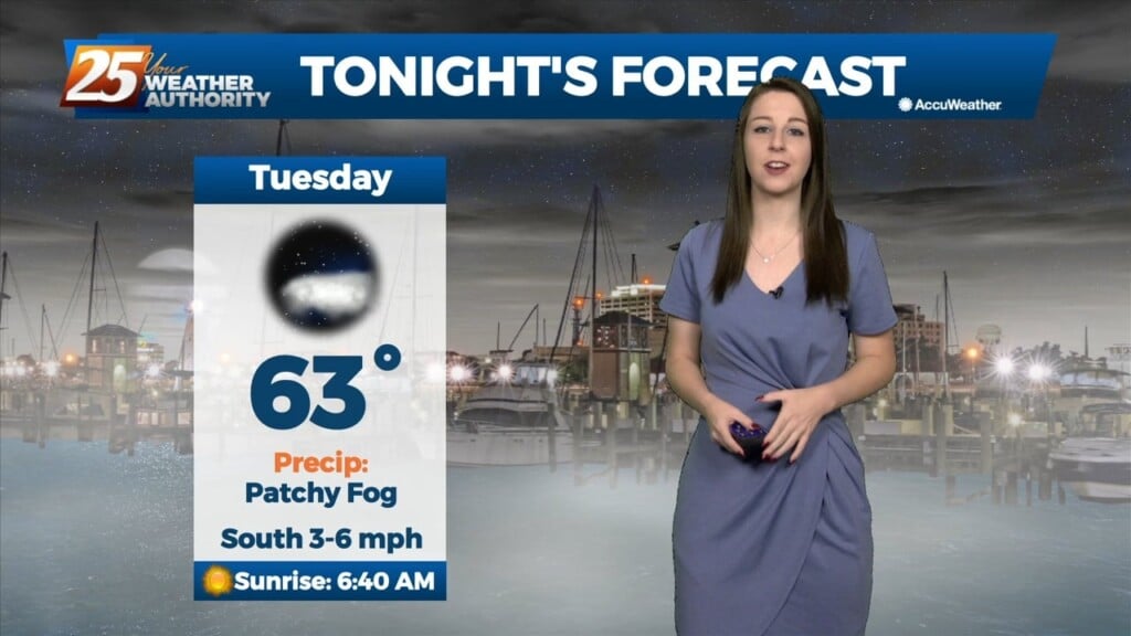
12/6 - Brittany's "Pleasant" Tuesday Night Forecast
Tonight will be yet another mild and cool night with the above seasonal norm temperatures sticking around. Heading into tomorrow, it'll be another quiet but rather warm day as…
Tonight will be yet another mild and cool night with the above seasonal norm temperatures sticking around. Heading into tomorrow, it'll be another quiet but rather warm day as…
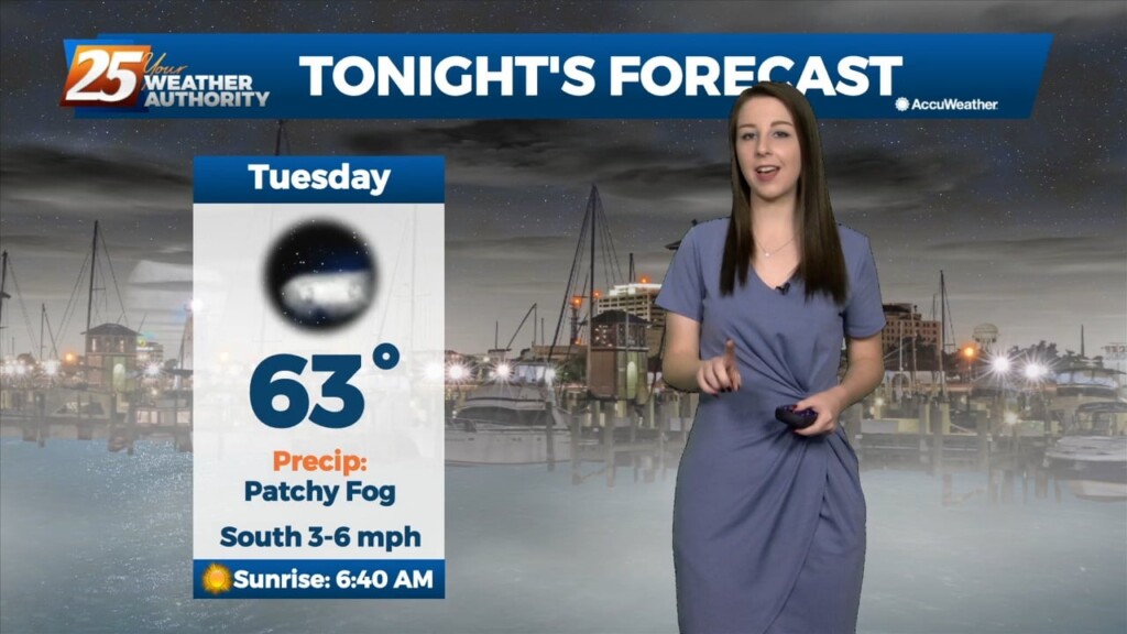
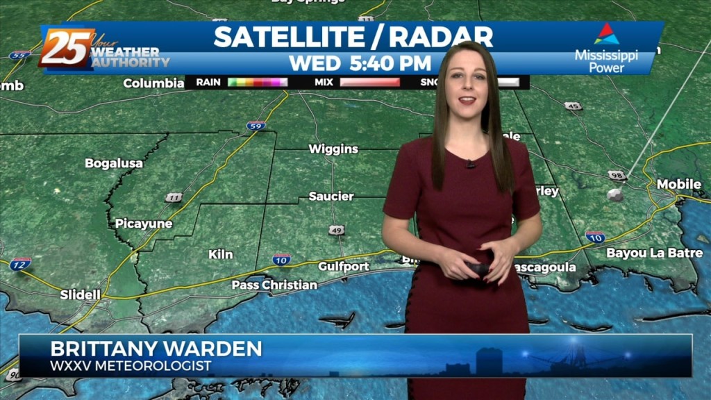
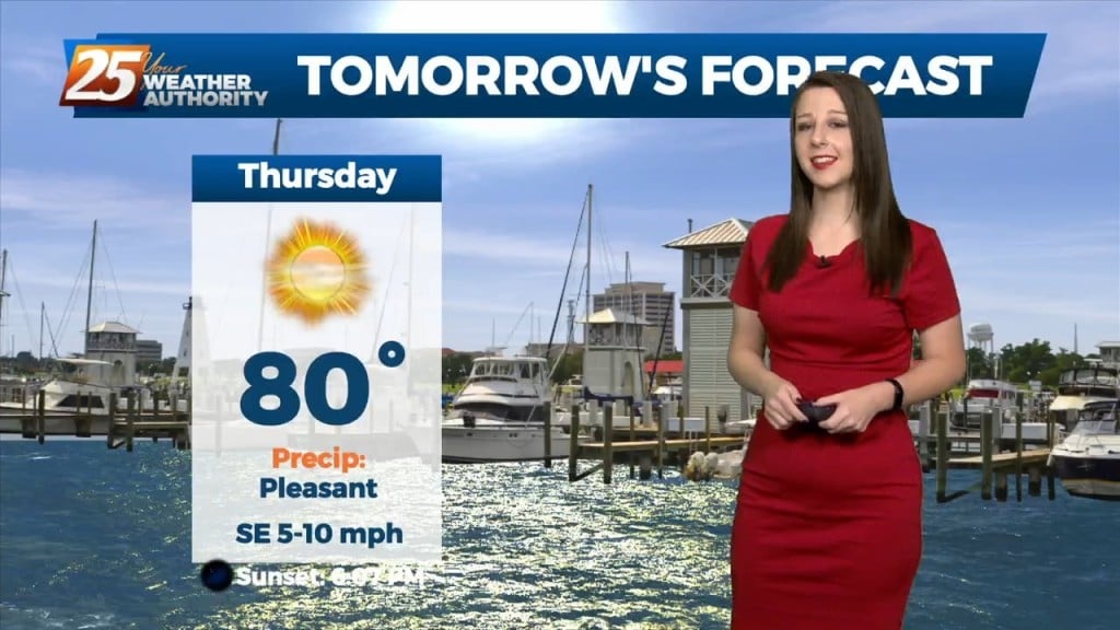
Tonight will be mild and cool while Wednesday promises to be another quiet but rather warm day as highs peak into the low 80`s for some with partly cloudy…
For the short term, like the last few days the primary forecast issue is fog potential tonight. We'll be under a DENSE FOG ADVISORY tonight, beginning at 10pm,…
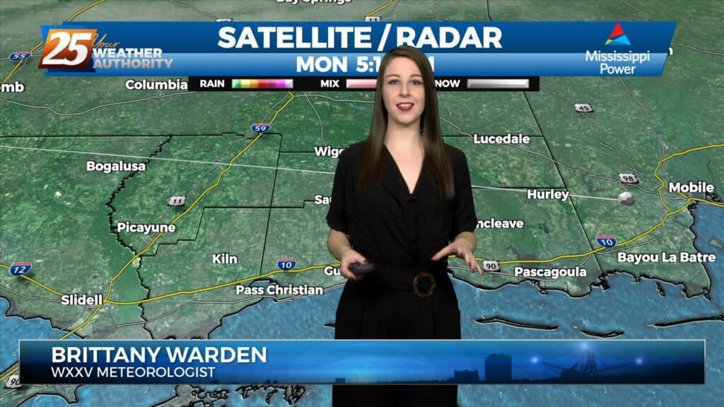
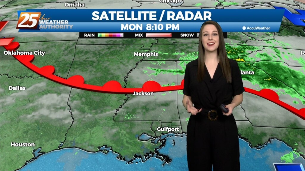
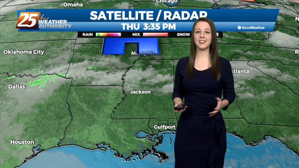
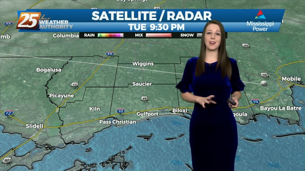
Low clouds and even some haze/light fog has been impacting the region outside of the light rain. The warm front retreated quickly and even by this morning…
Surface ridge continues to build in from the north while sliding east across the Ohio River Valley. This has kept temperatures on the cool side. This will…
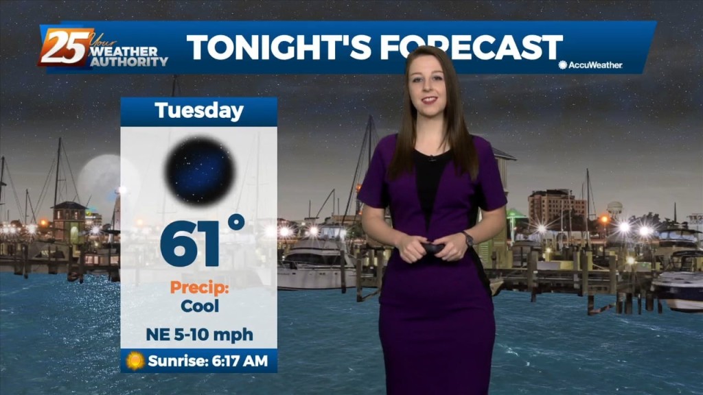
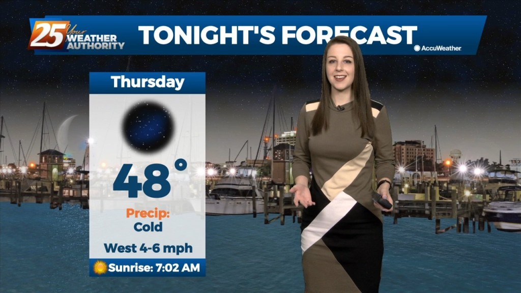
We're on tap for a clear and COLD night. Temperatures will drop down to the upper 30's tonight but given the breezy conditions we'll see, the 30's will…
The cold front that moved through the CWA early this morning is now well south and moving into the central Gulf of Mexico. Clear skies have developed…
Pleasant weather with seasonable temperatures have been observed throughout the day today on the backside of a shortwave trough lifting into mid-atlantic CONUS as height rises and stable air…
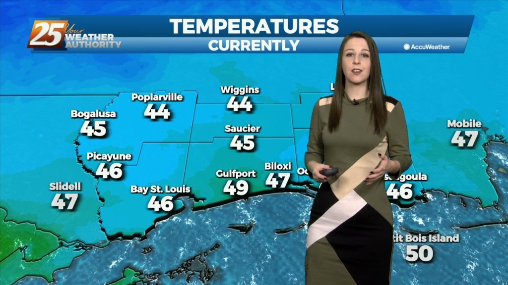
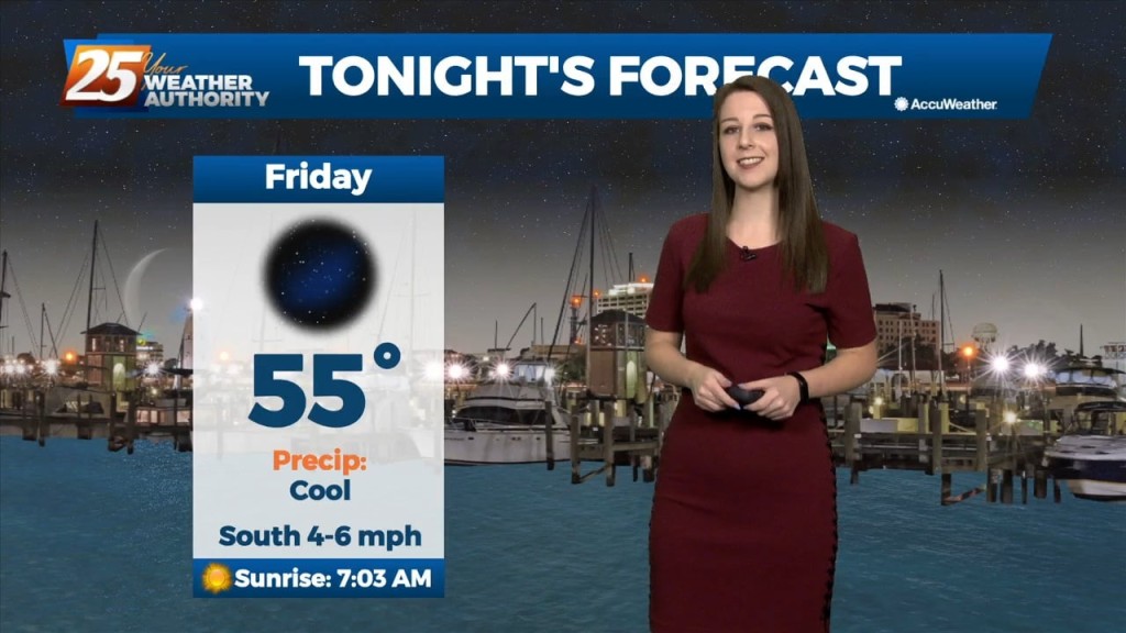
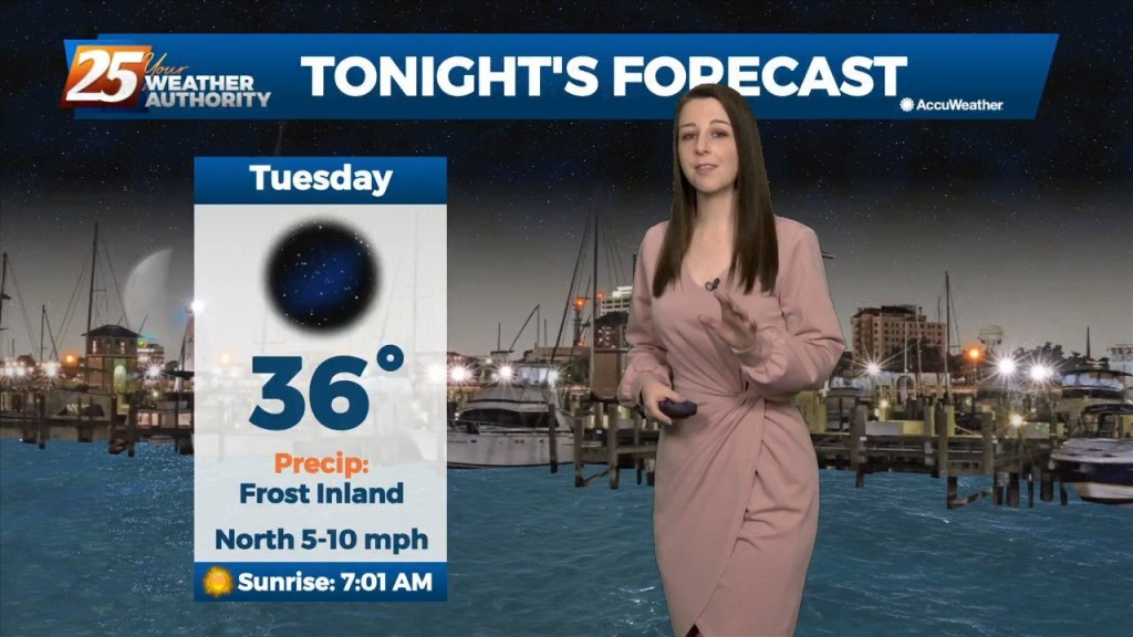
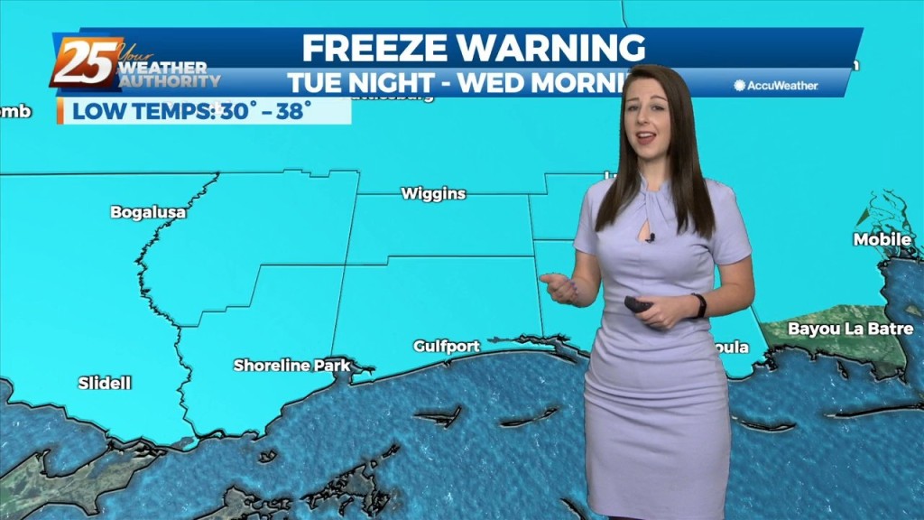
TONIGHT: Harrison & Jackson counties will be under a FREEZE WARNING beginning at 10pm, lasting through 8am. Temperatures could drop as low as 28 degrees. Pearl River &…
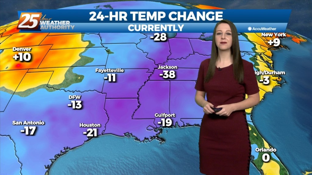
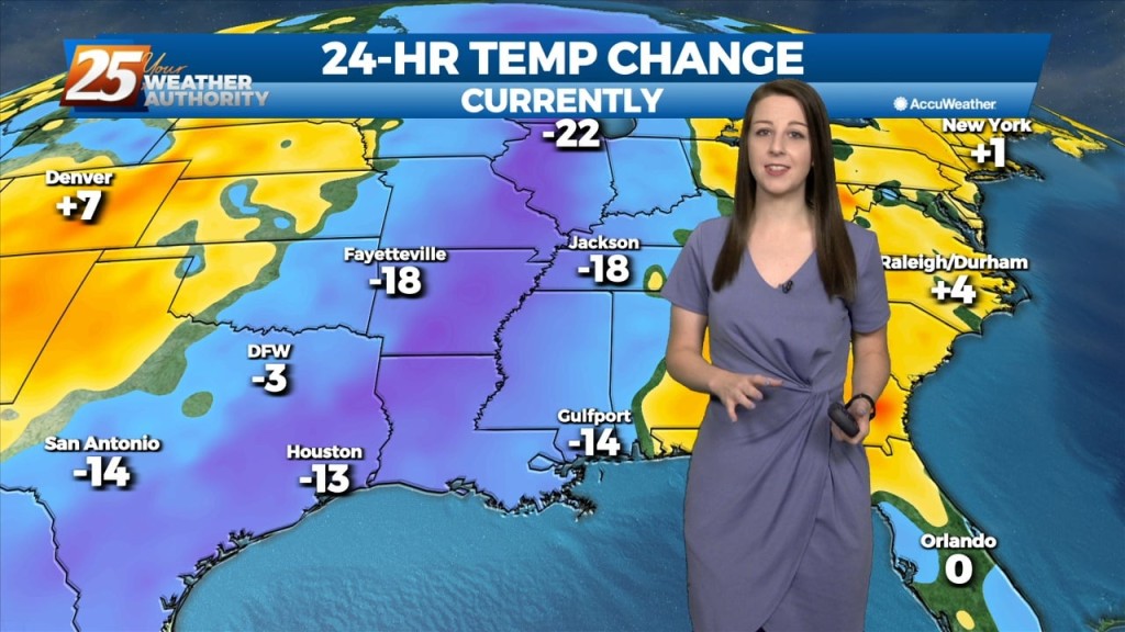
High pressure will continue to build into the region and usher in quite cold air for this time of year. High/low temperatures will be 15+ degrees below normal,…
Throughout the rest of the workweek we can expect strong high pressure to be one of the main factors shaping our forecast. It's going to usher in a…
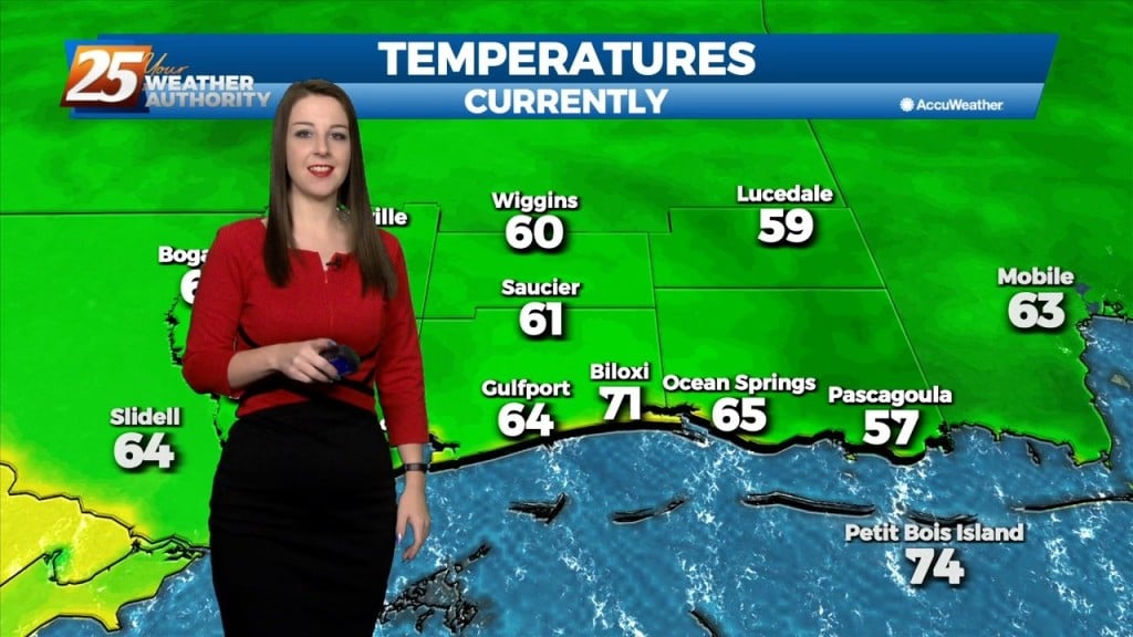
Cooler temperatures are finally ahead! Tonight, they'll bottom out more so toward the low 60's as opposed to last nights upper 60's. Beginning tomorrow, throughout the rest…
We're on tap for a clear, cool, and muggy night. Tomorrow, we'll have rain free and sunny conditions yet again with warm temperatures. Subtle changes will begin on Friday…
We've officially reached the peak of spooky season and we couldn't have asked for a better Halloween evening forecast. We'll have clear skies tonight with temperatures dropping down…
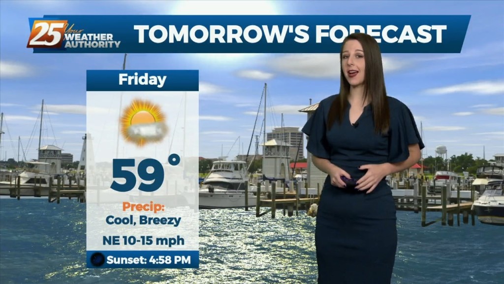
Changes area ahead as we get ready to close out this workweek. Basically one weather event for the long term forecast period, and that will be Friday…
The upper flow is expected to remain zonal across the area today and tonight before the Pacific Coast disturbance reaches the southern Rockies tomorrow. This will cause the upper…
The front is now east of the area and skies are clear. Dry weather is on-tap for tonight and Wednesday with cooler temperatures. Wednesday night and Thursday…
The clear and cool conditions will continue this weekend with morning lows in the 50s and 60s and high temperatures in the low 80s. Low-level moisture is…
Mid-upper level ridging coupled with surface high pressure will provide stellar fall conditions across the area this weekend with clear conditions, morning lows in the 50s and 60s and…
As the colder airmass continues to slide east, an upper level high pressure will move in behind it. Temperatures will continue to moderate today as high temperatures…
As the deep longwave trough situated over the eastern CONUS this week finally lifts out it will be replaced by a shortwave mid-upper ridge on Friday before flow…
This evening will be cold, breezy, and dry as a colder, drier airmass dominates the region. Temperatures will plummet after sunset and fall below 40 degrees shortly after…
As of this evening, the cold front has officially passed through our area with breezy conditions in store for the remainder of the evening. Temperatures will quickly…
A departing surface high and an increased onshore flow regime will be the primary drivers of the weather forecast through Saturday night. As southeasterly flow increases tonight…