6/12 - The Chief's "Low-End Severe Potential" Monday Afternoon Forecast
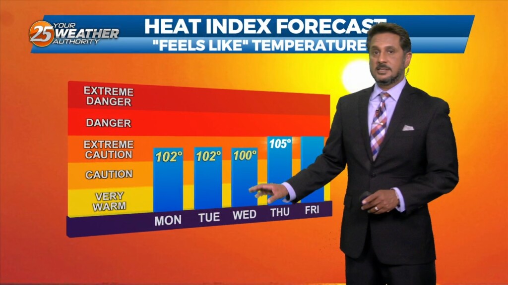
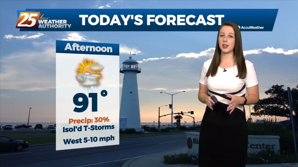
Very HOT temperatures ahead this afternoon as the HEAT INDEX will top the 100 degree mark. A stationary front coupled with daytime heating will pop afternoon showers/t-storm.…
Very HOT temperatures ahead this afternoon as the HEAT INDEX will top the 100 degree mark. A stationary front coupled with daytime heating will pop afternoon showers/t-storm.…
Hot temperatures heading into this afternoon with even higher heat indices values expected to max out closer to 100 degrees. High pressure across the…
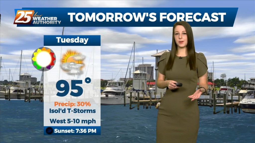
The main focus of the short term forecast will be the warmer temperatures heading into Tuesday and likely again Wednesday. It has been a while since we`ve…
A broad upper level high-pressure remains centered near New Mexico and extends from Mexico to Canada and the Pacific Ocean to the MS River Valley. A…
High pressure will dominate the upper level pattern today through Saturday morning. Southerly surface winds will help to advect moisture and warm air into the environment.…
Upper ridging forecast to drift slowly westward over the next few days to be centered over Kansas/Oklahoma by Friday. Main forecast question is whether ridging is far enough…
An upper level ridge that is centered over Texas and spreads across the Gulf Coast will continue to dominate the forecast over the next couple days. This…
This afternoon, high-pressure NE will easily support max temperatures around 90 degrees, with isolated locations approaching mid-90 with the heat index. Low-pressure currently in the western Atlantic will approach…
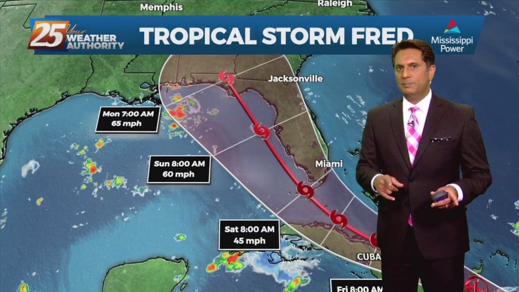
Fred has been downgraded to a tropical depression drifting north-northeast through western Georgia. Meanwhile along the northern Gulf coast, we remain parked underneath light westerly flow aloft upstream from the western section of departing TS Fred. Winds from the southwest…
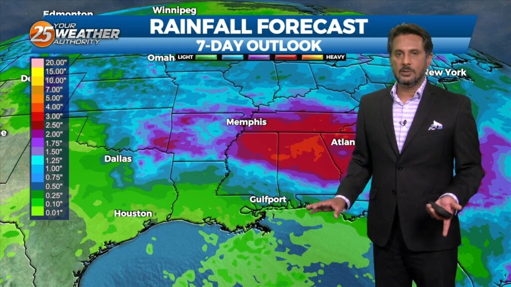
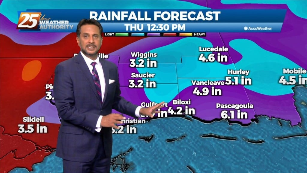
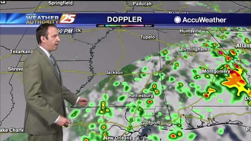
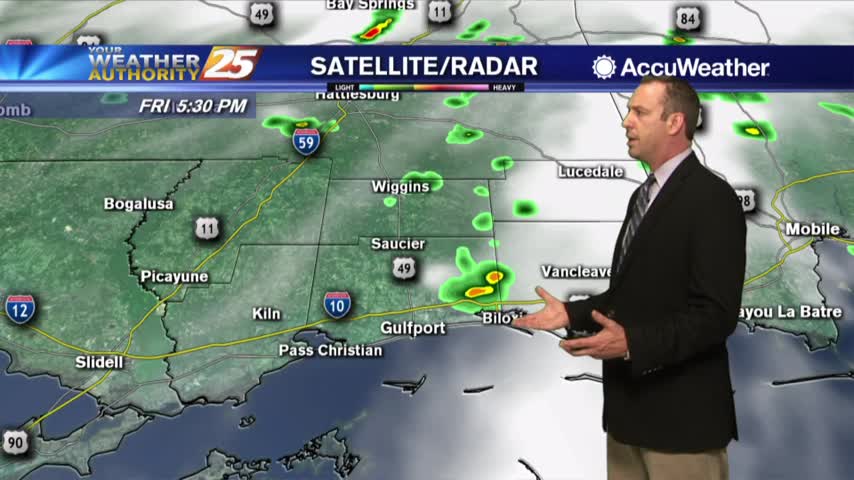
Another day of afternoon shower and thunderstorm activity is on tap with precipitation chances a good deal higher overall than they were yesterday, mainly during the peak heating of the afternoon hours. The main concern with the rainfall today will…
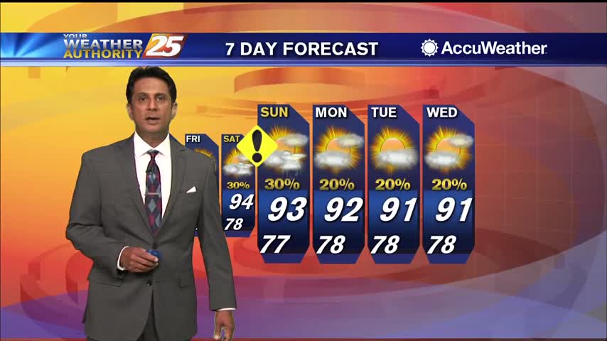
Summertime pattern continues over the next few days. An isolated shower will be possible this afternoon, with isolated to scattered Saturday and Sunday during the daytime afternoon and evening hours. These showers could have gusty winds and frequent lightning along…
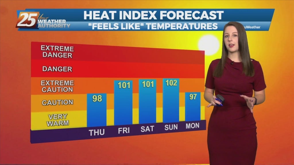
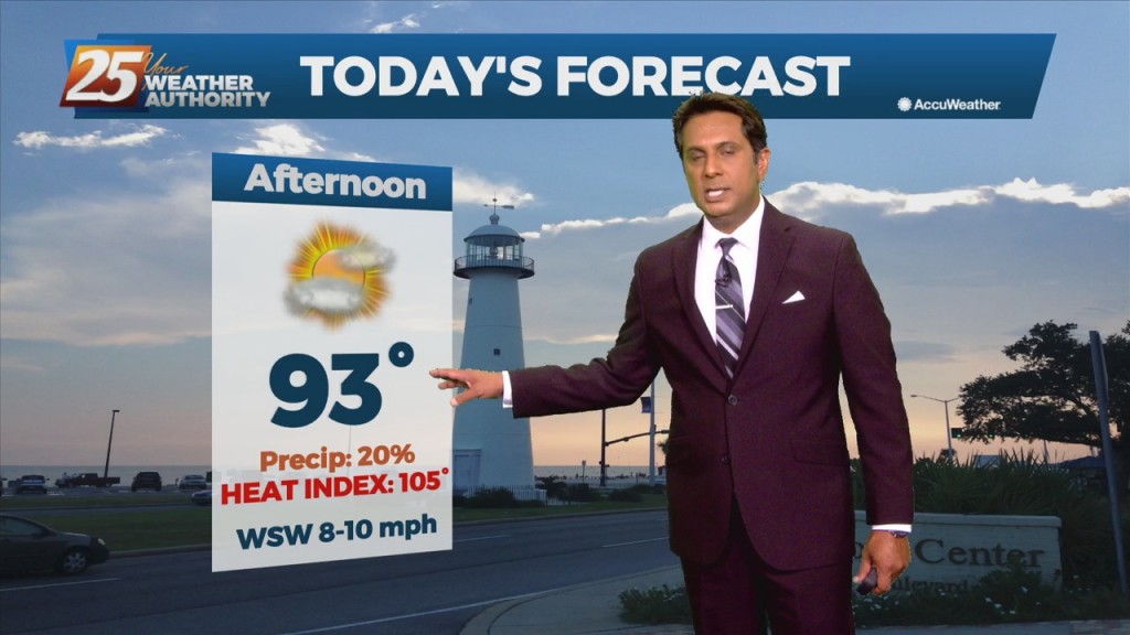
Didn't see much rain today, but that led to some sweltering conditions with heat indices near 105! That sadly is "the rub" when it comes to our weather.…
A much drier trend is already beginning to take hold with less than 20% coverage for showers/t-storms. The upper level weakness continues to hold over the mid-Atlantic and northeast with upper level high-pressure in place over the nation's mid-section. Our…
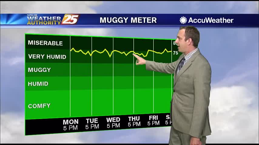
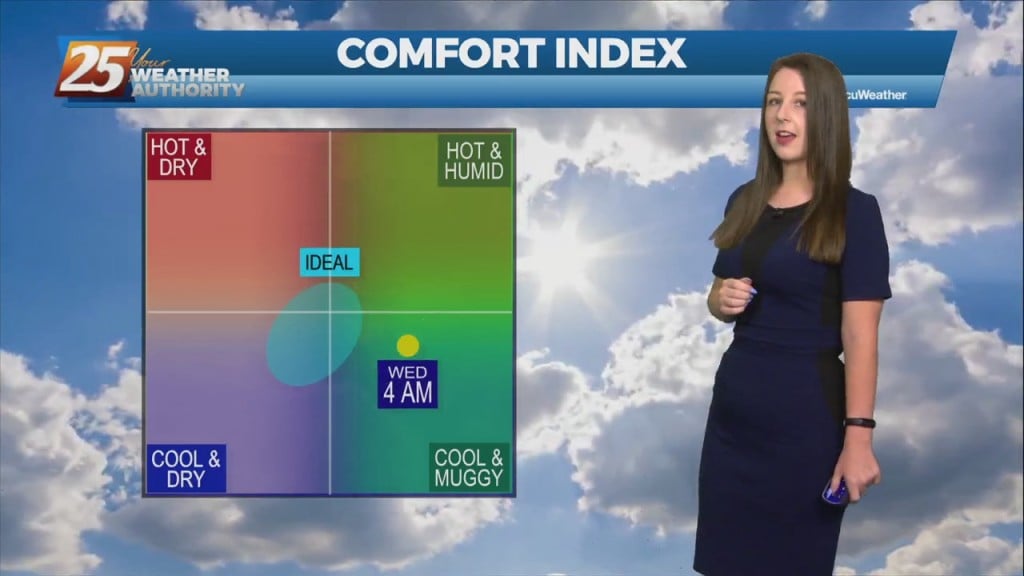
The high humidity has returned after a little bit of a break last week, so expect to be getting right back to some uncomfortably hot and humid weather.
Another muggy start to the day with just a few clouds overhead...
Scattered showers continue in South MS, but these wet, hot, and muggy days are almost over.
A rain-free start to the day with warm and humid conditions heading out the door...
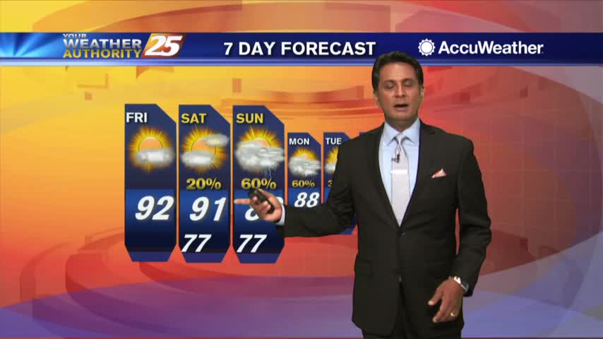
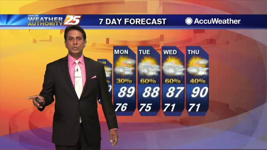
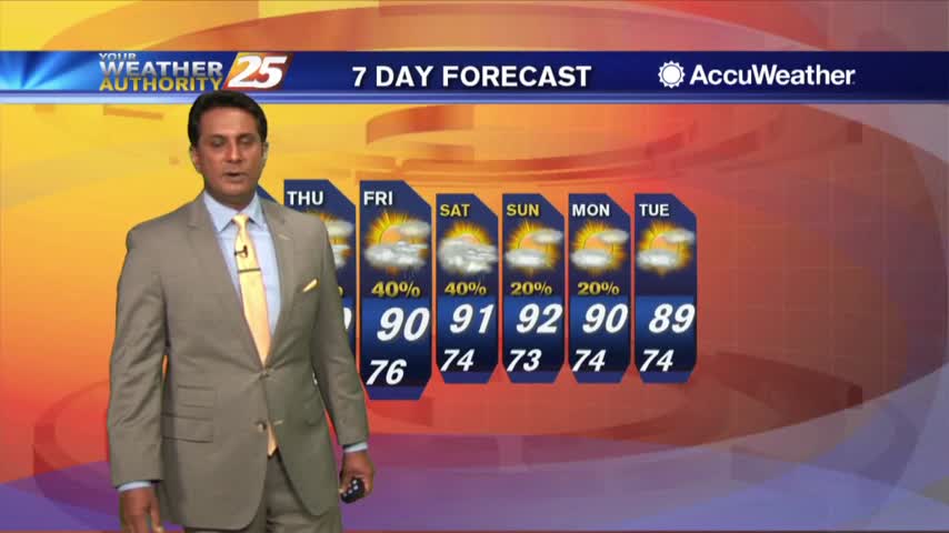
Expect a slight increase in rain chances through the weekend, but not much else changes...
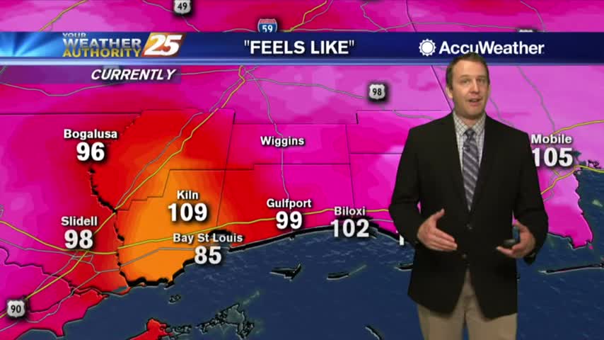
As temperatures continue to warm, the HEAT INDEX will be pushing 110 degrees through this evening...
A warm start with upper-level clouds moving across the area from east to west...
It was scorching hot in South MS today, nearly to Heat Advisory levels, and I believe even hotter days are ahead....
A very warm start to the day with a few upper-level clouds moving in from the west...
After a warm and humid start under cloudy skies, the sun is beginning to shine through...
A warm/humid start with light patchy fog along the coastal areas...