08/30 Ryan's "Active Weather" Wednesday Forecast
We expect more showers and thunderstorms through the night, but the end of Harvey is in sight. Click the forecast link for more details.
We expect more showers and thunderstorms through the night, but the end of Harvey is in sight. Click the forecast link for more details.

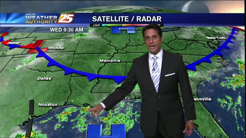
Rain overnight has continued this morning as TS Harvey has make landfall yet again in extreme SW Louisiana...
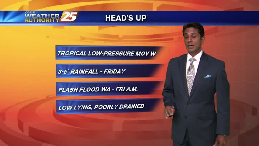
The stationary front from the south has moved into the area as a warm front with widespread rain through the region...
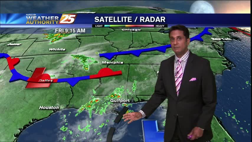
A DRIER start to the day but similar to yesterday, activity will develop and move across the viewing area from west to east...
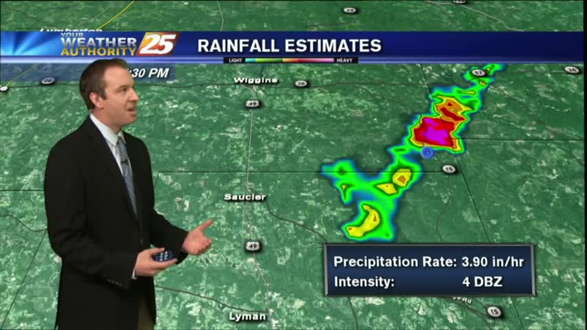
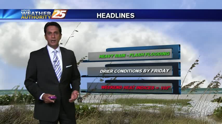
Rain was expected to begin the week, but we saw some ridiculously high rainfall totals from this afternoon's thunderstorms. Drier air moves in soon, watch the forecast for details.
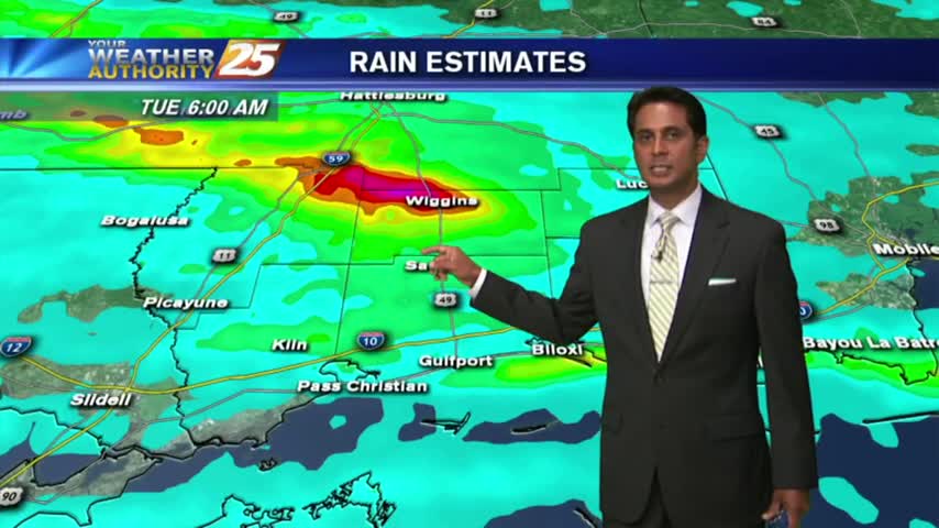
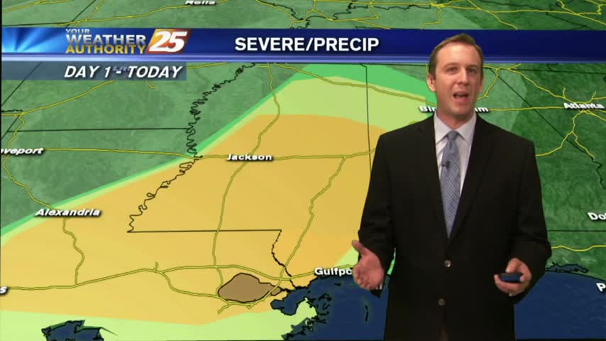
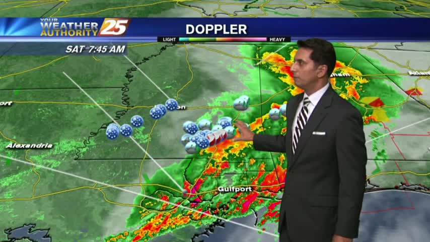
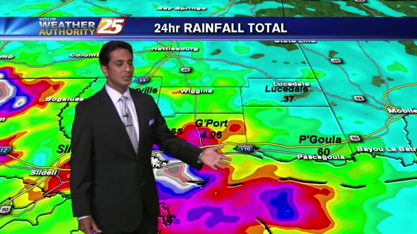
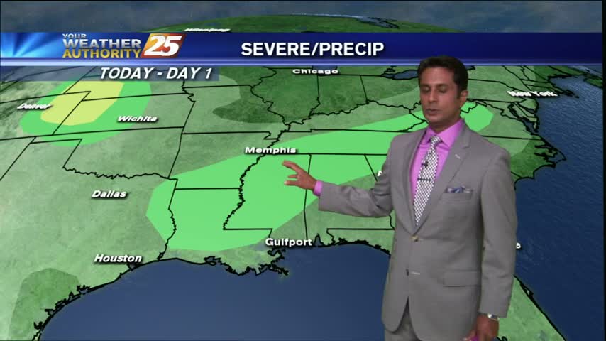
HEAVY RAINFALL has been in the area since last night...and will continue though tonight as a FLASH FLOOD watch continues...

A gray/gloomy start to the day as an area of low-pressure west of Lake Pontchartrain is bringing HEAVY RAIN into the area...
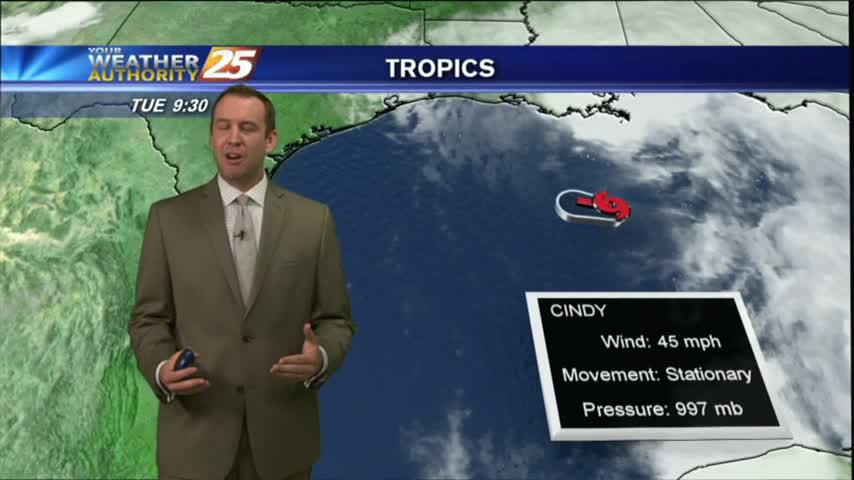
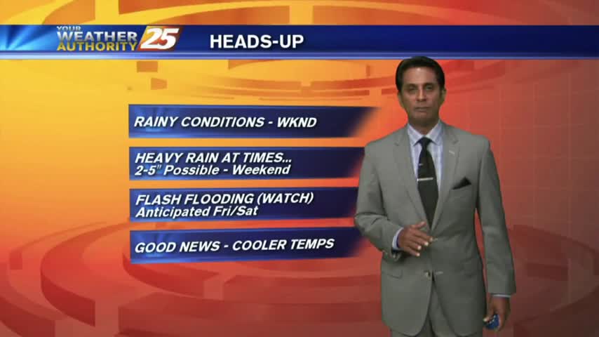
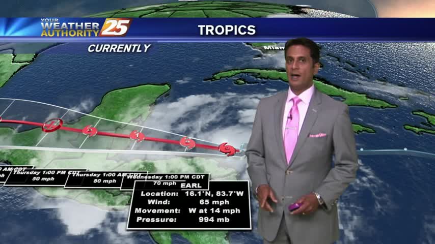
Tropical storm Cindy officially formed this afternoon and continues to pummel South MS with rain. Don't expect that to change for quite some time, meaning flooding woes will begin to arise. Watch the full forecast for more.
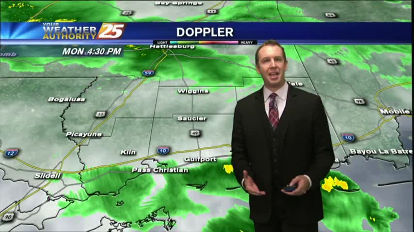
The clouds moved in early today and winds have been increasing throughout. Severe storms expected to inch into the area overnight, so be ready for a rough Monday morning. Click the forecast link for more information.
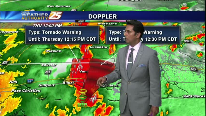
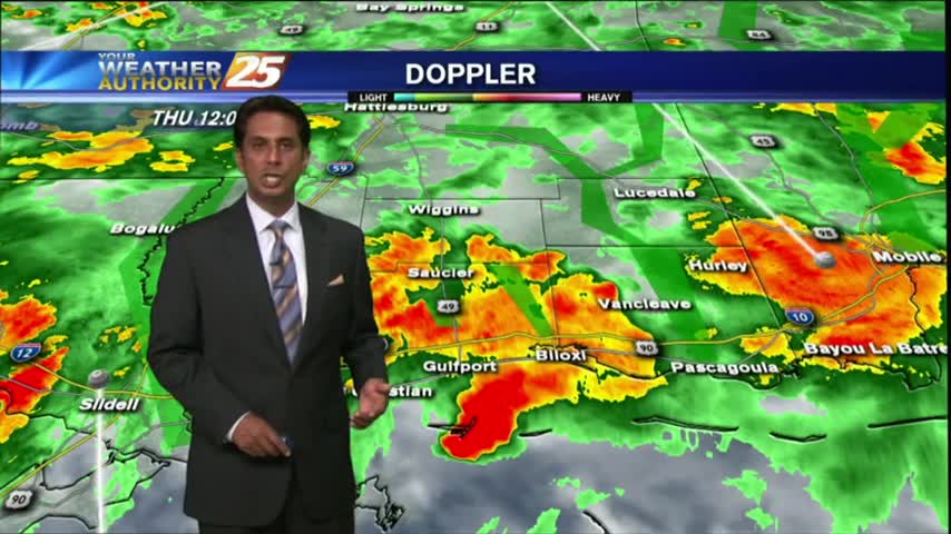
SEVERE WEATHER continues to move across the Southern 6...
After BUMPY weather early this morning, a lull in the activity will occur through this evening before flaring back up...

Dense fog is in the area with isolated showers and t-storms which continue from last night...

A line of INTENSE t-storms associated with a slow moving cold front will affect the viewing area this morning...

Showers have been in the area since prior to sunrise, daytime heating now developing them into T-Storms...
Round 2 has begun with HEAVY RAIN already in the area. Coupled with areas of patchy FOG...visibility is greatly reduced.
After a good bit of rainfall yesterday, isolated moderate/heavy rainfall is already in the area...
A dry and mild start this morning before the potential for HEAVY RAIN moves in this afternoon...
After a batch of t-storms with heavy rain overnight, isolated activity continues this morning...
Showers and thunderstorms have developed north of the coast and are pushing south...

Partly cloudy skies this morning with slight cooler temps from showers and t-storms overnight...

Another rain-free start but the activity is beginning to build, so expect early morning showers and then t-storms...
The tropical air mass continues...this morning the activity in over the sound, moving north towards the coastline...
With a few breaks in the clouds, warming temps will begin building t-storms capable of producing heavy rain...
After a WET morning with showers/t-storms moving across the area, the activity has decreased but will continue...