2/5 - Rob's "SEVERE THREAT" Midday Forecast
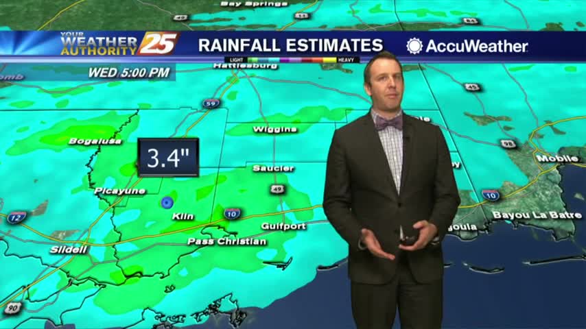
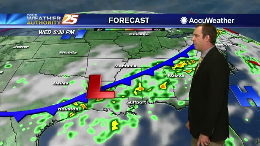
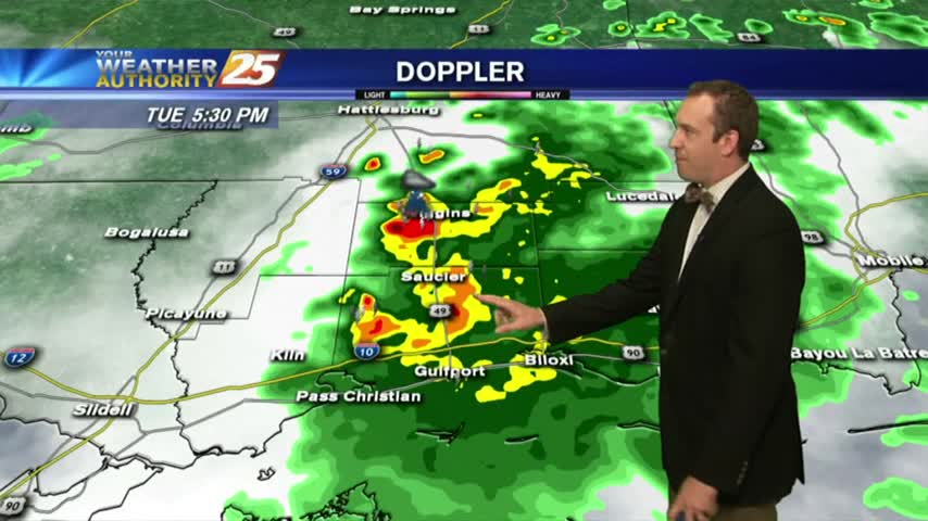
Moderate to heavy rain is moving across south Mississippi with t-storms and frequent lightning...

Moderate to heavy rain is moving across south Mississippi with t-storms and frequent lightning...
The disturbed weather continues through the night, but we'll finally see some clearing just in time for Halloween night....
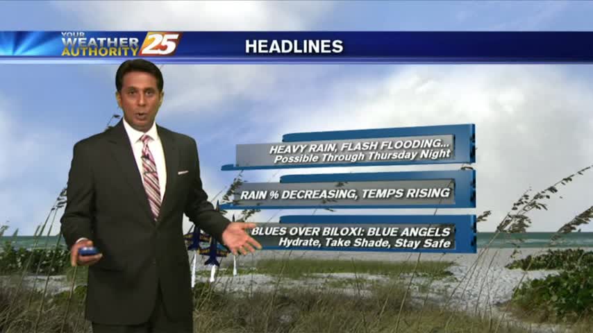
Scattered showers will continue moving onshore in South Mississippi on and off through the afternoon. High pressure near the Bahamas is steering a very weak tropical wave in the Gulf of Mexico north towards the Gulf Coast. This tropical wave…
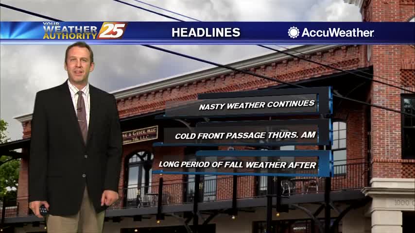
Our perfect weather is finally changing, and sadly not for the better.

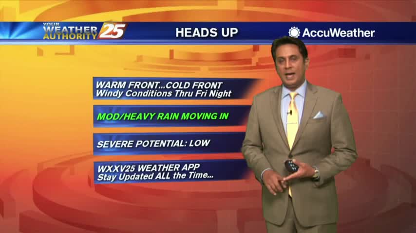
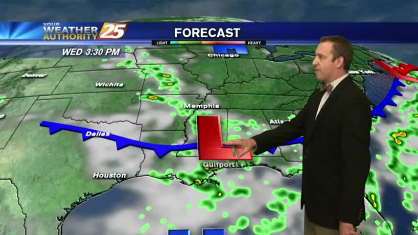
A warm & windy start to the day as the system west continues to move east and develop...
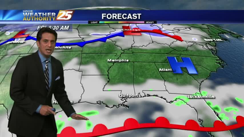
A few thunderstorms moved through the area earlier in the evening, but even more are expected over the weekend....

Yesterday's light rain has become showers, but potentially severe thunderstorms move in tomorrow....
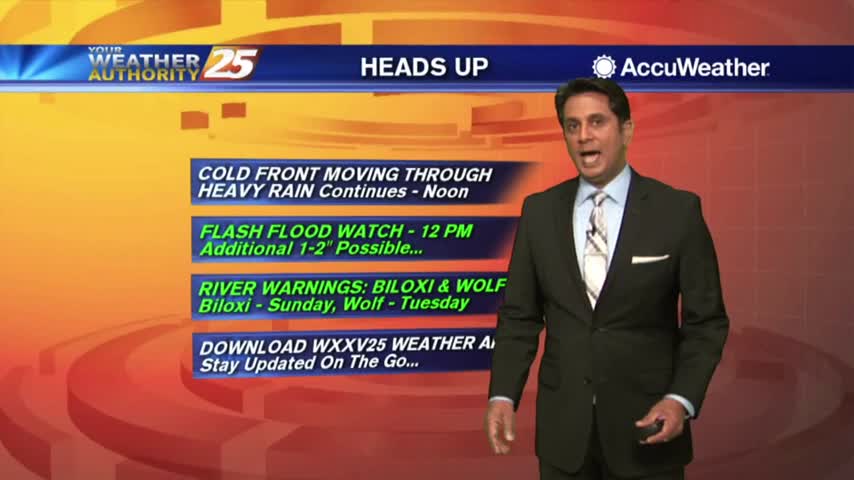
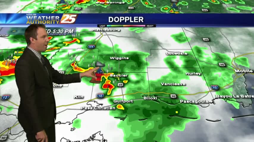
A VERY WET start to the day as HEAVY RAINFALL continues to move across the viewing area...
After a cloudy morning with light rain, the heavier activity is beginning to move in from our SW...

A warm/humid air mass is affecting the viewing area in advance of a low-pressure which will move in Saturday...
The rain continues as expected but there is an end in sight, and it'll bring some potentially frosty temperatures with it....

HEAVY RAIN is moving into south Mississippi from the SW...
The showers and thunderstorms will continue through the night, and while we'll see more tomorrow drier days are in sight....
A similar start to yesterday morning with isolated shower/t-storms over the sound, which will move ashore later this morning...
The rain returned as expected today, and it looks like we have one more rainy day before some drier and extremely hot conditions move in....
After another afternoon of TORRENTIAL rainfall, this morning is starting off with isolated light rain...
Another stormy afternoon leads to another damp, but much less rainy evening with even more on the way....
Localized flooding remains an issue as more slow-moving showers and thunderstorms crawl through the area, with more on the way....
After HEAVY RAINFALL yesterday, we are under mostly cloudy skies with another round of potentially heavy rain to come...
Overnight activity has dissipated but activity will redevelop this morning and then again this afternoon...

We had another record high temperature today, with more expected through the rest of the week. Watch the full forecast for more.
Another record breaking day in South Mississippi, and with much less rain than expected. The front will move further away helping to clear our skies, but you'll have to watch the forecast for details.
A cloudy and warmer start to the day before the potential of HEAVY RAIN this weekend...

Yesterday morning brought a FRIGID start to the day...this morning the mercury in the mid/upper 40s...