
08/20 Ryan's "Little Relief" Friday Night Forecast
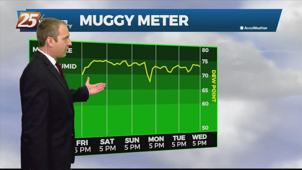
Today we were upgraded to an excessive heat warning, so there won't be much relief from that oppressive heat and humidity. That means heat indices across South MS…
Today we were upgraded to an excessive heat warning, so there won't be much relief from that oppressive heat and humidity. That means heat indices across South MS…
Yesterday we were under a heat advisory, but today that was upgraded further to an excessive heat warning. That means heat indices across South MS will lie between…
There weren't any weather surprises today as our active weather was once again driven by the sea breeze. That's when showers and thunderstorms develop due to the heating differences…

There weren't any weather surprises today as our active weather was once again driven by the sea breeze. That's when showers and thunderstorms develop due to the heating…
Hot temperatures and high humidity will peak this weekend, leading to some dangerously hot weather. We saw some of that weather today as a few areas climbed…
Much wetter in parts of South MS today as more widespread activity developed this afternoon. Today's t-storms lasted longer, and brought higher short-term totals that topped 4"…
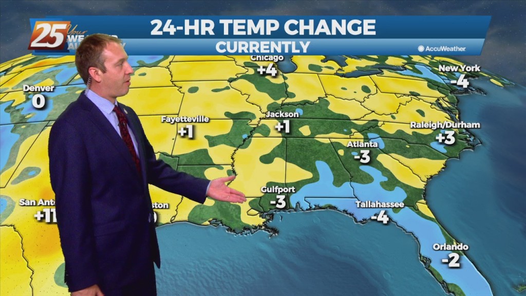
No surprises in tonight's forecast, just more hot, humid, and occasionally active weather. This afternoon was more rainy than yesterday was, slightly above average, but we'll trend in a drier direction for…
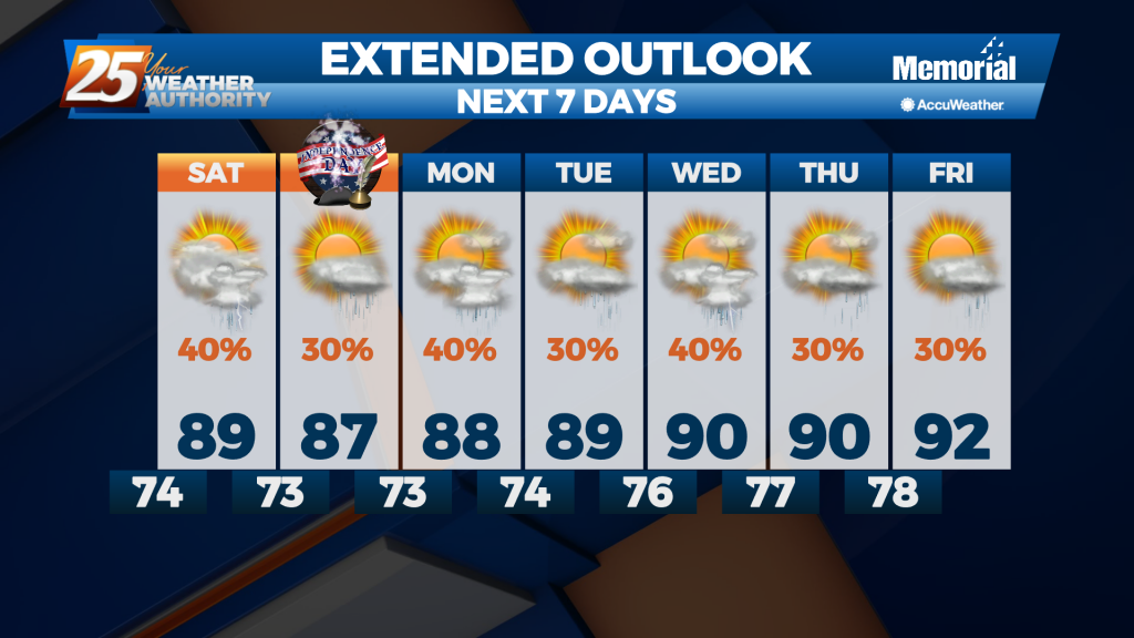
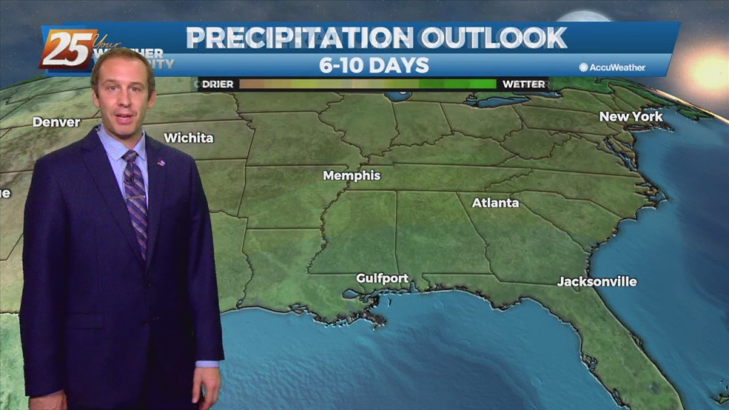
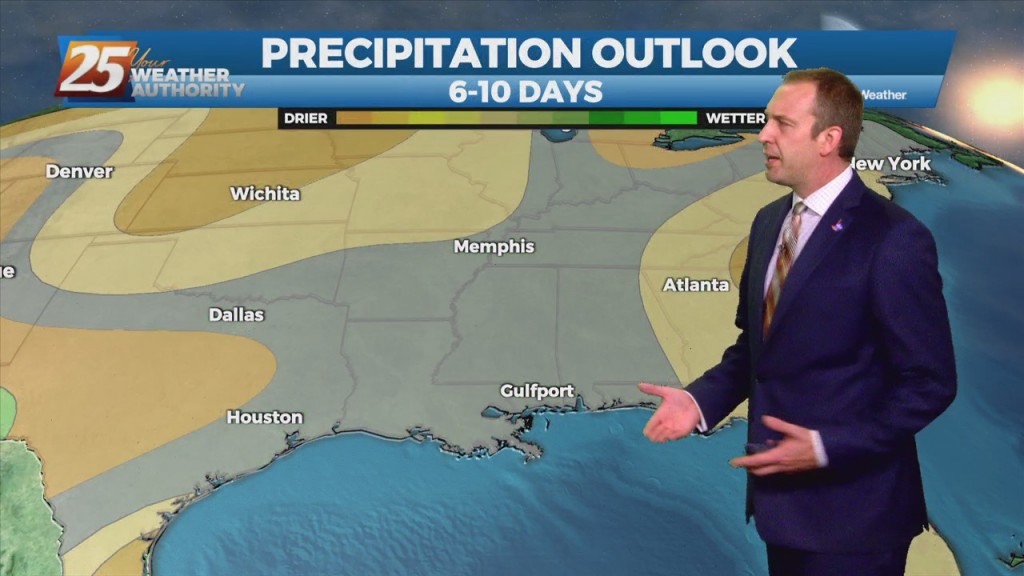
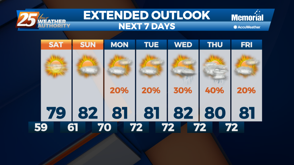
This week was pretty wet, and that isn't going to change as we head into Independence Day weekend. A front moved in today which acted as a jumping off point for enhanced afternoon showers, and it'll still be close enough…
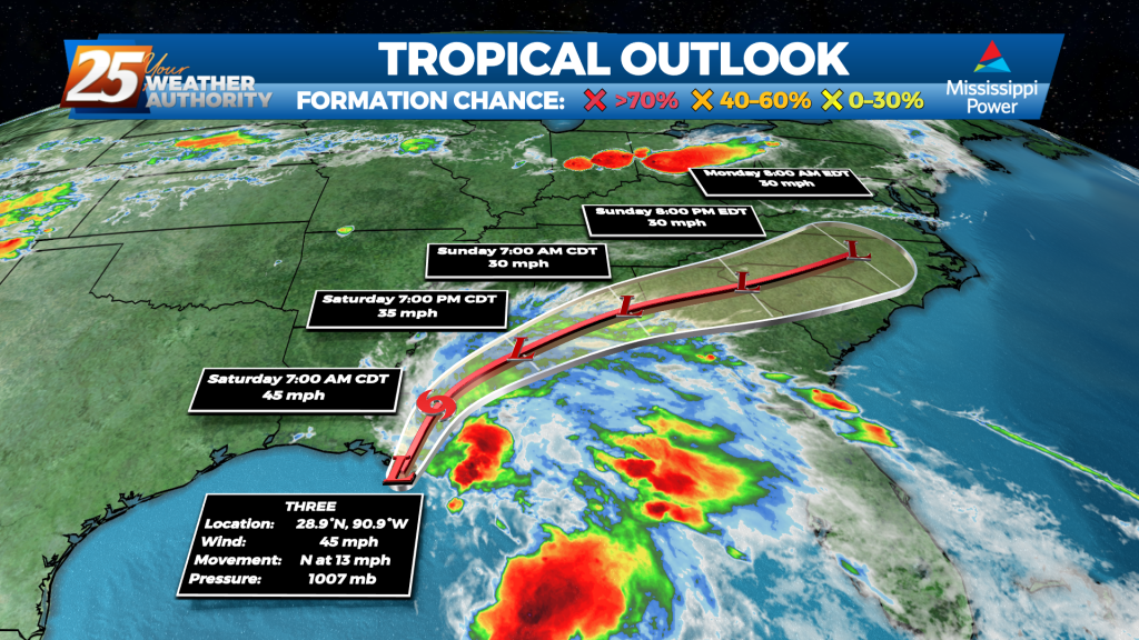
What should have been Tropical Storm Claudette by now still remains "Potential Tropical Cyclone 3." The reason for this is the system has not yet developed a closed center of circulation. It's close, the winds are at the threshold, and…
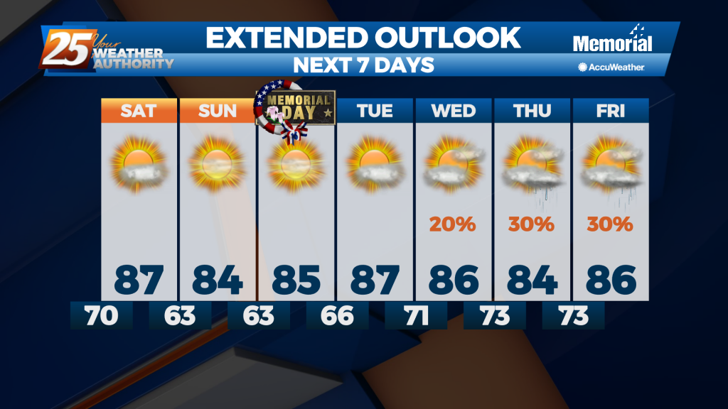
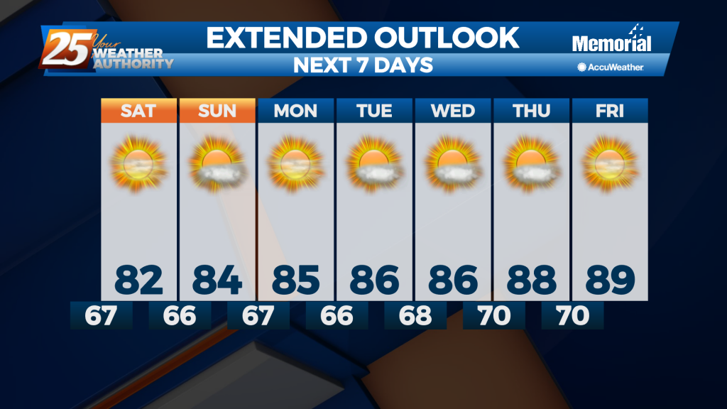
Saw a little active weather this afternoon as a weak front moved through, but now things are clearing nicely ahead of our Memorial Day weekend.
It's been a wet, grey, cloudy, and now windy week so far; but now we're heading into another sunny, drier weekend!
Nice and warm during the day while slightly cooler at night, but warmer, more humid, and eventually cloudy days are on the way.
Finally saw our rain moving in earlier today, and now the clouds will slowly clear through the night as things cool and dry....
Sad to say we have a wet weekend ahead after our ridiculously wet week, but things will begin drying up quickly as we head into the next....

We have a "moderate" (level 4 of 5) severe threat inching into South MS during the overnight hours, leading to a stormy start to another day this week.
Cold front brought a chilly night last night and we're in for more of the same tonight, but then a significant warm-up begins.

This week started clear and sunny but will end grey and damp, a trend we'll continue into next week.

Weird we only saw one clear day after Wednesday's front, but these clouds won't last much longer before the sun returns.
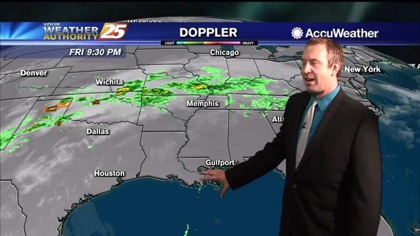
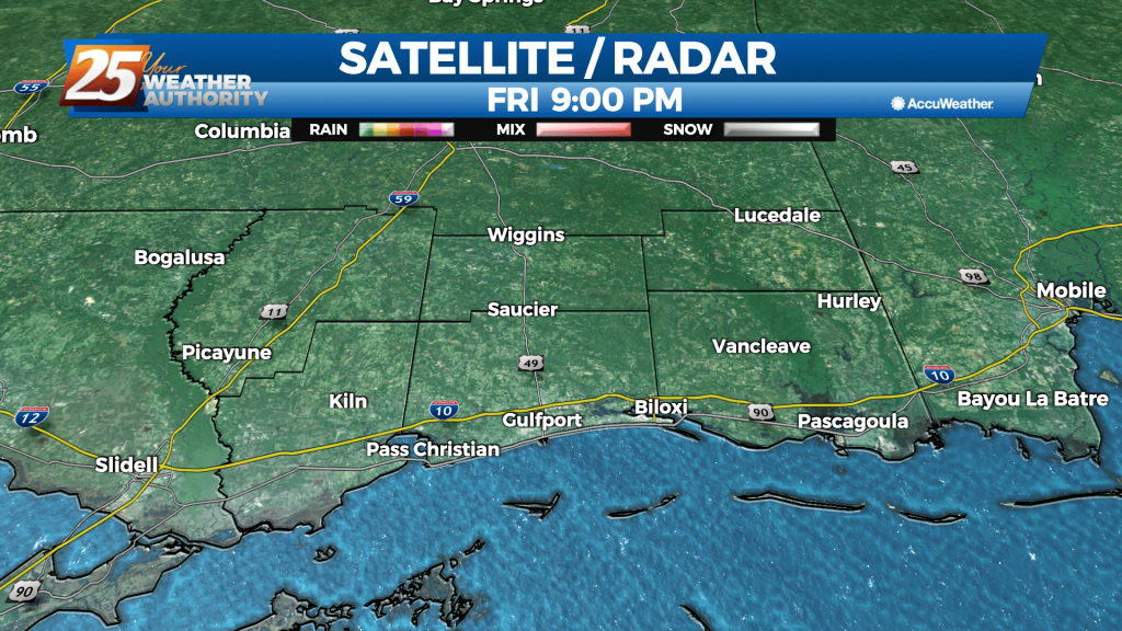
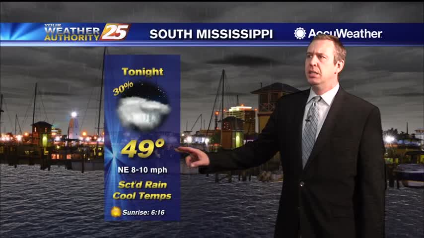
Another amazingly foggy night ahead, with little change expected until next week.
Getting some quick cloud cover and showers out of the way tonight so we can enjoy a beautiful, slightly cooler weekend.
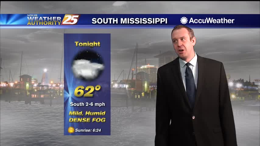
We'll see several warm, foggy nights in a row before anything changes noticeably, taking us well into next week....

Last night was cold, but tonight will be even colder as the skies clear and winds calm....
Cooling into the night, but we're still a few days away from possible winter weather.
The weekend will start cloudy, but we'll see a bit more sun as we begin next week...just won't last long.