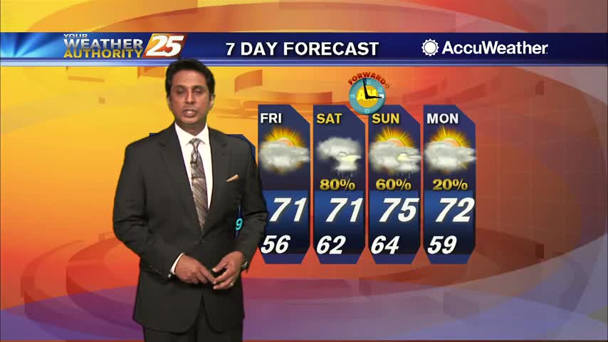
12/28 - The Chief's "Welcome Sunshine" Thursday Morning Forecast
The biggest forecast challenge in the short term is the temperature forecast and the threat of a light freeze for many areas that may have not seen…
The biggest forecast challenge in the short term is the temperature forecast and the threat of a light freeze for many areas that may have not seen…
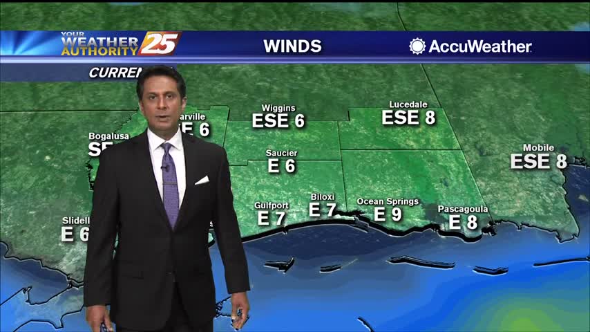
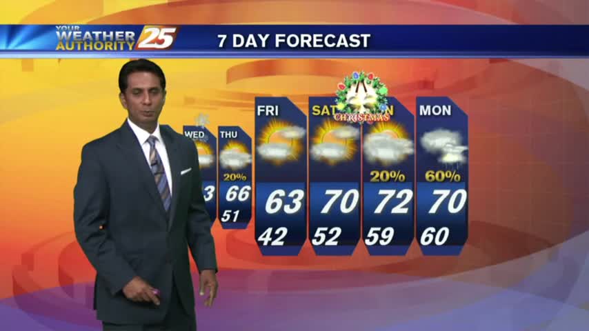
A cold and windy start to the day as winds are gusting into the mid-20 mph range...
Cloud coverage from this morning has cleared east with sunshine ahead this afternoon...
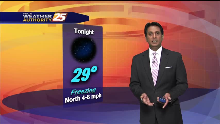
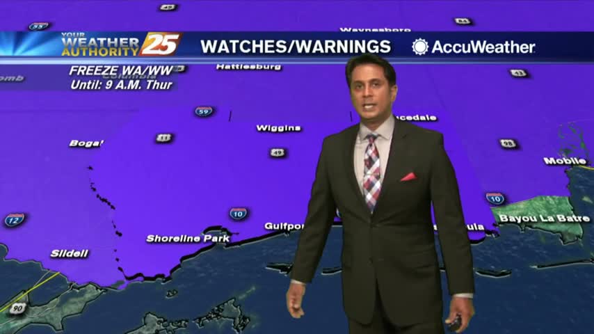
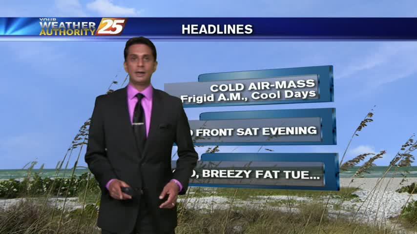
A FRIGID start to the day with a FREEZE WARNING in effect through 9 a.m...
With high-pressure dominating the region, it's a very cold start this morning...
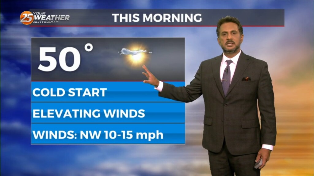
After a chilly start, cooler temperatures and breezy conditions are affecting the viewing area...
With an area of high-pressure to our NW...a cold dry winds has FRIGID temperatures to start off Mardi Gras...
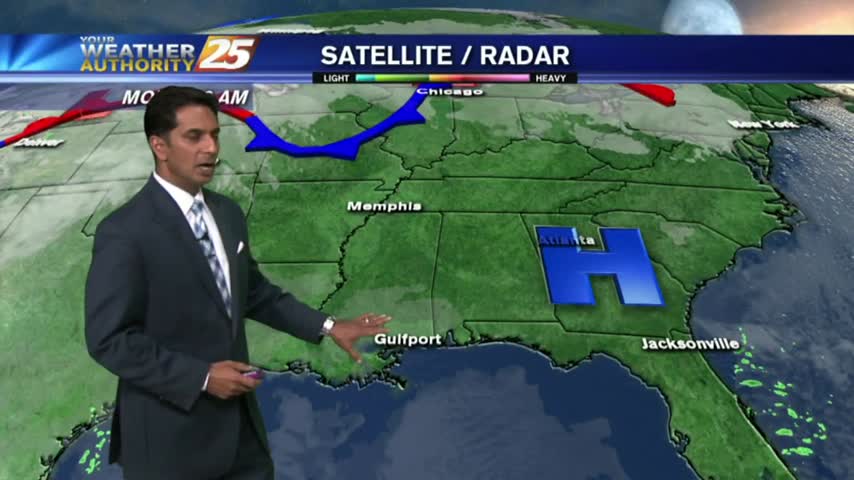
The rain has tapered-off with clouds and cold temps lingering into this afternoon...
Thin upper-level clouds are moving into the area from the NW, with COLD temps as a few locations are in the low 30s...
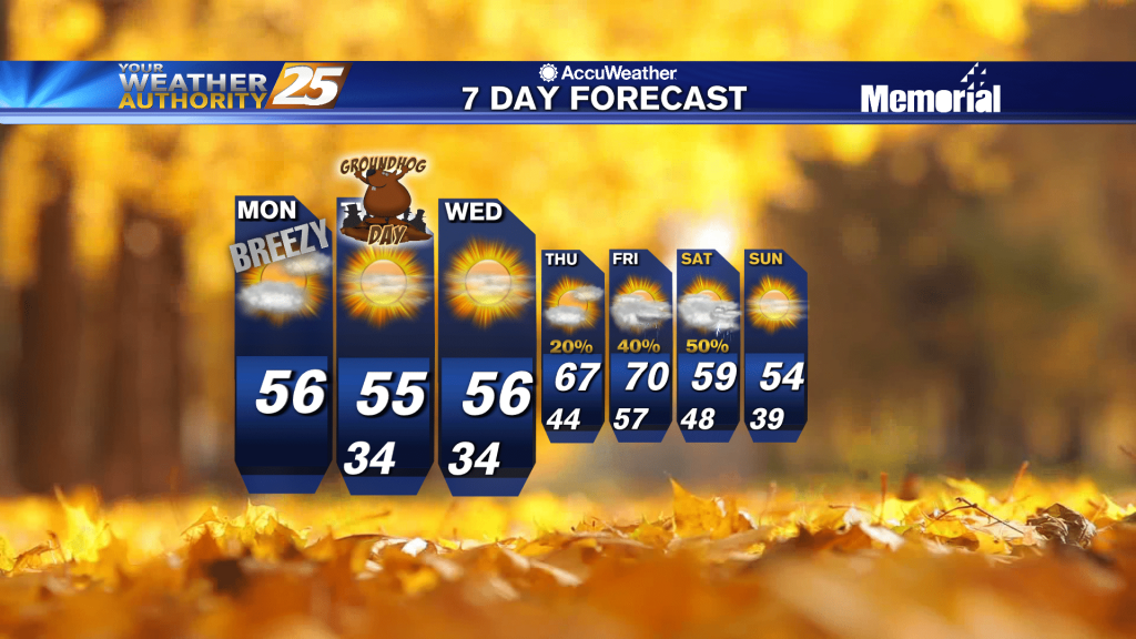
After a FRIGID weekend, it's a VERY COLD start on this Monday morning...with major changes ahead.
After some clearing late yesterday afternoon...the low-level clouds rolled back in after sunset and continue this morning.
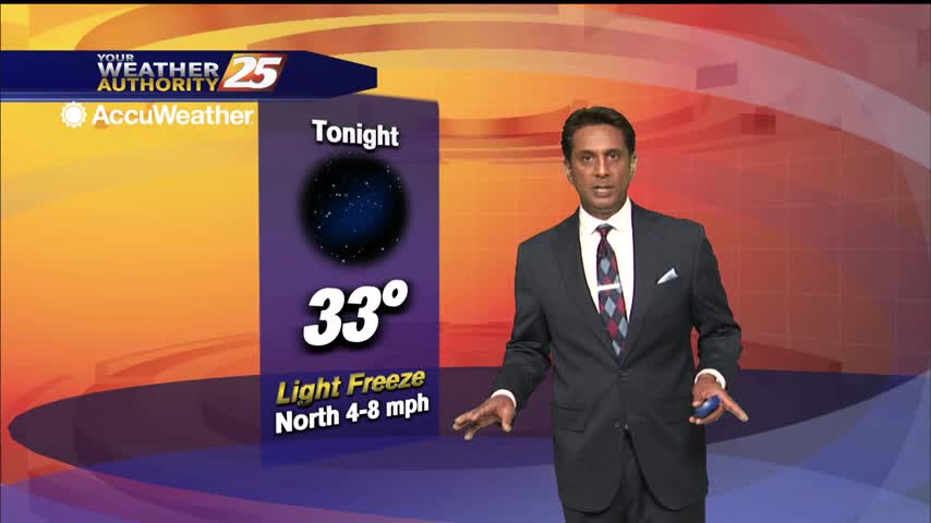
A VRY COLD start as temps are in the upper 20s to low 30s...