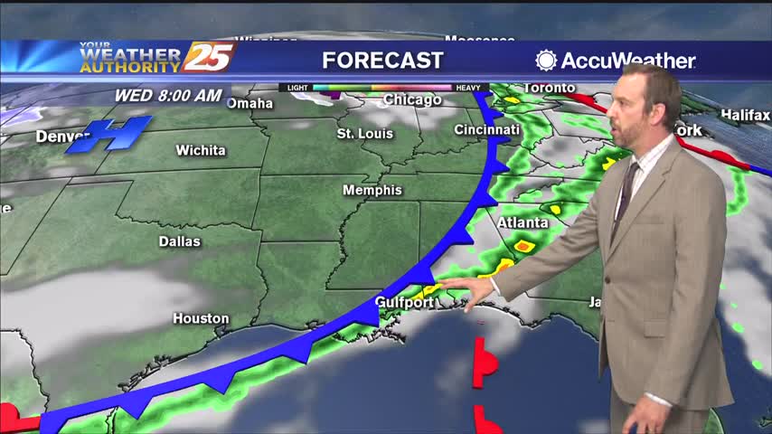
10/25 - The Chief's "A Few Showers Possible" Wednesday Morning Forecast
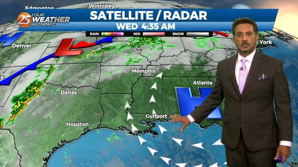
Fog development has been hampered this morning due to the increase in surface winds due to the developing surface low over the central US, this…
Fog development has been hampered this morning due to the increase in surface winds due to the developing surface low over the central US, this…

A few shower in the area will begin to dissipate this afternoon as a drier air mass moves in behind a cold front moving SE. High…

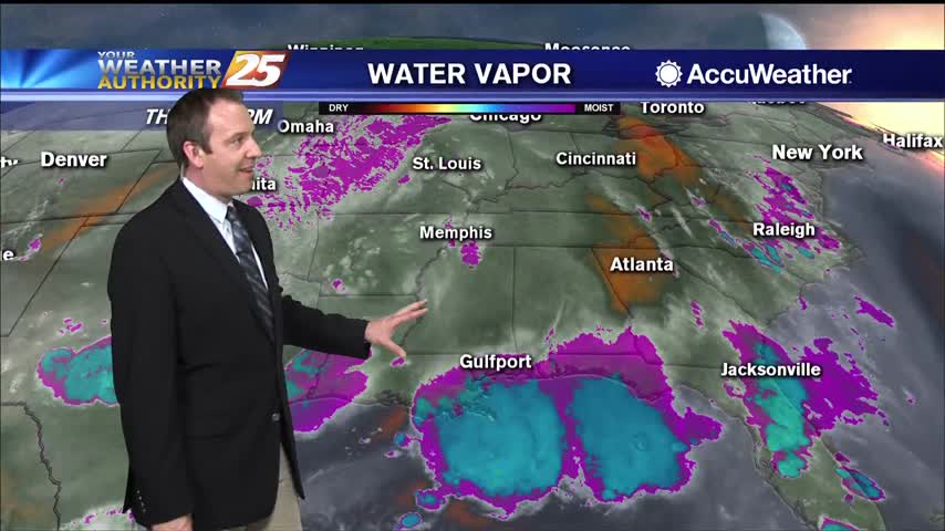
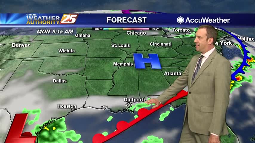
We start to enter a more active weather pattern starting today as an upper level disturbance moves eastward with an associated front forming at the…
A cold front is currently east of the area moving east with a few lingering showers. Behind the front, very subtle Cold Air Advection will…
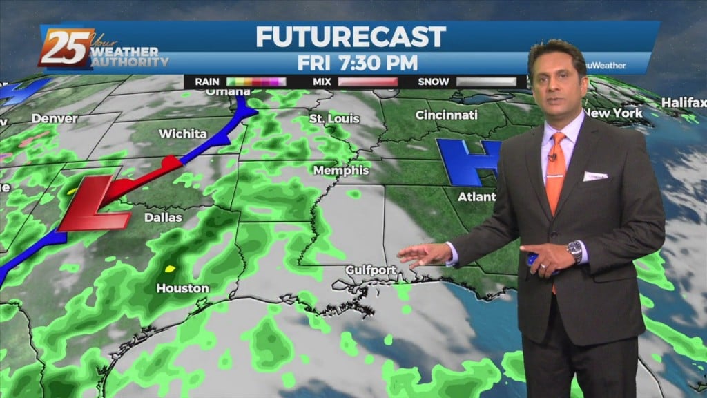
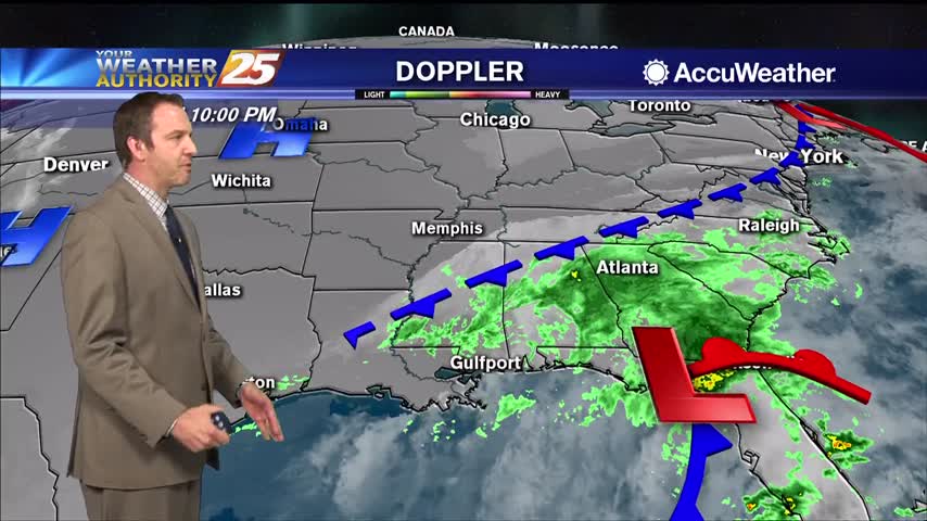
Pulses of weak Energy from the west are expected to continue to aid a wet environment favorable for more isolated showers and thunderstorms. Isolated showers and thunderstorms may still form later than previous days and affect west of the local…
It may not seem like it at first glance, but tonight will be a bit drier than the last few evenings we've seen. Still expecting an isolated shower or two, but considering the…
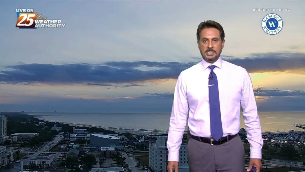
Warmer and even more humid than it was last night, making it feel rather tropical here in South MS....

Clouds have moved in, but still almost a full week before Hurricane Delta arrives as it continues to develop.
A few more clouds this afternoon but we'll have to wait a little longer for rain....
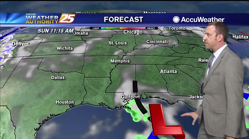
More rain tonight and tomorrow, but drier weather finally moves in just before the weekend.

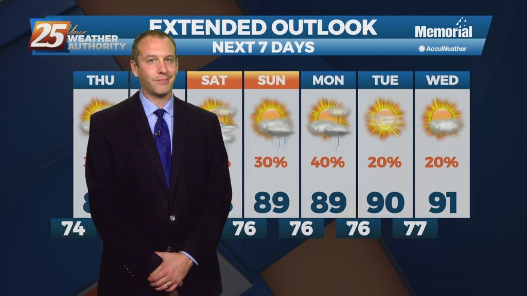
More wet weather today and on the way as we begin this week, but sunny days will return soon.
Today was much closer to average in terms of afternoon thunderstorm activity, but the next few days are going to be much wetter.
No measurable rain today and little expected over the next few days, but it will return soon.
Fewer showers this afternoon and evening, a trend that'll continue into the weekend along with higher humidity....
Much less rain today, but still cloudy in South MS. Expect the rain to return tomorrow ahead of some weekend clearing.

Today was one of the hottest we've seen so far, but some slight relief is on the way.
Much hotter today, but some slight relief is on the way as a front moves through.

Tomorrow is the last day of winter, and it'll continue to warm as we approach the weekend and a cold front moves in.
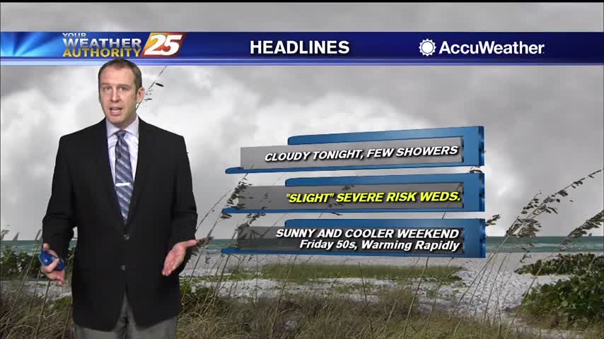
Skies were grey all day but the rain didn't arrive until later in the evening. Potentially severe storms move in tomorrow though, so stay tuned.
Humid and warmer tonight, with patchy fog likely becoming an early morning issue, but it does dry up a bit over the weekend.
Nice and cool this afternoon, but we're beginning a warming trend that will take us back into the 70s quickly.
Today's grey, dreary afternoon will be worth it tomorrow as overnight clearing brings sunny skies!
It's much warmer than it was last night, but still going to be quite chilly out there....
Cold front is moving in slowly and will keep showers and clouds in place through the night, but cooler and drier weather moves in quickly....