8/24 - The Chief's "When Will The OPPRESSIVE Heat End" Thursday Morning Forecast
Yet another hot day is anticipated across the central Gulf region today as high pressure remains situated to our north with a general…
Yet another hot day is anticipated across the central Gulf region today as high pressure remains situated to our north with a general…
Temps will climb a bit today as dry air will begin to take the place of the departing tropical environment but won’t be too fast…
The nice "cooler" temps yesterday were courtesy of the tropical wave that became TS Harold. The back end of this is exiting stage left for us…
The pattern has change slightly as the cold front overhead dissipated overnight. The lower dew-points will remain with us as drier air will once again…
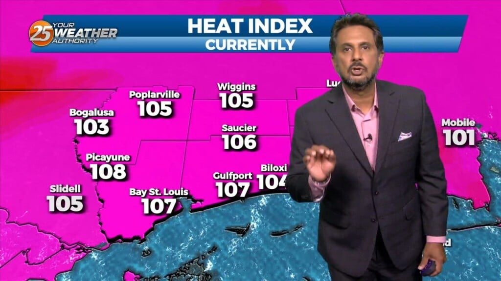
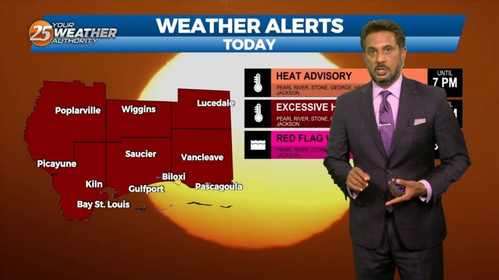
A HEAT ADVISORY is in effect once again this afternoon with heat indices between 106-112 degrees expected. Synoptically, the region remains under the influence of a large…
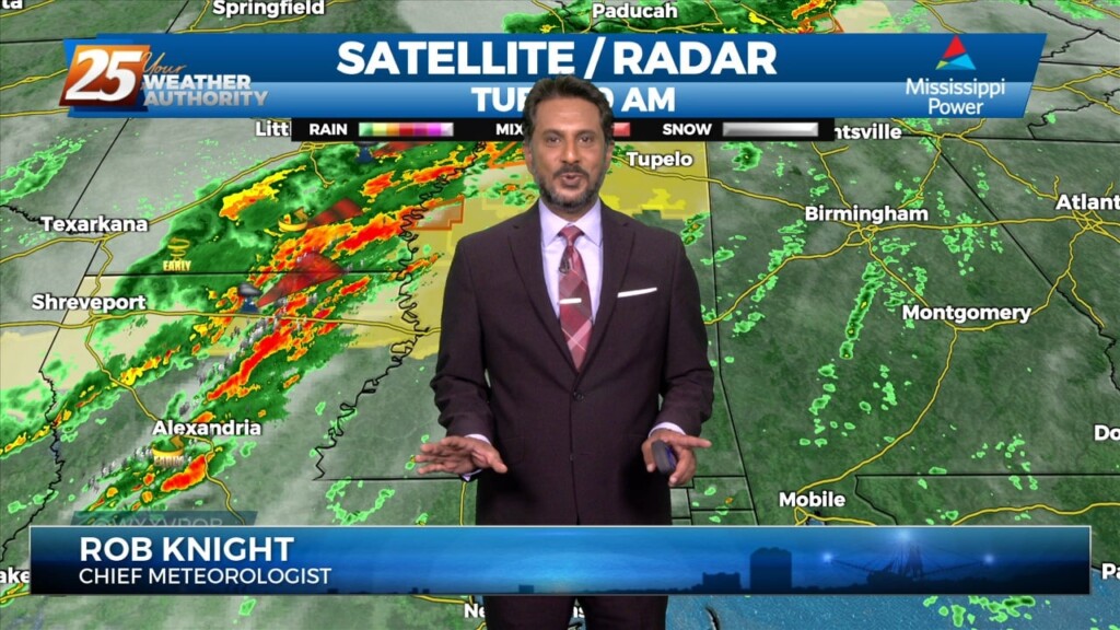
Spotty Showers continue through the area this morning, as radar is indicating activity in the vicinity. This activity will continue through this morning with the activity…
A few scattered showers have developed across the region early this morning, which will continue to develop into t-storms as we progresses towards midday. Today looks…
A drier day today as additional dry air advects into the region as northwesterly flow continues to take shape. Temperature will likely be a bit…
Showers and a few thunderstorms continue over portions of the Gulf waters this morning. This area is also the most favored for convection a disturbance south…
With the cooler upper levels and amplifying disturbance, expect a continuation of lower end rain chances despite being on the drier side with upper level flow becoming…
This afternoon will bring drier conditions from the spotty rain moving across the area earlier. The lack of convection will lead to warmer afternoon temps but…
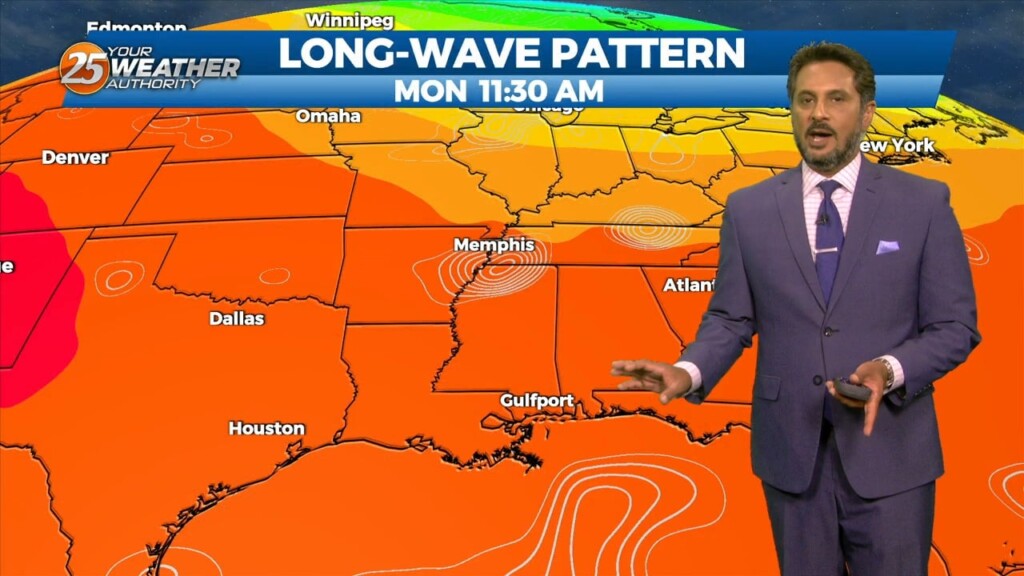
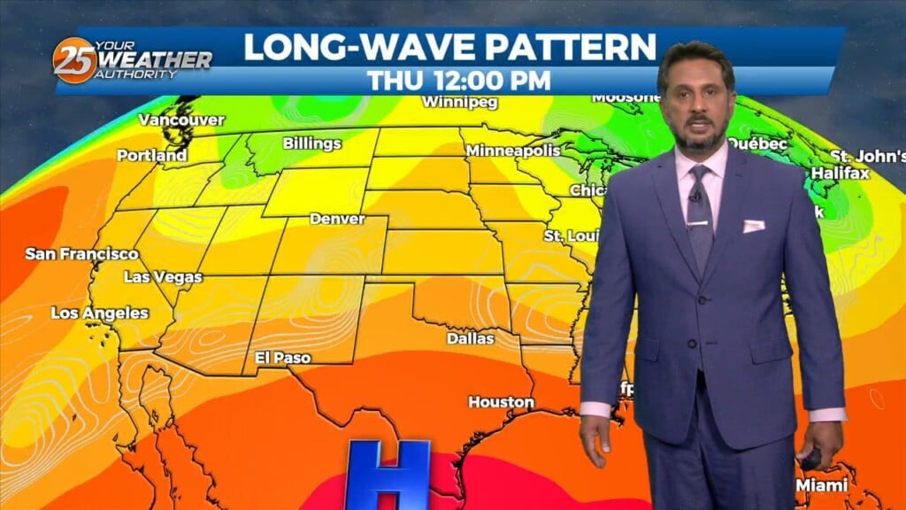
An upper level high pressure will build in across the middle of the country from the Gulf Coast all the way to the Northern Plains.…
There really isn’t a whole lot of material for discussion in the package as we’re in a period of benign weather. Upper level northwest flow on…
High pressure covers much of the Gulf of Mexico, extending northward toward the Great Lakes. A deep upper disturbance extends from Montana to the Four Corners area.…
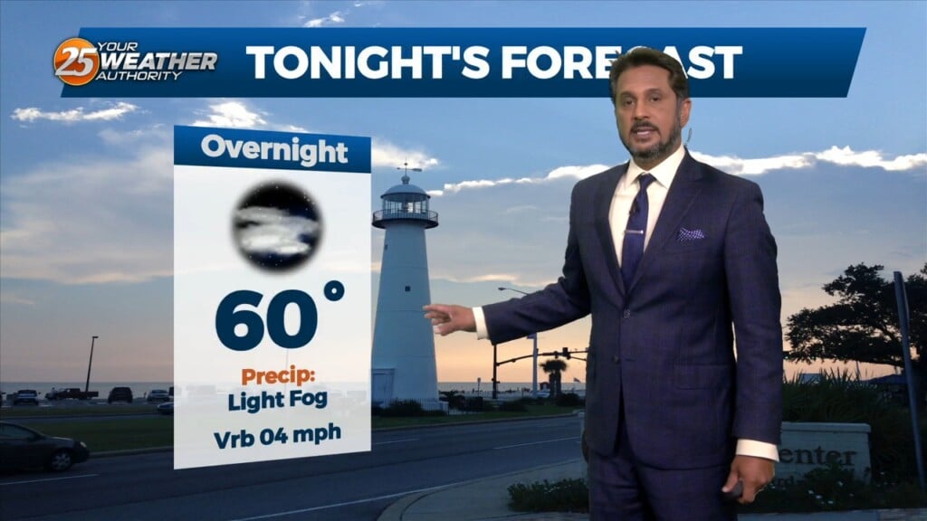
Fog will become an issue tonight but winds should stay too high nearest the coast and a cloud deck at 2k` starts to move in…
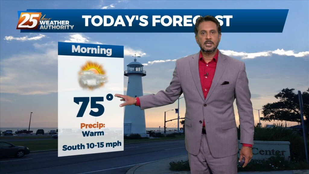
Another warm day expected across the region with most of the area warming into the upper 70s to low 80s along with breezy conditions. All eyes…
With the cold front east of the area and the upper level support moving north-northeast, the front won’t make a lot more progress much further eastward…
A stalled cold front is just inside the NW portion of the area this morning. The front will move SE as fast as molasses in winter. It…
Currently there is an area of high pressure over western Cuba, and a trough extending from the Great Lakes to the central California coast are combining to produce…
A disturbance over the Great Lakes has multiple bit of energy rotating through it. Flow is currently zonal across the southern states, with one disturbance exiting through…
A warm front will lift out of the gulf and move over the area around noon today. This front will allow some showers/t-storms to develop by…
With no significant cold advection behind this morning's cold front, we should mix out deep enough to get temperatures back in the 70s today with much…
High pressure to the NW will continue to move in and shape the forecast into the weekend. With insolation during the afternoon hours, expect temperatures to…
The focus today is the storm system due into our region. Expect the overall forward progression of the front to slow, with the main threat of discrete super-cell…