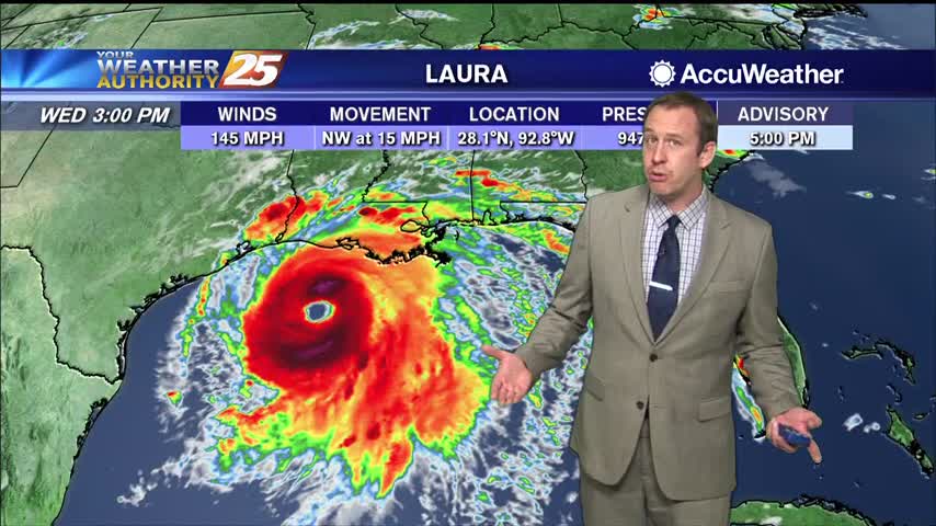
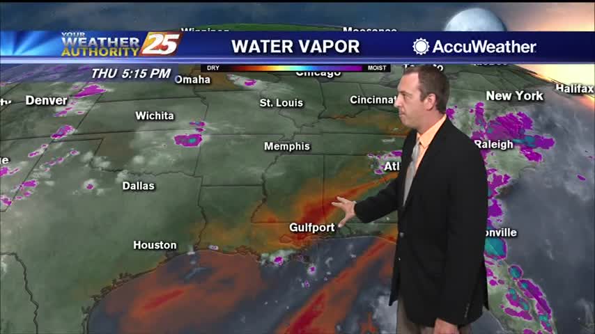
08/26 Ryan's "Category 4 Laura" Wednesday Evening Forecast
Hurricane Laura has continued to strengthen, and will make landfall later tonight as a major hurricane on the TX/LA border.
Hurricane Laura has continued to strengthen, and will make landfall later tonight as a major hurricane on the TX/LA border.
Hurricane Laura will miss us to the west, but we're still in for a few days of disturbed weather.
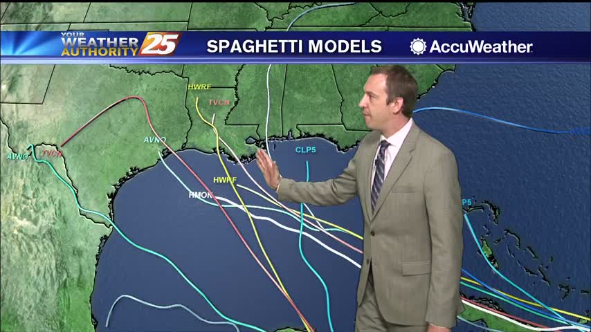
Marco is weakening rapidly, so we won't see much of a significant impact as it passes to the south, but Laura is slowly strengthening....
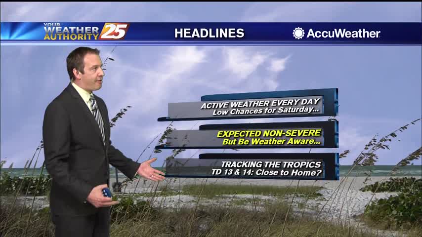
This forecast will largely focus on the looming tropical threat in the Gulf.
Dreary conditions this afternoon thanks to the tops of storms blowing our direction, otherwise not a lot of activity again today....

Finally a little cooler and drier, but it is over before it starts as the next few days get quite wet.
It was a few degrees cooler today, but more rain as we head into the weekend will bring highs down even further....
A weak sea breeze tried to bring some afternoon rain, but not much was able to happen today thanks to upper level drier air.
The weather has been drier today and will be again tomorrow, but more rain and higher humidity soon after.
Saw some late afternoon thunderstorms which accounted for most of the rain we'll see today.
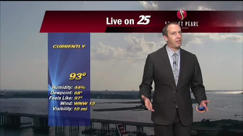
Another excessively hot and humid afternoon is in the books, with only a few afternoon showers coming to cool us down....
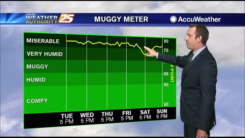
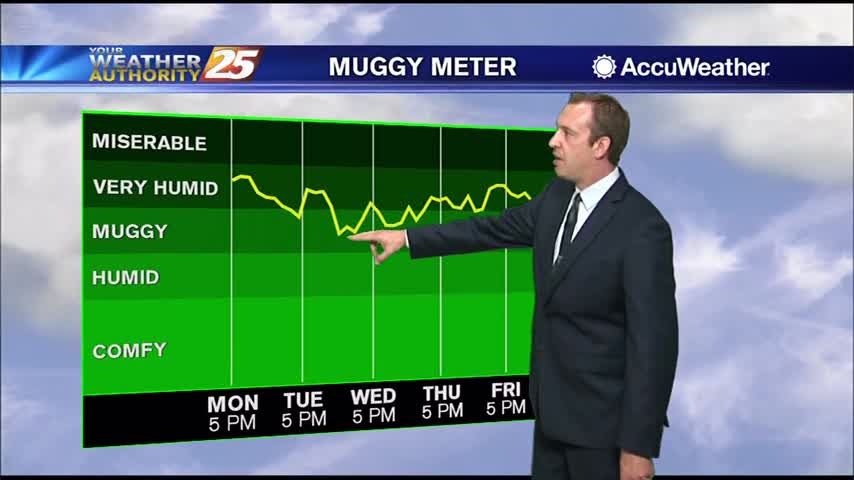
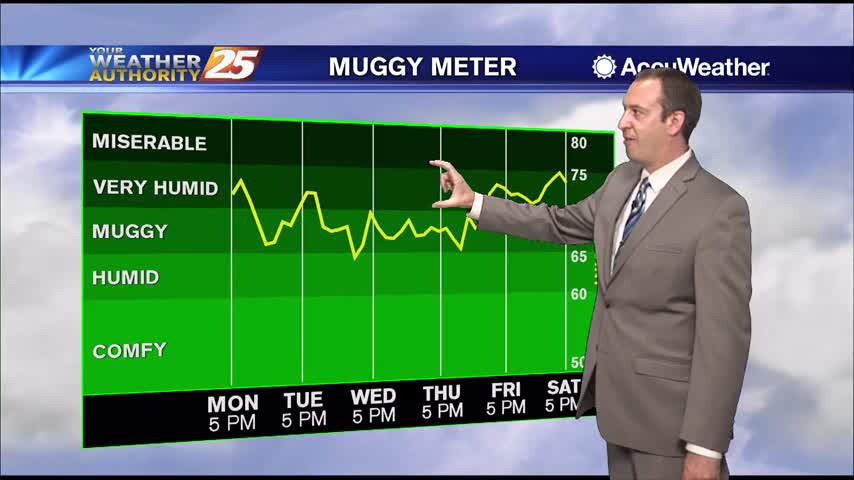
The high humidity has returned after a little bit of a break last week, so expect to be getting right back to some uncomfortably hot and humid weather.
Today was the last day without a rain percentage as our dry trend comes to an end, but it'll still be a while before we see any significant rainfall.
Our hot and dry streak continues, but at least one of those conditions will change in the days ahead....
Temperatures are above average, but the weather outside doesn't feel too bad thanks to slightly drier air. Doesn't last forever though....
Drier air has moved into the upper levels and is trickling down to the surface, meaning things will stay a bit cooler and drier for now.
Continuing our beautiful weather from the weekend into the week, and drier air is going to keep things nice and sunny for a while!
It was slightly cooler than average today, and we didn't see any afternoon thunderstorms, but those days will return quickly!

The drier period I've been talking up all week is finally here, but that means some hot and humid weather is moving in.
It's been pretty wet since the end of last week, but a drier trend is finally beginning which will take us through the weekend.
Tropical moisture remains in place, so widespread shower activity lingers for at least one more day before changes move in.
Another wet start to the week after a rainy weekend, but sunny weather returns soon!
Most of this week was dry, but rain chances began to increase yesterday and will remain quite high over the weekend.
Grey, rainy weather started today and sadly won't end for several more days.