11/20 - Sam Parker's "Chilly Starts" Wednesday Night Forecast
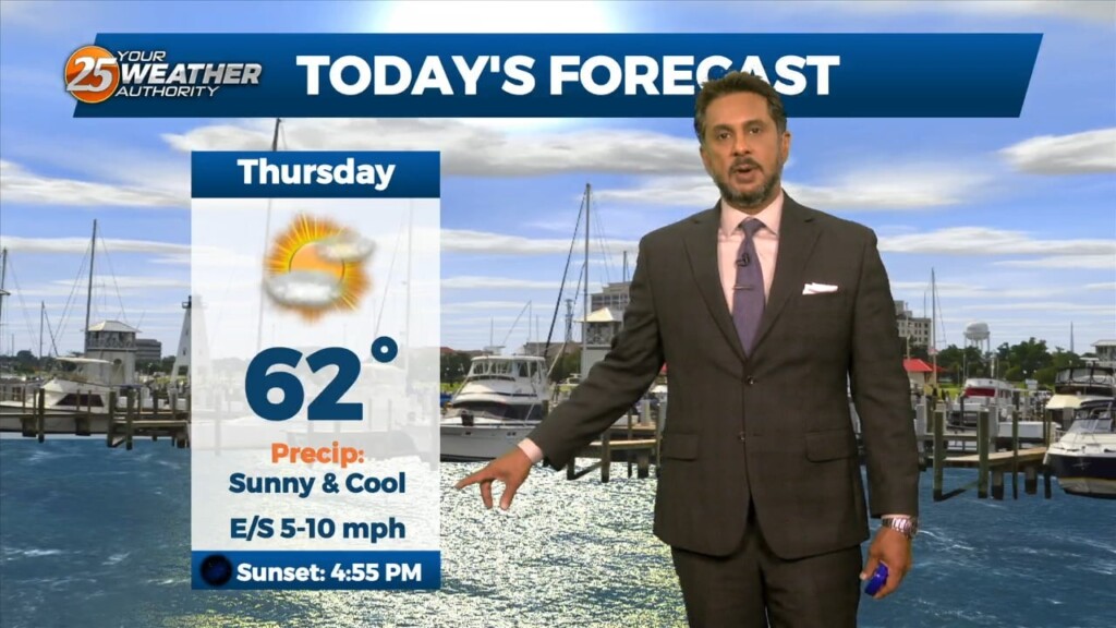
Our second cold front has past giving windy conditions earlier today. Thursday morning is round 1 of the chilly temperatures for our area. Most of us…
Our second cold front has past giving windy conditions earlier today. Thursday morning is round 1 of the chilly temperatures for our area. Most of us…

In the wake of yesterday’s cold front, strong dry air surge at the mid and upper levels is continues to move into the area.…
A slight amplification in the overall pattern with an area of high-pressure overhead allow for temps to moderate closer to climatological normal highs, albeit slightly…

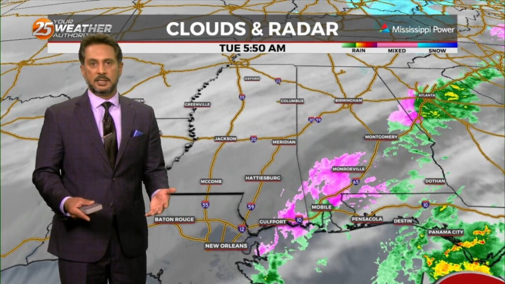
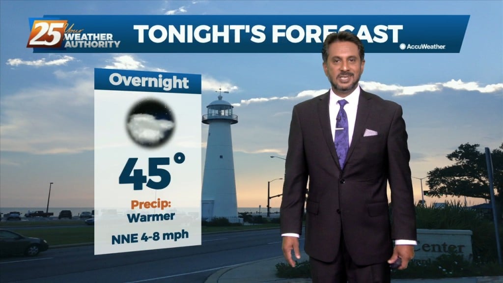
A dry air mass will remain in place through Wednesday. The next reinforcing shot of dry air will move down behind a new backdoor cold front…
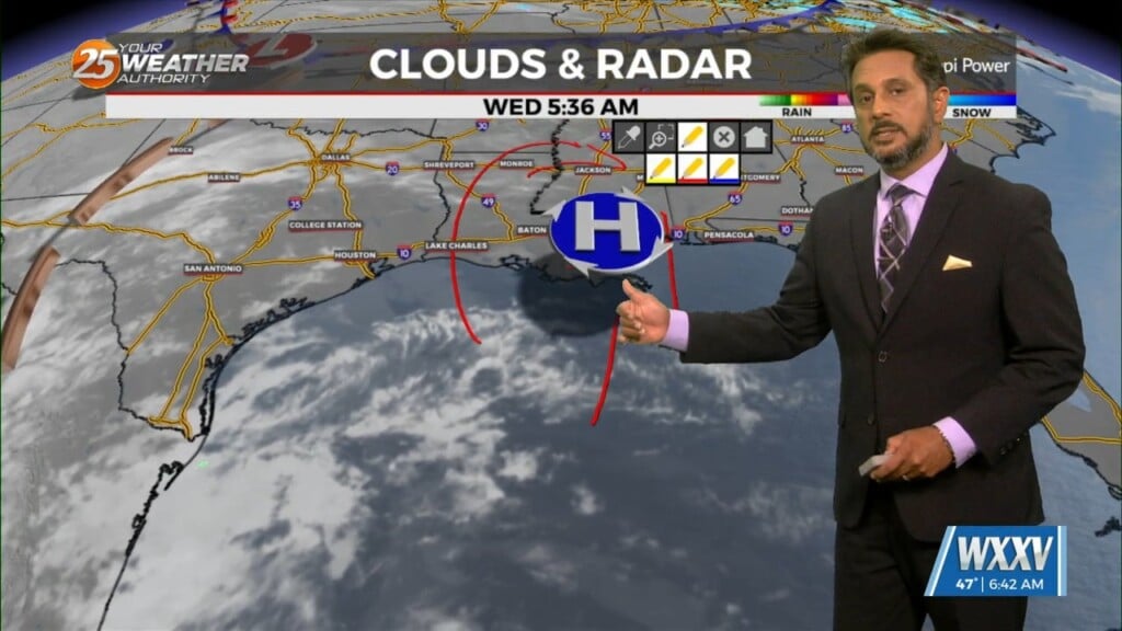
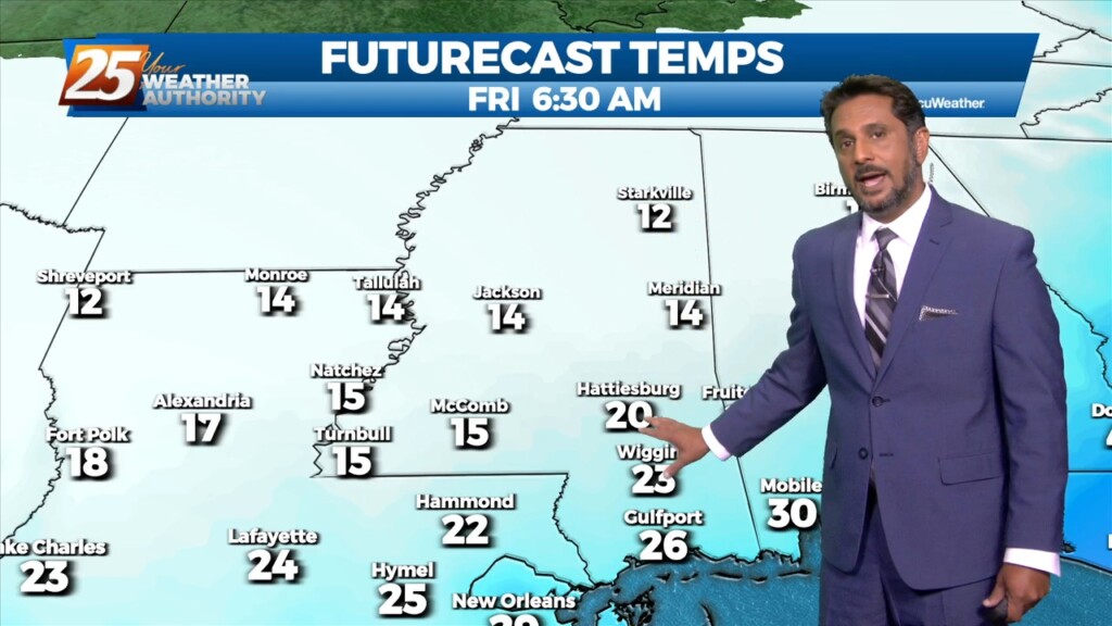
The arctic front has started to creep slowly to the east as a WINTRY MIX is occurring in south Mississippi a couple of hours prior to…
The deep upper-level system that produced Monday night’s severe weather is now over the Mid-Atlantic states and moving into New England. The next disturbance in a…
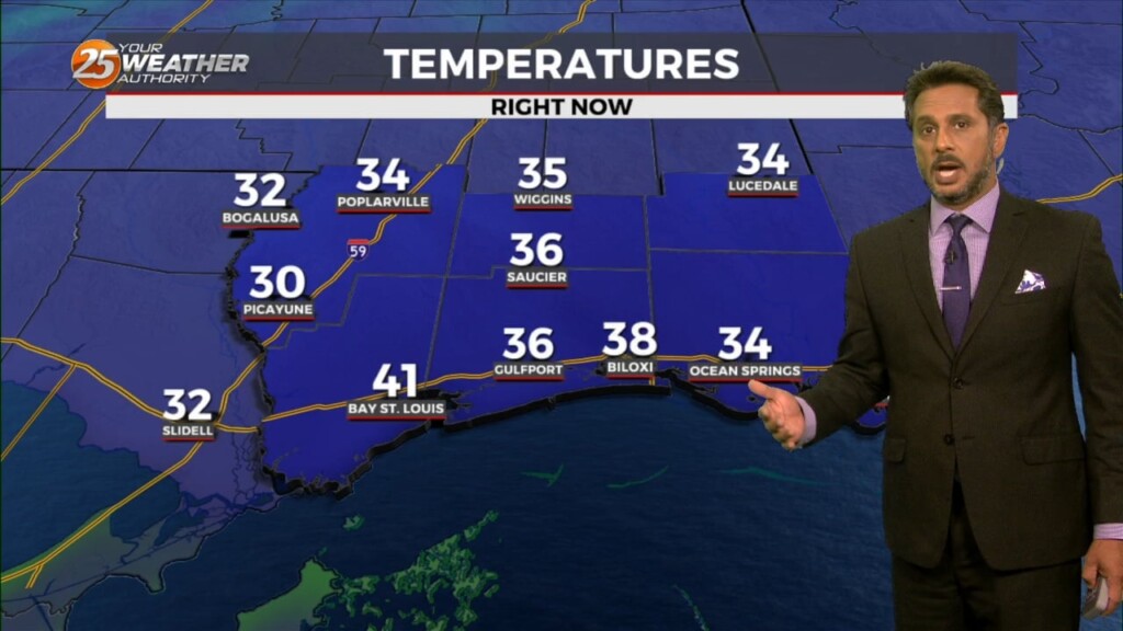
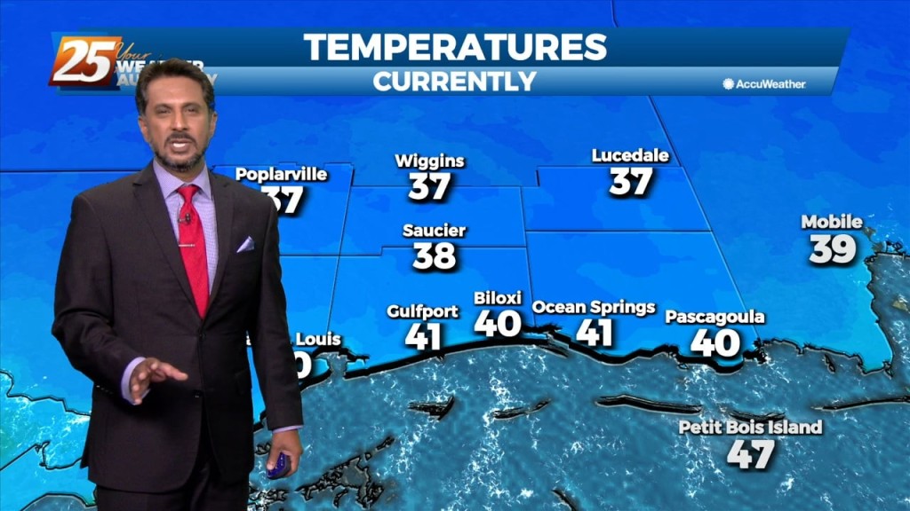
The winds will begin to relax from west to east across the region this morning. Along with clear skies and calmer winds, temperatures have dropped well…
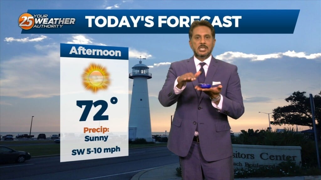
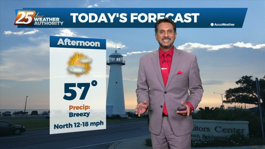
Temperatures will warm up nicely today with ample sunshine and upper level clouds moving in this afternoon. Surface high pressure will build to our east allowing…
Today looks a little warmer than yesterday, but only by a few degrees. Aloft, the upper levels will begin to shift to a more…
An upper level disturbance extends from off the New England coast to the Carolinas, down to the northeast and central Gulf of Mexico. High…
High pressure was currently located over the Great Plains, with the next in the series of strong storm systems moving across California. At the surface, high…
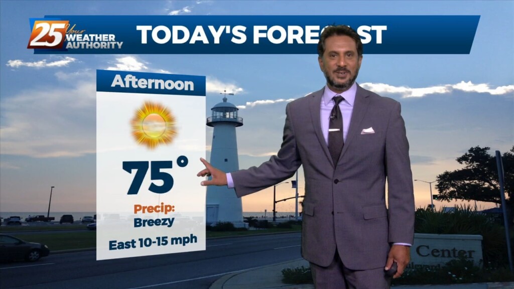
The return flow will become more established today and remain that way through the short term. This will help add to the warming trend over…
An upper level impulse continues to move downstream this morning after producing some light shower activity overnight. Today will be a transitional day for the region…
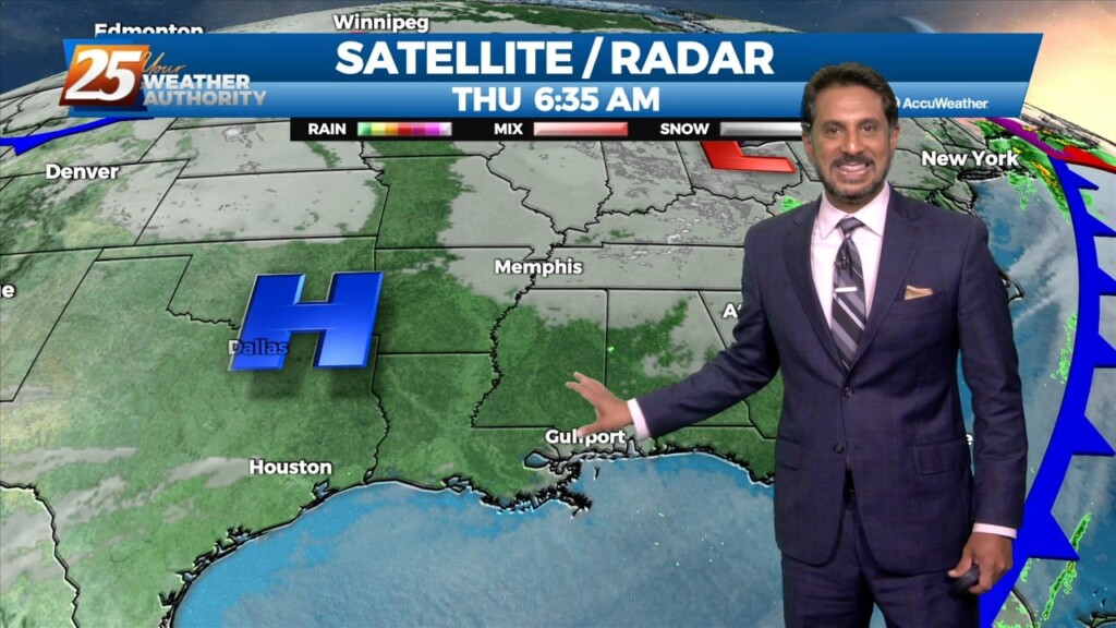
Generally a dry west or northwesterly flow currently resides over the region. At the surface, high pressure continues to spread eastward over the mid/lower MS River Valley…
As last night’s cold front continues downstream, cold air advection will continue to be the story, along with decreasing clouds later in the afternoon from…
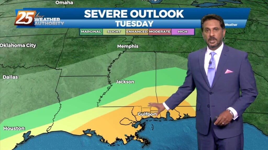
Finally seeing the models come into solid agreement on every variable and this has caused some sudden moderate changes in severe wx and rainfall risk levels…
There is SW’erly upper flow across the local area this morning with an area of high pressure along N’tern Mississippi. At the surface, high pressure was centered…
A disturbance over the Great Lakes has multiple bit of energy rotating through it. Flow is currently zonal across the southern states, with one disturbance exiting through…
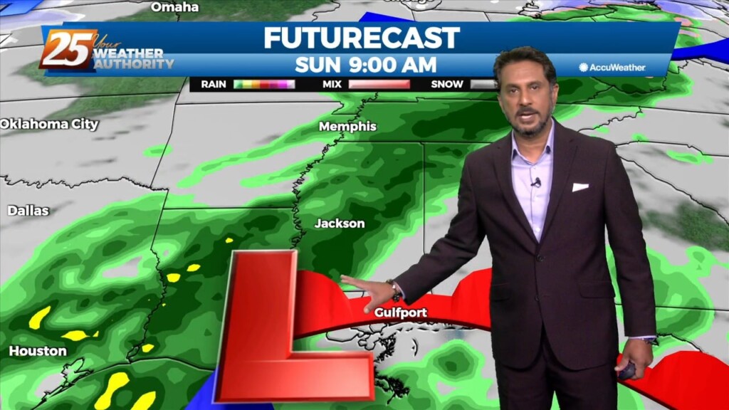
Bottom line up front...main concern for this forecast package will be with the storm system expected to impact the Gulf Coast Tuesday into Wednesday morning, with the…
The pattern will remain quiet today with transitional conditions tomorrow. A fast-moving upper level disturbance will move past the area late tonight, but with little moisture…
Today a surface high pressure will shift eastward as a disturbance pushes into the region. A second disturbance will follow quickly behind into Tuesday. This…
Temperatures will quickly rebound to normal for this time of year on Friday as the upper level trough ejects east and ridge centered over the Gulf of…
A weak disturbance currently over northern Texas will track east today and tonight, passing through the lower Mississippi Valley. Showers have developed well ahead of that system…
In the short term, a dry re-enforcing cold front with parent upper level disturbance will swing through the region later today. Ahead of this feature,…