2/16 - Brittany's "Approaching Cold Front" Thursday Evening Forecast
As far as threat timing is concerned, the tornado threat peaks this afternoon ahead of the cold front when SRH and surface-based instability is maximized while with…
As far as threat timing is concerned, the tornado threat peaks this afternoon ahead of the cold front when SRH and surface-based instability is maximized while with…
The threat for severe weather will be in the area this afternoon/evening with a cold front approaching from the west. Severe weather variables are not remarkable…
The old stalled cold front that retrograded west has primed the area with warmth and instability. But there is still a weak cap in the low levels…
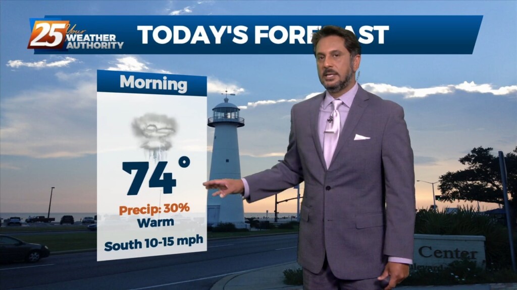
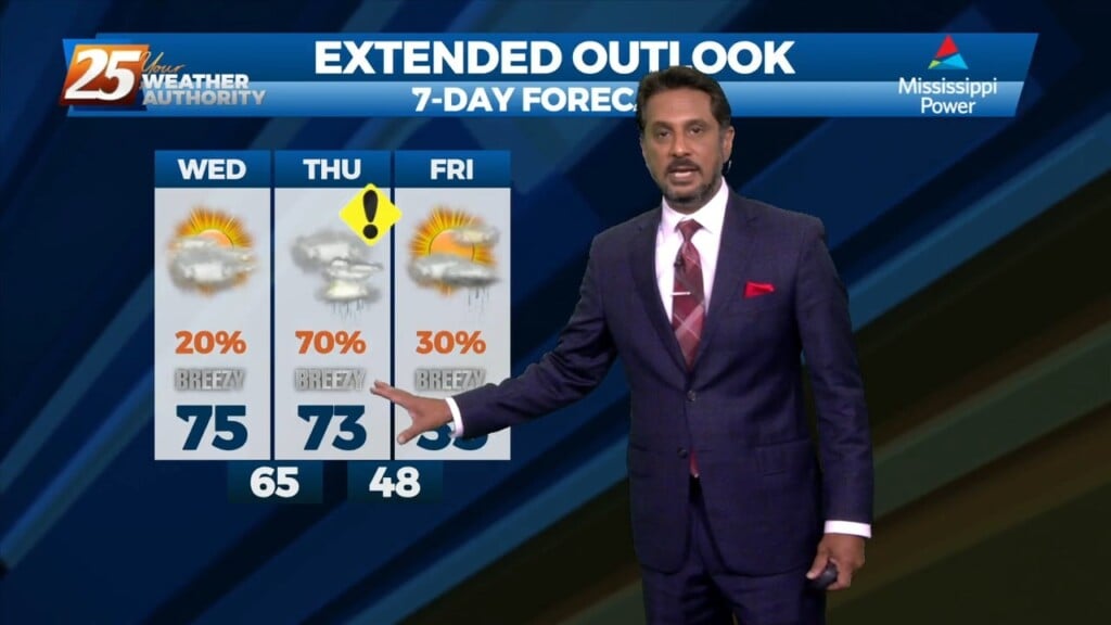
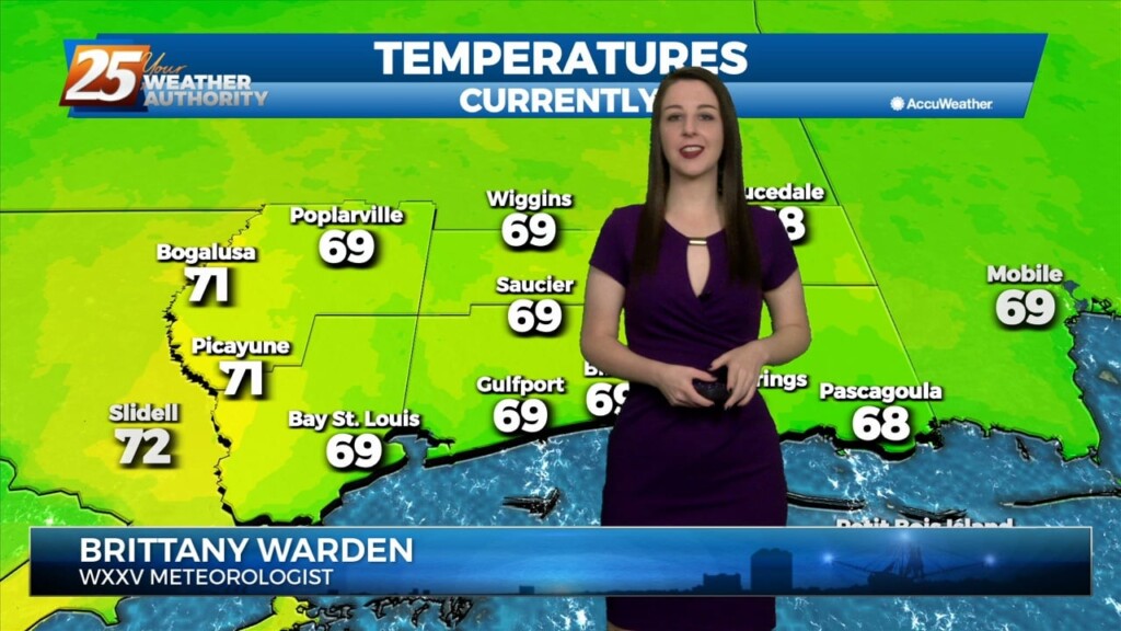
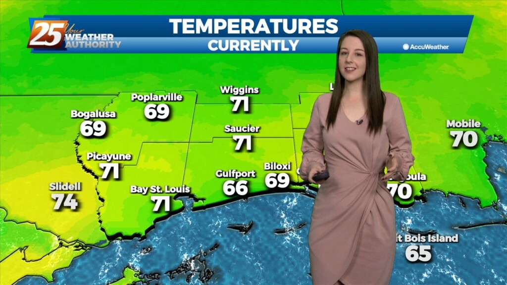
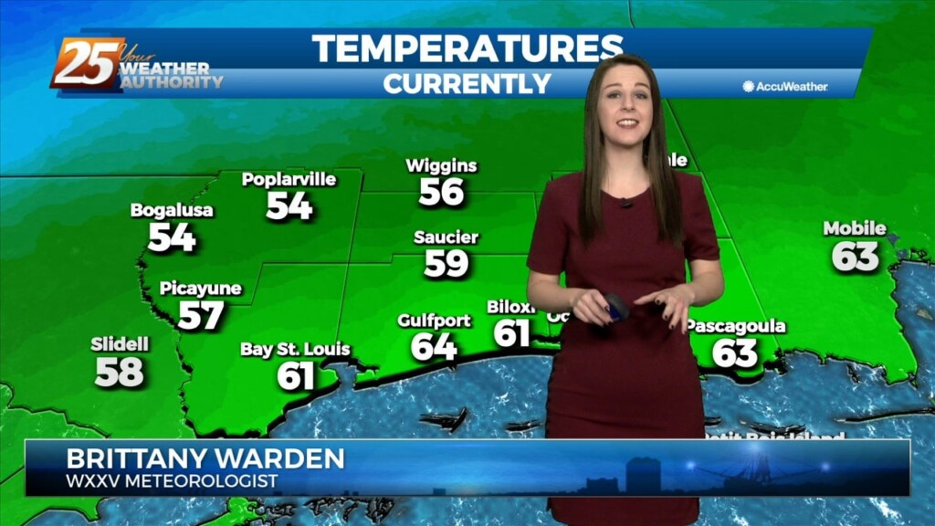
The warm and humid pattern continues across South Mississippi. Temperatures will be in the 70s this afternoon under predominantly cloudy skies, with breaks in the clouds…
The cold front that was moving toward the area yesterday slammed the brakes and stalled to the west. The next front will actually make it through…
Warm and moist air will stick around until Thursday after the main cold front moves through. This will keep us warmer than average tomorrow and Thursday ahead…
Upper level ridging will dominate the pattern for the next day or so ahead of an approaching upper level trough. Southerly surface winds will help to advect warm air…
No real changes in the thinking regarding the short term forecast. Stationary front near the mouth of the MS River will continue to serve as a focus…
Upper low and trough continue to lift northeastward today. With deep layer flow mostly parallel to the surface frontal boundary, expect it to remain stalled near the mouth of…
Upper low and trough continue to lift northeastward today. With deep layer flow mostly parallel to the surface frontal boundary, expect it to remain stalled near the mouth of…
With the cold front east of the area and the upper level support moving north-northeast, the front won’t make a lot more progress much further eastward…
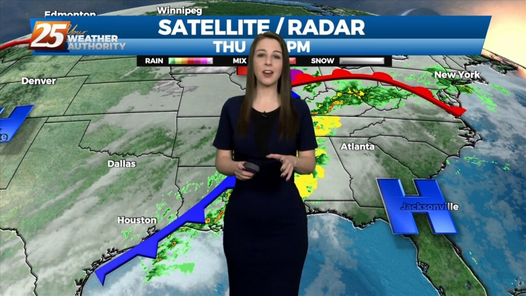
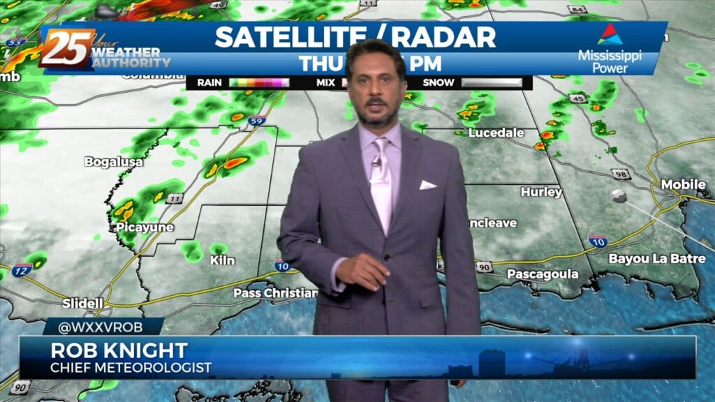
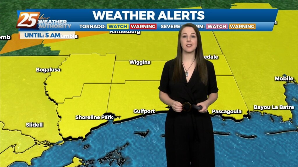
The biggest concern in the short term is the potential for severe through the remainder of this afternoon and overnight tonight ahead of an approaching cold front.…
The biggest concern in the short term is the potential for severe through the remainder of this afternoon and overnight tonight ahead of an approaching cold front. Already…
Going into the overnight low level moist flow will continue to increase leading to some marine fog development over the MS Sound and tidal lakes. It is possible for…
Going into the overnight low level moist flow will continue to increase leading to some marine fog development over the MS Sound and tidal lakes. It is…
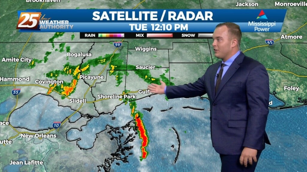
Some shower activity is passing through our area. There will be 40% coverage of showers for the remainder of this afternoon. Skies will be mostly cloudy and…
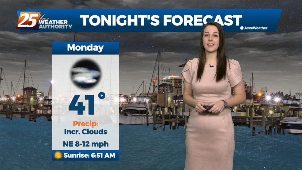
The weekend has finished out on a bright note. Temperatures will dip into the 40s tonight with the potential for patchy fog to develop overnight. Monday…
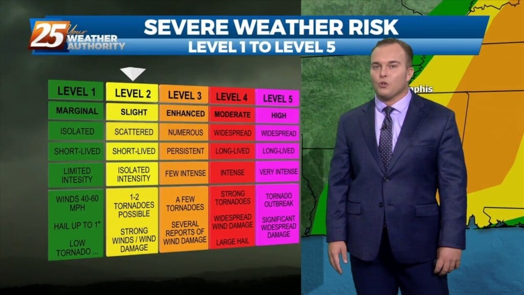
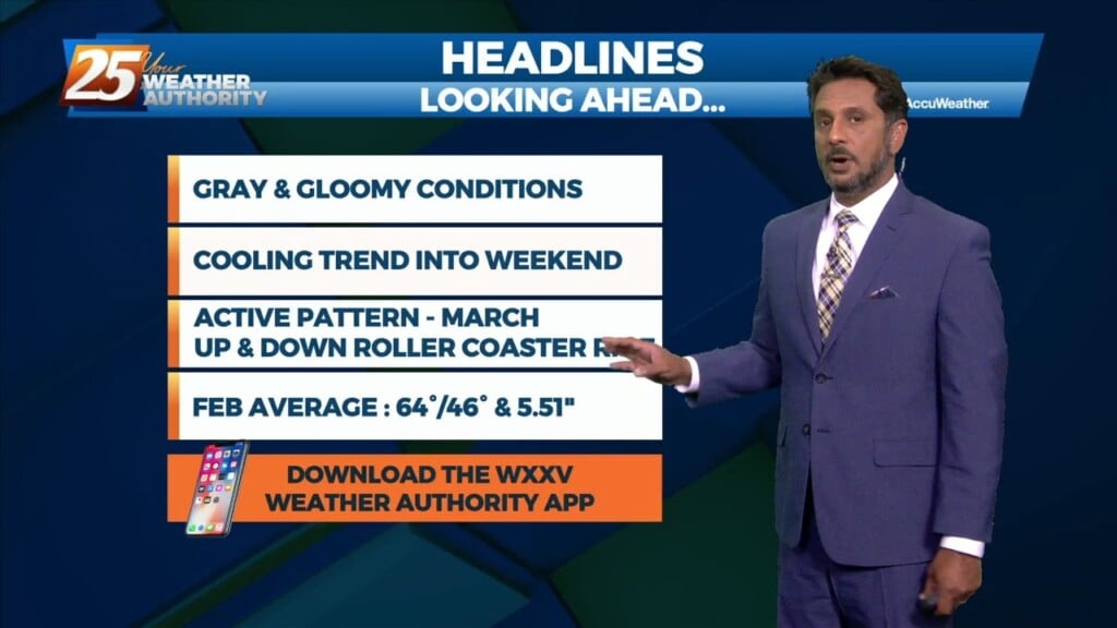
Finally seeing the models come into solid agreement on every variable and this has caused some sudden moderate changes in severe wx and rainfall risk levels…
Upper level analysis shows a ridge centered just south of Florida, a broad trough over the northern half of the country east of the Rockies and a…
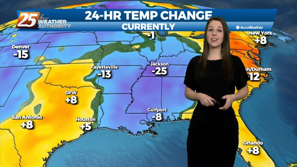
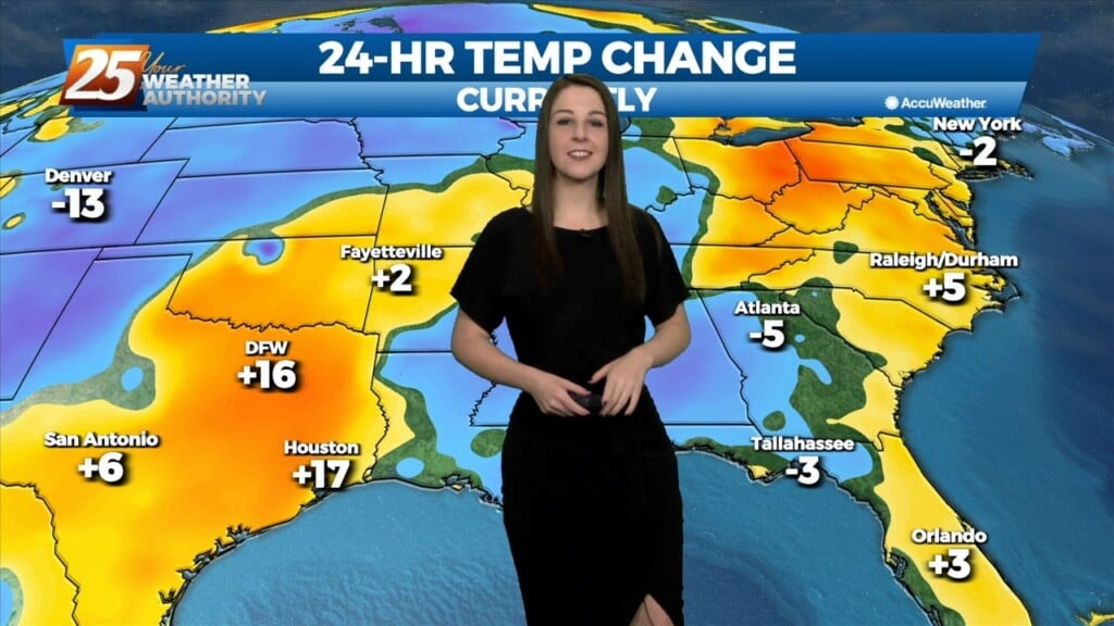
The gloom continues. Northeasterly flow behind a front is providing for a cooler feel today. Cloudy skies will continue through the rest of the day and tonight.…
Fog is settling in yet again across our area. In addition to that, a front will make its way through South Mississippi tonight. Winds will turn from…
This is the time frame that will be looked at the most. A warm front will lift out of the gulf and move over the area around noon…
This is the time frame that will be looked at the most. A warm front will lift out of the gulf and move over the area around noon…
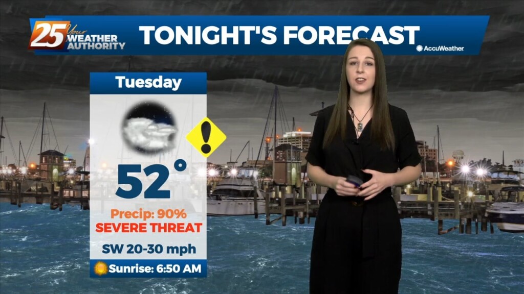
Bottom line up front...main concern for this forecast package will be with the storm system expected to impact the Gulf Coast Tuesday into Wednesday morning,…