2/1 – Jeff Vorick’s “Changes Coming” Wednesday Afternoon Forecast
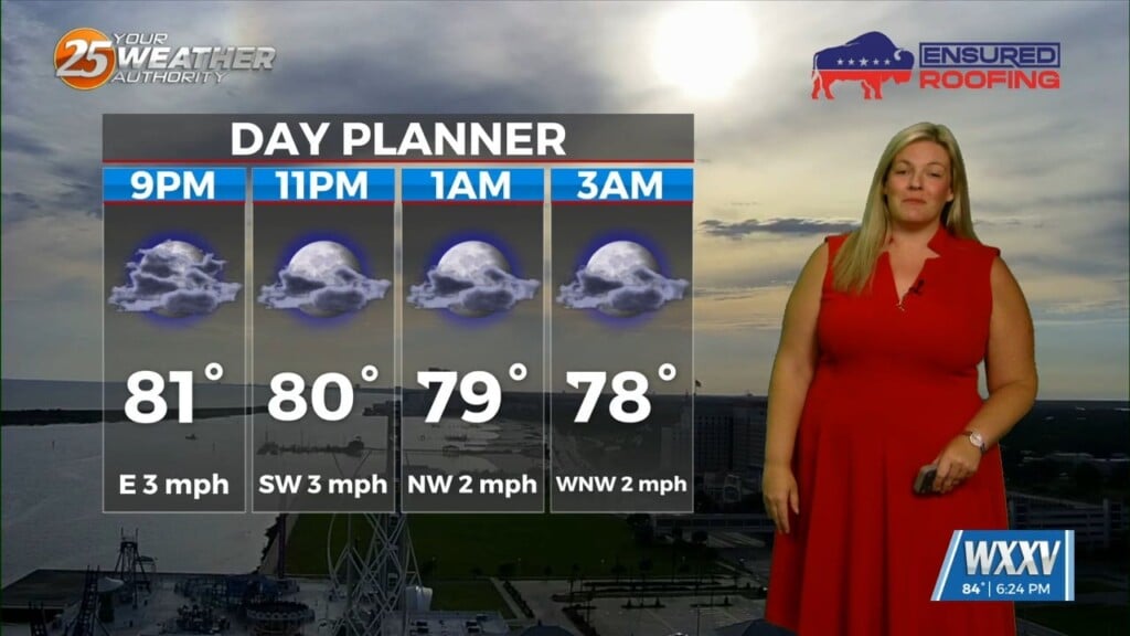
The gloom continues. Northeasterly flow behind a front is providing for a cooler feel today. Cloudy skies will continue through the rest of the day and tonight. Light fog could develop in spots with lighter winds.
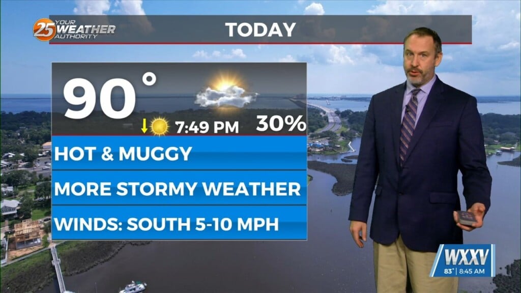
The front will retreat northward as we head toward tomorrow. Another system will be moving to its east Thursday. A batch of rain will skirt our northern areas around midday. Towards the late afternoon and evening timeframe, showers and embedded thunderstorms will be in the picture.
There is not a lot of instability to work with. There is a low-end potential for strong thunderstorms capable of producing a damaging wind gust or two. The clouds and shower chances will be stubborn to leave until the cold front’s upper-level support clears the area Friday morning.
Skies will clear in rapid fashion Friday and a brief cool period will be what we enter the weekend with. Temperatures will be in the 30s across our area Saturday morning. However, the cold snap will be short lived as the pattern will moderate in quick order.