2/3 - Rob Knight's "Slight Severe Threat" Afternoon Forecast
A cold front west will slowly move east and through the area this evening. This afternoon will bring the biggest potential for impactful weather to the local…
A cold front west will slowly move east and through the area this evening. This afternoon will bring the biggest potential for impactful weather to the local…
An area of low-pressure to the south along with a cold front north will continue to bring rain to the area. May not see a lot of movement…
A rather complex forecast scenario will play out over the short term period. High pressure will remain centered east of the area, and this will…
One more comparatively nice day before the local area gets back on the weather roller coaster tomorrow. Surface high shifts eastward today, with surface…
Today will be a quiet weather day locally while high-pressure to the west shapes the forecast. Any significant moisture return isn't likely to occur until sometime…
A cold front is barreling down from the northwest will bring a few showers and even a brief t-storms this afternoon- evening. Winds will sharply transition and pick…
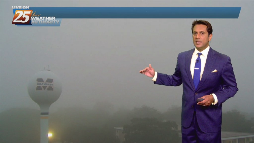
Clouds will continue to break up and dissipate towards the southeast late this evening and overnight tonight, revealing mostly clear skies for all areas... but it`ll be cold.…
Isolated to scattered showers will then persist the rest of the evening and overnight hours as moisture remains in place but loss of daytime heating limits convective potential.…
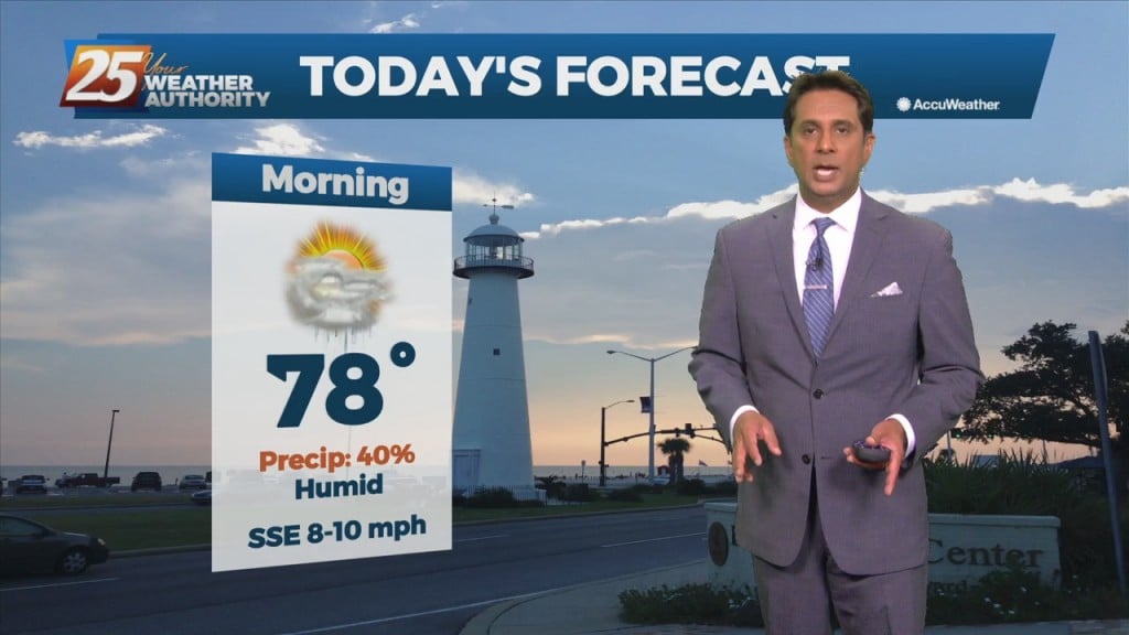
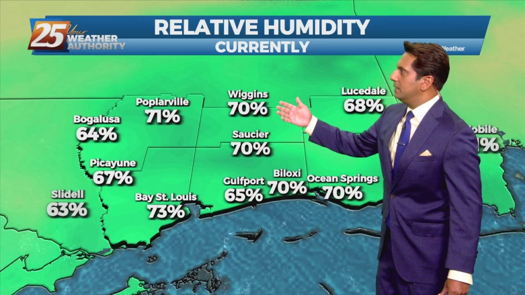
High temperatures today are forecast to reach around 80 for many areas with dew points in the mid-60s, which will make for fairly muggy conditions. I…
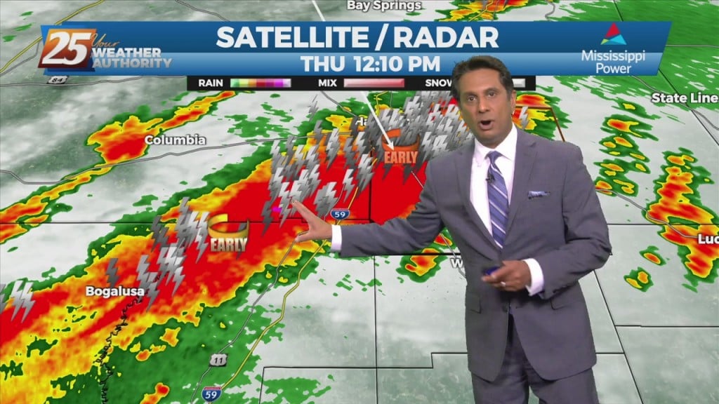
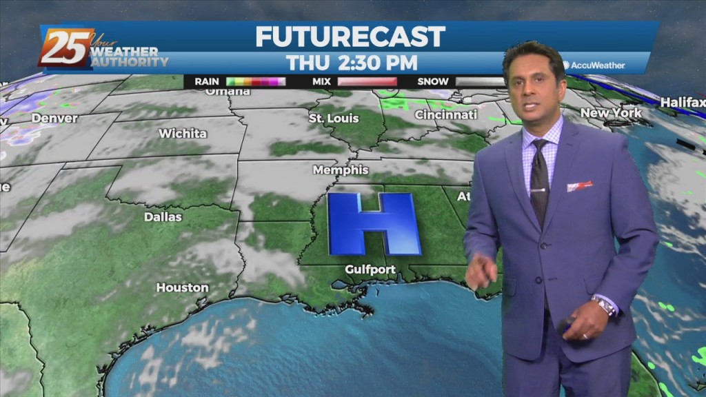
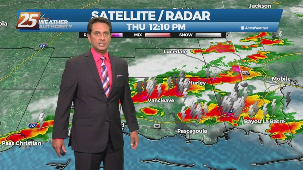
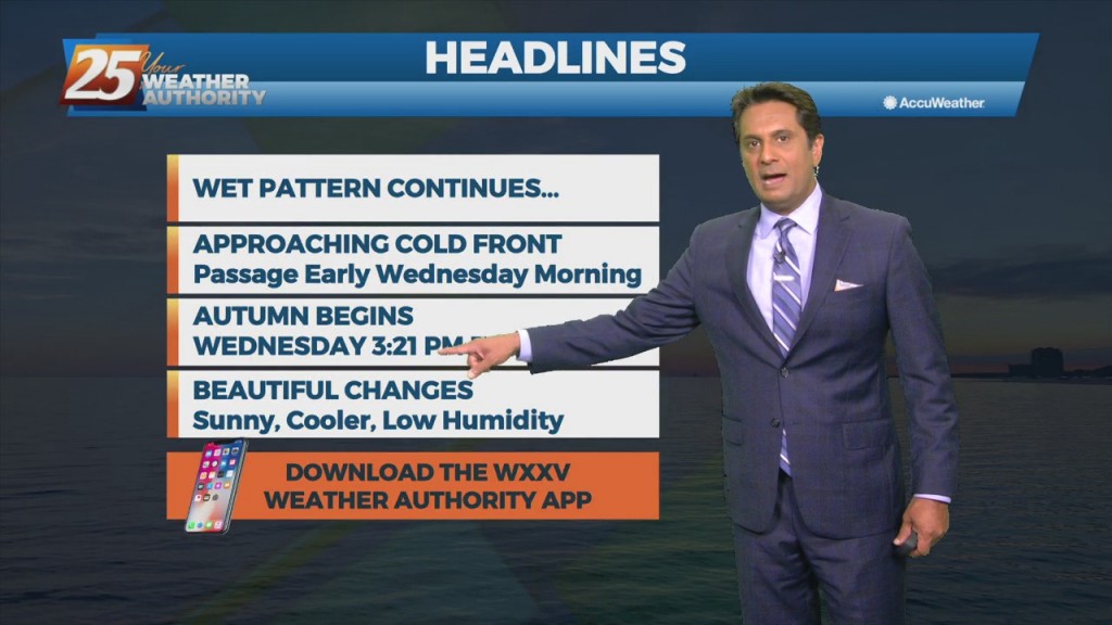
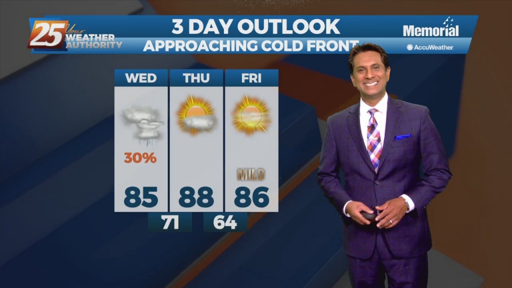
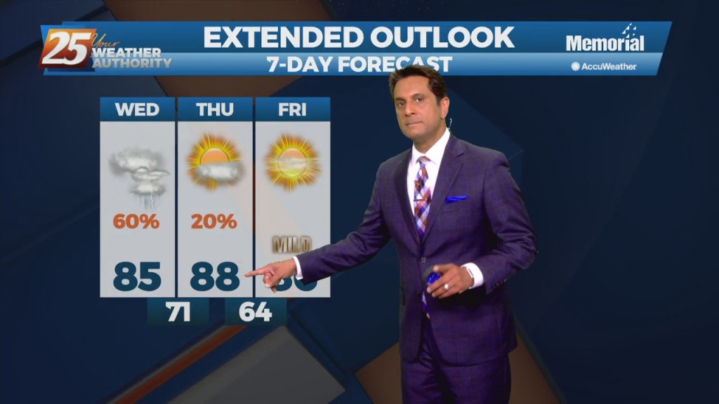
A cold front west will quickly sweep through our area Thursday, it will be accompanied by a few showers and thunderstorms. Moisture and instability is limited and unfavorable for any extremely heavy rainfall but it cannot be ruled out. Also…
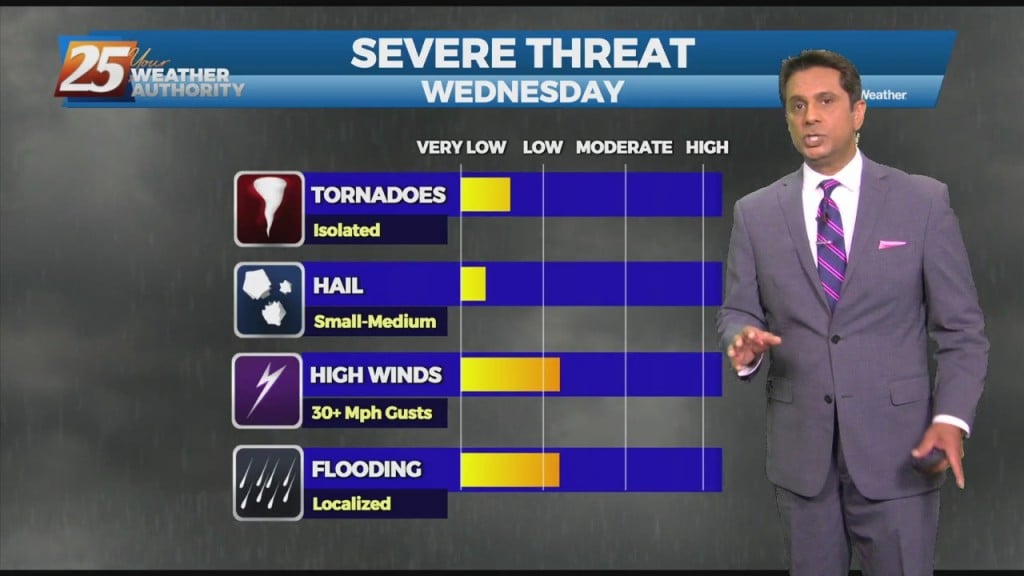
A lovely day today post dry frontal passage last night. We continue to see a severe weather/heavy rain threat Wednesday afternoon and Wednesday night with much cooler weather…
A shallow cold front continues to move SE through the region. Sufficient moisture in place with enough instability to support showers and a few thunderstorms will continue this…
A region of high pressure NE of the area is steadily moving SE'ward, allowing for more moisture to move in from the south. A weakness in…
A broad upper level high-pressure extends from the Gulf Coast to the Great Lakes. A trough of low-pressure off the east coast of the country will sag southwest today. In doing so, the flow will shift to more onshore which…
Today will bring advance moisture flow to the area in advance of a front now moving east across the southern plains. As instability slowly decreases, a few showers will be possible through tonight. A few showers will also affect the…
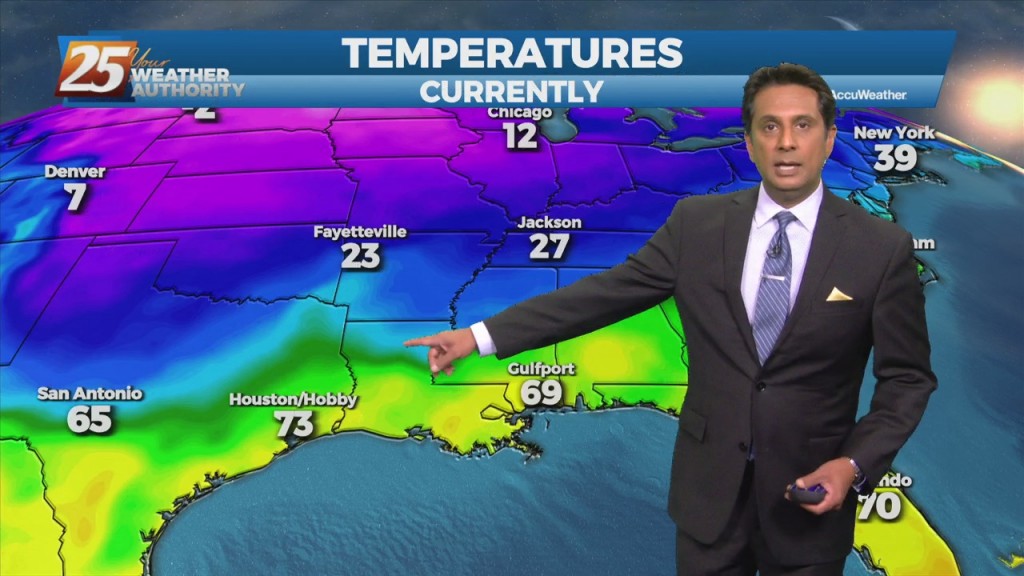
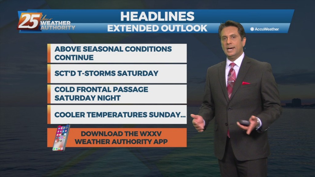
Southerly return flow around high-pressure to the east will keep us in the same weather pattern we have been in for the past week with mainly dry conditions and slightly above normal temperatures. The high-pressure will start to retreat to…
Weak upper-level high pressure currently extends along the Mississippi Valley from Canada to the Gulf of Mexico. The ridge isn't particularly strong enough to keep the low-level moisture flow out of the area however. The main concern for today will…
A disturbance with an associated cold front are expected to move across the area Tuesday night into Wednesday morning. Models indicate moisture flow decreasing slightly today/Tuesday, but still sufficient for at least scattered showers/t-storms. Scattered convection is also possible just…
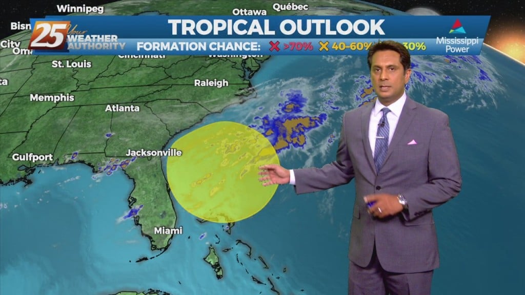
As a tropical wave south moves towards the Florida Big Bend area, expect isolated t-storms through tonight with any heavy rain rather localized and not worthy of a large scale Flash Flood Watch. Activity will wind down this evening as…
Any significant weather impacts in the short term for most of the area should be limited to the daytime hours today. As a tropical wave south moves towards the Florida Big Bend area, expect scattered t-storms through today with any…
Showers and t-storms will affect the area with the potential for pockets of more heavy rainfall will exist. The Weather Prediction Center continues to outlook most of the forecast area with a Marginal risk of excessive rainfall this afternoon. An…
A frontal boundary will remain nearly stationary across the forecast area, while gradually dissipating. Showers and t-storms will affect the area with the potential for pockets of more heavy rainfall will exist. The Weather Prediction Center continues to outlook most…
The words "cold front" and "August" are not often associated together in the Gulf coast. The persistent high-pressure over the west will allow a cold front to lag across the region through mid/late workweek. The stretch of heat and humidity…
A stalled frontal boundary from the Carolinas to southeast Texas will slowly shift north and wash out by Thursday afternoon. High-pressure over the mid-section of the country will build slowly eastward by Thursday bringing lower rain chances and a return…