9/29 - Rob Knight's "Pretty Fall Weather Continues" Thursday morning Forecast
Fall is in the air! No rainfall is expected for the next few days. We are still experiencing some impacts across the area from pressure…
Fall is in the air! No rainfall is expected for the next few days. We are still experiencing some impacts across the area from pressure…
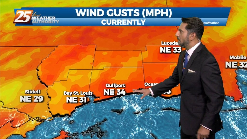
Strong northerly flow will be in place over the region for the next few days. While we are entering a Spring Tide, the new trends in the…
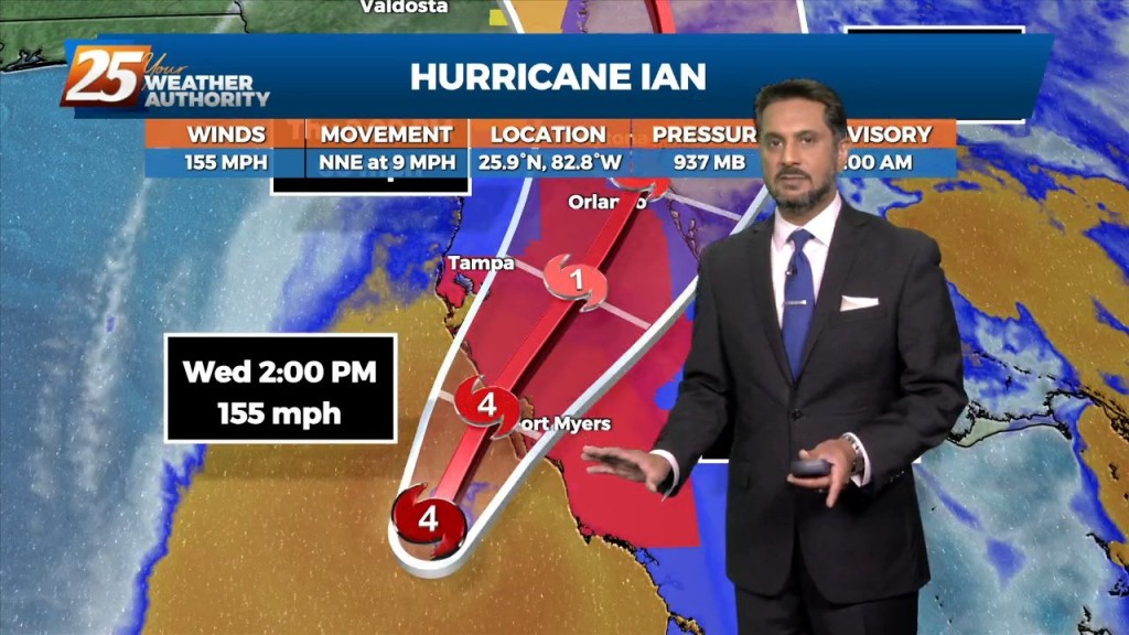
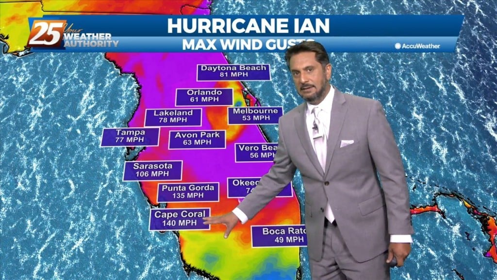
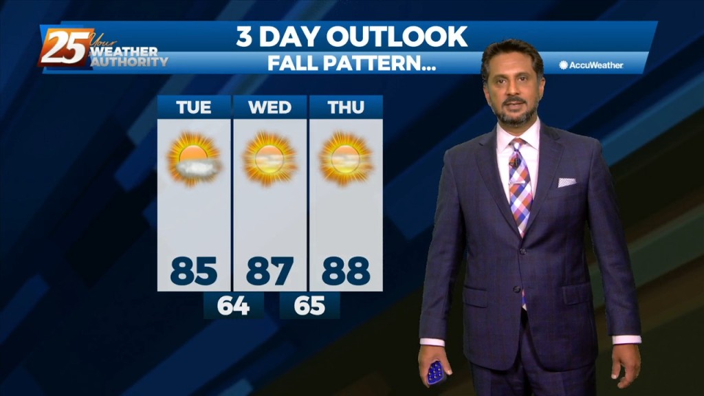
Drier and cooler temperatures are here, and Fall-like feeling is in the air! No rainfall is expected for the next few days. And while the Hurricane Ian is…
High pressure to the north moving closer will provide for lovely conditions through the rest of the workweek. A less humid flow and cooler temperatures will continue…
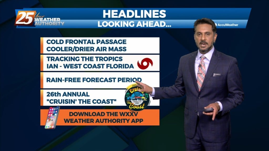
A cold front will push through the area this morning bringing in a cooler/drier air mass. Isolated to scattered showers could be possible along the coastal…

Dry conditions will continue trough the rest of the workweek thanks to the high pressure to the NE. Consequently, temperatures will be fairly warm for…
The forecast continues to be dictated by a strong mid-level high pressure situated over the south-central CONUS that is providing drier and warmer mid-level air to…
High pressure will expand across the southern US early in the week and should be centered across TX. An upper level weakness looks to clip…
For this first couple days of this forecast period, the upper level high pressure will dominate the forecast. After expanding across the southern US early in the…
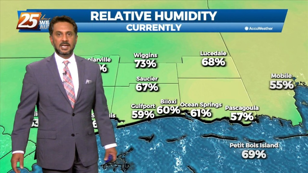
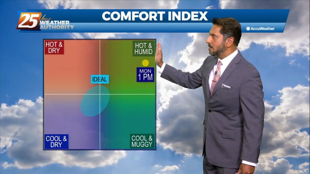
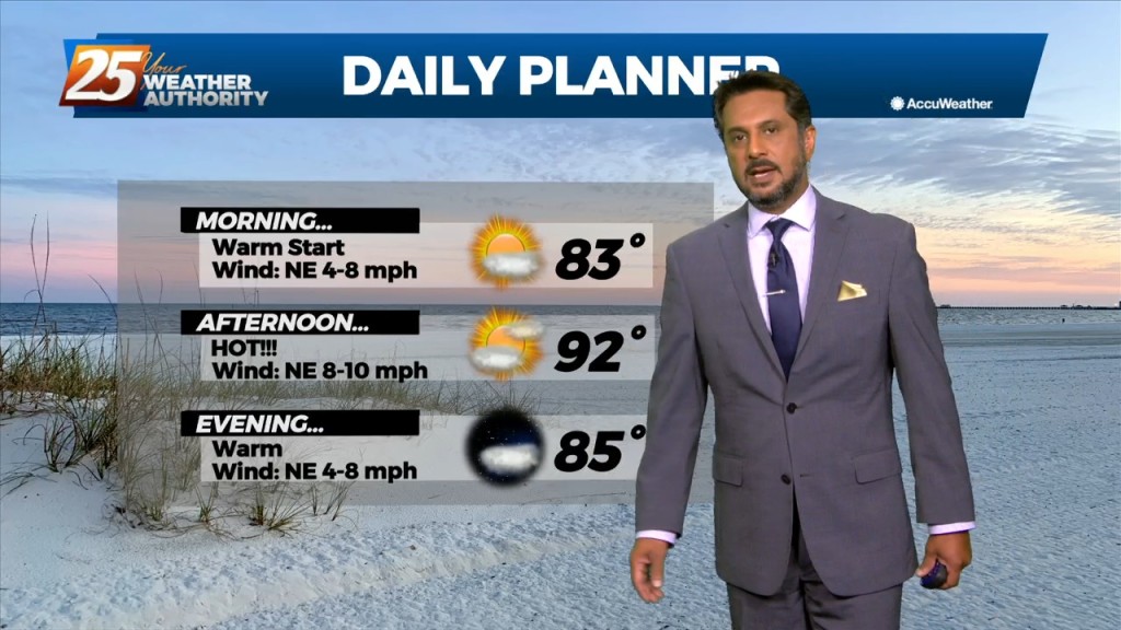
Lovely conditions ahead this afternoon as temperatures in the mid-80s and relative humidity in the 30/40% range will make it feel comfortable. As the evening and overnight…

The base of the upper level disturbance and surface cold front is now in the northern Gulf of Mexico. Other than some outer coastal convection south of…
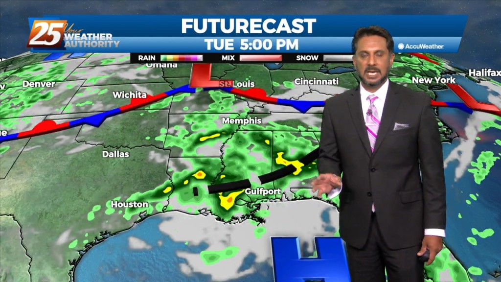
The main story is a cold front overhead moving SE. The upstream support will press east allowing the high to surge the front south and east through our…
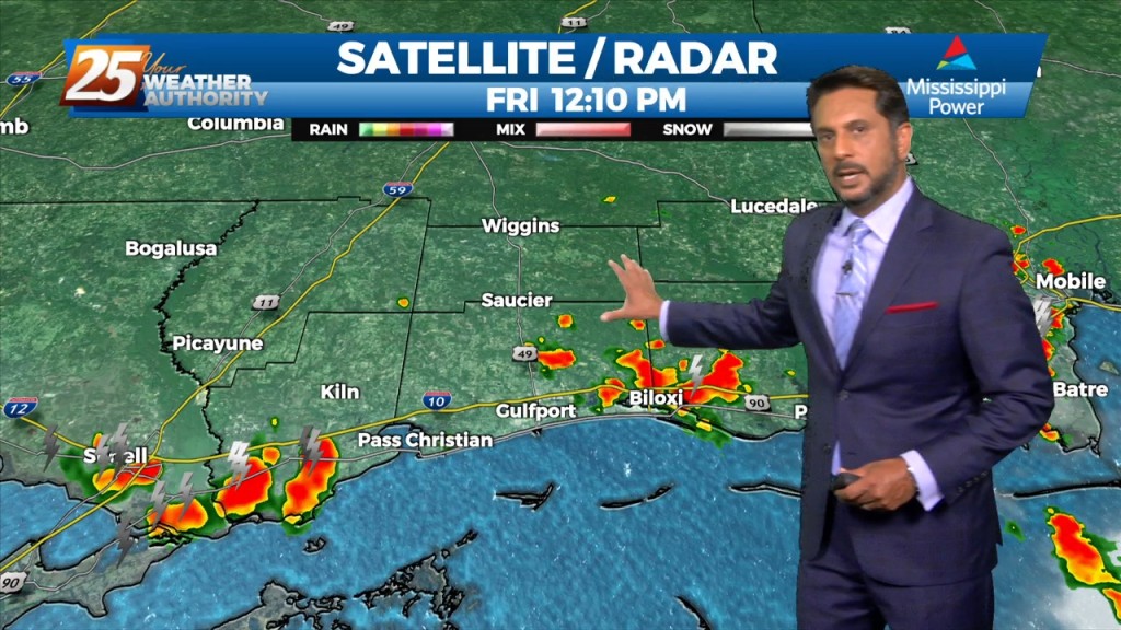
Early this morning, we will continue to see decaying showers over coastal Mississippi, with a remnant boundary possibly leading to a few re-developing isolated showers…
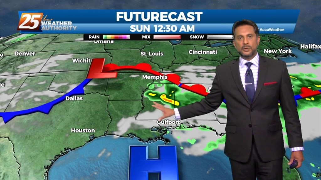
The same closed mid to upper-level low pressure remains parked over our area, centered generally over SE LA. The same corridor of deeper moisture continues along progressive…
The area is still under the influence of upper level weakness which is slowly moving east while further west has a large area of high pressure with…
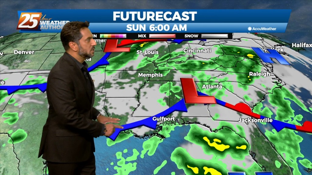
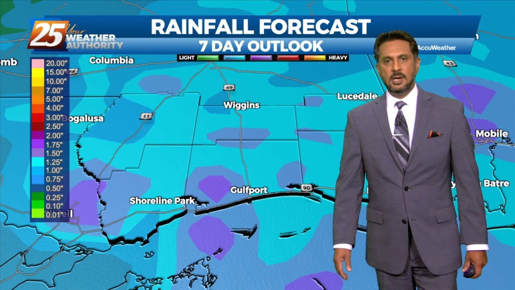
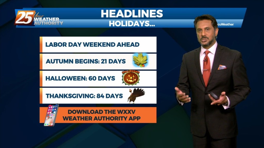
Going into Labor Day weekend, the general thought is that the dry pattern we’ve enjoyed (although hotter) will likely come to an end this weekend. Aloft,…
The best potential for rainfall, similar to Wednesday looks to be again along and west of the I-55 corridor later this afternoon. With the…
Overall, a fairly quiet day is expected across the area. It should be another lackluster convective day with plenty of dry air aloft. The best potential…
Mid level dry air will remain in place today. This will help cap the environment, making it harder for thunderstorms to get started. There will be some…
Daytime heating will continue to flare up afternoon showers and t-storms which could produce pockets of HEAVY RAINFALL... Over the short term period a wetter period will…
High pressure will continue to move into the area and shape the forecast though the weekend. The Bermuda ridge extends westward from the Atlantic Ocean to…
High pressure is over much of the lower Mississippi River Valley and extends westward across the northern Gulf of Mexico. Don’t see much indication of a frontal…
An easterly wave noted in the pattern will move westward across the area this afternoon/tonight, enhancing t-storm development. Areal coverage over land this afternoon/tonight should be fairly…
Overall, expect the same stuff, different day, at least this afternoon and Saturday. Western portions of the area may see a little more convective activity over…