04/16 Ryan's "Great Start" Monday Evening Forecast
We're starting the week with beautiful weather after our stormy weekend, but it doesn't last forever....
We're starting the week with beautiful weather after our stormy weekend, but it doesn't last forever....
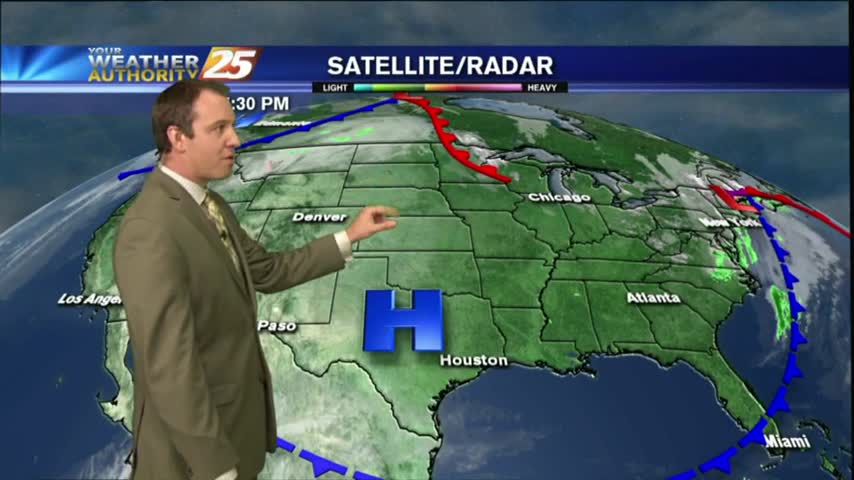
It's still fairly calm now, but a severe weather threat is moving in for tomorrow afternoon....
It remained cloudy and warmed a few degrees as we expected, and the potential for severe weather is still on for tomorrow....
The rain moved in earlier, but is now on it's way out ushering in a cooler and drier Thursday. Click the forecast link for the details.

Happy Groundhog Day everyone! Today's weather was nice, but we'll see drastic changes as we head into tomorrow evening. Click the forecast link for more.
A cold front moved through last night and brought very little rain, but cleared our skies and cooled things down a bit. These changes don't last long, so be sure to watch the full forecast for details.
Rain is expected late tonight, but we'll be sunny and clear by tomorrow afternoon. Don't expect those changes to last though as rain moves right back in! Watch the full forecast for the details.
Lots of changes on the way over the next week as at least three fronts move through bringing increasing humidity & temperatures, then rain, and finally clearing & drying. Click this link for the full forecast.
After a clear and warm afternoon, we're headed for a clear and chilly evening. Continued cooling will bring nearly perfect conditions tomorrow though, but you'll have to click the forecast link for details.
Grey skies, humid air, and rainy conditions have all been pushed to the East by yesterday's cold front, and the sunny and clear days will linger through the middle of the week. Changes happen quickly though, click the link fore more.
We've had several days of warm and humid weather, and we're making up for it tonight as last night's cold front has brought wind chills as low as 20 degrees. It only gets colder this weekend, click the forecast link for more.
Last night's cold front has moved on, but it's Arctic airmass is moving in quickly. Click the forecast link for the details.
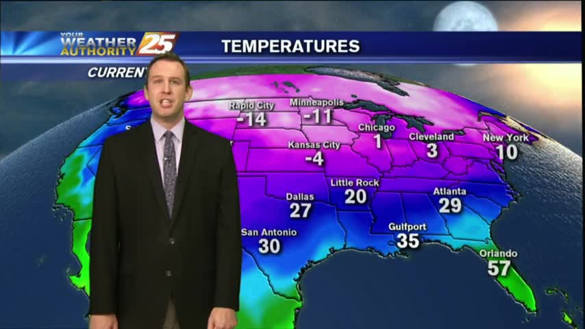
Dangerously cold temperatures move in for the next several nights, so we'll be starting the New Year off on frigid note. Watch the full forecast for details.
A cold front passed through South MS during the early morning hours with little fanfare, but we'll feel those chilly and drier conditions tonight...and again a few times this week. Check out the full forecast for details.
Clouds will tonight after our cloudy day, with much cooler and drier conditions tomorrow. Watch the full forecast for details.
The first true "chilly" night lies ahead for South Mississippi, and it won't be the only one over the next several days. Click the link for the full forecast.
A cold front moved through just after midnight last night, and the cooler/drier air continues to pour in. Watch the full forecast for details.
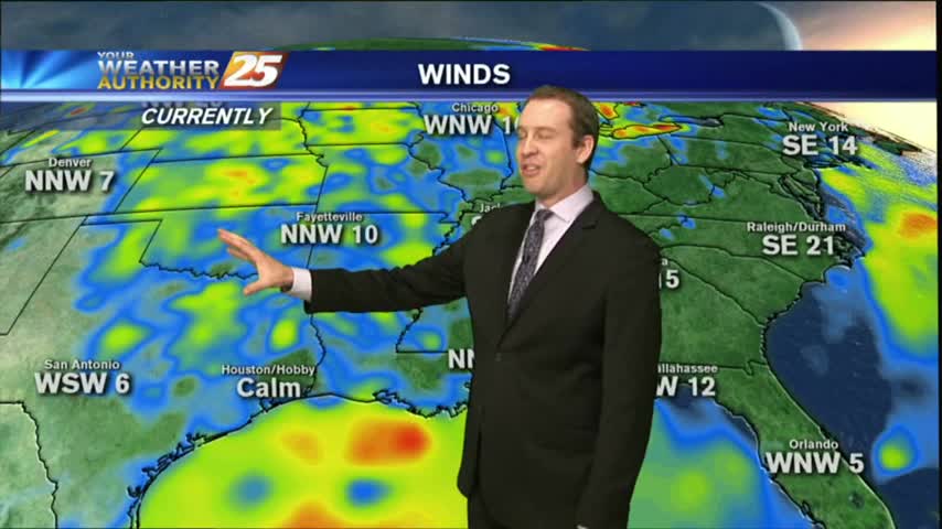
Drier are has moved into the area, and that means nice weather for the next few days, but changes are on the way.
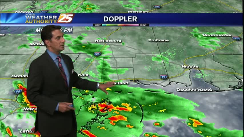
This morning started out cooler with breezy conditions along with isolated rain moving in from the SE. The activity continues with more activity developing...poised to move into he area this afternoon...
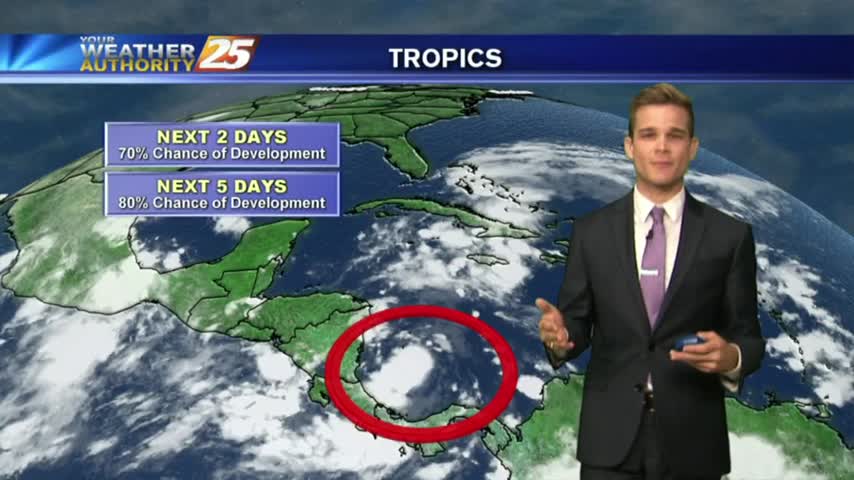
As a tropical wave moves across the N'tern Gulf of mexico, rainfall has already begun to move into the coastal counties...
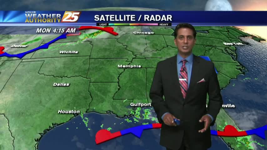
Expect overcast and on and off showers and thunderstorms for your Monday.
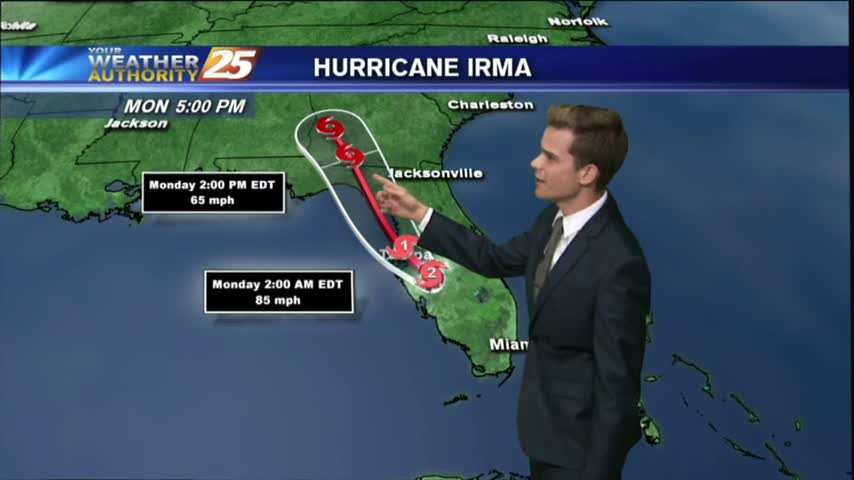
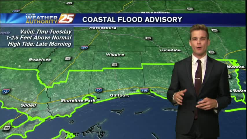
Irma made its second landfall Sunday in Marco Island, FL at 2:35 pm local time as a category three storm.
Today's warm & humid afternoon will give way to another humid night, with temperatures even warmer than the one before. This trend continues until a weekend front, so watch the forecast for details.
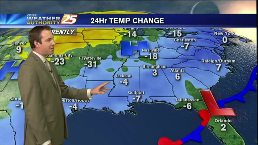
The cold front associated with last night's strong storms finally moved East of the area today, and we're already seeing significant clearing & cooling. Watch the full forecast for all the details.