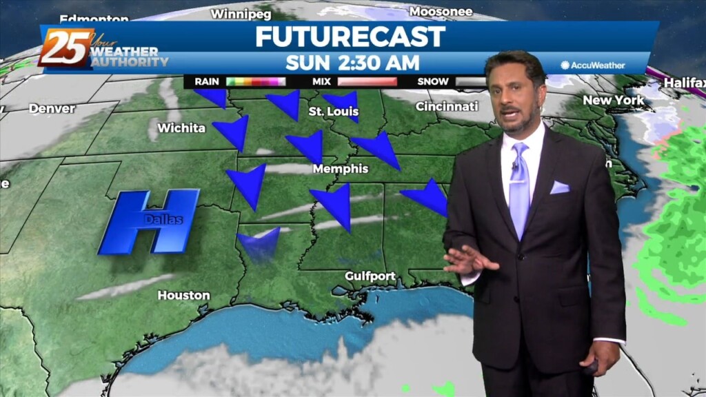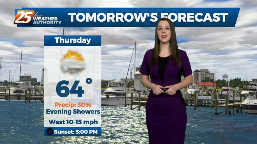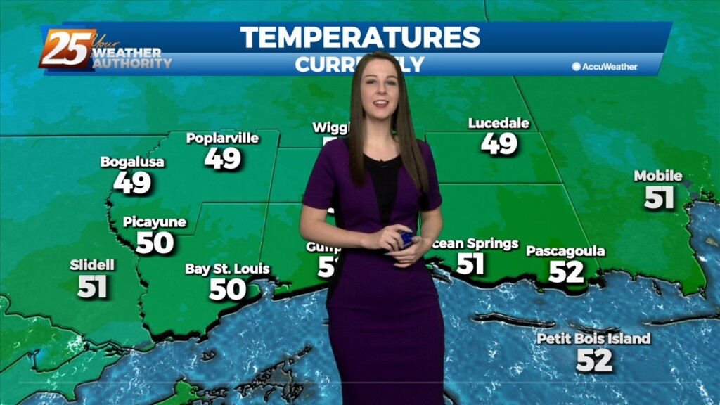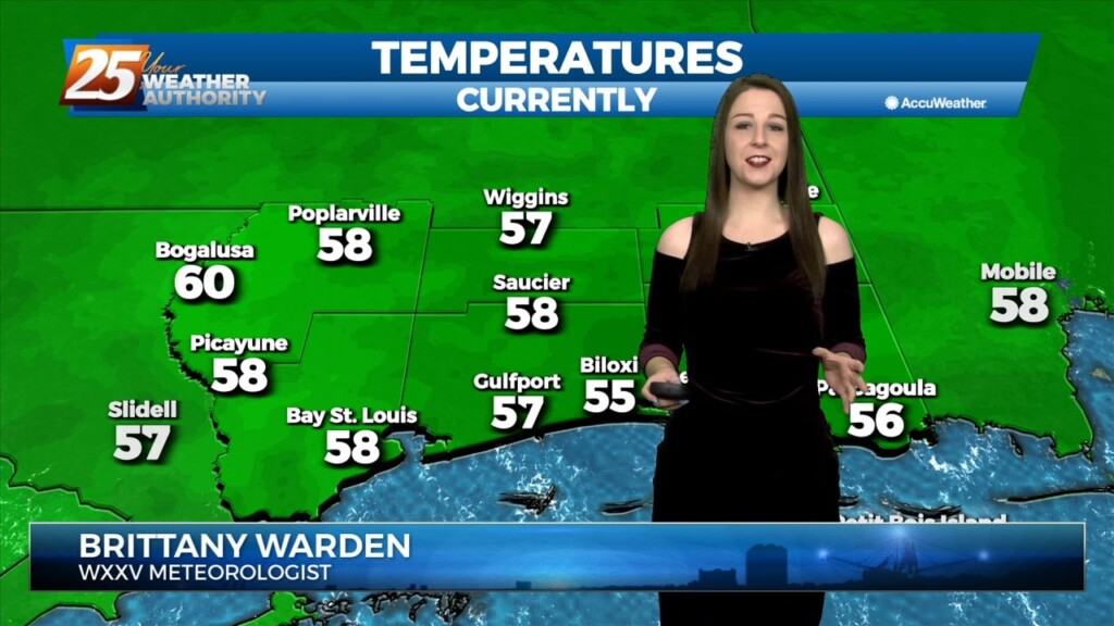
12/22 – Brittany’s “DANGEROUSLY COLD, Arctic Air Mass” Thursday Evening Forecast
An Arctic front and a very cold air mass to the NW continues to move SE. Current expectation is that cold front will reach the extreme western portions of our area northwest of Baton Rouge and McComb…then moving rapidly across the area to the Mississippi-Alabama border before midnight. By midnight, today’s highs will be a distant memory as cold air…