12/21 - Rob's "Hump Day" Afternoon Forecast
After a FOGGY start, the fog has burned off with the low clouds lifting. Partly/mostly cloudy skies will continue as upper-level clouds begin to move in...
After a FOGGY start, the fog has burned off with the low clouds lifting. Partly/mostly cloudy skies will continue as upper-level clouds begin to move in...

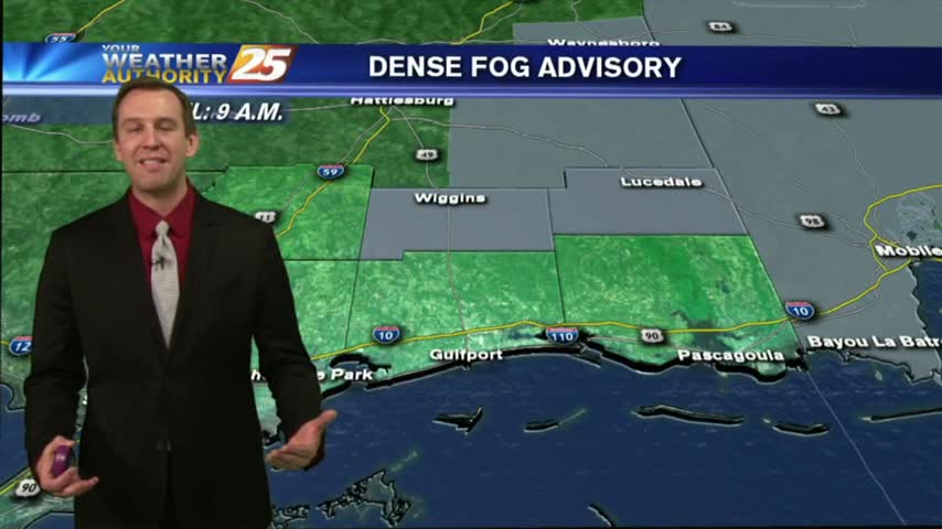
As temperatures have begun to warm, it's another morning of DISRUPTIVE weather in the form of patchy FOG...
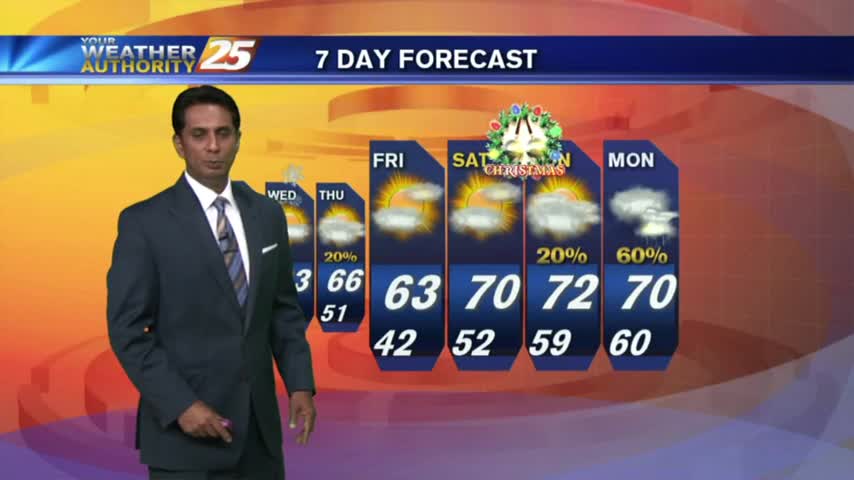
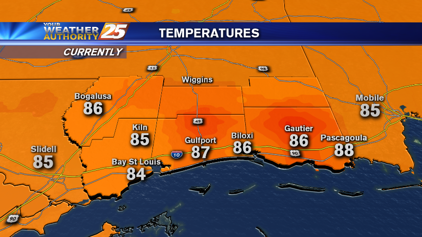
Today started our gradual warm-up, and we'll continue to see some slightly higher temperatures tomorrow afternoon and night, but then things cool down a bit. Watch for details.
Excellent and seasonable weather is forecast moving into the Holiday weekend.
After some clearing late yesterday afternoon...the low-level clouds rolled back in after sunset and continue this morning.

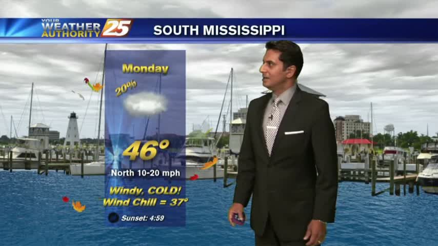
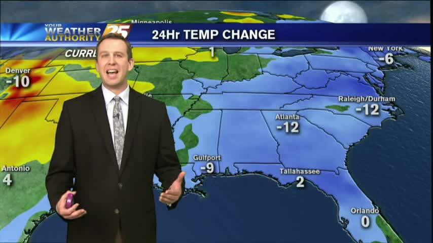
We'll see some freezing temperatures around South MS tonight, but the "winter" weather won't stick around long...even for the official start of Winter on Wednesday.

Very cold wind chills are forecast for tonight. Some readings will dip into the mid-teens before sunrise Wednesday.
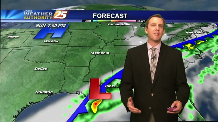
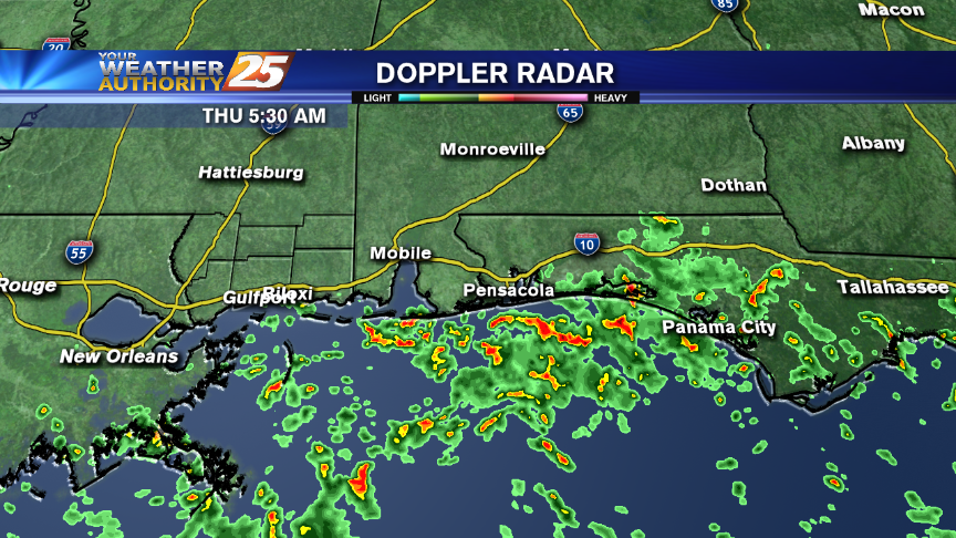
After a RAINY Sunday, the rain has moved east as very WINDY CONDITIONS continue to affect the local area...
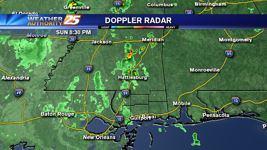
Light rain is still possible overnight while cold northerly winds will make it feel like it's in the twenties.
It warmed up considerably today as expected, and that will continue into tomorrow, bringing our afternoon high into the mid to upper 70s. Doesn't last forever though, so check out the forecast for details.
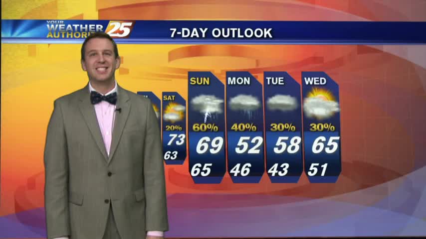
Heavy thunderstorms will be possible across the area on Saturday night and Sunday morning!
While severe weather is not expected on the Coast this weekend, we'll be in close proximity to some that is expected to occur over SE Louisiana on Saturday. Dense fog is possible Friday night and Saturday.
Colder air has officially arrived this evening, but coastal areas don't need to worry about freezing too much tonight. The cold won't last long though, check out the forecast for details.
Very cool weather through tonight for the Coast, with increasing rain chances beginning on Friday.
Clearing conditions greet you on this Thursday morning with disruptive weather forecast for late in the coming weekend.
Low level moisture still lingers in the area, but cooler & drier conditions will move in overnight. Details inside.
Rain has ended across coastal Mississippi and fog continues to linger. Several days of cloudy skies and rain will begin over the weekend.
After some BUMPY weather yesterday afternoon, the cold front is now to our south as patchy fog has developed...
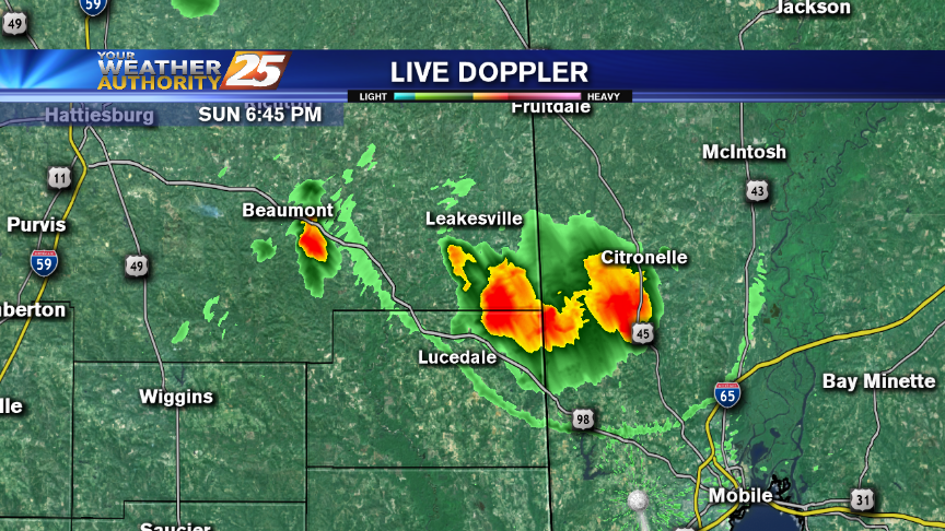
After a stormy afternoon with some severe damage, things have quieted down for the evening. How long will it last? Watch the forecast for more.
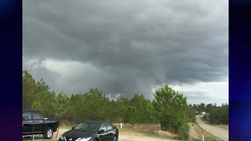
News 25’s Shelby Myers is following the storm on the ground and has the latest from north Harrison County.
Rain and thunderstorms have stayed north of the Coast during the morning hours. They'll descend south later today, affecting us this afternoon and tonight.
With a cold front in the area providing for WARM/HUMID air in advance, PATCHY DENSE FOG has developed with and ADVISORY through mid-morning...
Expect another night of foggy conditions, but an approaching front will clear everything out...after dreary rainy day tomorrow.
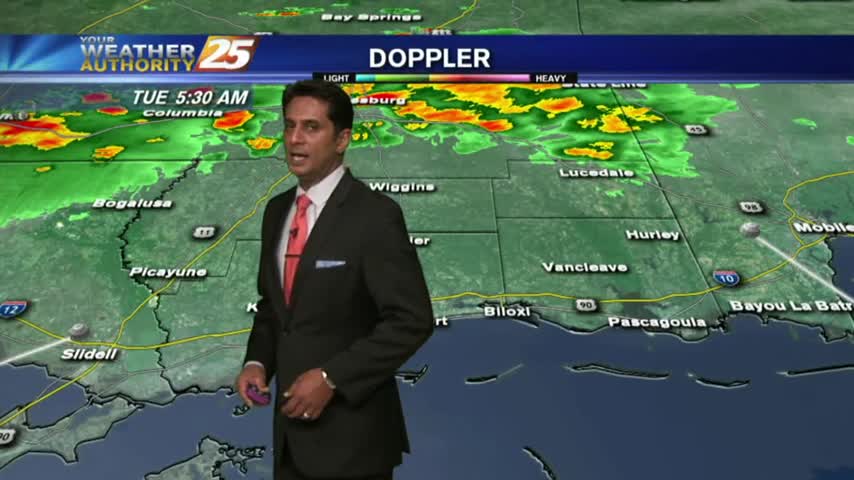
Showers and thunderstorms begin this afternoon here on the Coast, with increasing thunderstorm chances on Tuesday.