01/13 Ryan's "Warm & Humid Winter" Friday Night Forecast
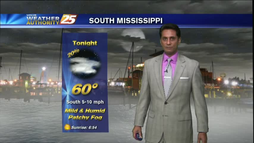
Expect some spooky fog for your Friday the 13th evening, and warmer temperatures through the weekend.
Expect some spooky fog for your Friday the 13th evening, and warmer temperatures through the weekend.
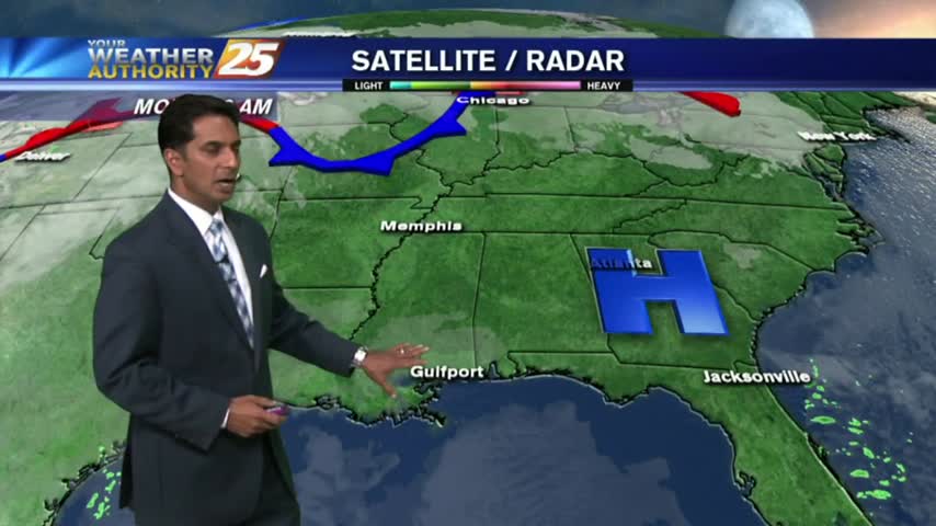
After DENSE morning FOG; skies have cleared, temps continue to warm with a few clouds along south Mississippi...
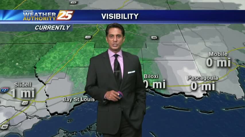
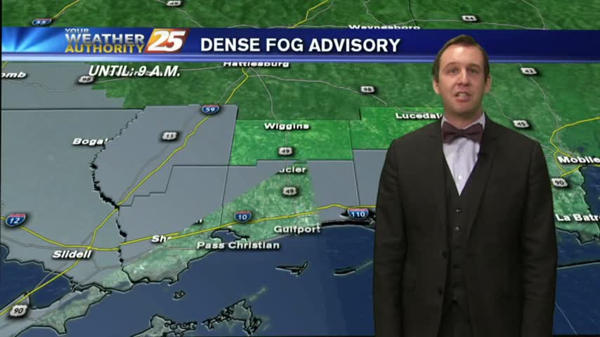
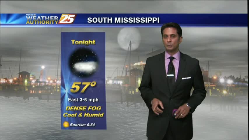
Another morning with warm/humid conditions along with areas of DENSE FOG...an advisory is in effect through mid-morning...
Spotty showers and warm weather is continuing on the Coast.
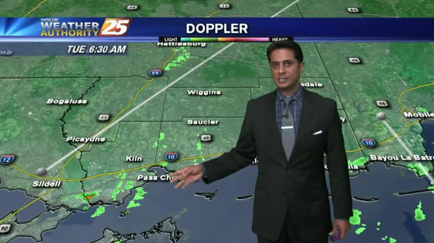
After areas of patchy DENSE FOG earlier this morning, Light rain is moving in from the SW...
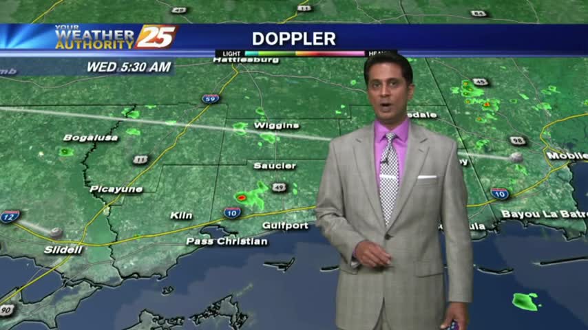
Another start with warm/humid air flowing from the GOM, has PATCHY DENSE FOG affecting the local area...
Weather conditions will remain mild over the Gulf Coast tonight and Thursday.
After patchy dense morning fog...sunny skies have dissipated the fog with warming temps and increasing humidity...
The warm and humid air mass continues to move in from the Gulf providing for areas of patchy fog...
Isolated showers and warm weather are the rule for the next couple of days!
After a few VERY FRIGID days...warmer air has begun moving in from the Gulf...
We saw flooding and freezing conditions last week, but will this week be just as exciting? Watch the forecast to find out.
After a good bit of sunshine this morning...the clouds have rolled back in as temps warm to around 70 degrees...
Very slight rain chances are back in the Seven-Day Forecast.
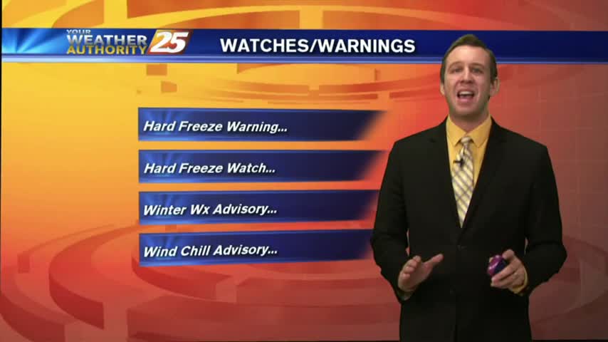
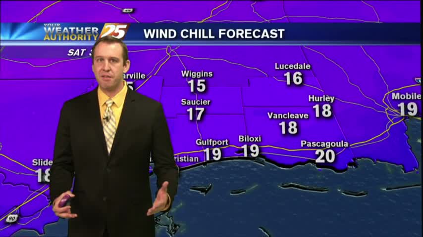
After a FRIGID weekend, it's a VERY COLD start on this Monday morning...with major changes ahead.
Much warmer weather is on-tap for the Coast this week!
The rain has moved East but the most dangerous road conditions are still ahead. Forecast details inside.
News 25's Hank Davis speaks with emergency officials on what to be cautious of during the winter storm passing through Mississippi. Rupert Lacy with the Harrison County Emergency Management Agency is closely monitoring the winter storm that's passing through our…
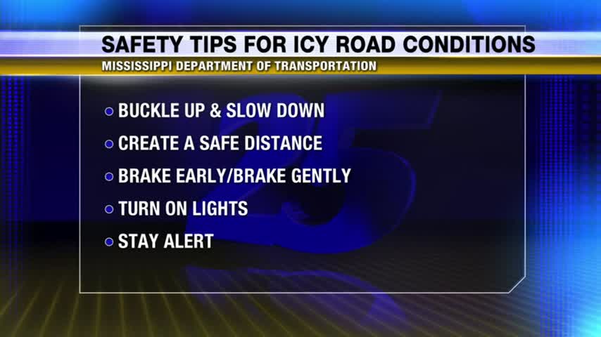
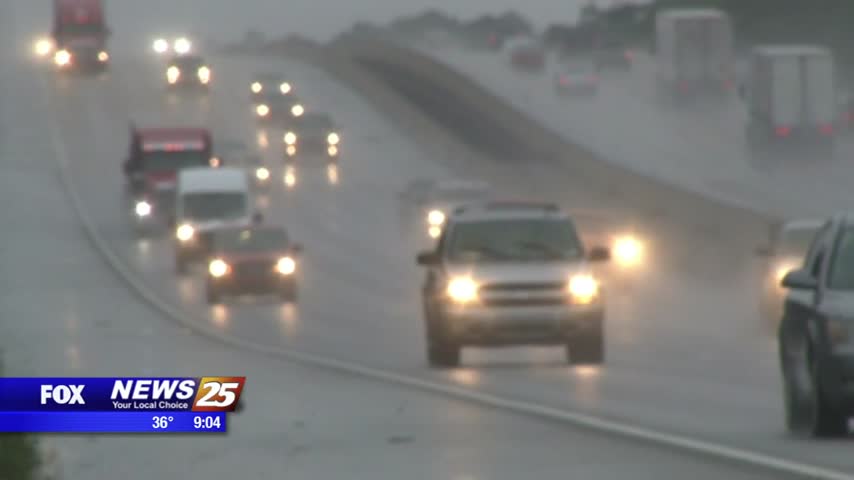
With ice expected to cover a significant amount of roadways throughout Mississippi, News 25's Kendra Turley provides tips on how to stay safe during your weekend commute.
We're still not expecting any significant frozen precipitation in the coastal counties, but a hard freeze will cause icy roads overnight. Click for forecast details.
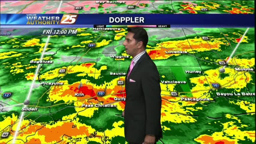
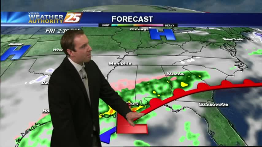
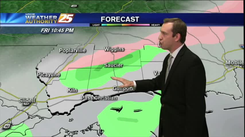
After light rain early this morning...moderate rainfall will continue with a SLIGHT change for a WINTER MIX late tonight along the coastal counties...
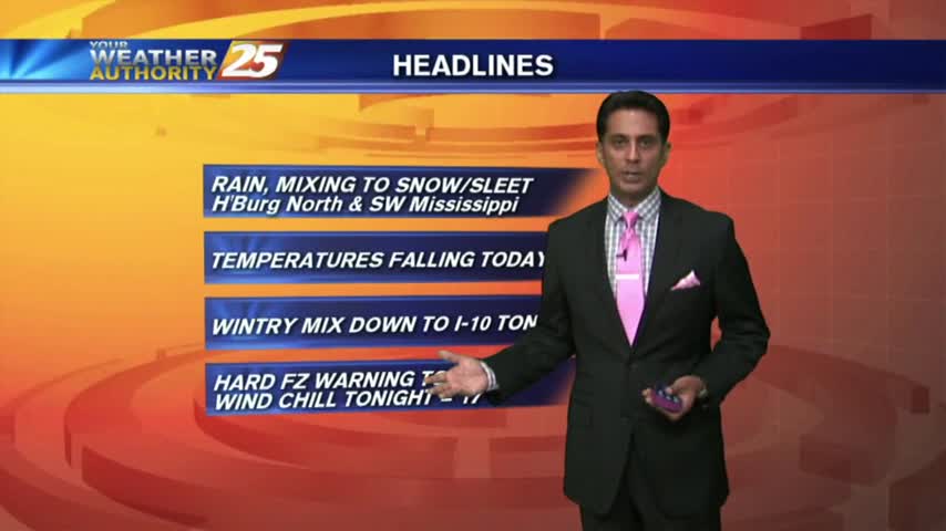
Rain moved in overnight and will become WIDESPREAD through today with it mixing to SNOW/SLEET north of the coast.
Winter weather chances march further and further South, so check out the forecast for the latest.
There's been a lot of talk about the possibility of winter weather in South MS, here's a forecast update with the latest.