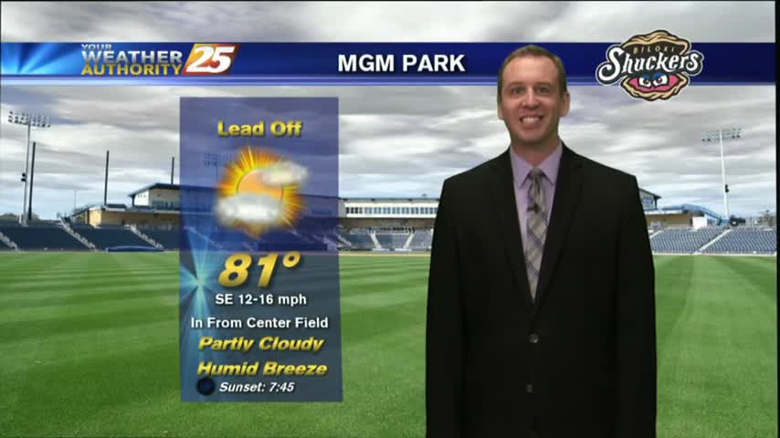
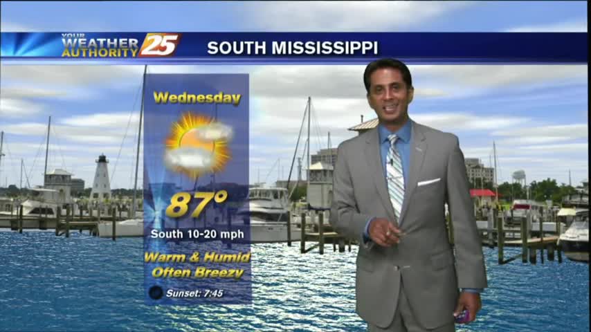
5/24 - Rob's Wednesday "Clearing Skies" Forecast
With a front affecting the Gulf Coast, cloudy skies with activity through midday...then clearing skies.
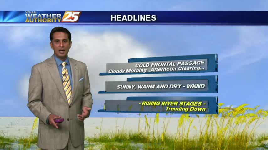
With a front affecting the Gulf Coast, cloudy skies with activity through midday...then clearing skies.
Overnight rain cleared for a sunny afternoon, but one last wave of rain is expected tonight. Watch the full forecast for details.
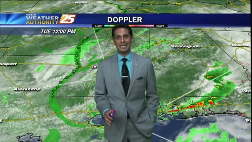
Morning showers/t-storms have subsided and moved to the east as the stationary front moves east...

With a stationary front over head, showers/t-storms continues with areas of patchy fog along the Southern 6...
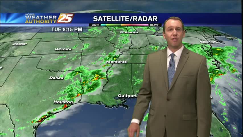
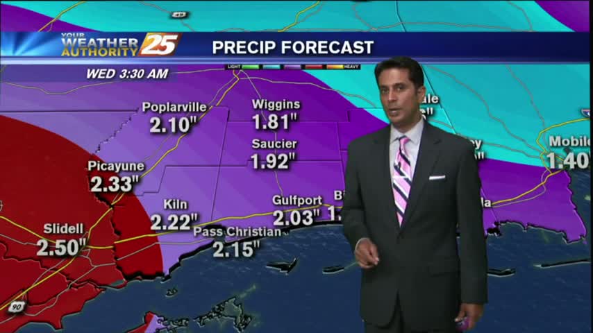
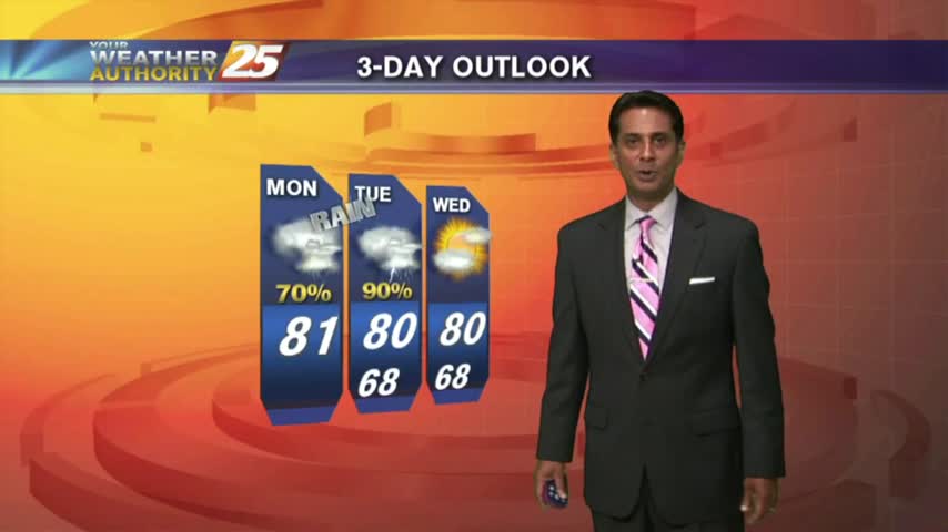
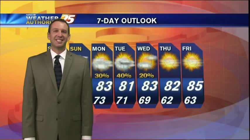
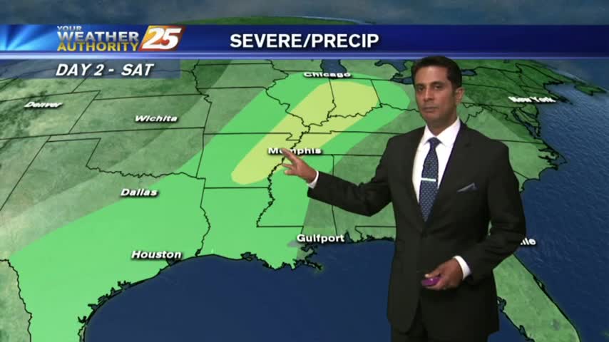
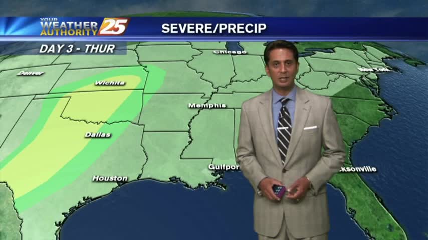
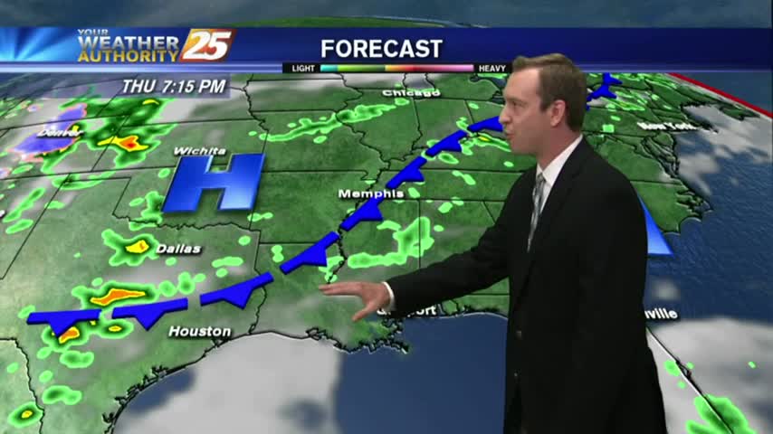
Another round of Gulf Coast rain this morning, with more moving in for tonight, and still even more into Wednesday. This means flooding will be an issue, watch the full forecast for details.
Light rain has been moving into the area this morning, scattered showers/t-storms on-tap this afternoon...
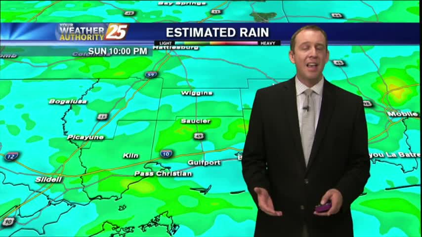
After a WET WEEKEND, showers and t-storms will move back into the area later this morning...
Another round of rain moved through South MS this afternoon, adding more to our already saturated ground. Flooding will be the likely issue going forward, so be sure to watch the forecast for details.
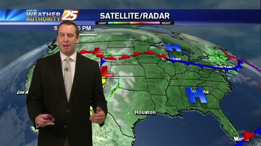
Tonight will be even warmer than last night was, only barely dropping below 80 for the evening low. Clouds have broken up a bit at the moment, but will thicken again early tomorrow morning as the first of many "squall…

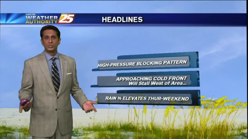
It's a WARM/HUMID day long the Mississippi Gulf Coast with the potential for HEAVY RAIN through the weekend...
Under mostly cloudy skies...it's a warm & Humid start with very light sprinklers along the coast.
It almost seems impossible, but it'll be even warmer and more humid this evening than it was the last few nights and the moisture just keeps piling up. Watch the full forecast for details.
After a HUMID start to the day, isolated showers have been moving into the area along with a few T-Storms for this afternoon...

A very humid tropical air mass continues to move in from the Gulf...with isolated light showers to kick-off the day...
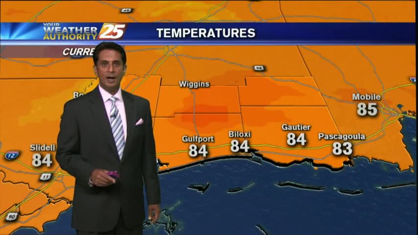
Today's warm & humid afternoon will give way to another humid night, with temperatures even warmer than the one before. This trend continues until a weekend front, so watch the forecast for details.
After a warm/humid start...a tightening gradient east of the Rockies continue to elevate winds, now gusting into the upper teens/low 20 mph range.
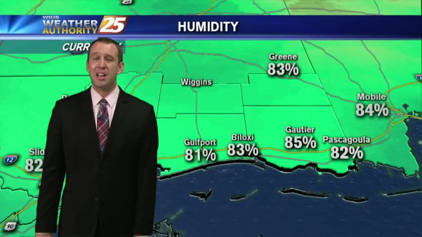
Another Warm/Humid start to the day with areas of PATCHY DENSE fog along the coastal counties...
Still clear but getting warmer out there tonight, though winds will be a bit too high for fog formation. Watch the full forecast for details.
After a few morning clouds and patchy fog, a low-deck of clouds have now formed along the coastal counties...
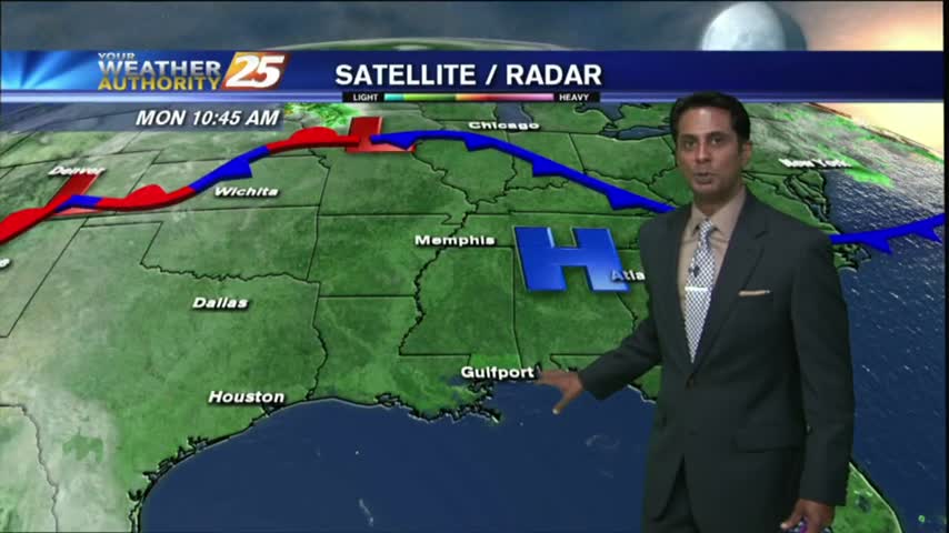
Another humid start with areas of patchy fog as an area of high-pressure continues to block the Gulf Coast...
Last night's conditions carry over into tonight, meaning light shifting winds will limit fog production, but some patchy fog is likely. Watch the full forecast for more.
After a clear start with patchy fog, temperatures continue to warm with a few clouds developing...
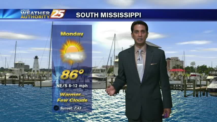
A warm/humid start to the workweek along with areas of PATCHY FOG along the Southern 6...
Mother Nature may have helped us out with a great Mother's Day afternoon, but don't expect many changes in the next few days. Watch the full forecast for the details.