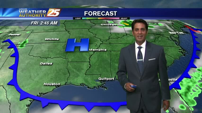
9/13 - Payton's Wednesday Morning Forecast
It was a chilly and dry start to the morning with temperatures in the mid 50s to lower 60s.
It was a chilly and dry start to the morning with temperatures in the mid 50s to lower 60s.
Irma is no longer a tropical system and Jose continues on its "path to nowhere," but the season isn't over just yet. Locally things are looking good though, full details inside.
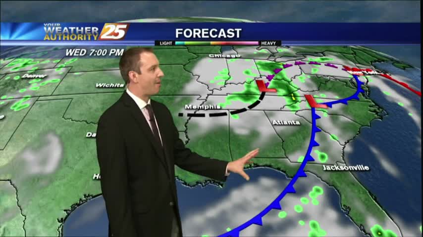
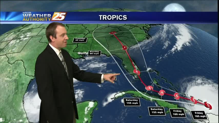
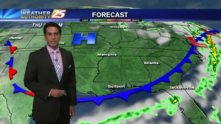
As IRMA continues its track to the NW…now moving through N’tern Alabama as a low pressure system, the lovely conditions will continue here in South Mississippi.
IRMA, now a TROPICAL DEPRESSION moving through N'tern Alabama continues to bring lovely conditions and a dry north wind to south Mississippi.
Irma ravaged Florida as a major hurricane over the weekend, but has since weakened into a post-tropical low. Watch the forecast for a tropical and local update.

The LOVELY conditions continue this afternoon as TROPICAL STORM IRMA brings a drier air mass to the area...
A lovely start to the workweek as IRMA moves towards north Florida. South Mississippi dealing with a DRY north wind which will become BREEZY through this evening...
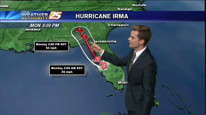
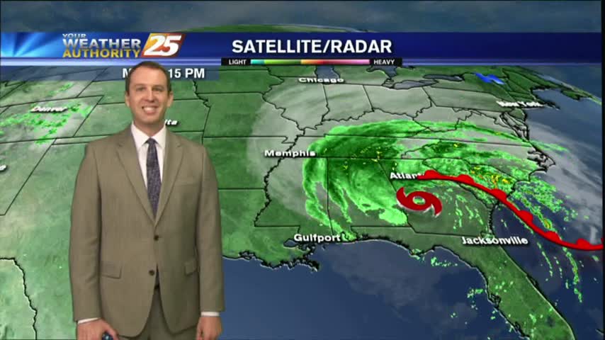
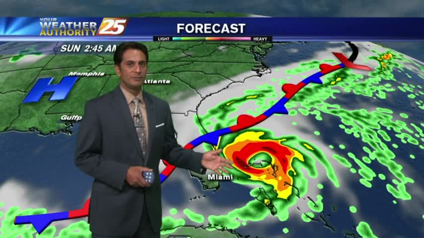
Irma made its second landfall Sunday in Marco Island, FL at 2:35 pm local time as a category three storm.
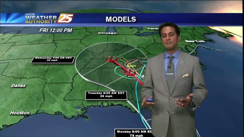
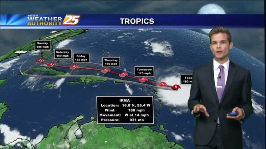
Irma's forecast path keeps shifting Westward, so click on the link below for the latest information (as of 10:45 PM).
Irma continues to head North-Northwest towards South Florida, and is expected to turn North soon. Watch the full forecast for the latest update.
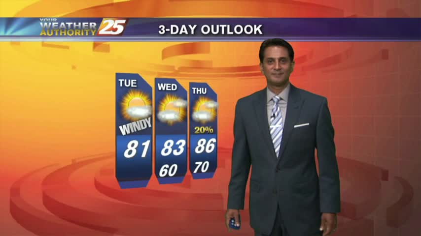
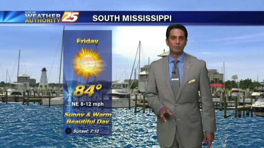
After a BEAUTIFUL start to the day, your Friday afternoon will bring sunny and warm conditions with VERY LOW humidity...
As all eyes continue to focus on the tropics and MAJOR HURRICANE IRMA, it's a BEAUTIFUL start to the day under clear skies and cool temps...

Irma continues to close in on a potential U.S. landfall, but the forecast path still holds on to a considerable amount of uncertainty through the weekend. Click the link for details.
Local conditions continue to impress, but Irma continues to bear down on the Southeast coast. Click this link for a full tropical update.

SPLENDID conditions this afternoon along the Mississippi Gulf Coast with temps in the 70s, low humidity and mostly clear skies...
A BEAUTIFUL start to the day as high-pressure to he NW is ushering in a cooler/drier air mass which will shape our forecast through the weekend...
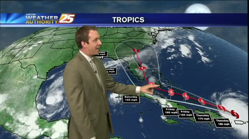
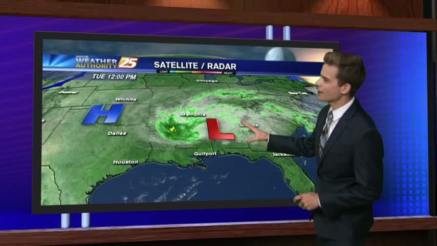
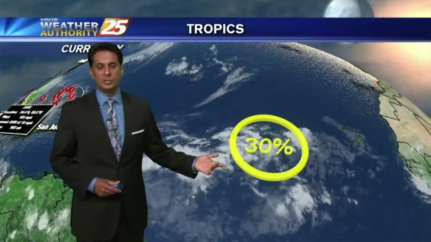
We ended yesterday with only one hurricane in the Atlantic, but we're ending today with three. Click the link for the latest on all the tropical systems.

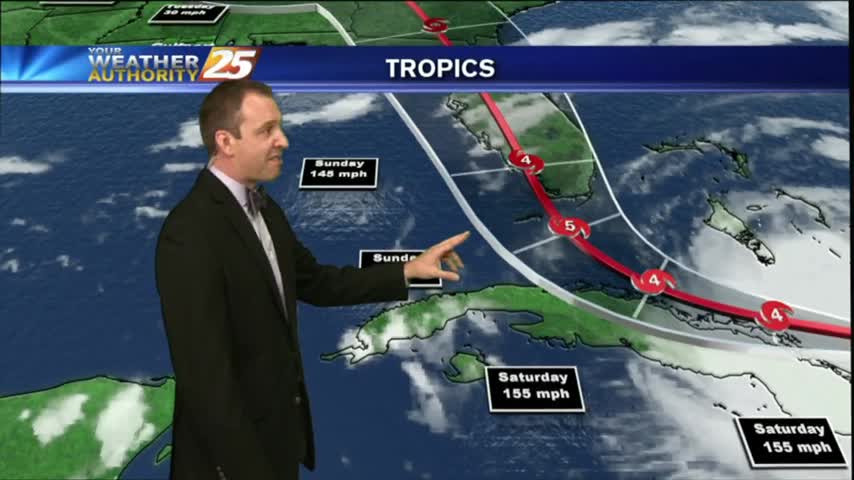
The Atlantic tropics remain active, as now three hurricanes are expected to continue strengthening over the next few days. Click the forecast link for the full Tropical update.

The cold front has moved south of the area with overcast skies continuing. Major changes area ahead as a COOLER/DRIER air mass moves in...
A mild start to the day with elevated humidity and mostly cloudy skies with a cold front overhead...
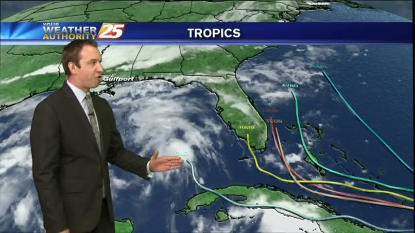
There is still a decent amount of uncertainty when it comes to Hurricane Irma's final path towards landfall in the U.S, and we discuss all the options in tonight's forecast. Details within.
With Irma, Jose, and now tropical depression 13 all moving about the Atlantic/Gulf at the same time, this forecast was very heavy on the tropics. Click the link for the latest.
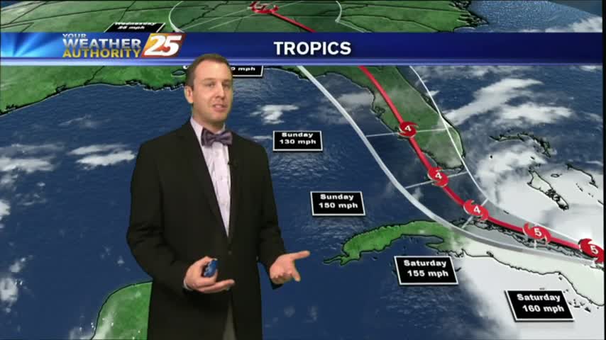
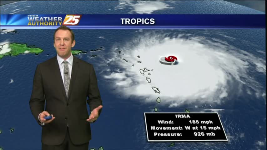
Irma continues to strengthen this morning and afternoon into the strongest Hurricane ever recorded in the Atlantic Basin with winds up to 180 mph.
With an approaching cold front to our NW...this morning is a bit more HUMID under a good bit of mid/upper level clouds...