1/8 - Rob's "Gray/Gloomy & Wet" Monday Morning Forecast
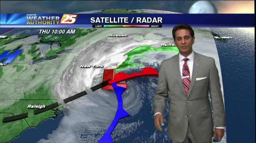
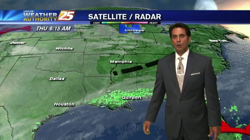
An area of low-pressure west drifting east will continue to bring rainfall to the viewing area with a FLASH FLOOD WATCH remains in effect...
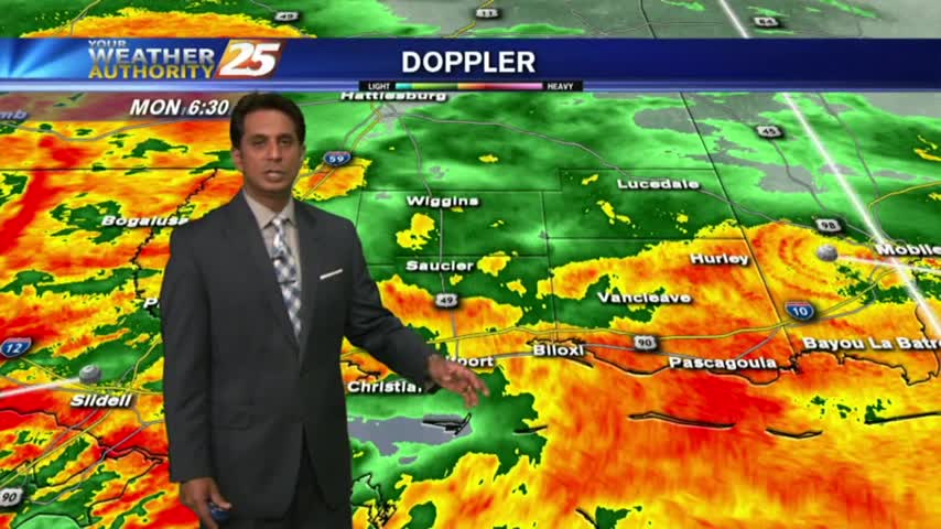
An area of low-pressure west drifting east will continue to bring rainfall to the viewing area with a FLASH FLOOD WATCH remains in effect...
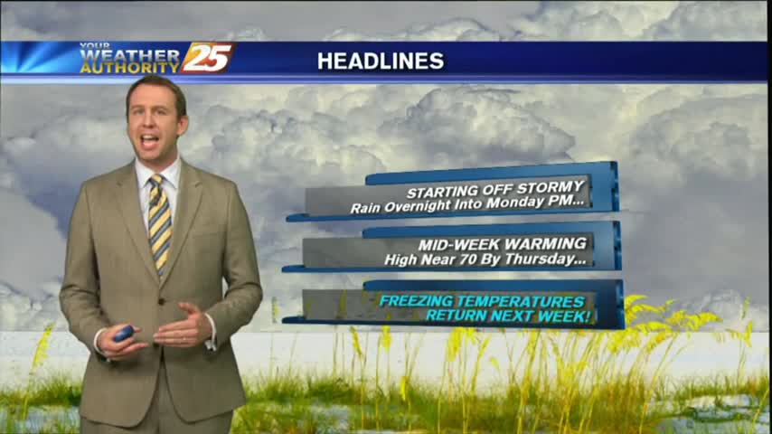
After an extended period of cold and dry weather, we're finally seeing warm and moist air move in along with some active weather. Click this tab for the full forecast.
Today was the last afternoon below 50 degrees and tonight will be the last evening below freezing for at least as week as warmer, wetter air moves in rapidly through the weekend. Watch the full forecast for more.
Today remained in the upper 40s as expected, and we'll see one more night at or below freezing before our evenings warm drastically. Click this forecast link for more information.
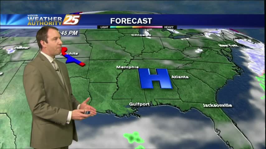
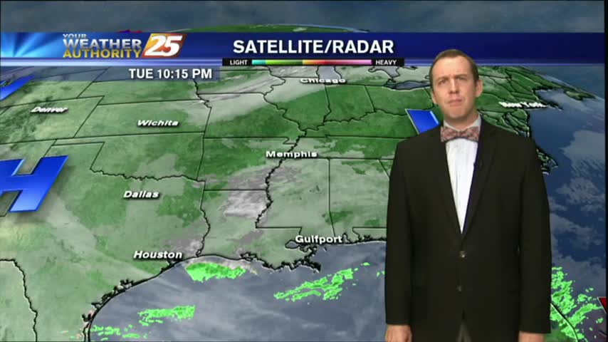
Extensive upper-level clouds from this morning beginning to clear to the east, providing much more sunshine this afternoon...

Another FRIGID start to the day as upper-level non-rain producing clouds begin to move across the area...
Temperatures continued their warming trend this afternoon, but we'll see a slight setback tonight as reinforcing cold air moves in from the North. Click the link for the full forecast.
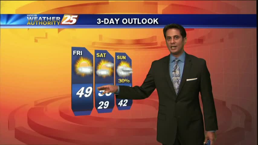
Continued gradual warming has brought us very close to the 50s for our afternoon high, but reinforcing cold air will keep them away until the weekend. Expect another night below freezing tonight, and watch the full forecast for details.
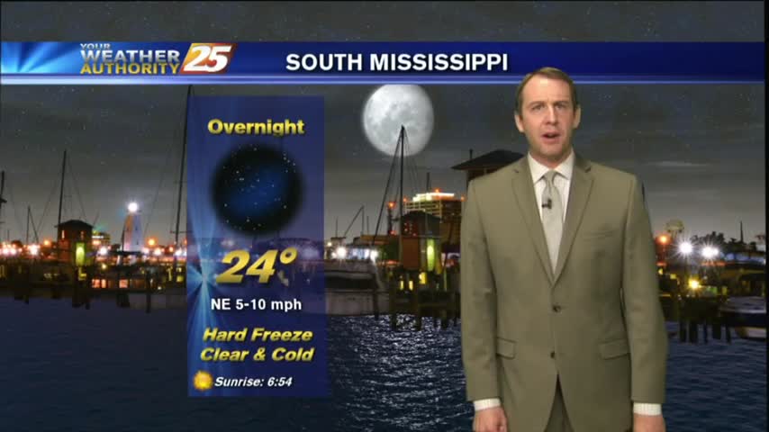
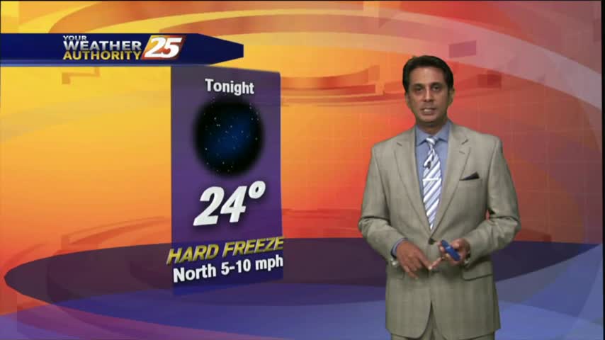
After another FRIGID night, temps are warming nicely under an abundance of sunshine. A HARD FREEZE warning in on-tap again tonight...
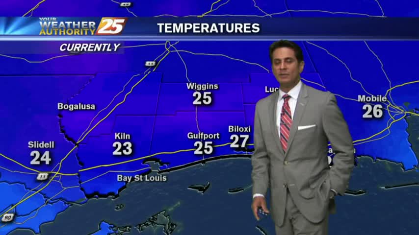
Another FRIGID start to the day as clear skies are in the area, Bundle up the kiddos as they head back to the bus stop...
While it is still bone-chillingly cold outside at night, our afternoons are warming and we'll see highs in the 60s returning soon. Watch the full forecast for details.
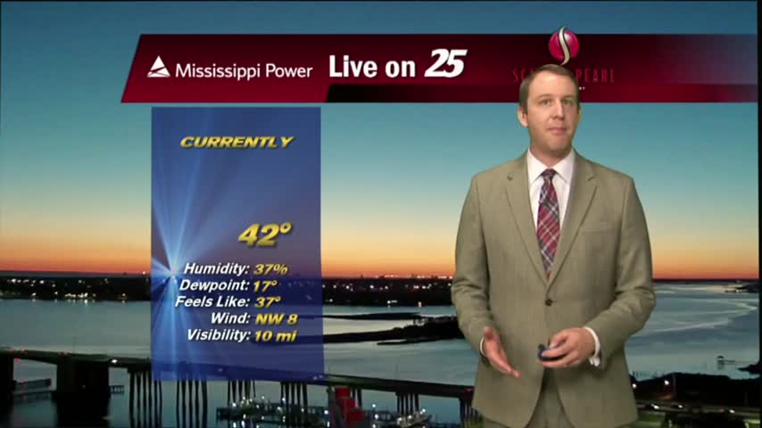
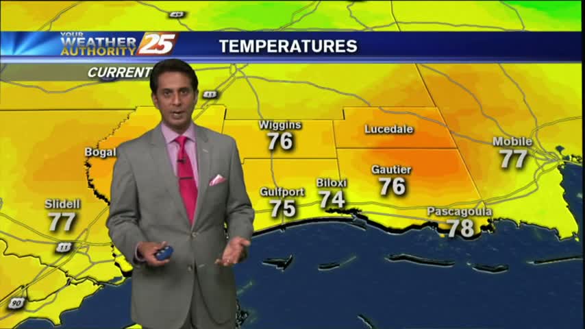
Weather conditions are continuing to improve on the Gulf Coast by becoming slightly warmer and more humid, but it is still dangerously cold for the next few nights. Watch the full forecast for details.
After a cold and cloudy start to the day, clouds have cleared with SUNNY skies this afternoon then FRIGID conditions overnight...
Another FRIGID start to the day with slightly warmer temperatures as light rain is moving across the northern GOM...
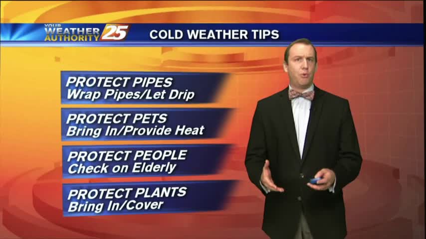
More dangerously cold nights ahead, but our afternoons will begin warming soon. Be on the lookout for some non-accumulating snow flurries late tonight/early Wednesday. Full forecast within.
More sub-freezing temperatures ahead for the next few nights, but we're already seeing some slight warming which will continue gradually through the week. Click the forecast link for details.
After another FRIGID start to the day with temps in the upper teens...they are slowly warming into the upper 30s...
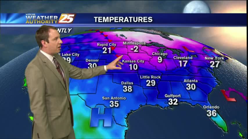
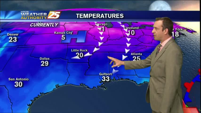
Another BITTER COLD start to the day with the wind chill making temperatures feel like single digits...
This year is starting off on an abnormally cold foot, and we'll remain in the 40's during the day and 20's at night all week long despite a gradual warming trend and plenty of sun. Click the forecast link for more details.
It's the first day of the new year and we're starting off by continuing our abnormally cold conditions. Don't expect much change this week, details within.
An ABSOLUTE FRIGID start to the day/new year as temps are in the 20s...but wind chill makes it even COLDER...
Dangerously cold temperatures move in for the next several nights, so we'll be starting the New Year off on frigid note. Watch the full forecast for details.
A cold clear night, but things change as we head into Saturday.
Enjoy the Sun and warmer temperatures before the cold air arrives for the New Year.