1/15 - Payton's Monday Afternoon Forecast
Another cool and sunny day, but very cold air is headed our way.

Another cool and sunny day, but very cold air is headed our way.

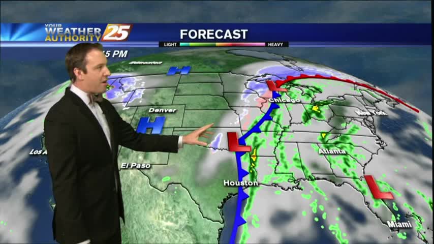
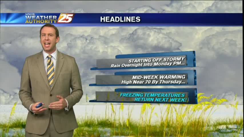
A FRIGID start to the day/workweek as a cold front from the central plains continues to move to the SE and into our area Tuesday...
One more day of nice weather, but very cold air is headed this way.
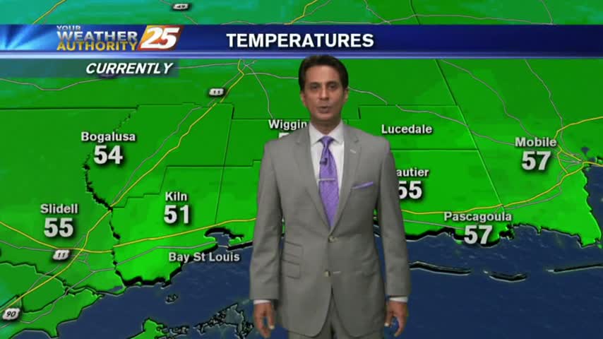
We've had several days of warm and humid weather, and we're making up for it tonight as last night's cold front has brought wind chills as low as 20 degrees. It only gets colder this weekend, click the forecast link for more.
Last night's cold front has moved on, but it's Arctic airmass is moving in quickly. Click the forecast link for the details.
Extensive cloud coverage continues but the clearing process will begin this afternoon with COLD and WINDY conditions...
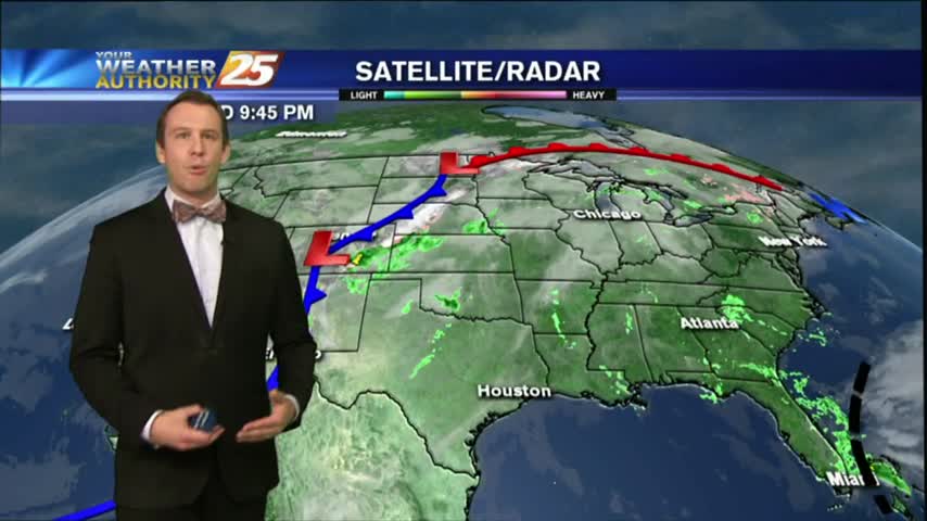
Rain has ended as the cold front is now to the east of our area, with improving sky conditions expected through today...
Not much change in weather from the afternoon until now (11 PM), but a cold front is moving through overnight and we have long week of frigid nights ahead. Click here for the full forecast.

Another warm and humid afternoon today, but tonight's cold front will reverse both of those conditions as we head into the next several days. Click on this forecast link for the details.
Light showers today, but a strong cold front will bring rain and a few rumbles of thunder tonight.
After temps in the upper 60s to 71 degrees yesterday afternoon, warm conditions continue this morning as low temps are in the mid-60s...
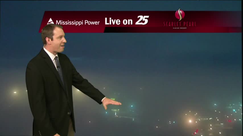
The fog cleared this afternoon and the skies even opened up for a while, but dense fog is already forming in the Southern coastal counties and Dense Fog Advisories have been issued. Click here for details.
We warmed into the early 70s a day earlier than expected, and increasing southerly winds will bring even more moisture and warmth into the area. Click here for the full forecast.

After areas of PATCHY FOG earlier this morning, mostly cloudy skies with much more sunshine is on-tap this afternoon...

Another mild start to the day with DISRUPTIVE weather in the form of DENSE FOG developing through the viewing area and the region...
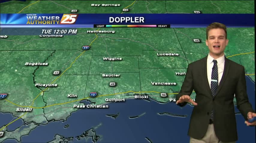
Fog is developing quickly to the North of us near Hattiesburg, but Dense Fog Advisories have now been issued for all coastal counties and the Mississippi Sound. Click here for the full forecast.
It was a gloomy day in South MS as our high humidity lead to a misty light fog and low pressure lead to cloudy skies. Expect little change in the short term, but you'll have to click the forecast link fore the details.
Cloudy and gloomy, but colder weather and sunshine are on the way.
Patchy fog and low clouds are out in full force this morning through the region with light activity through our viewing area...
Patchy fog has been developing over the last few hours, and will continue to do so throughout the night and into Tuesday morning. Click this link to watch the full forecast for the details.
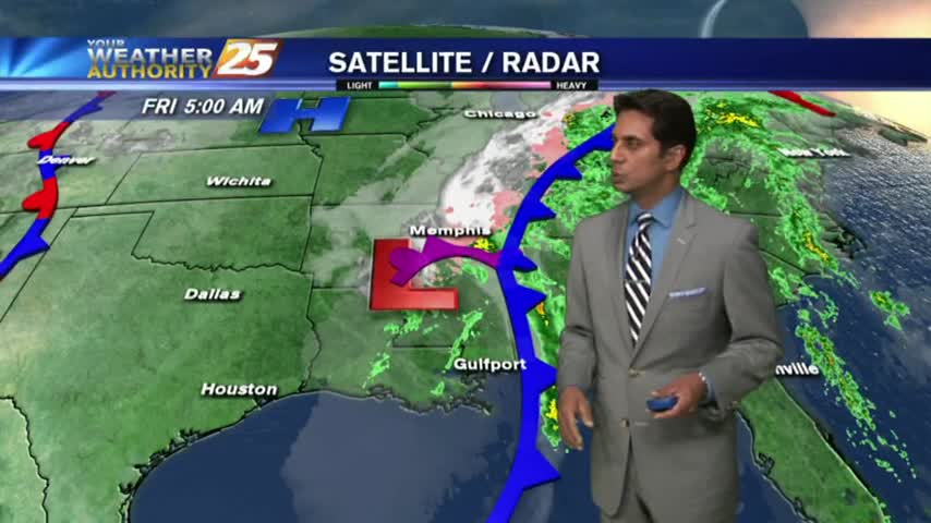
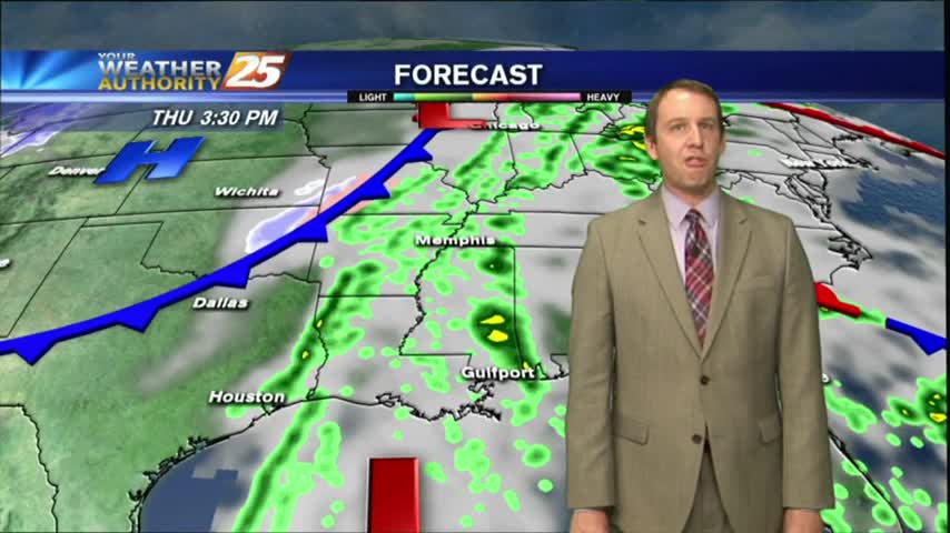
The showers and storms moved in as expected last night, and while the rain may have moved on, the moisture will remain for most of the week. Click this forecast link for more details.
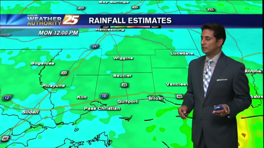
After moderate/heavy rainfall last night through this morning, the majority of the rain shield has shifted to the east with just a few showers this afternoon...
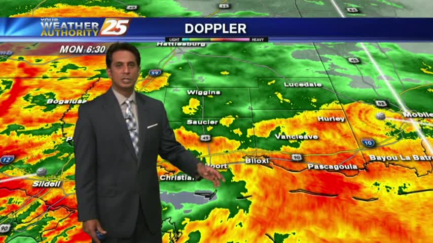
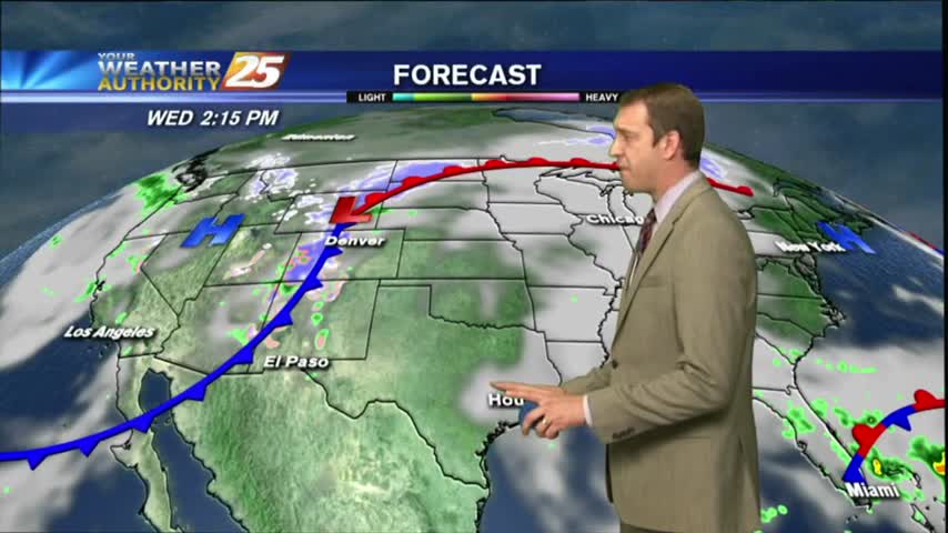
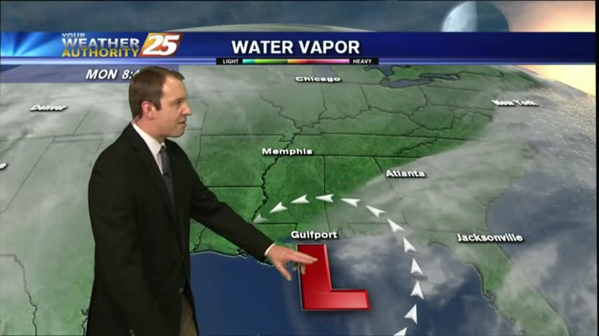
An area of low-pressure west drifting east will continue to bring rainfall to the viewing area with a FLASH FLOOD WATCH remains in effect...
After an extended period of cold and dry weather, we're finally seeing warm and moist air move in along with some active weather. Click this tab for the full forecast.