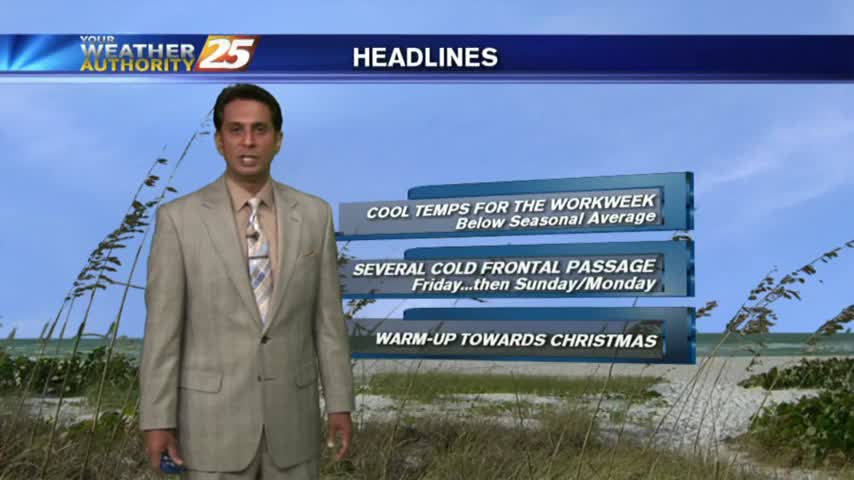
12/13 - Rob's "Roller Coaster Ride" Wednesday Forecast
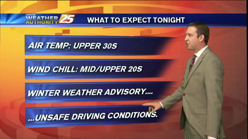
A VERY COLD start to the day with many locations below freezing, even in the mid/upper 20s...
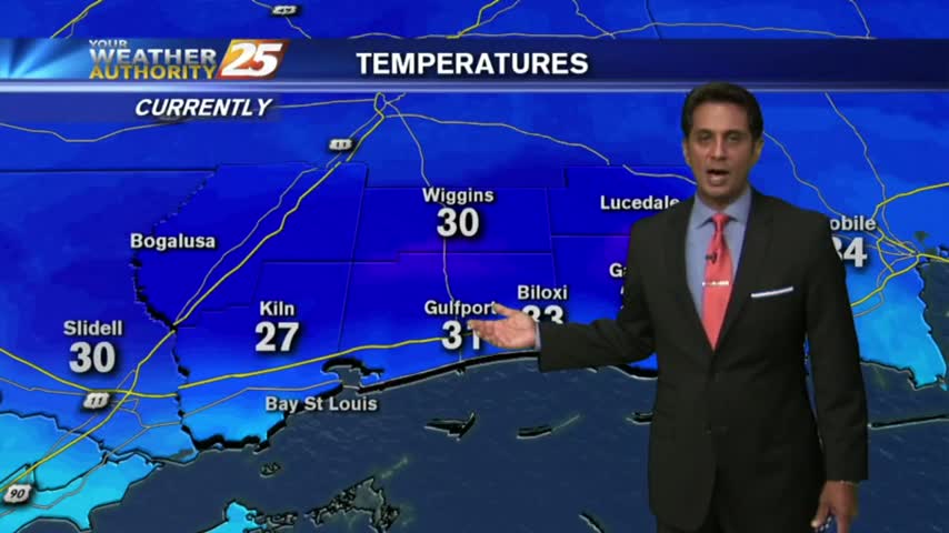
A VERY COLD start to the day with many locations below freezing, even in the mid/upper 20s...
While it ended up being a few degrees warmer than expected, it was still slightly cooler this afternoon thanks to last night’s cold front, but it’ll be much colder this evening as the "roller-coaster" continues. There haven’t been any Freeze…
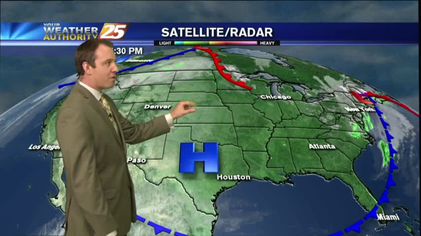
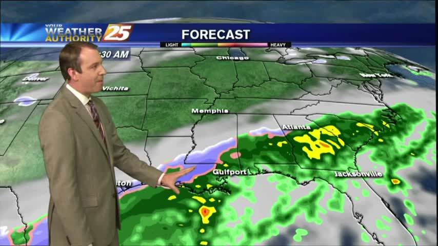
A cold front passed through South MS during the early morning hours with little fanfare, but we'll feel those chilly and drier conditions tonight...and again a few times this week. Check out the full forecast for details.
A cold front moving through the area will make for cooler conditions today and tomorrow.
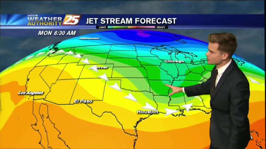
From yesterday morning with low temps in the low 30s...to the upper 40s this morning as a cold front is overhead moving SE...
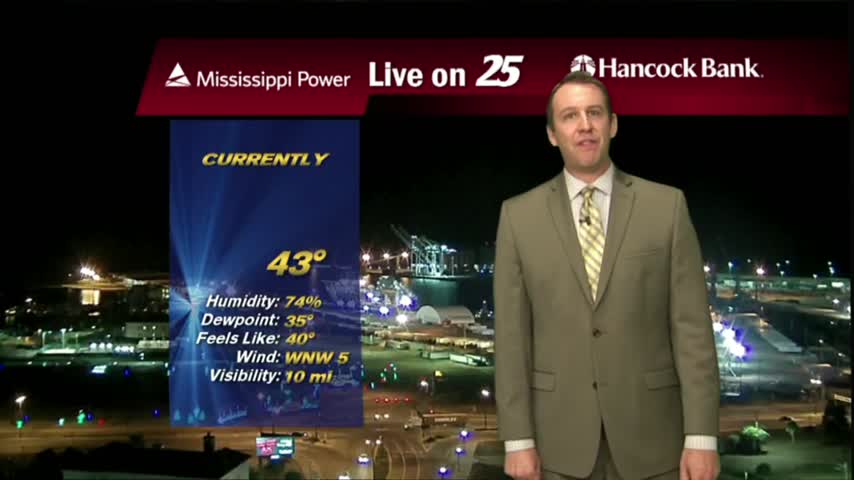
It's been slowly warming ever since our winter weather moved through and tonight will be the warmest we've seen in several days. A weak cold front is moving through tonight though bringing changes, details inside.
Last night's chilly temperatures lingered into the morning, but we warmed into the mid 60s through the afternoon. A weak overnight front will bring another round of cooler weather; click the forecast link for details.
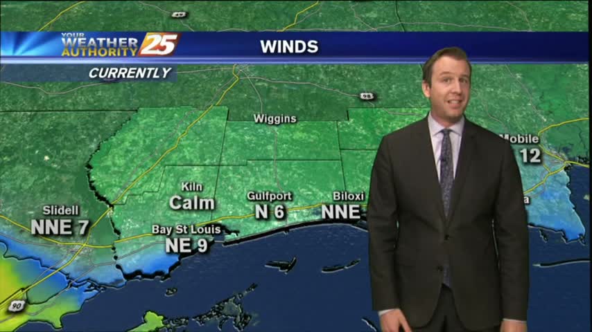
Cooler weather continues and another cold front is on the way.
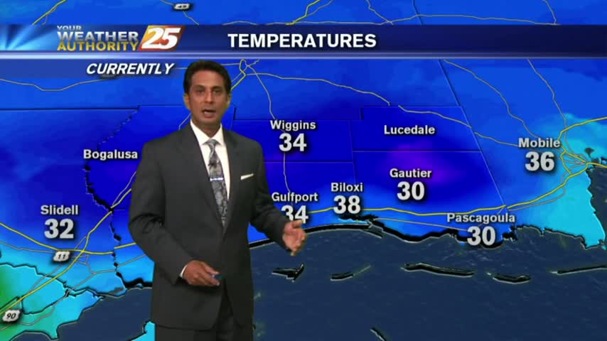
Bundle up heading outside this morning, its' another VERY COLD start to the day with several locations below freezing...
We've been trending upwards through the weekend with our temperatures and that continues into tomorrow, but we'll see two more fronts this week. Click for forecast details.

The winter weather has moved on, but even colder conditions are moving in as cooler and drier air forces the active weather from the area. Watch the forecast for the full forecast.
As we finished the afternoon shows earlier today the winter weather was beginning to taper off, but the coldest temperatures are still coming in. Watch the full forecast for details.

After a very disruptive morning with WINTER WEATHER in the area, the activity continues...
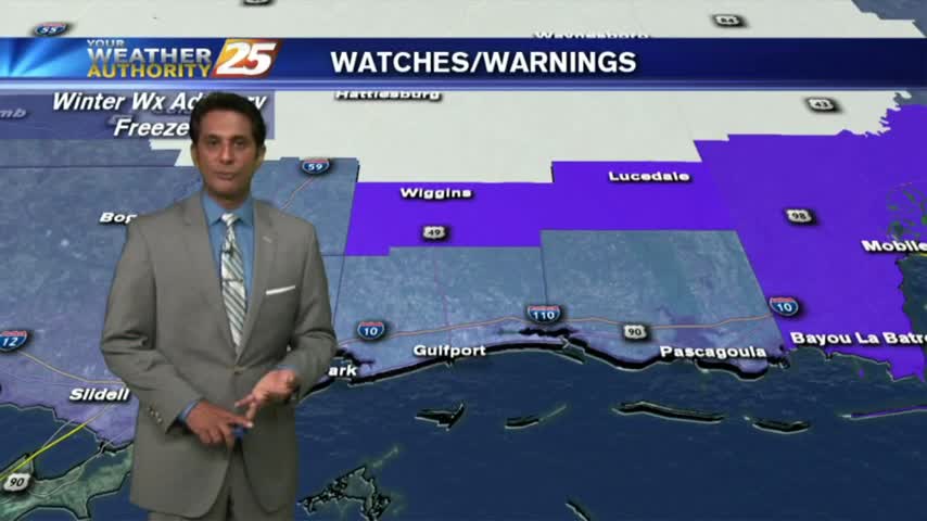
Wintry Mix continues to threat the Southern 6...along with SNOW NW of the coastal counties...
A COLD start with rain along the Southern 6...but the "SNOW LINE" is moving in from the NW...
A COLD start with rain along the Southern 6...but the "SNOW LINE" is moving in from the NW...
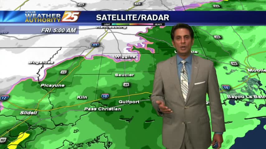
The rain continued its on-again/off-again pattern through the day, but night will bring conditions conducive to the creation of freezing rain/sleet or even snow flurries. Watch the full forecast for details.
Winter weather is moving into South MS, but it remains to be seen just how much we will actually see and whether it will accumulate. Watch the full forecast for the latest and stay tuned for updates.
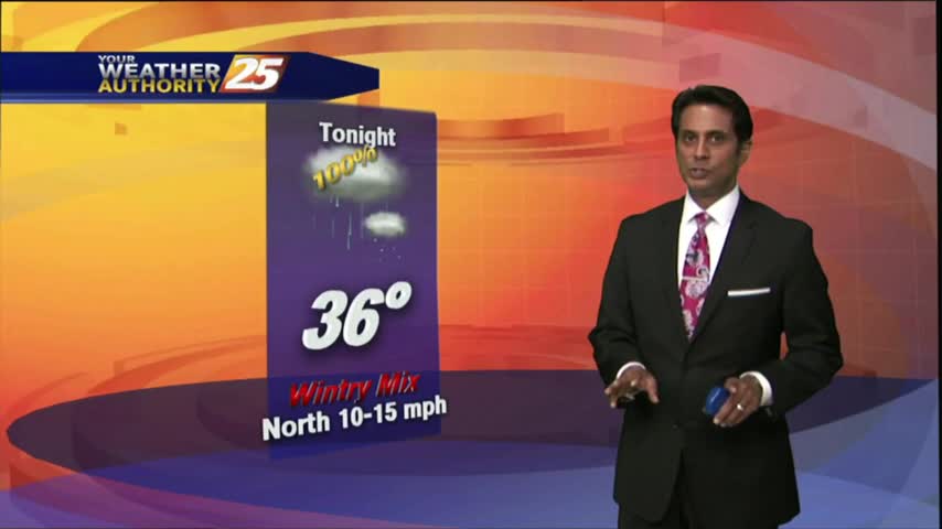
After a COLD start with light rain...the activity continues with slight warming. Overnight will bringing a WINTRY MIX/SNOW to the area...
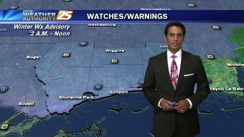
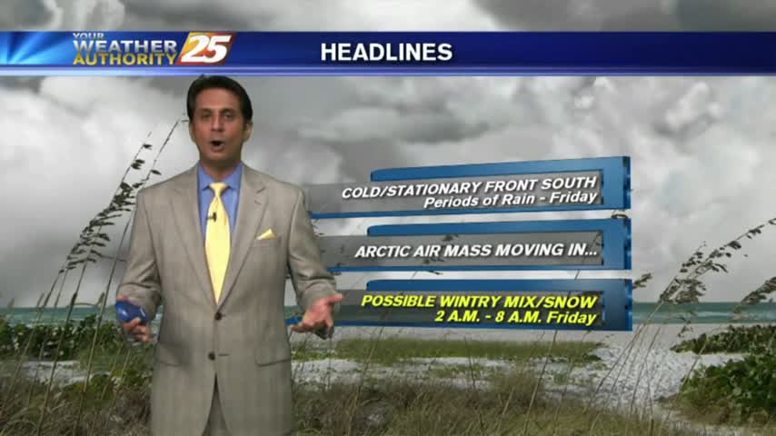
A COLD start to the day as rain continues...with a WINTER WEATHER ADVISORY in effect overnight through Friday morning...
Expect another few days of cold, cloudy, and rainy weather before the possibly of winter weather moves in Friday morning. Full forecast within.
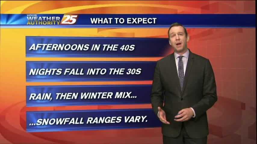
Yesterday's cold front brought rain and colder temperatures, but we haven't seen the last of either just yet. Even winter weather may make an appearance before the week is up, but you'll have to watch the forecast for details.
The HEAVIER activity has moved east with light rain linger through the viewing area...along with COLD TEMPS and WINDY CONDITIONS...

With a cold front to the south, overrunning conditions will continue to bring rainfall to south Mississippi along with COLD temps...