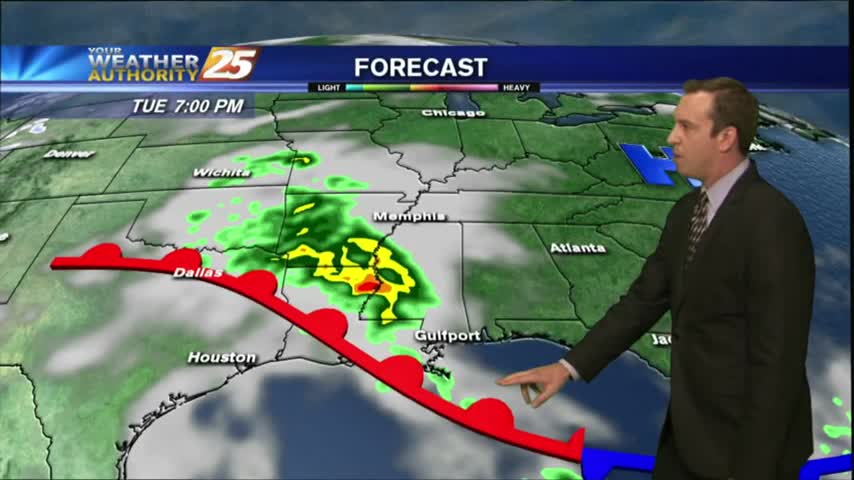
03/05 Ryan's "Overnight Rain" Monday Forecast
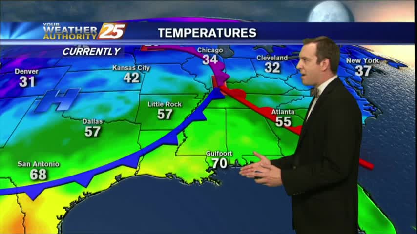
The humidity has been increasing seadily throughout the day as a cold front moves in from the Northwest, and showers and thunderstorms are expected overnight. Watch the full forecast for the details.
The humidity has been increasing seadily throughout the day as a cold front moves in from the Northwest, and showers and thunderstorms are expected overnight. Watch the full forecast for the details.
We're seeing clouds move in today after our amazingly dry weekend, with rain and thunderstorms moving in quickly. Watch the full forecast for details.
Clouds continue to move in, and rain chances will be on the increase as well.

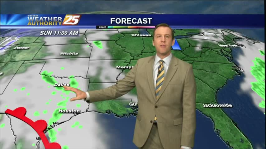
It's a slight warmer start to the day with cloud coverage and light rain as a warm front is moving through the NW Mississippi...
The beautiful weather this weekend is coming to an end as we start the workweek.
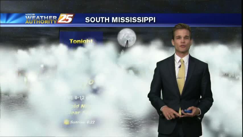
Tonight will be the first of several chilly nights in the 40s this week, and this weekend is looking gorgeous. It gets even cooler and drier next week though, so watch the full forecast for details.
It ended up being just as beautiful today as forecast, but just a little bit warmer. Expect more great days and nights ahead, but you'll have to watch the full forecast for the details.
Weekend weather is shaping up to be picture perfect!
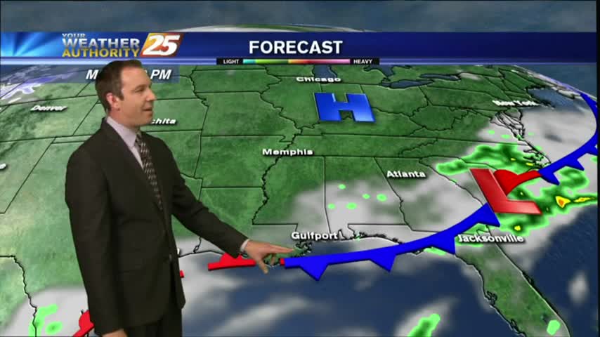
Beautiful weather now that the cold front has moved through.
One front down, one weaker, upper level front to go. Expect clearing skies into tomorrow and a beautiful, sunny weekend. Click the link for details.
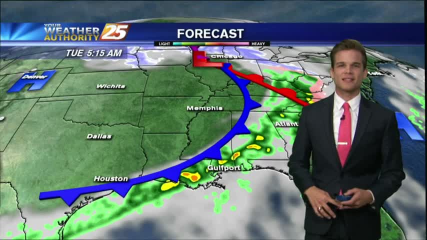
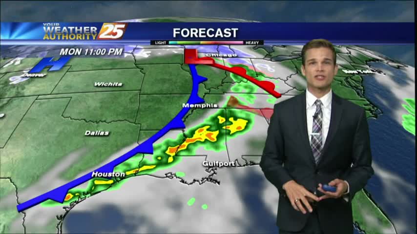
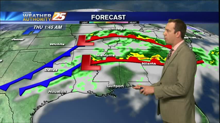
The cold front we expected is slowly moving through the area, so cloud cover and a few showers will last into the night, but cooler and drier air is moving in quickly afterwards. Click the link for details.
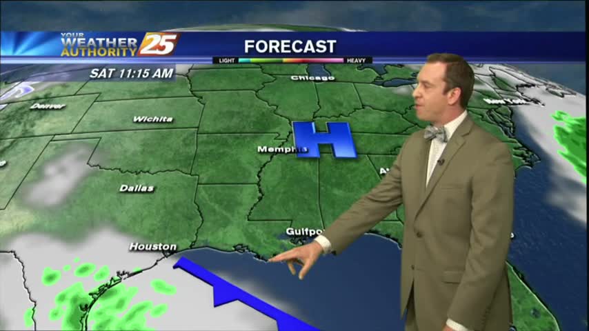
The cold front is approaching Hattiesburg at lunchtime, and will soon be in South Mississippi.
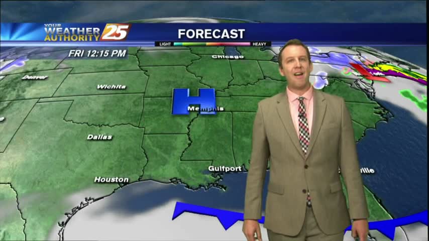
The first day of March will bring warm weather, a cold front and rain chances.
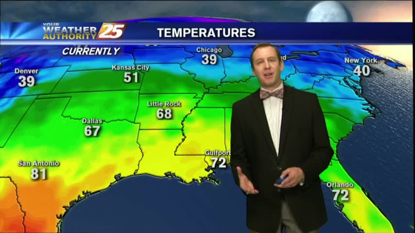
Last night's warm front has moved North, but the record high temperatures in it's wake remain. Watch the full forecast for the details.
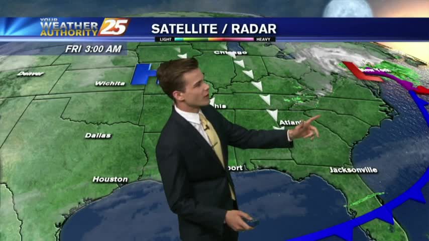
Record high temperatures and above average humidity moved in this afternoon, but our first cold front passage in weeks will finally bring cooler and drier air. Click the link for details.
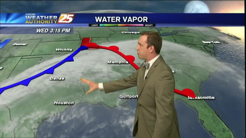
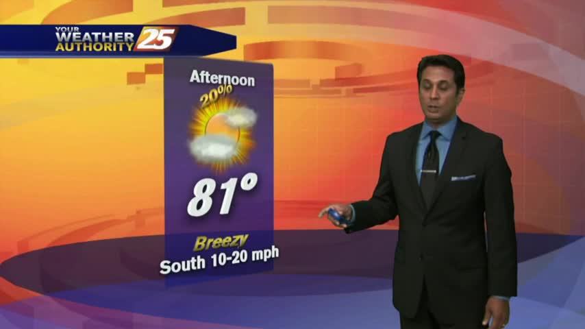
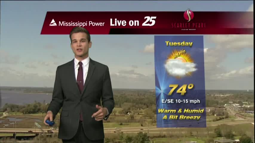
A warm/humid and very breezy afternoon is ahead in advance of an approaching cold front...
It's a warmer start to the day with isolated showers moving across the viewing area...
A few sprinkles of drizzle and one light shower have already passed through Gulfport tonight, and the warm front is still on the way. Watch the full forecast for details.
Cooler today as expected, but an approaching warm front will bring much higher humidity and temperatures tomorrow. Watch the full forecast for details.
Southerly flow is back and that means more clouds and eventually rain.
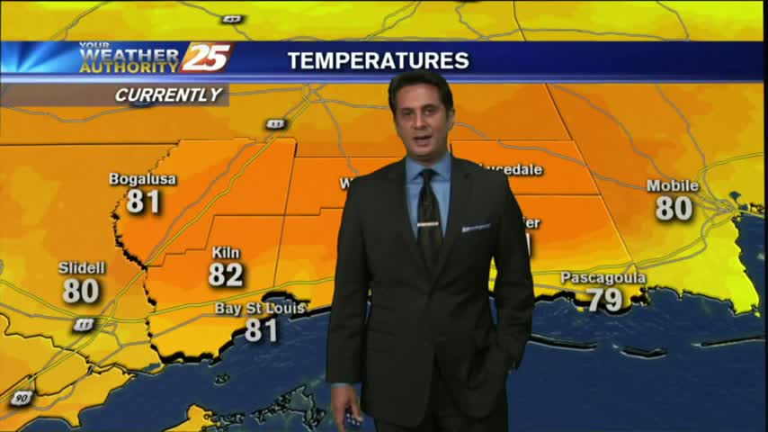
Quite a different start to he day from 24 hours ago, with rain-free conditions, cooler temps and lower humidity...
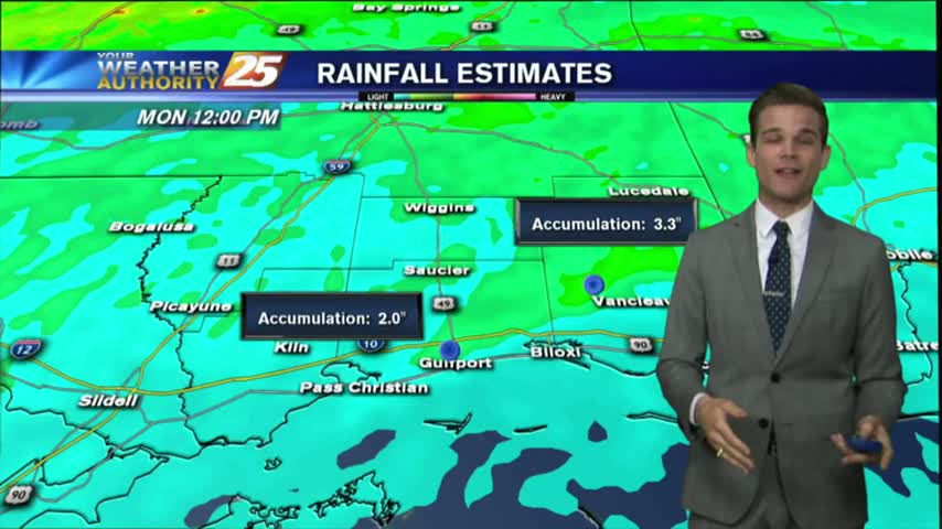
Only flood warnings near the Biloxi and Pearl Rivers remain from the weekend's rain, and today was much drier. Watch the full forecast for more.
There's some flooding left after the weekend's rain, but it was much drier today. Watch the full forecast for details.
After a stormy start, beautiful weather for the first day of the workweek.