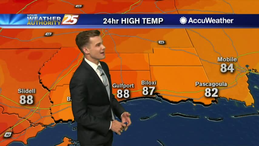
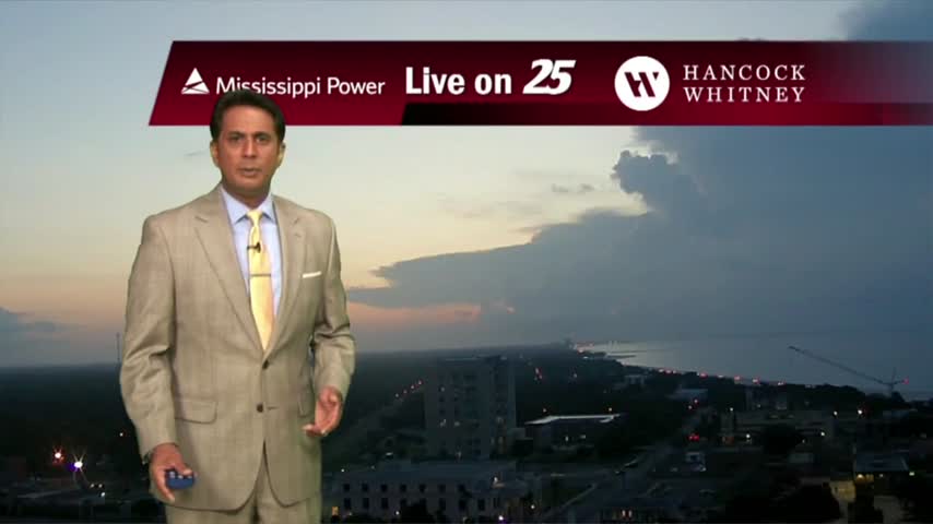
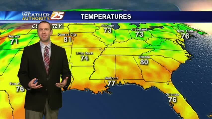
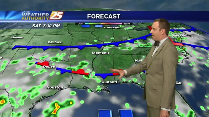
8/19 - Payton's Sunday Night Forecast
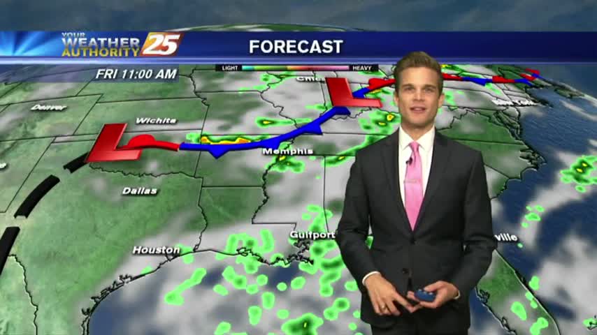
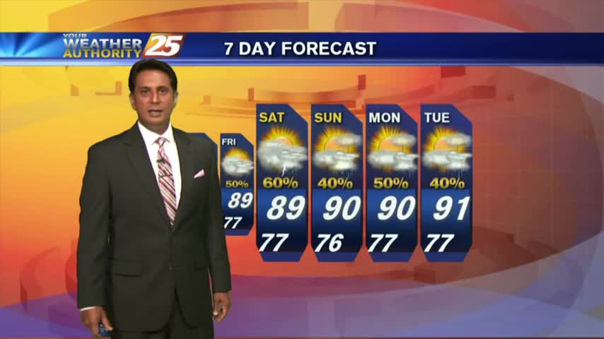
A wet start to the week then a cold front??
A wet start to the week then a cold front??
Expect more activity each afternoon through the weekend, but our nights will keep clearing up nicely....
It was quite stormy this afternoon, and while it will clear some through the night we'll see more stormy days ahead....
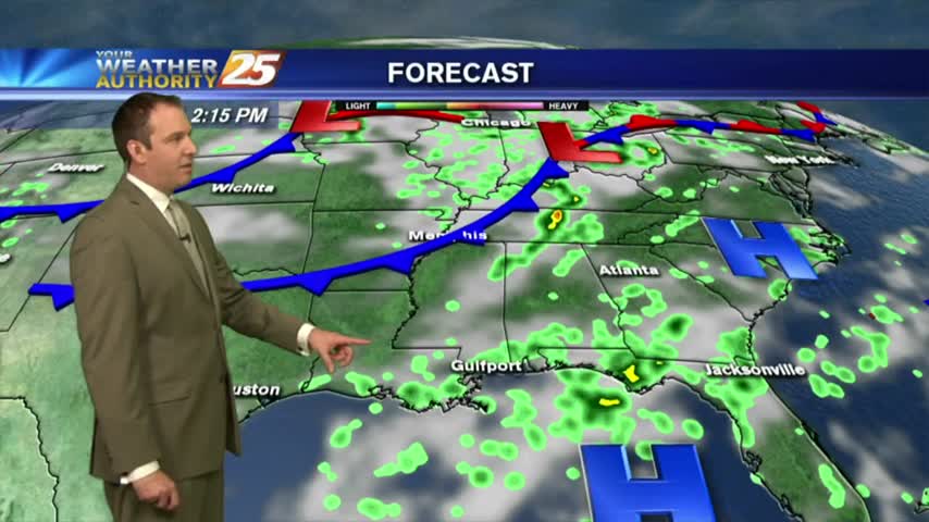
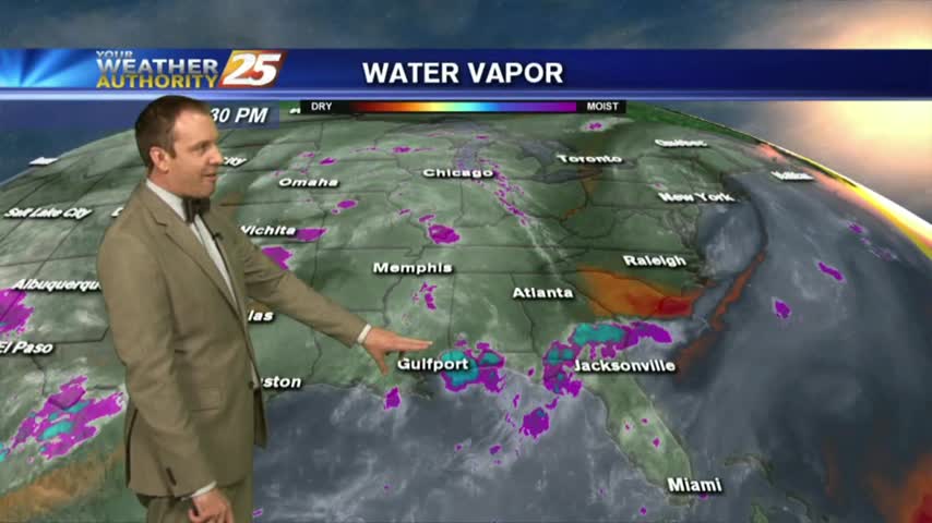
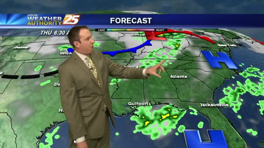
Showers and thunderstorms continue to develop...

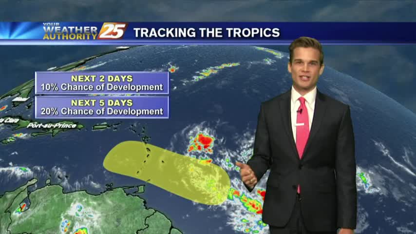
A Look Back at Hurricane Camille: 49 Years Ago
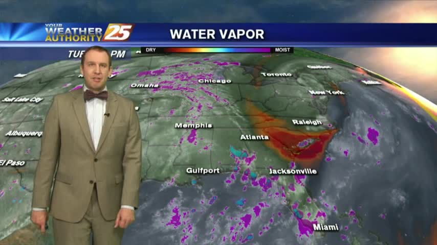
More showers and thunderstorms this afternoon/evening.
Rain has all but left the area as the evening rolls around, but we'll see more in the coming afternoons....
We got our showers and thunderstorms out of the way early today, so the night will be considerably clearer and mostly dry....
More showers and thunderstorms in the forecast...
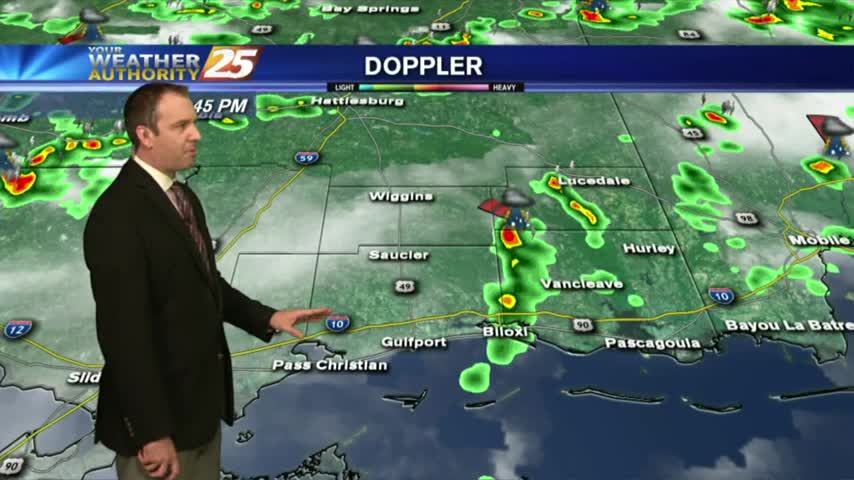
Isolated showers south are moving north and into the coastal counties...
Tonight was much clearer than the afternoon was, and we can expect even more afternoon showers in the days ahead....
We saw another day of limited afternoon shower activity, but we'll see wetter days ahead....
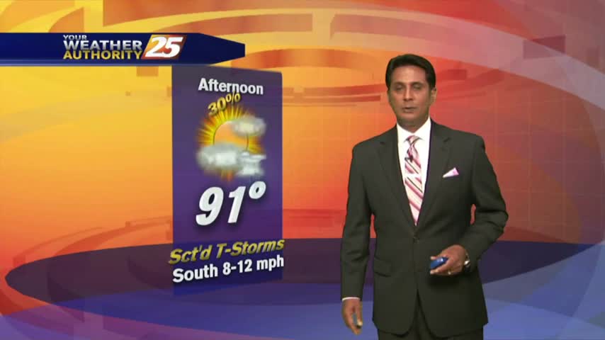
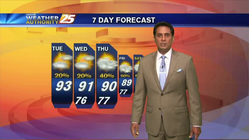
Temperatures warming into the 90s with isolated showers/t-storms developing...
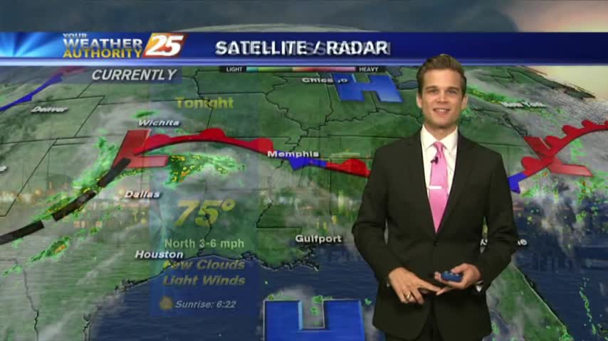
Overnight clouds have cleared to the SE, with warm & humid conditions to start off the day...
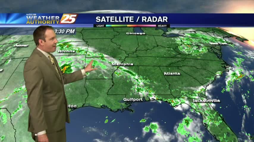
A few showers made it into the sound this afternoon, but we still saw almost no measurable rain inland. Expect more of the same tomorrow....
It was as dry as expected and just as hot, so check out the forecast and find out when the rain returns....
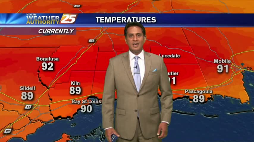
Early morning clouds have thinned considerable with HOT & HUMID conditions expected this afternoon...
Similar to yesterday morning, thin mid/upper level clouds moving in from the NW are thinning...
We only saw one cluster of significant rain this afternoon, and I expect even drier days ahead, but the rain won't stay away for long....
Today was as dry as expected, but still cloudy and humid and the rain won't stay away for long....
Rain chances remain low, and temperatures remain hot.

It's a warm start to the day with mid/upper level clouds moving in from the NW and thinning...
Gradually clearing skies should give us some quality viewing of the Perseids meteor shower tonight, and slightly drier days lie ahead....
This afternoon's disturbed weather is subsiding, but we'll see more each day this weekend....