4/24 - Rob Knight's "Frontal Passage" Midday Forecast
After a bumpy morning, the cold front will clear the area this afternoon...
After a bumpy morning, the cold front will clear the area this afternoon...

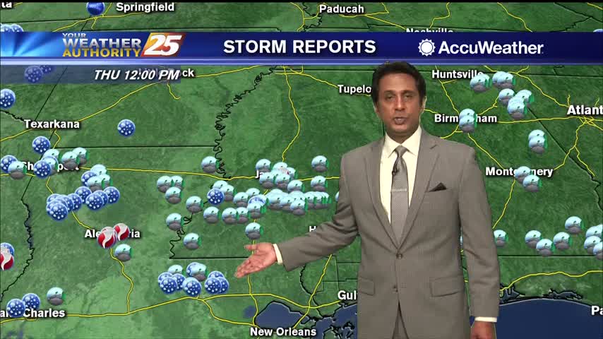
Lucedale residents are picking up the pieces Thursday after a storm ripped through and damaged the area overnight. WXXV's Kristen Anzuini is reporting that there is pretty severe damage with many homes now missing roofs.
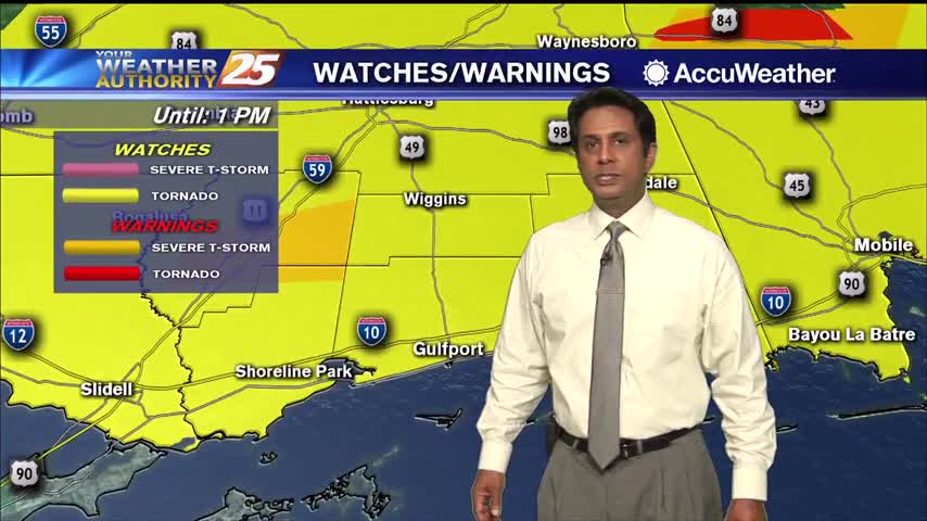
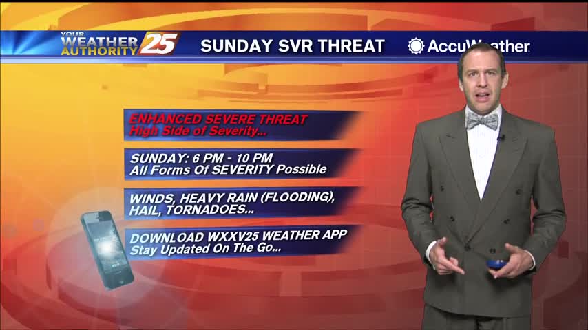
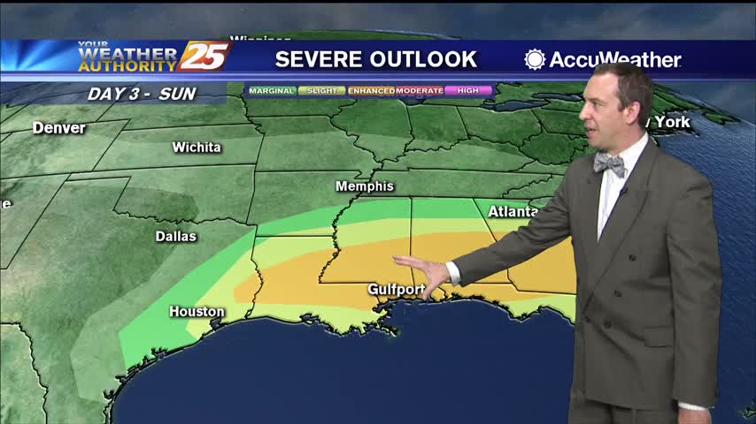
A very windy start to the day with multiple watches in effect as a vigorous system approaches...
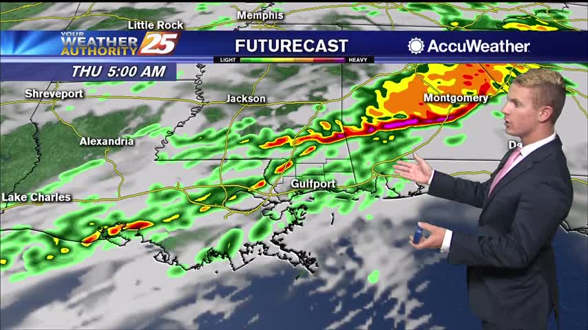
Expecting showers to get going a little after midnight, but stronger, potentially severe storms are likely before sunrise.
Expect the breezy conditions to linger through the night as a front closes in and brings strong storms tomorrow afternoon.
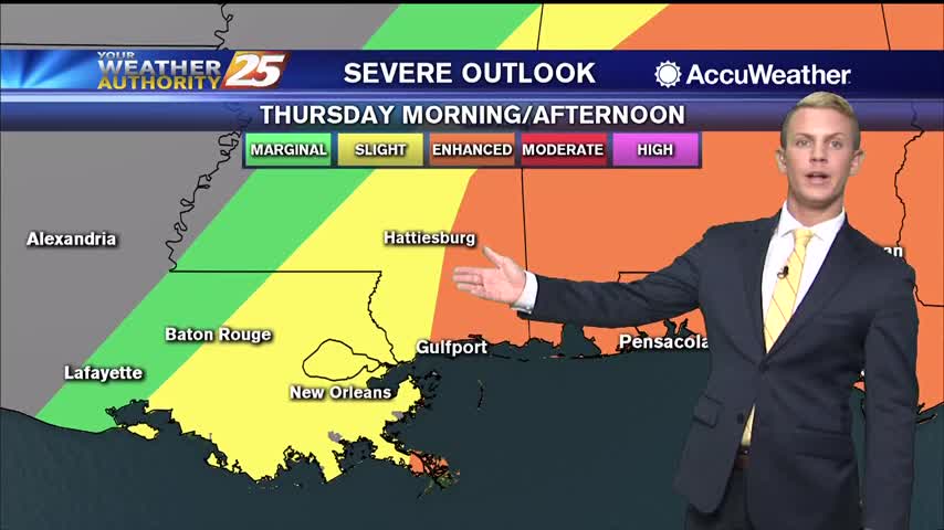
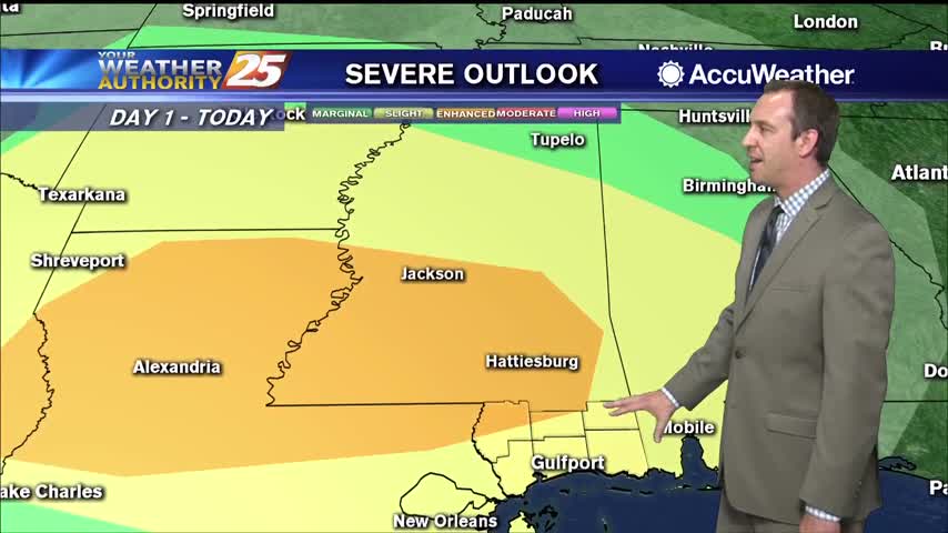
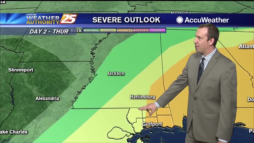
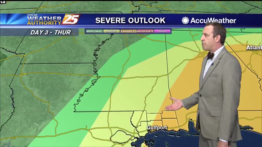
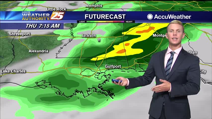
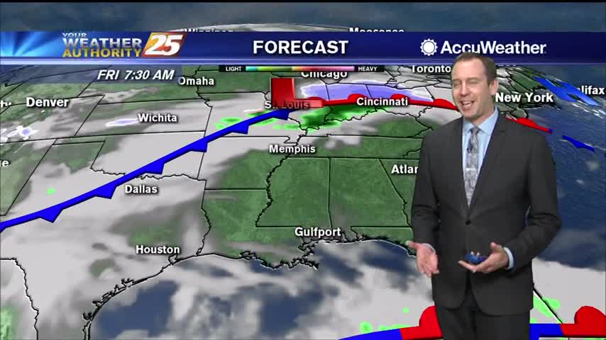
The next 36 hours will deliver showers and thunderstorms to the area with some of these becoming strong to severe. The first of these looks to arrive after dark tonight and should be mainly reserved for the northern portion of…
The next 36 hours will deliver showers/t-storms to the area with some of these becoming strong to severe. The first of these looks to arrive after dark tonight and should be mainly reserved for the northern third of the area…
Things are calming down as we're in between frontal systems, but changes will come quickly tomorrow afternoon.
Today was warmer and more humid than yesterday, but we'll backtrack a bit after a week front tonight. That's all ahead of a strong front on Thursday though...
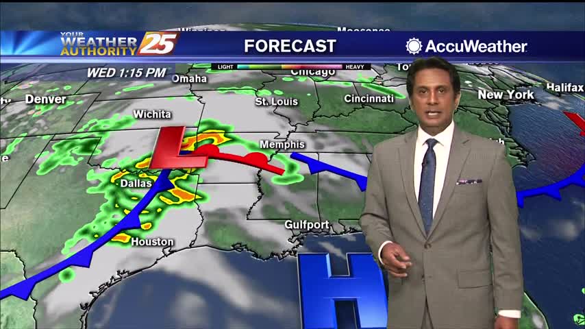
Sunny skies will continue through the remainder of the day, but clouds will begin to filter into the region overnight and tomorrow ahead of our next weather maker. The next system we're watching will be a potent disturbance currently over…
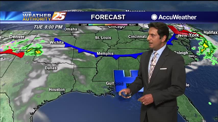
The next system we're watching will be a potent disturbance currently over California that is expected to emerge in the southern plains region on Wednesday. This disturbance along with an associated potent surface low and cold front will move across…
Expecting a cooler and drier night compared to our weekend weather after yesterday's front.
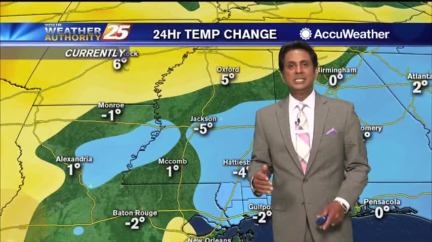
Cold front brought storms last night, but cooler and drier weather today!
After a stormy night, we are now seeing very pleasant conditions across the Gulf Coast. Aside from a few upper-level clouds rolling through, sunny skies are expected for the remainder of the day with a high near 80 degrees. Clear…
T-storms and heavy rain from last night has cleared the area as conditions continue to improve...
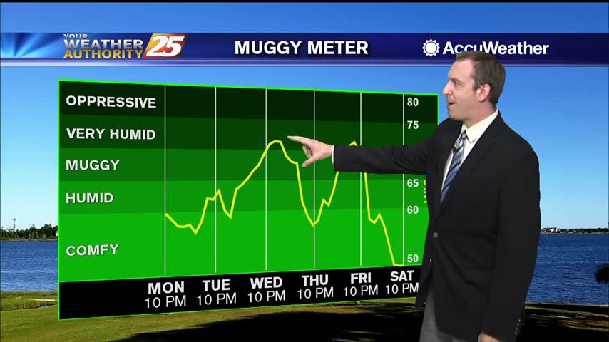
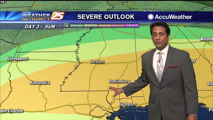
Much warmer and more humid today, and sadly it doesn't improve through the weekend...even gets worse as potentially severe weather moves in to start next week.
Wasn't much warmer and more humid yesterday, but today is a drastically different and the weekend will be even wetter.
A warm/humid afternoon ahead with winds often gusting into the upper teens to low 20 mph range...

A much warmer start as the return flow has begun in advance of an approaching cold front...
Little warmer and more humid today, but much more so as we head into the weekend. Even our first rain since last Sunday isn't far away.
Another gorgeous day out there despite being slightly warmer and more humid, though both will increase rapidly into the weekend.
Another gorgeous day is on tap for the Gulf Coast with lots of sunshine and mild temperatures! Just a few clouds will be rolling through and highs today will only be in the mid 70s. Tonight, mostly clear skies are…
Today will bring mild, pleasant sunny conditions across the forecast area with a few degrees warmer daytime temperature. Breezy conditions will continue with winds gusting into the upper teens to low 20 mph range at times. Surface flow will veer…
Pretty cool and dry today, but warm, humid, and cloudy weather with scattered showers will move in quickly ahead of the weekend.