07/02 Ryan's "Wet Weekend" Thursday Evening Forecast
Things cooled down after an early afternoon round of showers and thunderstorms, but even more rain lies ahead.
Things cooled down after an early afternoon round of showers and thunderstorms, but even more rain lies ahead.
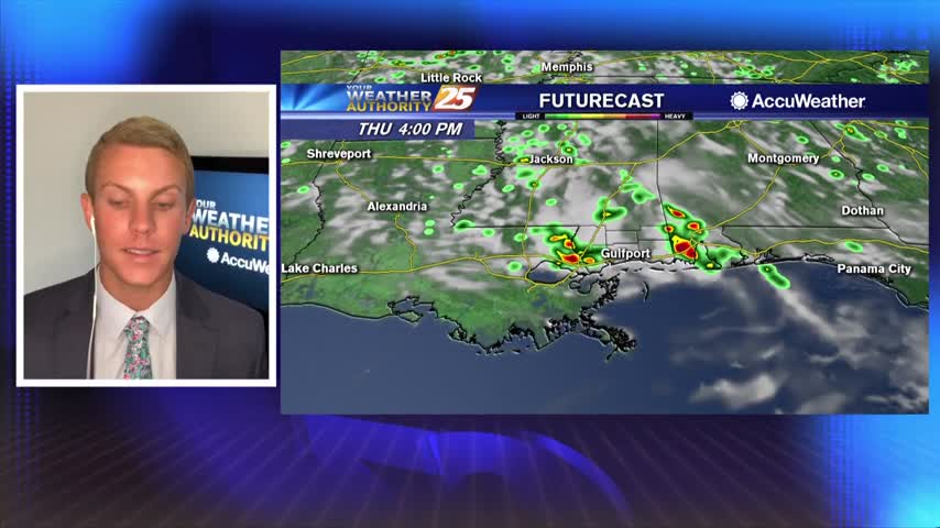
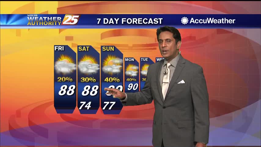
It's not as hot today due to increased cloud cover across the area. High temperatures will likely top out in the upper 80s to lower 90s. Some showers and storms will move in from the north by the middle of…
Cooler temperatures this morning due to pockets of heavy rainfall yesterday afternoon...
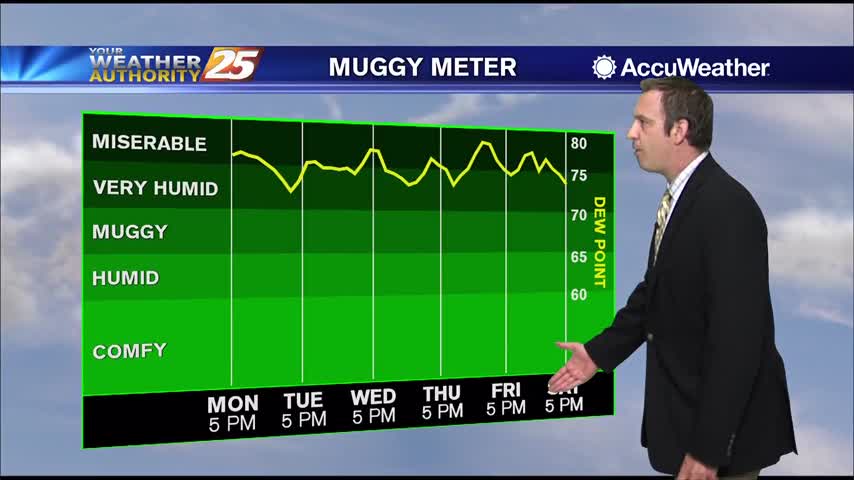
We're seeing more rain each afternoon now, a trend that will continue into the weekend.
Afternoon thunderstorms returned today, and we'll see even more of them in the days ahead.
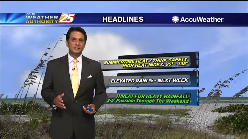
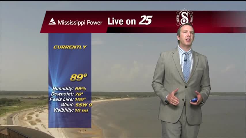
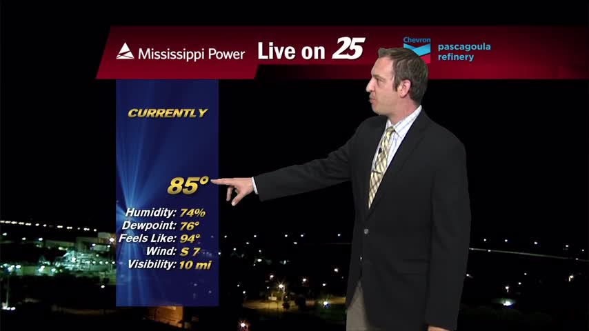
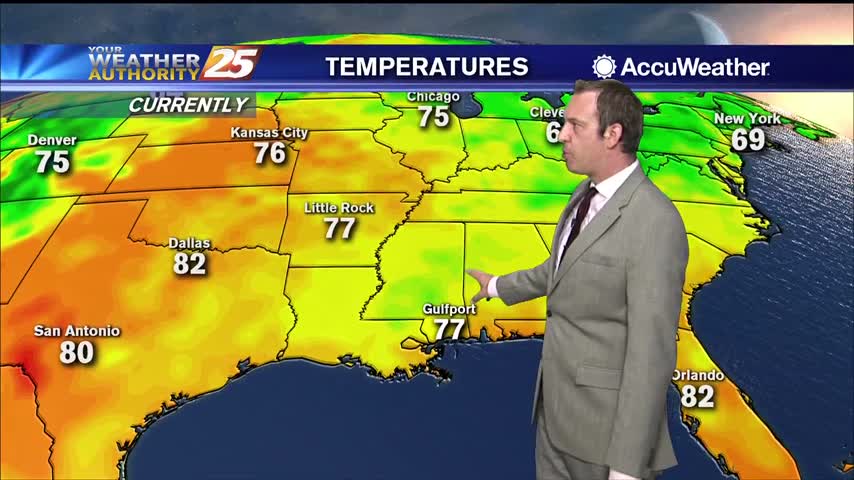
Temperatures will remain hot across the Gulf Coast. High temperatures will top out in the lower 90s, but a very humid air mass will make it feel much warmer. Heat index values or "feels like temperatures" will be between 104…
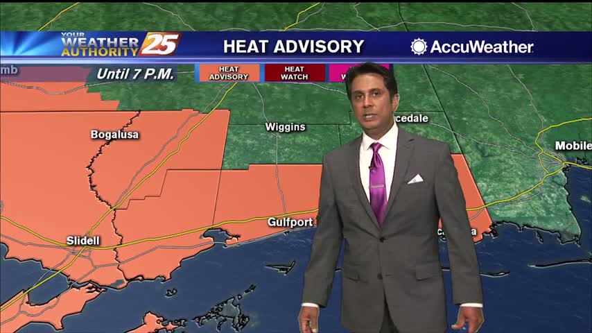
Avery warm start to the day with ares west of south Mississippi already under a HEAT ADVISORY...

More similar days ahead, but rain will be arriving just in time to keep things from getting out of hand.
Hot and exceptionally humid weather remains, with little else changing for the rest of the week.
A very warm start with the Heat Index expected to be in the 90s by mid-morning...
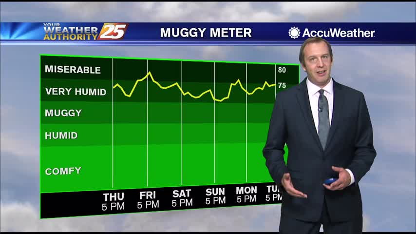
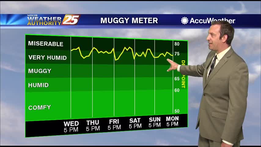
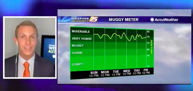
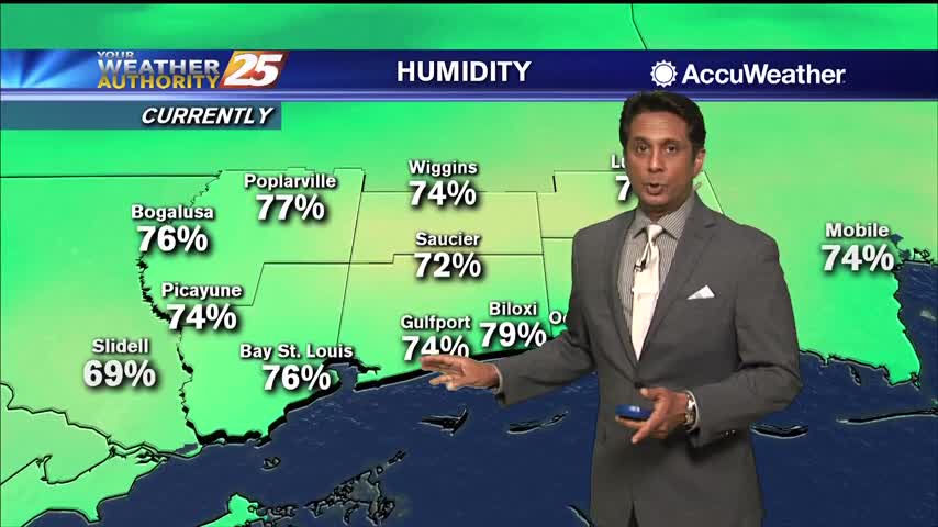
More miserably humid afternoons lie ahead, but more rain is on the way to bring some light cooling.
More miserably hot and humid weather ahead, but thankfully more rain moves in later.
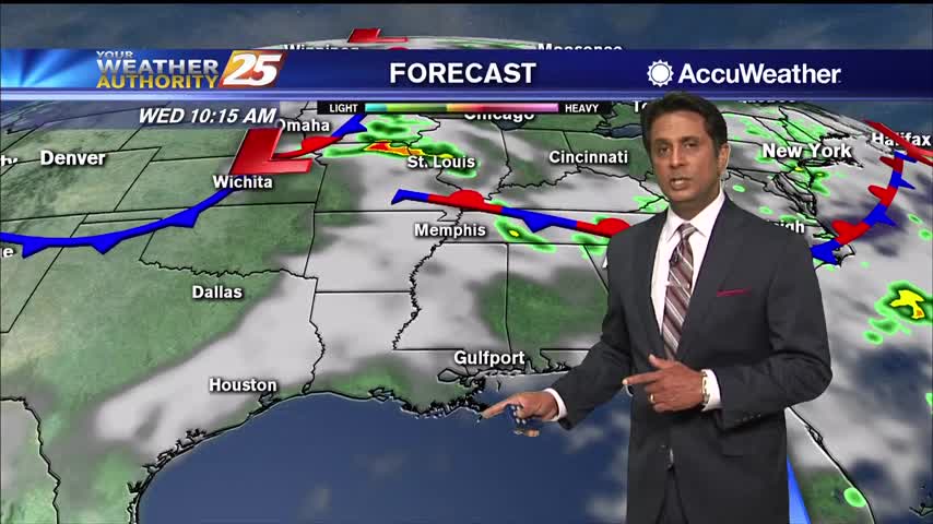
As per usual for this time of the year, conditions will be semi-favorable for gusty winds and possibly a severe storm, but overall the threat will be very localized. Storms will likely fire up in the mid-afternoon around 2 p.m.…
A very warm start with multiple location reporting the low 80s for overnight low temperatures...
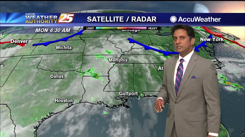
High pressure continues into the day Monday leaving us with a more classic summertime pattern with storms beginning on the land breeze during the morning and then a second round of more robust storms initiating along the sea breeze and…
Fewer showers this afternoon and evening, a trend that'll continue into the weekend along with higher humidity....
Less rain today, but still very hot and humid and the rain doesn't stay away long.
A very HOT afternoon ahead especially when we factor in the Heat Index...
A warm and humid start to the day with areas of light patchy fog...
Been quite a miserably humid, hot, and rainy week so far, but positive changes are moving in.
Less rain today, with even fewer showers heading into the next few days! Still going to be exceptionally humid and hot though.
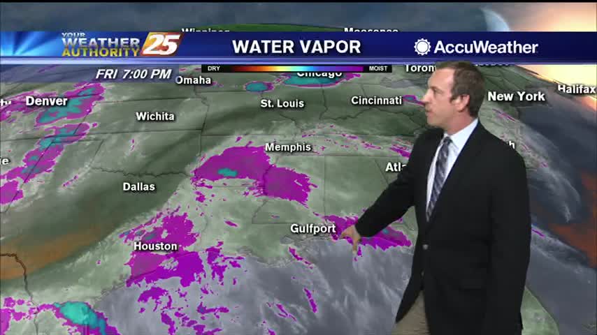
The region will remain at the base of a large area of low pressure dominating the eastern half of the nation today. At the same time, plume of tropical moisture will move into Eastern Texas and Southwest Louisiana in the…
A humid start with areas of light rain moving across the area...
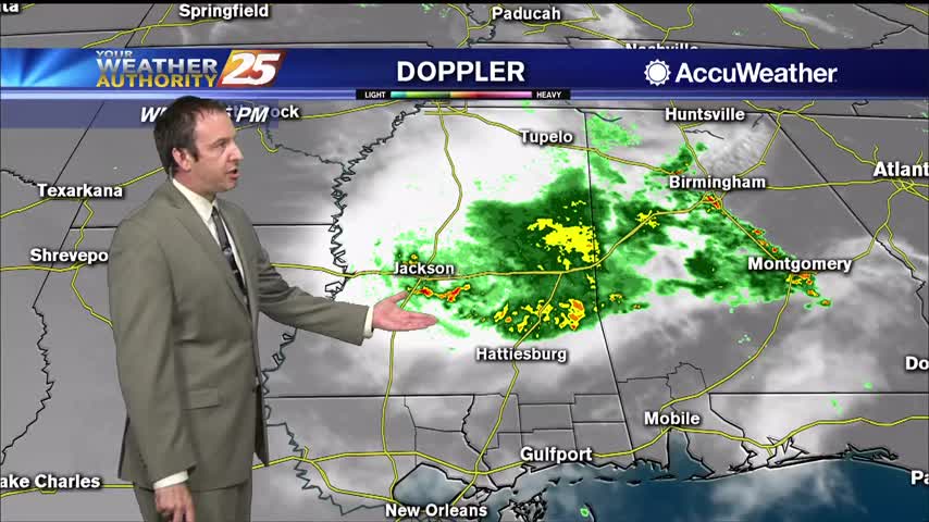
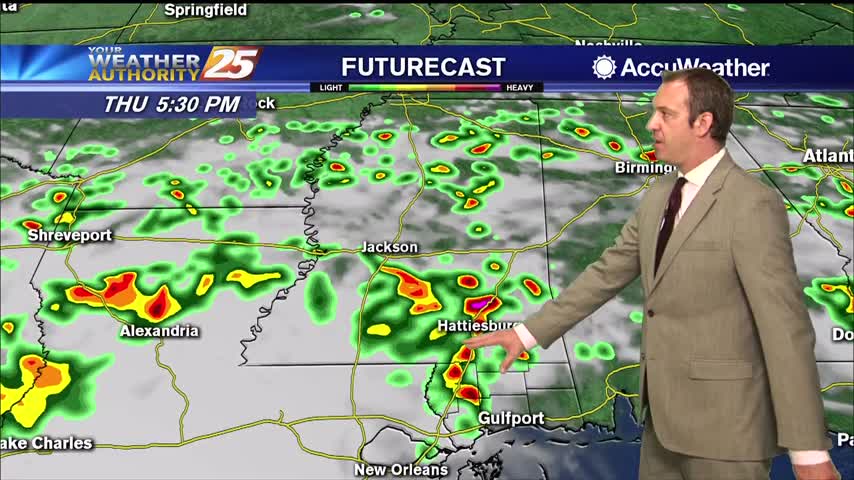
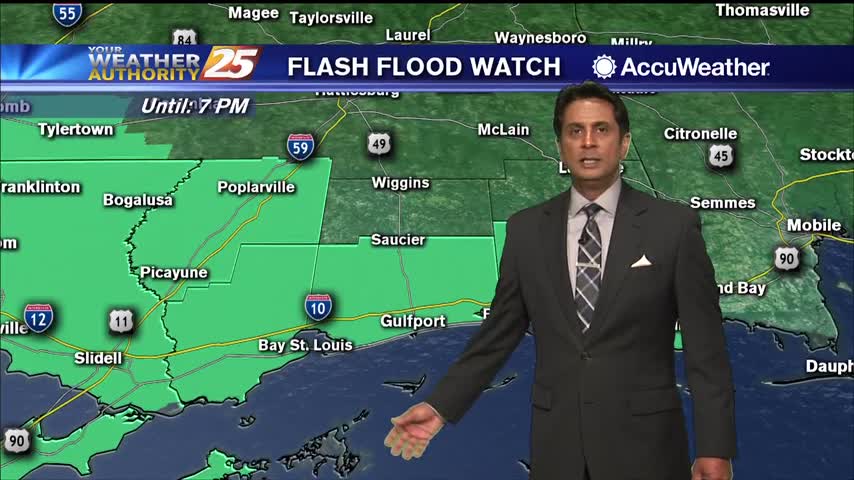
Active, strong weather moved in early this afternoon, and while it did weaken a bit through the evening the rain didn't leave completely.