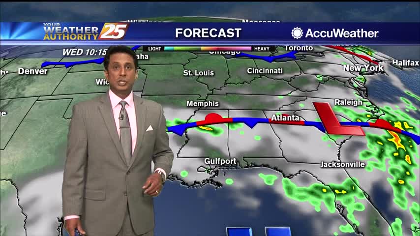
07/10 Ryan's "Miserable" Friday Evening Forecast
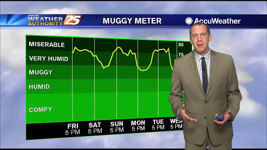
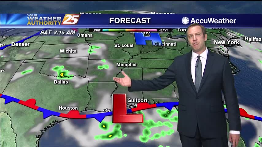
Conditions this weekend will be downright uncomfortable as dangerously high heat indices move in while afternoon showers will be harder to come by.
Conditions this weekend will be downright uncomfortable as dangerously high heat indices move in while afternoon showers will be harder to come by.
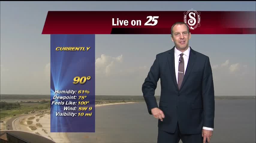
Temperatures continue to climb into the low/mid 90s with the HEAT INDICES topping the 100 degree mark...
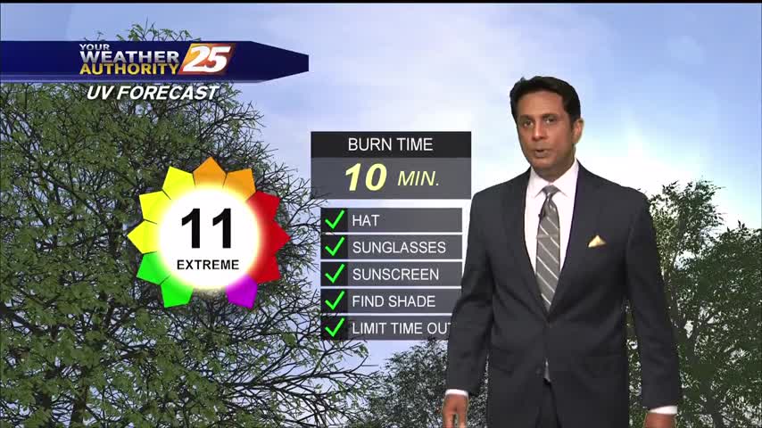
A very warm start to the day with a HEAT ADVISORY in effect through this evening...
Much drier weather today as our trend of substantial afternoon showers and thunderstorms ended, but dangerously hot and humid weather lies ahead.
No rain in South MS so far today, which made it even hotter heading into the afternoon.

After several rainy days, skies are looking a little more clear this afternoon. Rain chances are down to just 20 percent for Thursday and Friday, but the air will continue to feel damp with a humid air mass in place.…
Another muggy start to the day with just a few clouds overhead...

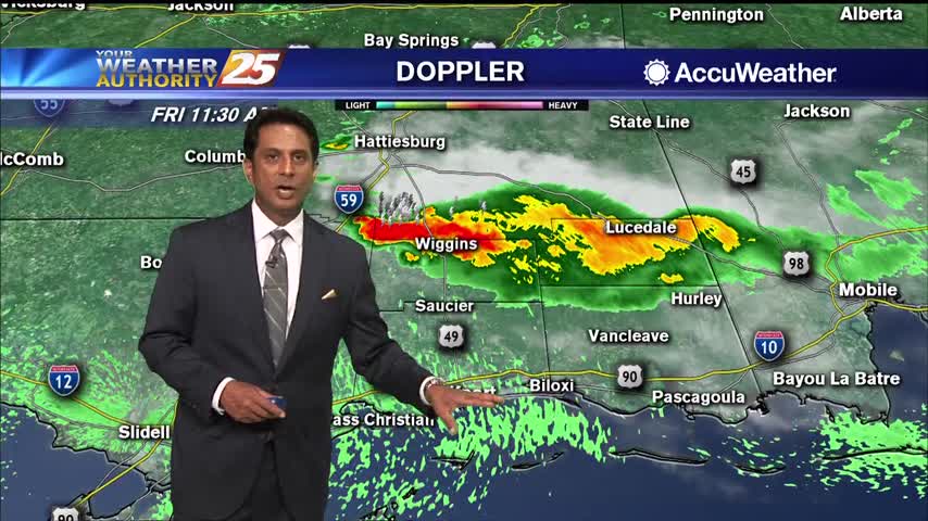
Saw a few severe warnings earlier today, but that stormed raced through and skies are already clearing.
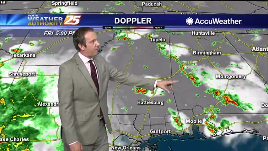
A strong line of showers and thunderstorms moved through late in the afternoon, something we're expecting to see less of over the weekend.

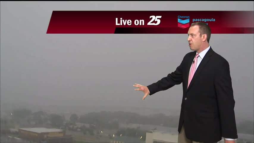
A very muggy morning with areas of light patchy fog north of the interstate...

We've been stuck in a familiar pattern all week long: showers and thunderstorms pop up in the heat of the day and slowly clear through the night, but drier changes lie ahead.
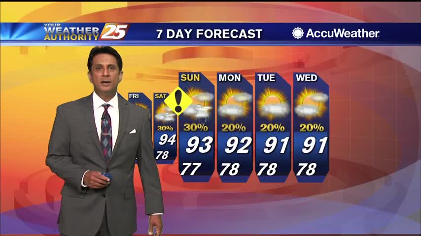
More nasty afternoon weather for another day or two, but much hotter and drier days are expected soon!

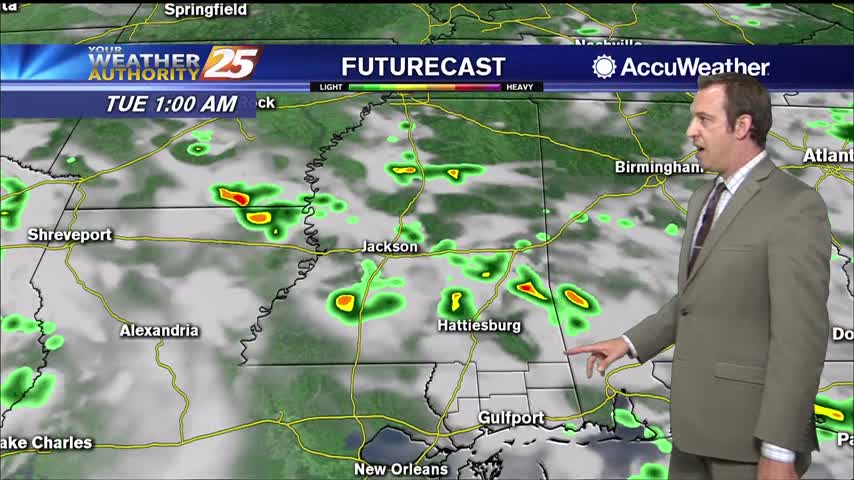
A Flash Flood Watch continues for South Mississippi through Tuesday evening as showers and thunderstorms may produce heavy rainfall on already saturated grounds. 4 to 6 inches of rain will be possible, especially where we see storms consistently rolling over…
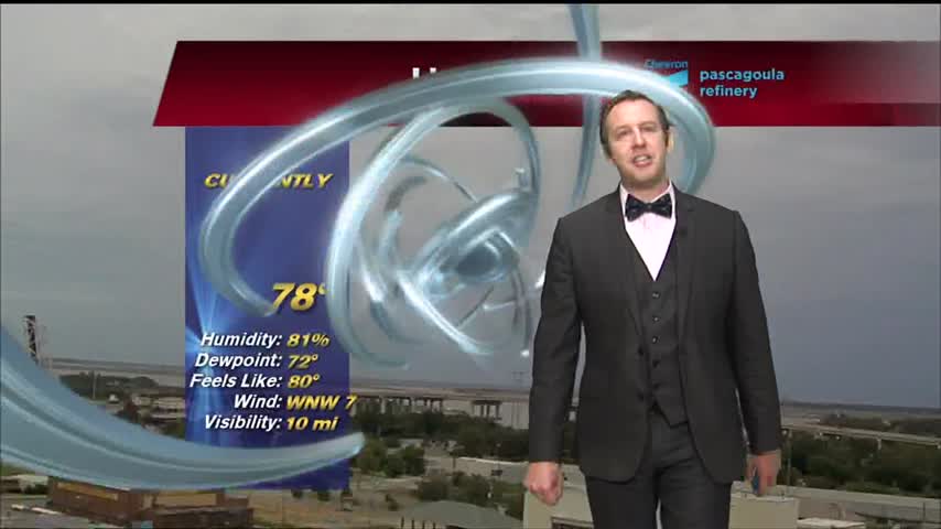
A warm and muggy start to the day with patchy fog and spotty light rain...
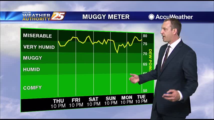
More muggy, rainy weather ahead, but at least the rain will be drying up soon. Not that lucky on the humidity....
Not much has changed weather-wise over the weekend, but drier days do lie ahead though the humidity isn't going anywhere.

A Flash Flood Watch is in effect until 8 p.m. Monday for Hancock, Harrison, Jackson, and Pearl River Counties. Localized amounts of 4 to 6 inches of rain will be possible as heavy showers and thunderstorms continue to roll across…

A very humid start to the day with areas of patchy fog north of the interstate...
Today through Wednesday, an upper level trough will cause a frontal system to continue to be in place over the area, which will enhance rain chances. This system will still be stalled through this time period. And there is plenty…

More wet weather is on the way, and will stick around through the weekend and into the beginning of next week.
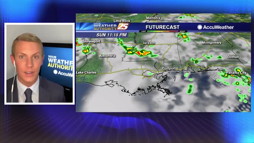
Didn't see as much rain today as expected, but that's largely becuase a huge line of afternoon thunderstorms just missed us to the west. This weekend overall will be quite wet though.

Showers & T-Storms moving in from the NW will continue through this evening...

A warm and muggy start to the day with showers and t-storms north of the area...
The week started on the drier side, but afternoon rain has moved in each afternoon for the last few days. Expect to see much more rain over the weekend though....