11/3 - Rob Knight's "Warming Trend" Midday Forecast
After the coldest temperatures of the season earlier this morning, the warming trend now begins...

After the coldest temperatures of the season earlier this morning, the warming trend now begins...
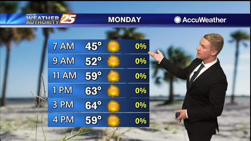
After a very cold start to the day, temperature are slowly warming under sunny skies...
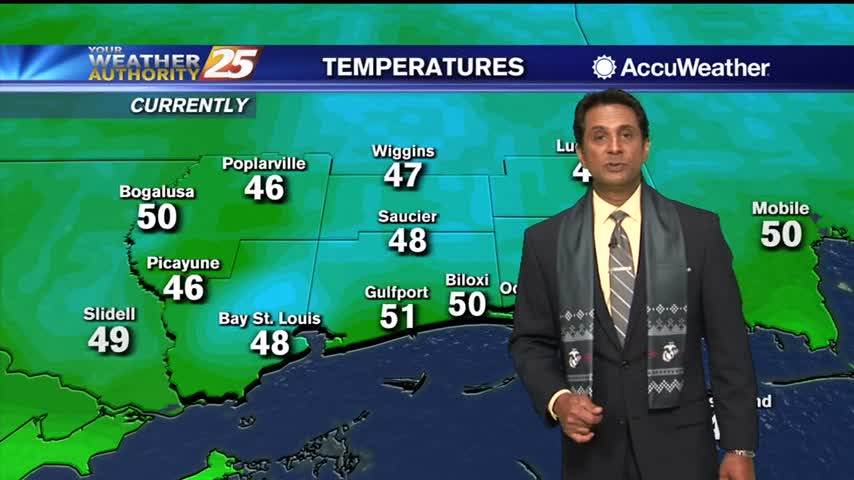
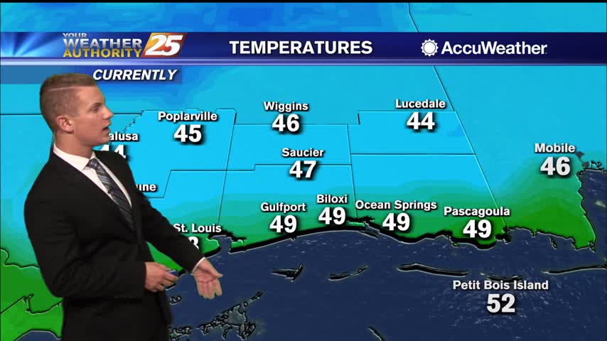
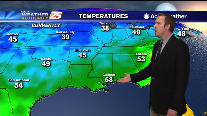
It’s quite the chilly morning across the area with some of the coldest temperatures we’ve seen in a while. Early morning temperatures are sitting in the lower to mid 40s across most of the viewing areas. Some upper 30s are…
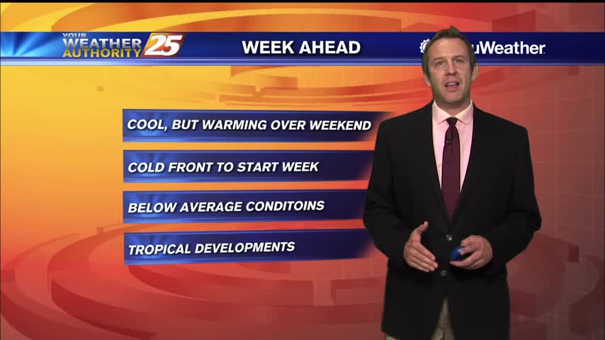
Much colder after Sunday's cold front, but it steadily warms throughout the week.
Not too bad of a weekend anyway, but then a front moved through yesterday bringing even drier air to start the week.
Temperatures are going to linger in the mid-60s this afternoon due to a cold north wind...
After a CHILLY start, temperatures are slowly warming under an abundance of sunshine...
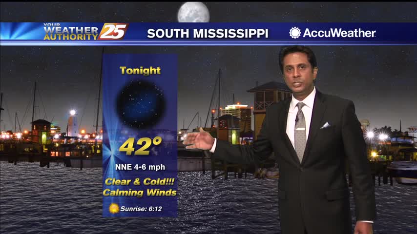
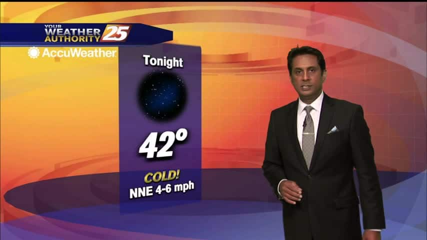
Coldest overnight lows of the week are expected Monday night into Tuesday morning as skies remain clear and winds turn very light to calm across inland areas. Temperatures will plummet into mid to upper 30s across most inland communities Monday…
Coldest overnight lows of the week are expected Monday night into Tuesday morning as skies remain clear and winds turn very light to calm across inland areas. Temperatures will plummet into mid to upper 30s across most inland communities Monday…
Another chilly night in the upper 40s, but slightly warmer weather is ahead...just doesn't last long before another cold front moves in.
Another cool evening ahead before we move into quite a chilly night, but a little warm-up is on the way.
A lovely afternoon ahead with sunshine and the winds relaxing...
A chilly start to the day with temperatures in the upper 40s/low 50s...
Zeta is gone and cooler, drier air is rapidly filling in its wake...
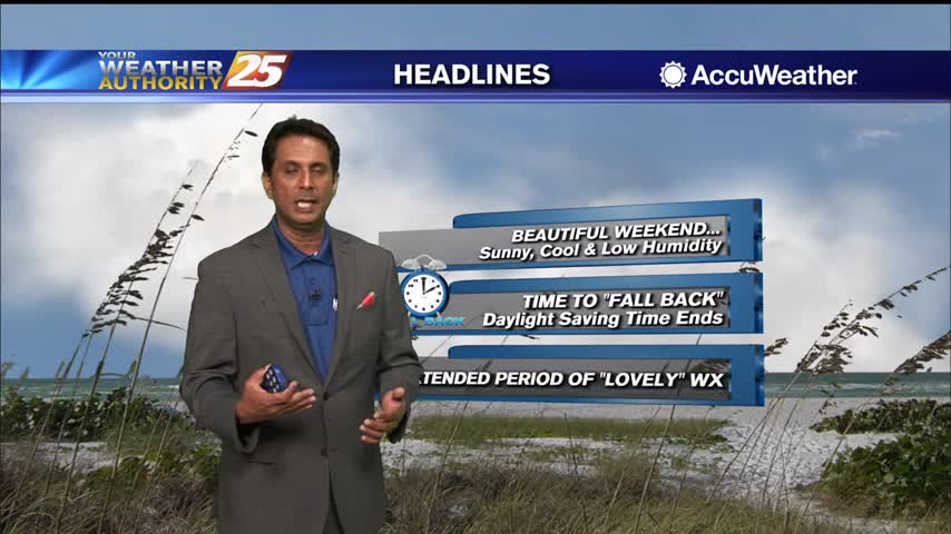
Our first day of post-Zeta weather is practically perfect, and will remain so through the weekend!
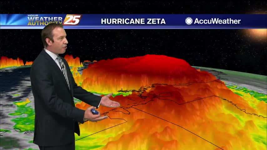
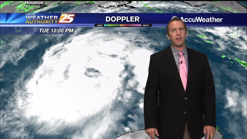
It was quite the day and evening yesterday. Zeta intensified into a strong Category 2 hurricane and brought a swath of wind damage to portions of Southeast Louisiana and South Mississippi. Zeta sped up and by early this morning had…
Chief Meteorologist Rob Knight has the latest on Hurricane Zeta as of 7:45 PM.
4 PM Hurricane Zeta Update for South MS
Here is the latest on Hurricane Zeta.
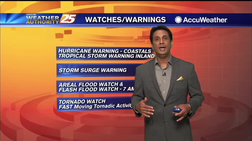
Activities and events around South Mississippi have been cancelled or rescheduled because of bad weather associated with Hurricane Zeta: Temple Baptist Church, located at 3 Rivers Road and Dedeaux Road in Gulfport, will be closed Wednesday night. Harrison County is…
A warn and cloudy start to the day as Hurricane Zeta continues to move towards the N'tern Gulf...
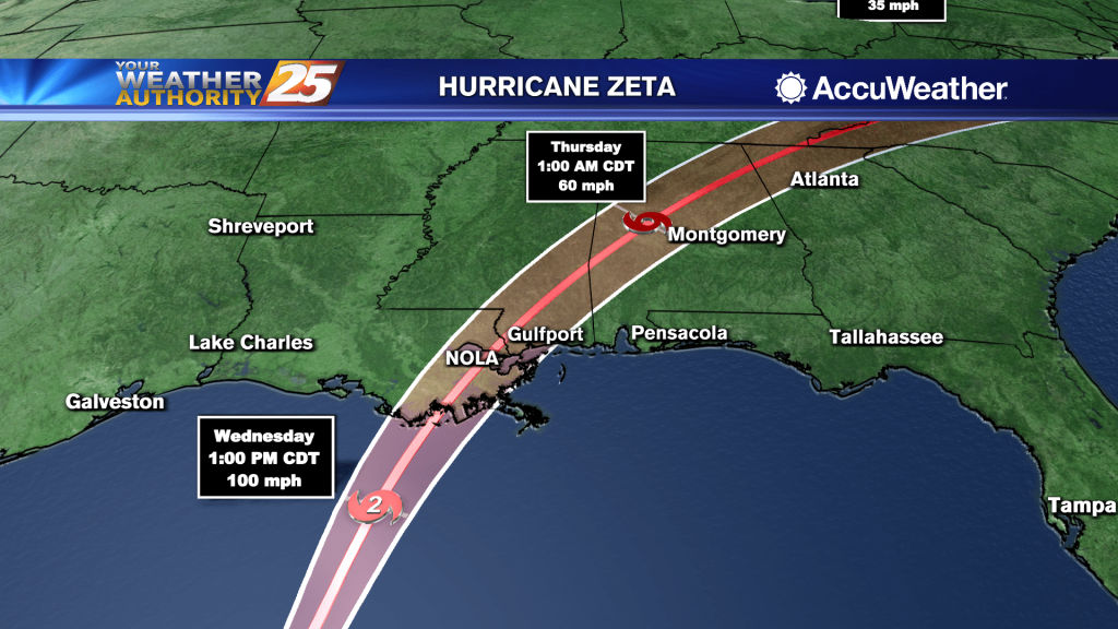
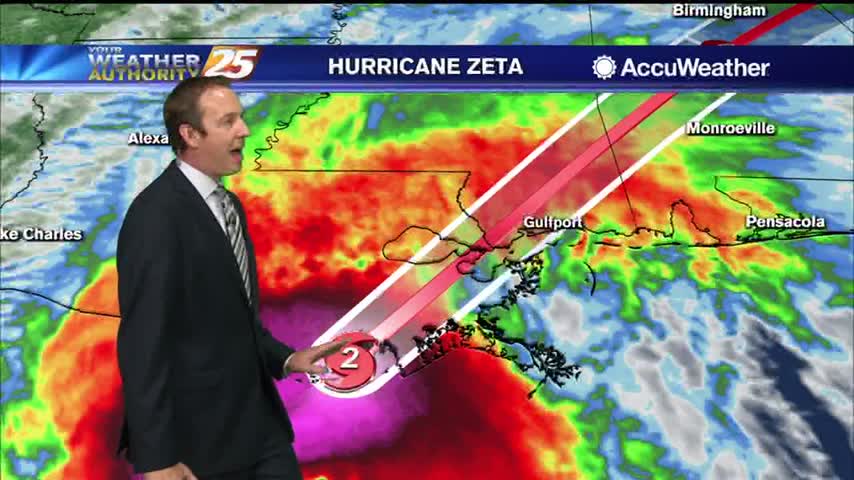
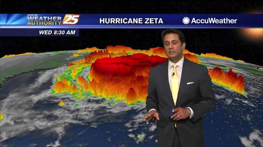
(WXXV) — As of 7 a.m. Wednesday, Air Force and NOAA Hurricane Hunter aircraft observations indicate that Hurricane Zeta has strengthened and now has maximum sustained winds of 90 mph with higher gusts. Some additional strengthening is forecast this morning.…
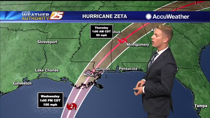
(WXXV) — As of 7 a.m. Wednesday, Air Force and NOAA Hurricane Hunter aircraft observations indicate that Hurricane Zeta has strengthened and now has maximum sustained winds of 90 mph with higher gusts. Some additional strengthening is forecast this morning.…
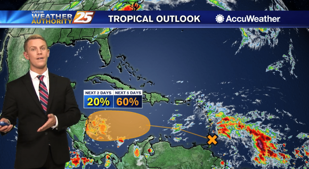
Zeta remains a tropical storm for now, but will regain hurricane status as it bears down on the Gulf Coast tomorrow evening.