10/27 Ryan's "Zeta" Tuesday Evening Forecast
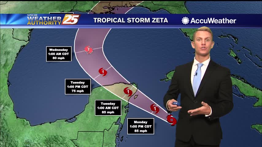
Tropical Storm Zeta is in the Gulf and expected to regain hurricane status before moving towards South MS tomorrow.
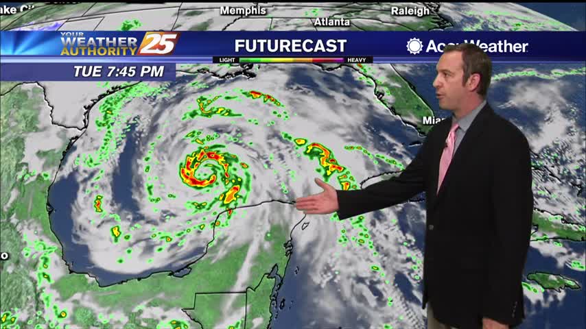
Tropical Storm Zeta is in the Gulf and expected to regain hurricane status before moving towards South MS tomorrow.
Spotty rain continues to move in from the south with t-storms ahead this afternoon...
Zeta is back over open waters...this time in the southern Gulf of mexico...
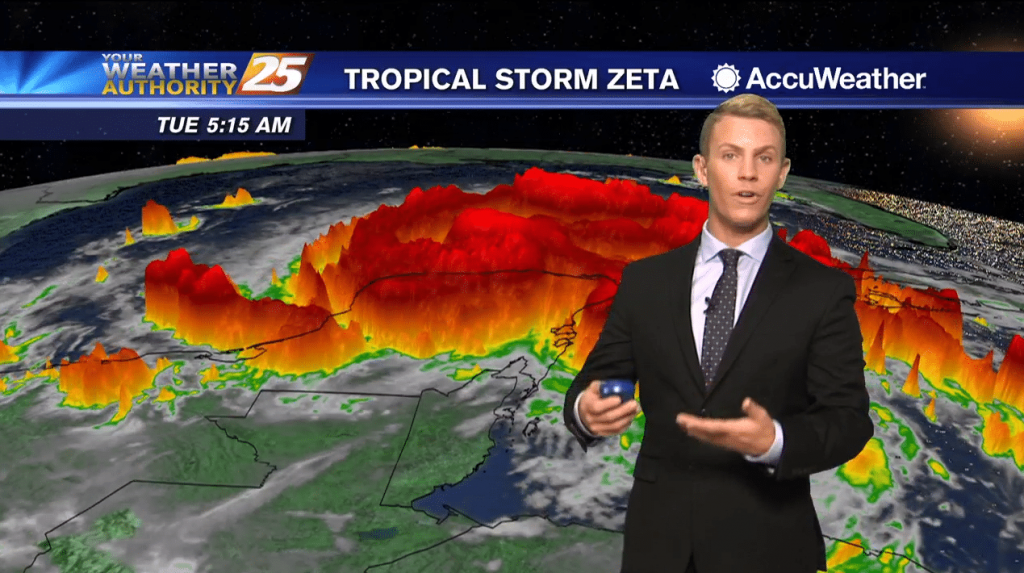
(WXXV) — As of 7 a.m. Tuesday, Tropical Storm Zeta had maximum sustained winds of 70 mph with higher gusts. Zeta is forecast to re-strengthen when it moves over the southern Gulf of Mexico later this morning, and become a…
Quiet start to the week, but it gets cloudy and wet pretty quickly as a hurricane closes in.
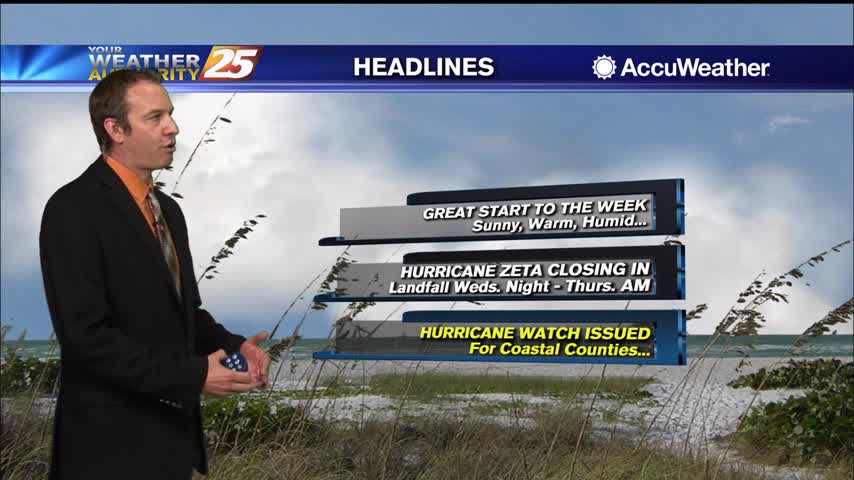
Off to a great start after a nice weekend, but the clouds are gathering as a possible hurricane closes in.

A BEAUTIFUL Monday afternoon ahead with sunshine mix with clouds and warm temperatures in the low 80s...

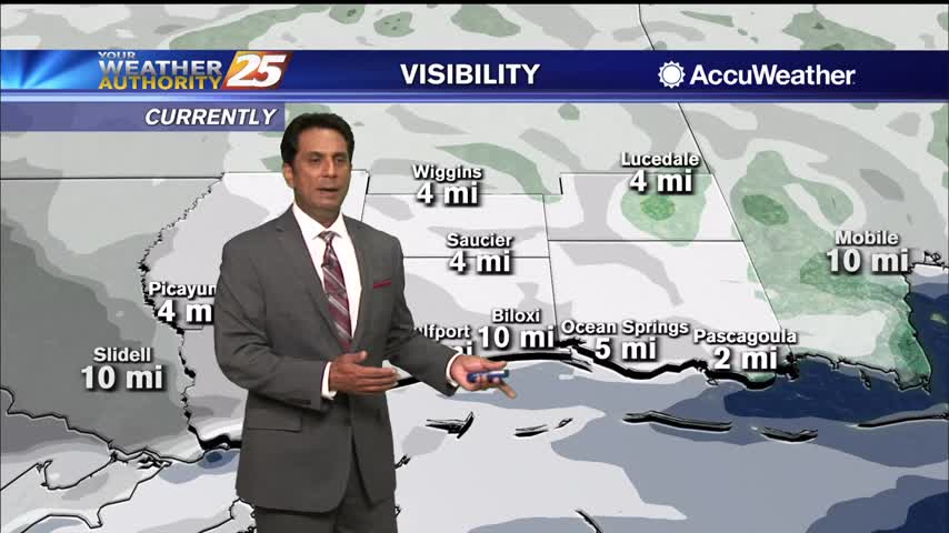
Areas of patchy dense fog beginning to burn off leading to mostly clear skies...
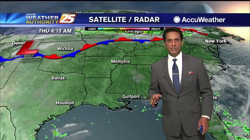
As of 7 a.m. Monday, the center of Tropical Storm Zeta was moving toward the northwest at about 9 mph. Observations from a NOAA Hurricane Hunter aircraft indicate that maximum sustained winds are near 70 mph with higher gusts. Strengthening…
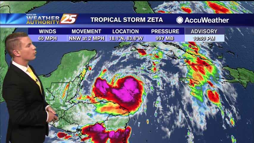
(WXXV) — As of 11 p.m. Sunday, Tropical Storm Zeta was drifting toward the north-northwest near 2 mph but a faster northwestward motion is expected over the next couple of days, followed by a turn to the north. On the…
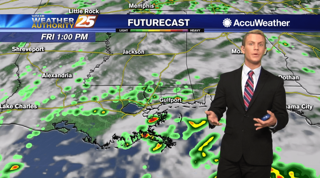
Wet end to this week, but the start of the next will be much drier...just not much cooler, at first.
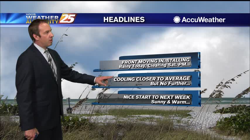
Been dry, warm, and humid all week long, but now wet weather moves in before things clear for the start of next week.
A fairly nice start to the day with light fog and mild temperatures...
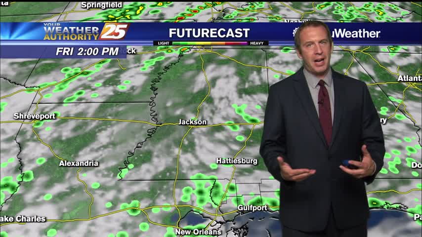
Finishing off this week on the rainy side, but more fall-like weather is on the way.
No major changes today, but more clouds and even rain will move in rather quickly.
A warm afternoon ahead with increasing humidity and a few spotty showers possible...
Patchy fog is dissipating along with low-level clouds here in south Mississippi...
The nose of a ridge of surface high pressure remains rooted at the beginning of the period over the southeastern United States. This nose of high pressure gets erased as a weak upper level shortwave trough continues to move across…
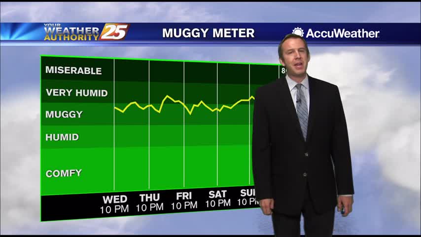
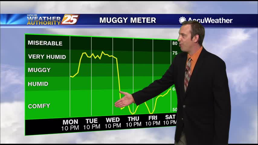
Hot and humid trends continue, but fall weather will return before too long.
Certainly feels more like summer than fall right now, but these warm and humid conditions will be forced out before too long.

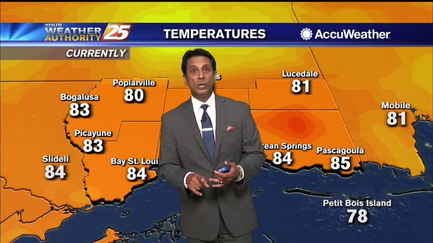
Warm temperatures and a few/party clouds skies heading into this afternoon...
Light patchy fog has dissipated as temperatures begin to warm...
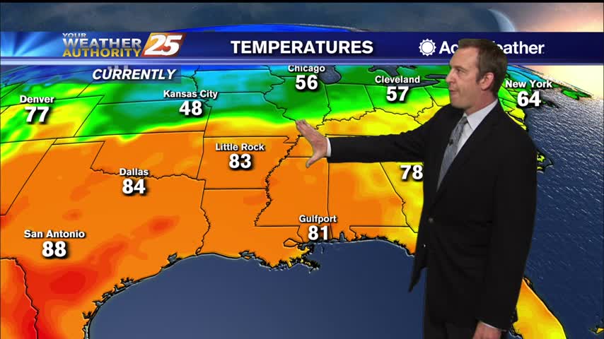
It will be warm and humid once again today along the Gulf Coast. Expect a mix of sun and clouds with high temperatures staying above normal… topping out in the lower to mid 80s. As the upper ridge begins to…
Feels more like early summer or late spring than fall right now, but slightly cooler and drier weather is on the way.