04/27 Ryan's "Foggy" Tuesday Night Forecast
Another foggy night ahead as a slow moving front piles up moisture in the South MS area, with little change until the weekend.
Another foggy night ahead as a slow moving front piles up moisture in the South MS area, with little change until the weekend.

High pressure continues to dominate the southeastern U.S. through Wednesday night, giving us calm conditions with little to no chance for rain. Our high pressure system shifts east into Wednesday and Wednesday night as a low pressure system slowly shifts…

Didn't dry much after our weekend front and now the humidity will slowly rise for most of the week, so get ready for some muggy, foggy evenings....

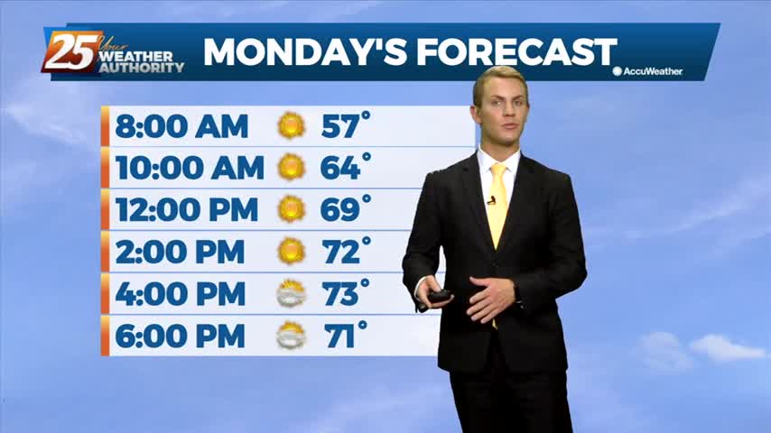
Winds are expected to gradually become more southeasterly today as the return flow begins to develop. A little warmer for Monday as the return flow sets up, with highs mainly ranging from the 80s over inland areas to the mid…
Clear skies tonight and only a few scattered clouds are expected on Monday. Light northerly winds will become light and variable overnight, then gradually become more southeasterly on Monday as the return flow begins to develop. A cool night is…
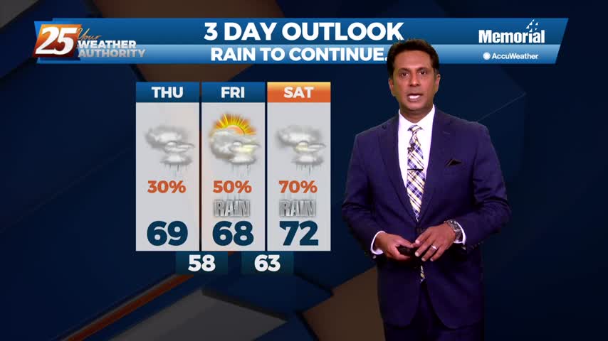
Just like the last few weekends, we're getting off to a stormy start to the weekend
Today was the last of the week we'll see clear, blue skies, but our cloudy, stormy weather won't last too long into the weekend.
One of the coolest nights we've seen in a while is moving in later, but we'll begin warming from there until our next front moves in Saturday morning.
Very quiet conditions continue over the next couple of days. High pressure continues slides east across the region, giving us clear skies and calm weather. A dry cold front will be dropping southeast across the region this morning will give…
Skies have finally cleared for good and will remain that way for almost the entire week, but that's when rain begins to creep back in....
Expect a few clouds through the night, but much more sun and dry weather for most of the rest of the week. Not all of it though....
A ridge of high pressure will build eastward from Texas into the Lower Mississippi Valley and adjacent north central Gulf Coast region through Monday afternoon. A cooler and drier airmass will spread over our forecast area through the day Monday.…
Sad to say we have a wet weekend ahead after our ridiculously wet week, but things will begin drying up quickly as we head into the next....

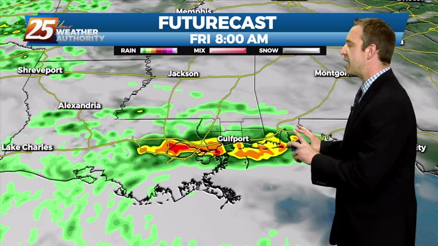
A break from the rain this afternoon as organized activity will begin moving back into the area this evening...
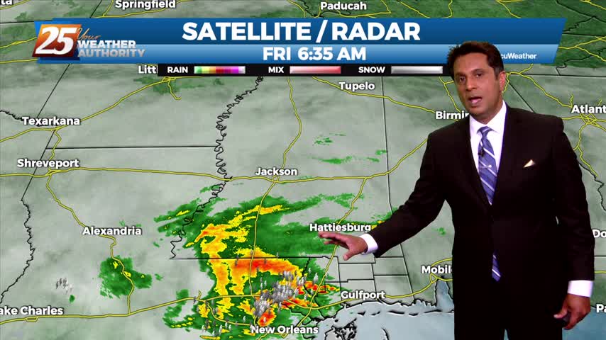
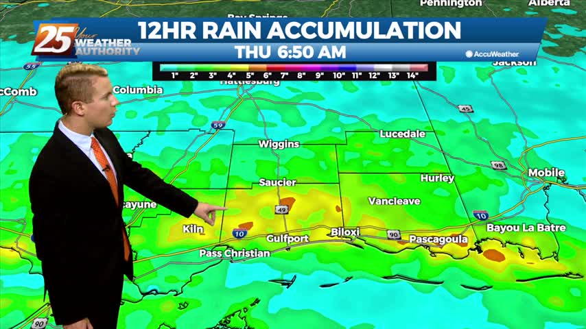
Moderate/heavy rain from the west is beginning to move into south Mississippi...
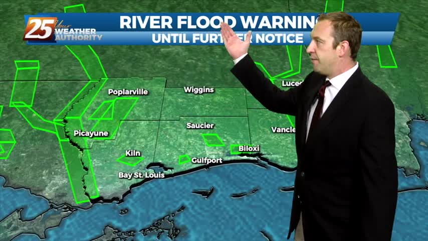
It's already quite damp out there with flooding issues popping up, and we still have at least a day or so of rain left!
The area will get a break from the torrential rainfall for the next 18 hours...
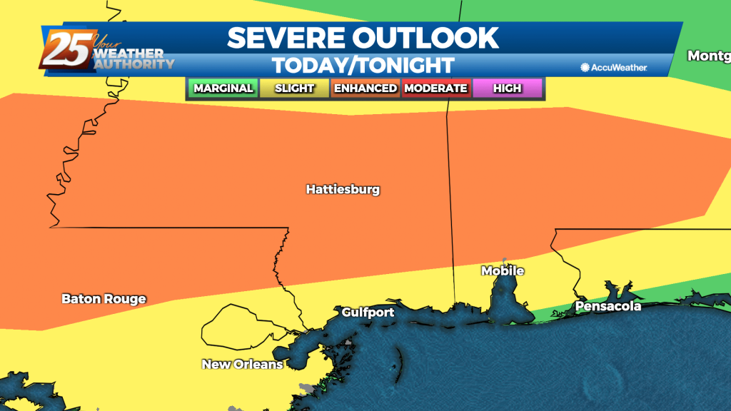
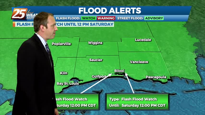
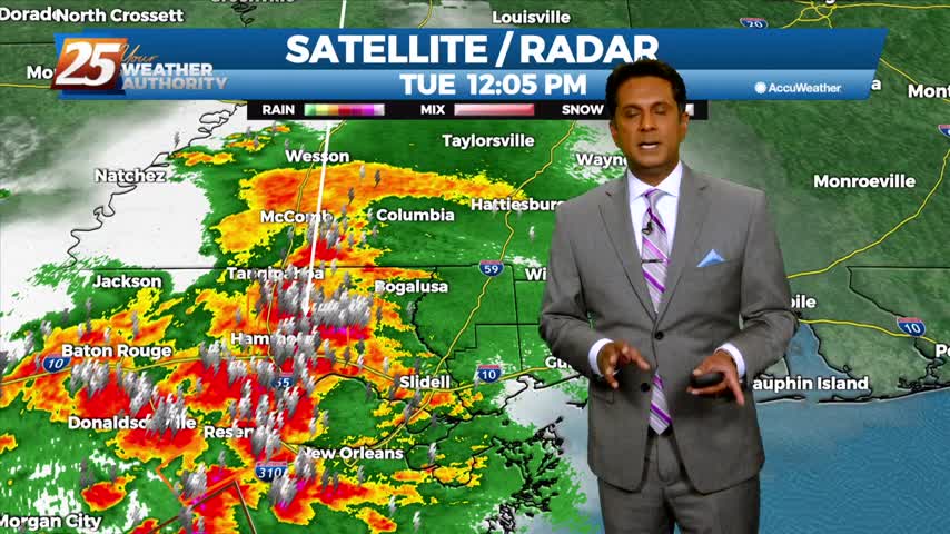
Another active weather day can be expected with the potential for a few severe storms and localized flash flooding. A frontal boundary, pretty much centered over the area from east to west, is moving very slowly and dumping heavy rain…
Finding ourselves in the midst of a familiar pattern as a lingering boundary with frequent impulses bringing rain each day. The sun will return soon though....

T-Storms and heavy rain will begin to taper-off by mid-afternoon...

Expect cloudy through the next day or two with highs today in the lower to mid 70s. High temperatures tomorrow are expected to top out in the 70s once again due to increased cloud coverage and a higher chance of…

Strong, gusting winds followed our active afternoon as showers and thunderstorms moved through. The rain will dry up through the night, but come back quickly tomorrow.
A complex of t-storms moving in from the west could provide for SEVERITY this afternoon...
Highs today will reach the mid to upper 70s along the coast with some inland locations reaching the lower 80s. Scattered showers will make things cool off quickly in select areas. Tonight, lows fall into the mid 50s over the…