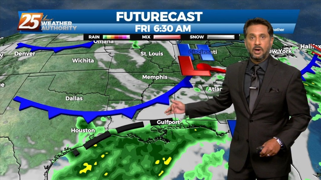
8/19 - The Chief's "Another WET Start" Friday Morning Forecast
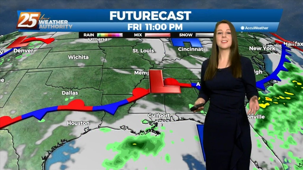
Multiple disturbances expected to move through the eastern US today. One is moving through Arkansas and east Texas into Louisiana, while a stronger one is dropping…
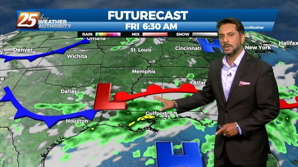
Multiple disturbances expected to move through the eastern US today. One is moving through Arkansas and east Texas into Louisiana, while a stronger one is dropping…
Main concerns over the next few days will be the threat of thunderstorms. Heavy rain will be the point of highest concern, but can`t rule out a…
Main concerns over the next few days will be the threat of thunderstorms. Heavy rain will be the point of highest concern, but can`t rule out a few reports…
This afternoon will continue to bring showers/t-storms to the area. The main concerns over the next few days will be the threat of thunderstorms. Heavy rain…
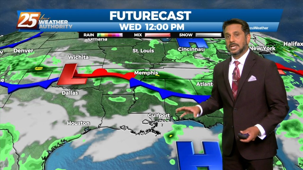
The overall current pattern is fairly interesting across the Lower Mississippi River Valley. A surface "frontal" boundary resides generally along and north of the I20 corridor. As the…
The overall current pattern is fairly interesting across the Lower Mississippi River Valley. A surface "frontal" boundary resides generally along and north of the I20 corridor. As the…
The focus this afternoon and evening will be on convective development to our north and east, moving into south Mississippi. A zone of low-level convergence oriented NW…

The focus late this afternoon and evening will be on convective development to our north and east, moving into south Mississippi. A zone of low-level convergence oriented…
Hot and dry again for most of the day today. Focus this evening will be on convective development to our north and east, with short-range guidance identifying a…
Hot and dry again for most of the day today. Focus late this afternoon and evening will be on convective development to our north and east, with short-range…
The focus late this afternoon and evening will be on convective development to our north and east, with short-range guidance identifying a zone of low-level convergence oriented…

Hot and dry again on today for most of the day. No real distinct changes in the overall profile of the atmosphere. This subsiding dry layer has…
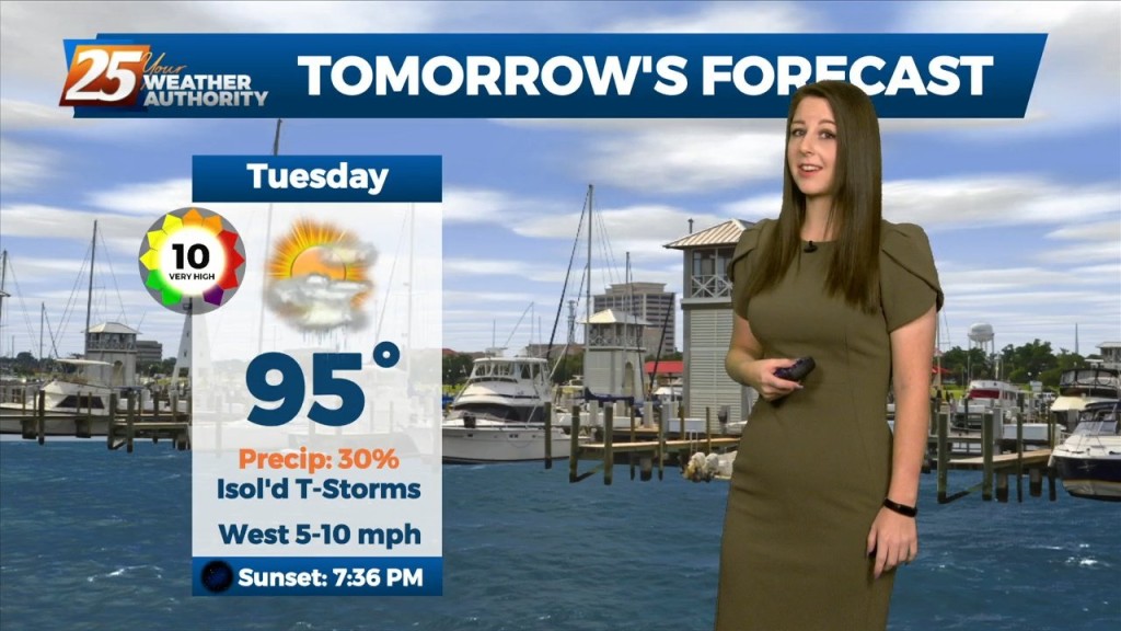
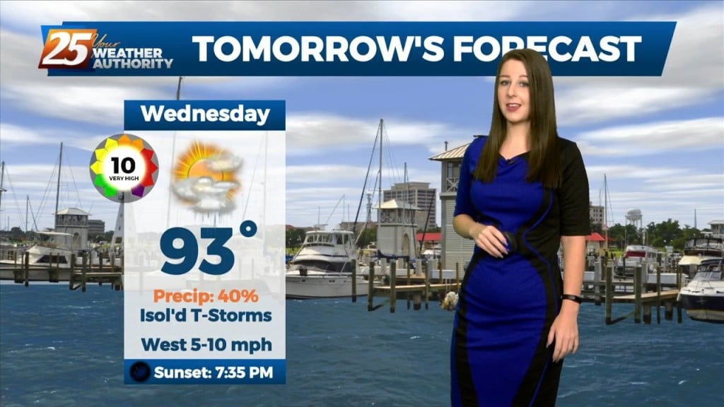
The main focus of the short term forecast will be the warmer temperatures heading into Tuesday and likely again Wednesday. It has been a while since we`ve…
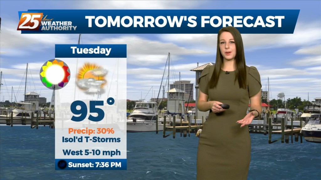
The main focus of the short term forecast will be the warmer temperatures heading into Tuesday and likely again Wednesday. It has been a while since we`ve…
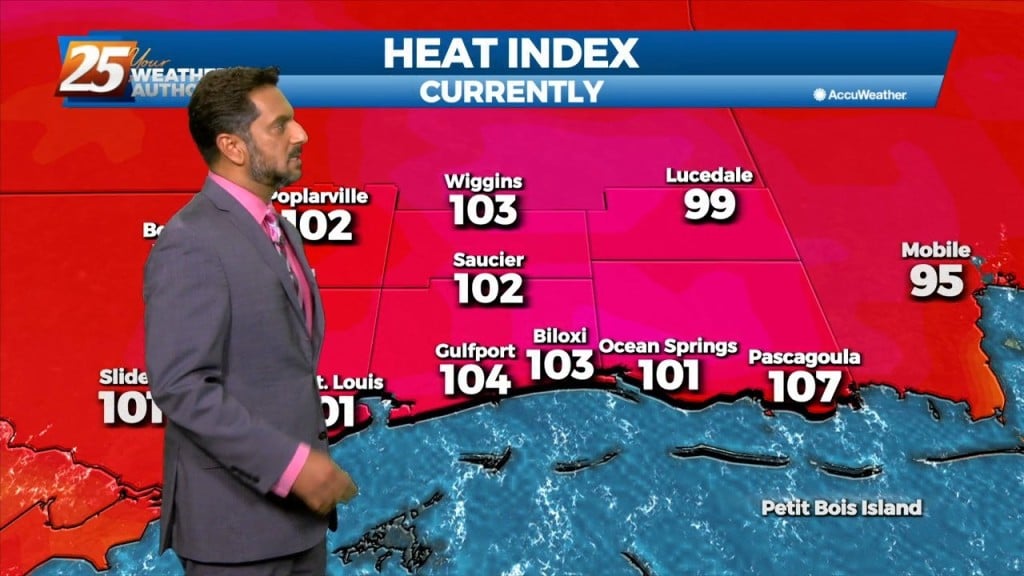
Low moisture flow will lead to low rain chances and HOT TEMPERATURES... The upper pattern doesn’t change a lot between now and Wednesday afternoon, with the local…
Moisture flow has decreased and there are no real saturated layers. Winds are primarily northerly from 5k upward. No real indications that anything will change significantly during…
Weak ridging over the area has brought in slightly drier air and kept rain coverage down for the most part today. As we begin the new work week,…
The upper level pattern across the country, and somewhat locally, is starting the transition process that will begin to finally lower rain chances for the northern Gulf…
The upper level pattern across the country, and somewhat locally, is starting the transition process that will begin to finally lower rain chances for the northern Gulf Coast.…
The upper high pressure over Colorado this morning will gradually build southeastward over the next few days, even as the trough to our northeast continues to dig…
The upper high pressure over Colorado this morning will gradually build southeastward over the next few days, even as the trough to our northeast continues to…
The broad upper level analysis shows a ridge centered over the Rockies which expands over at least 2/3 of the country and trough digging across the northeast…
The broad upper level analysis shows a ridge centered over the Rockies which expands over at least 2/3 of the country and trough digging across the northeast CONUS.…
Today the flow will shift more northerly as a weakness along the coast continues to amplify activity. At the surface, a weak frontal boundary…