8/10 - Brittany's "Wet Conditions Ahead" Wednesday Evening Forecast
Going into tonight, a few scattered showers should continue to cycle downward over the land-based zones as the diurnal cycle shifts offshore. On Thursday the flow shifts…
Going into tonight, a few scattered showers should continue to cycle downward over the land-based zones as the diurnal cycle shifts offshore. On Thursday the flow shifts…
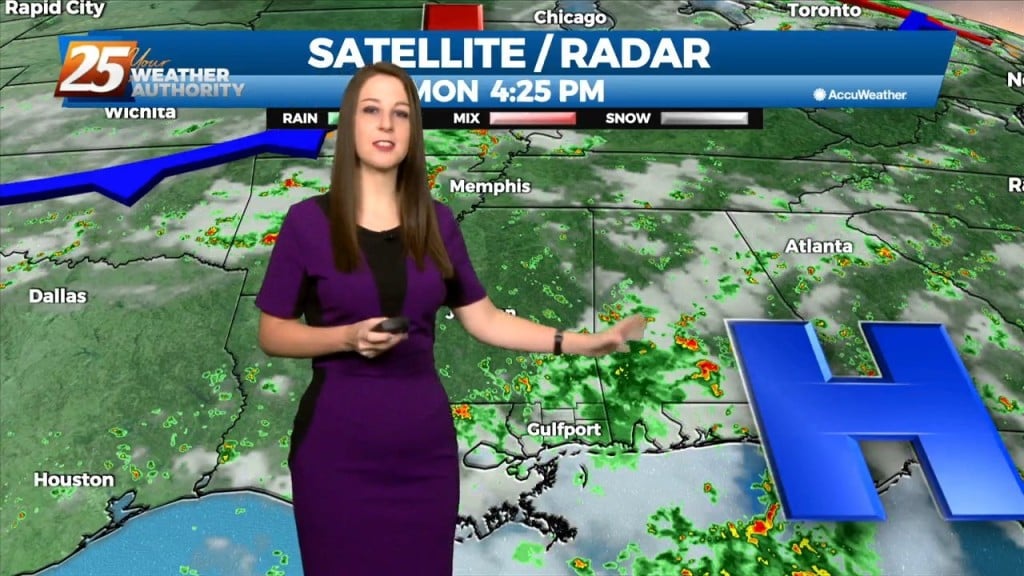
Convection is ongoing across the region this afternoon. Going into tonight, a few scattered showers should continue to cycle downward over the land-based zones as the diurnal cycle…
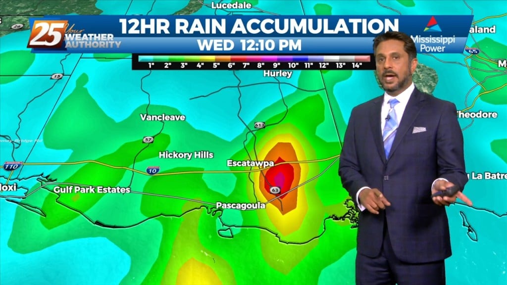
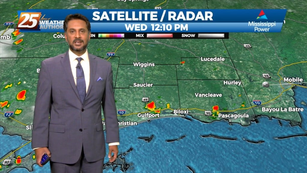
The threat for heavy rain and pockets of FLASH FLOODING continues this afternoon. While it is very likely that some areas see heavy rainfall, the somewhat…
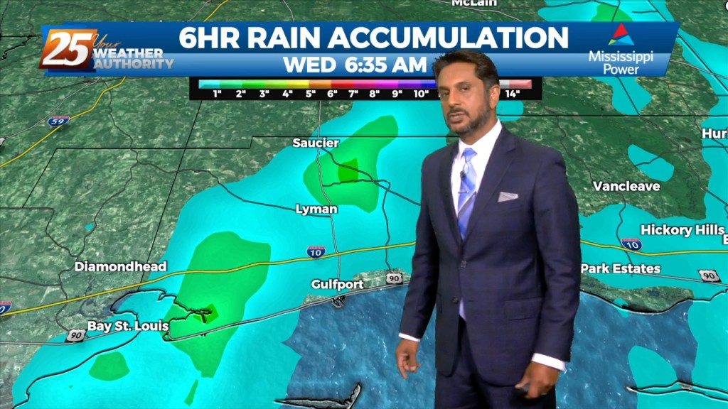
At the risk of sounding repetitive, another day of high rain chances is on tap for the area. Once again, these storms can easily produce hourly…
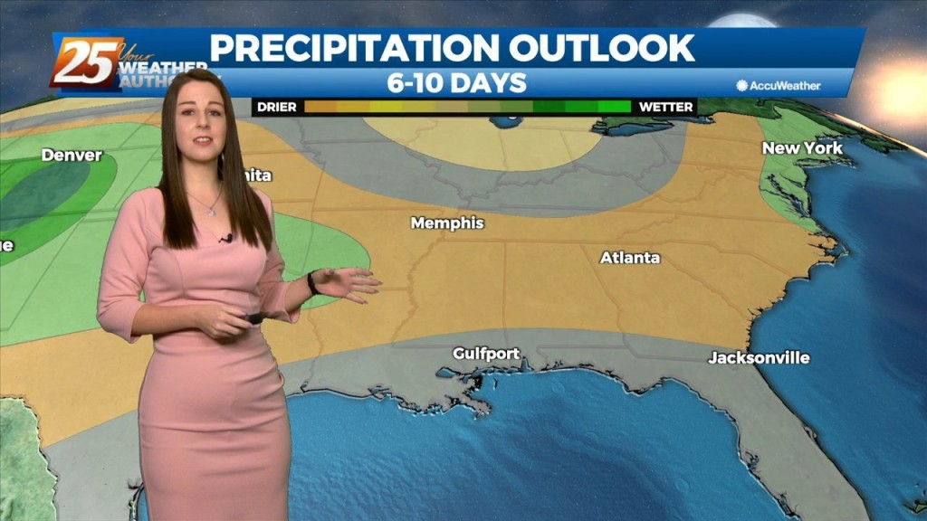
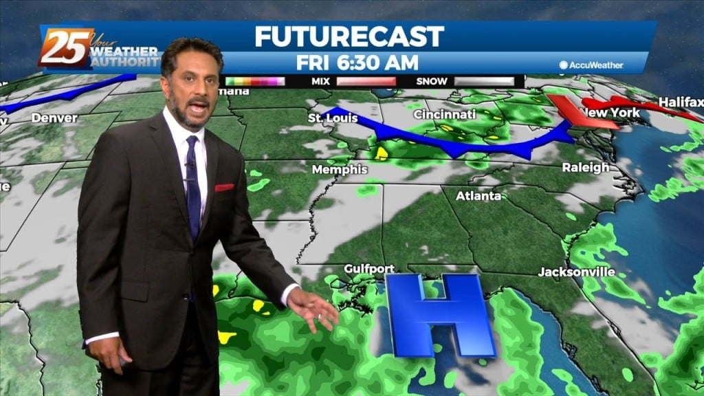
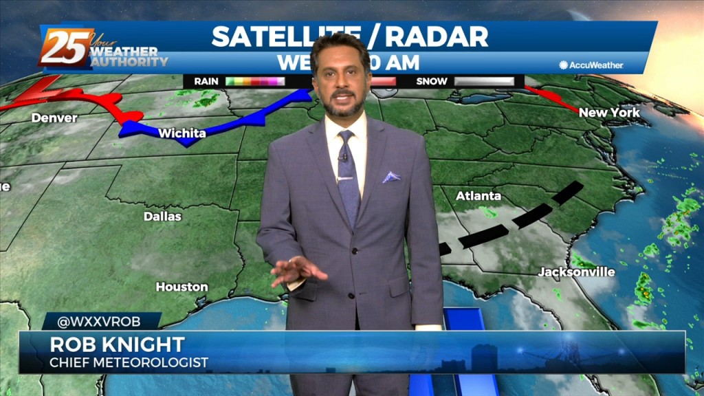
In a near carbon copy of last week, rain chances will once again continue to be high through the period. High pressure over the western Atlantic will keep…
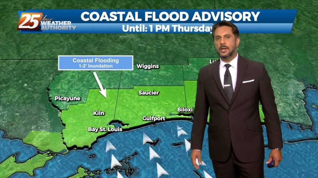
A COASTAL FLOOD ADVISORY is in effect through midday Thursday. High pressure over the western Atlantic will keep the area in a period of…
In a near carbon copy of last week, rain chances will once again continue to be high through the period. High pressure over the western Atlantic…
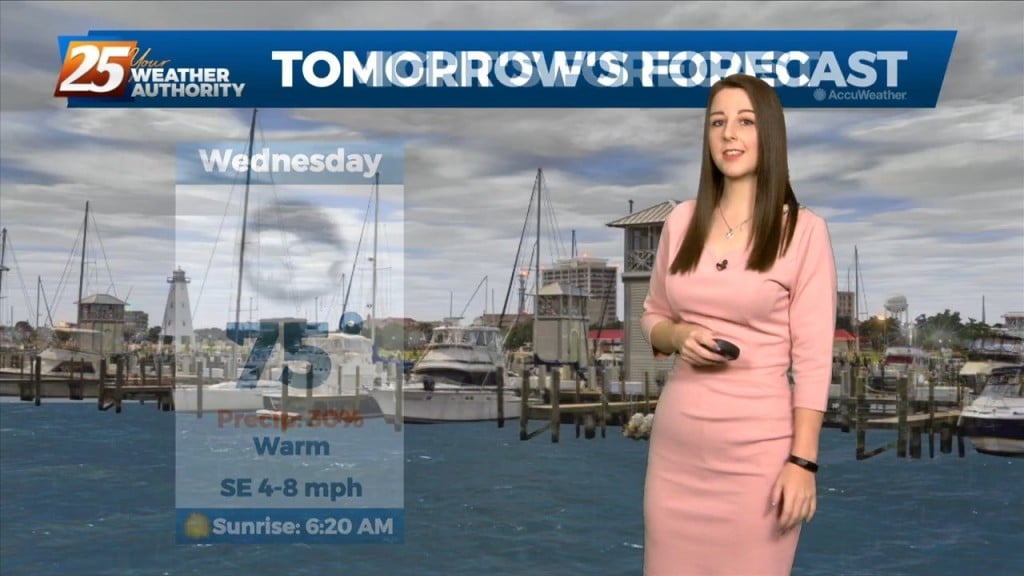
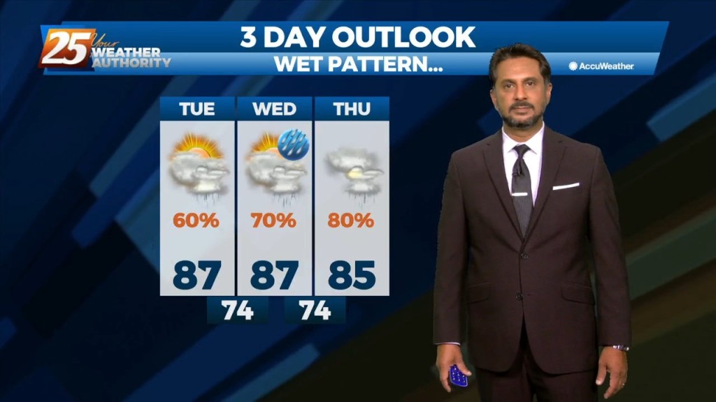
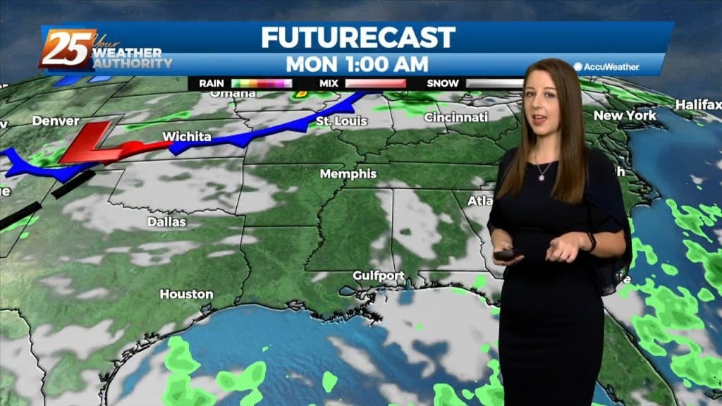
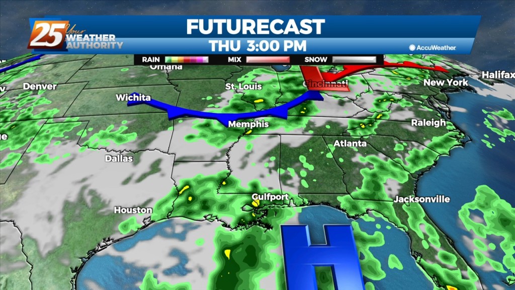
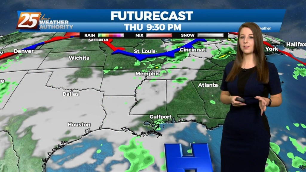
If we thought we had a lot of rain and coverage today it looks like things will ramp up over the next 3 days. We start tomorrow…
If we thought we had a lot of rain and coverage today it looks like things will ramp up over the next 3 days. We start tomorrow…
There is little change in thinking from the previous forecast concerning the overall trend of gradually increasing moisture, lift, and rain chances through Wednesday. The overall…
Forecast remains stubbornly similar for the next few days before a more focused system impacts the region late this week. The mid level ridge that has been…
The area is currently still between high pressure to our west and and the Bermuda high pressure to our east and a weak mid level inverted trough…
The area is currently still between high pressure to our west and and the Bermuda high pressure to our east and a weak mid level inverted trough over the…
This afternoon will bring hot temperatures and a few showers/t-storms induced by the sea-breeze. Activity will fizzle out just before sunset. With an uptick in mid-level drier…
Today will bring hot and humid conditions with t-storm coverage slightly more reduced for generally areas along/near of I-55 and east to the MS coast given…
Upper ridging to the west and east with troughing across the local area. This pattern has been rather stubborn to remain over the area for much of…
A weakness/subtle mid-level inverted trough over the northern Gulf continues a slow retrograding motion towards the WSW along the outer periphery of a mid-level high pressure…
A weakness/subtle mid-level inverted trough over the northern Gulf continues a slow retrograding motion towards the WSW along the outer periphery of a mid-level high pressure…
Looks like one more day of anomalously high moisture levels before some drying occurs. Now...that doesn`t mean we`re going to have totally dry and sunny days, but…
The convection will decay in the late evening as the sun goes down and it will give way to warm and muggy overnight conditions. More of the…
Many parts of the area have seen considerable rainfall over the past several days with a few locations having had measurable rainfall for quite an extended period. While…
The main concern will quickly shift to the possibility of heavy rainfall once again today. Many parts of the area have seen considerable rainfall over the…
Not much in the way of change is expected tomorrow or Thursday. As mentioned yesterday, the continued rainfall across the area will accumulate as the week continues…
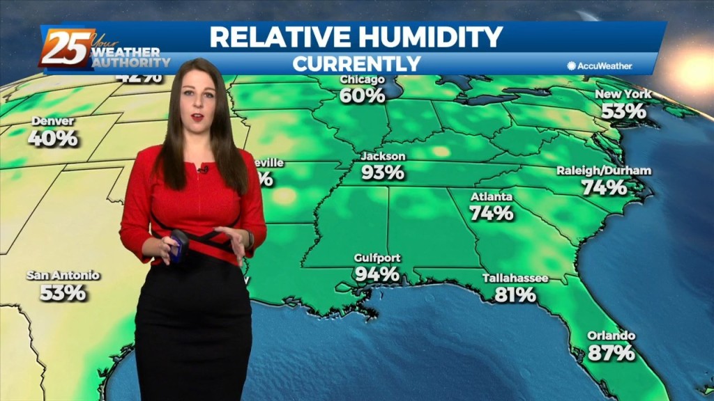
Deep moisture from the Gulf of Mexico continues to stream into the area with model soundings showing precipitable water values well above 2 inches, and as high as…