3/19 - Rob's FOGGY START, Monday Morning Forecast
A warm/humid start to the day with DENSE FOG through the viewing area. A DENSE FOG ADVISORY is in effect...
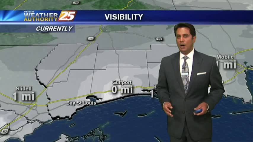
A warm/humid start to the day with DENSE FOG through the viewing area. A DENSE FOG ADVISORY is in effect...
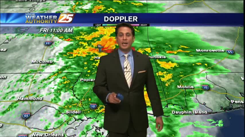
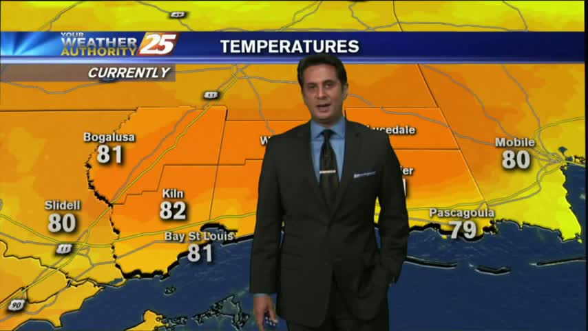
It was a much warmer start to the day with morning low temps about 20 degrees warmer than yesterday. Moderate rainfall is now moving across the area...

Another FROSTY start to the day...but the warm-up will begin later this afternoon...
After another FRIGID start to the day, temps are a bit warmer this afternoon under sunny skies...
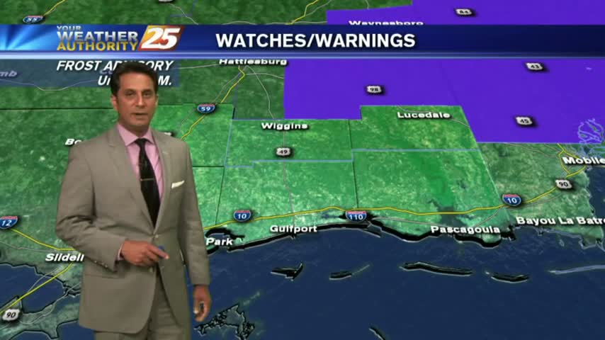
A COLD start with several locations inland below the freezing mark. A FROST ADVISORY continues though 9 a.m...

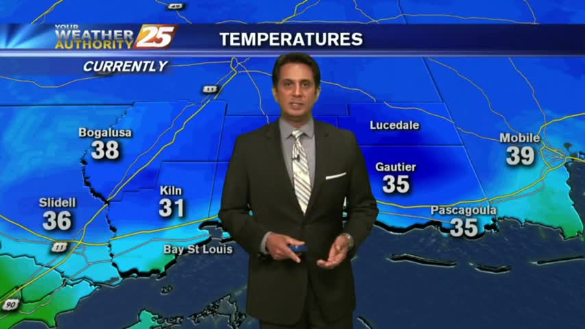
A clear and COLD start to the day with temps in the low/mid 30s inland, mid/upper 30s along the coast...
A colder and windy start to the workweek with a few clouds which will erode quickly...
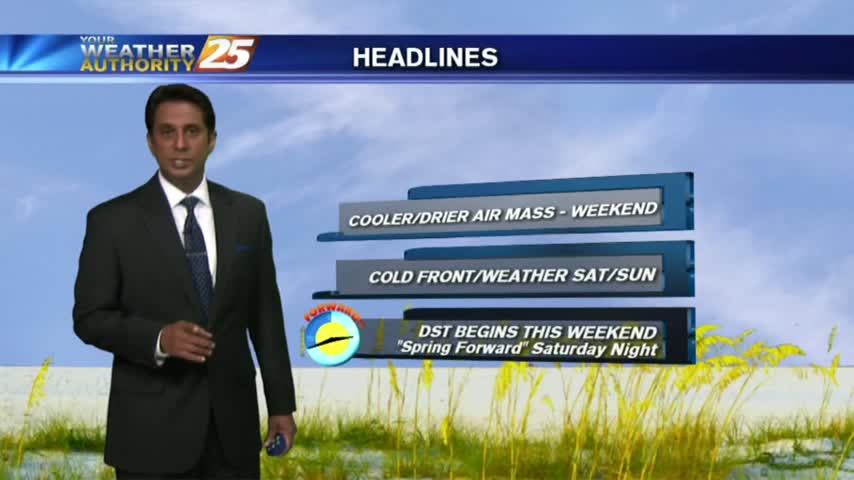
Warming temperatures under beautiful blue skies as the humidity is beginning to return to the area...
It's another COLD start heading into the weekend with inland areas under a FROST ADVISORY...

After a FRIGID start at a few locations, temps are warming nicely with upper-level clouds moving cross the area...
Thin upper-level clouds are moving into the area from the NW, with COLD temps as a few locations are in the low 30s...
After a CHILLY start to the day, a sunny, cool and breezy afternoon is on-tap...
Clear skies overnight has brought a chilly start to the day, temps in the low 40s...

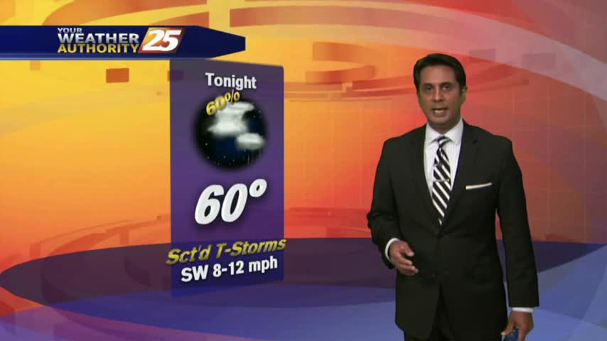
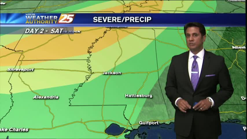
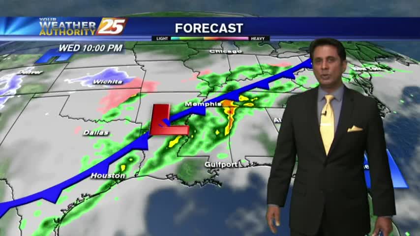
With a cold front moving across the area, showers/t-storms are in south Mississippi...
It's a slight warmer start to the day with cloud coverage and light rain as a warm front is moving through the NW Mississippi...
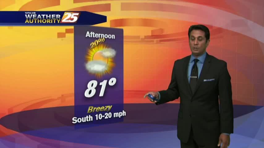
A warm/humid and very breezy afternoon is ahead in advance of an approaching cold front...
It's a warmer start to the day with isolated showers moving across the viewing area...
Quite a different start to he day from 24 hours ago, with rain-free conditions, cooler temps and lower humidity...
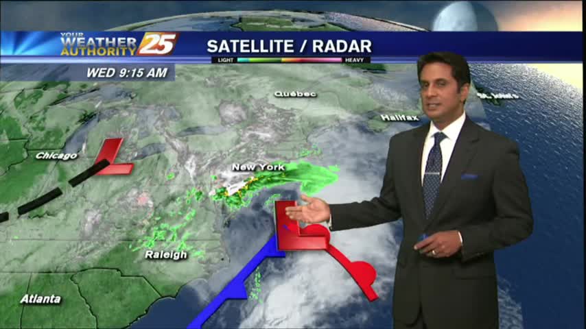
A RAINY start to the workweek as showers/t-storms continue through the local area with a passing cold front...
Isolated showers have been moving into the area with a few t-storms on-tap this afternoon...
Another morning with DISRUPTIVE weather in the form of PATCHY FOG, along with slightly cooler temps...
After a HUMID start to the day with areas of very light fog, the WARM/HUMID and now BREEZY conditions continues...
With a stalled cold front to our NW, the warm & muggy conditions continue with areas of patchy fog this morning...
After a HUMID start to the day with areas of PATCHY FOG, warm & humid conditions continue...