12/19 - Rob Knight's "Rain Moving In" Morning Forecast
In advance of a warm front, extensive mid/upper level clouds have moved into the area...

In advance of a warm front, extensive mid/upper level clouds have moved into the area...
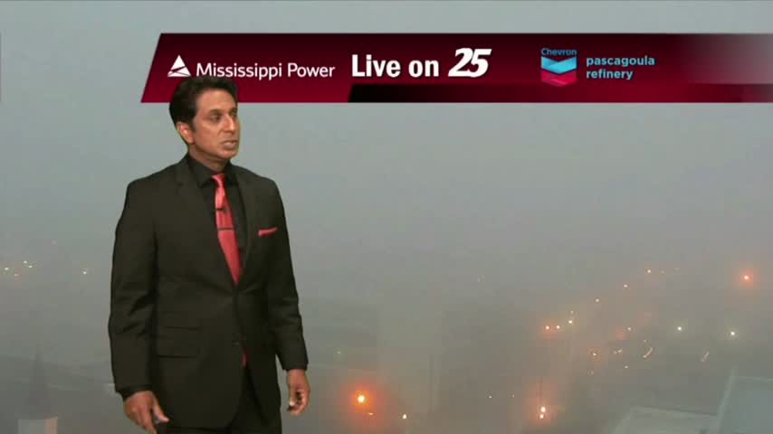
As the moisture flow is beginning to move back into the area, areas of patchy dense fog has developed...
It's a chilly start to the day with thin upper/level clouds moving across the area...
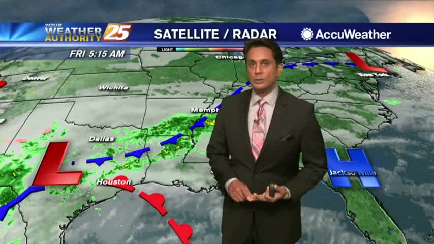
Cloud coverage and spotty rain continues as the area of low-pressure over E'tern Texas slowly moves NE...
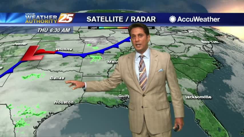
The system affecting the Gulf coast is starting to die out but clouds and spotty rainfall continues...
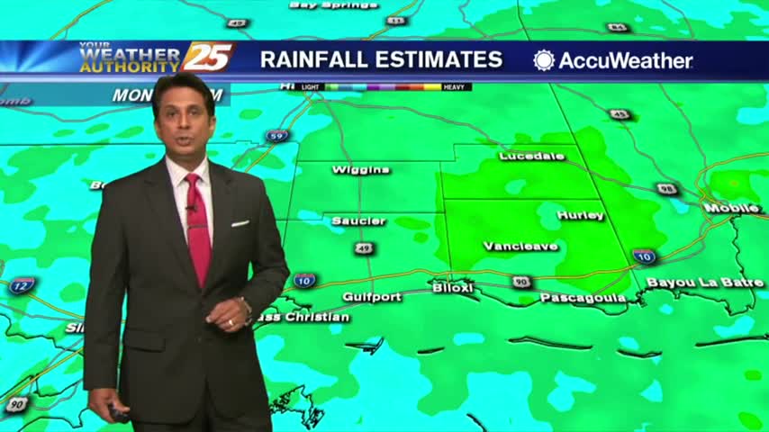
After a cloudy morning with light rain, the heavier activity is beginning to move in from our SW...
A cloudy and warmer start with pockets of light rain moving in from the Gulf...
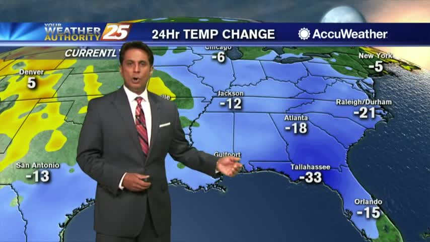
Another FRIGID start but with an area of high-pressure to our east, the warming temps will begin moving in...
Another FRIGID start to the day with high-pressure to our NW providing for a COLD north wind...
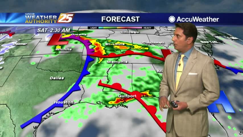
After a TON of rainfall Saturday, COLDER air moving is will begin to clear the cloud coverage...

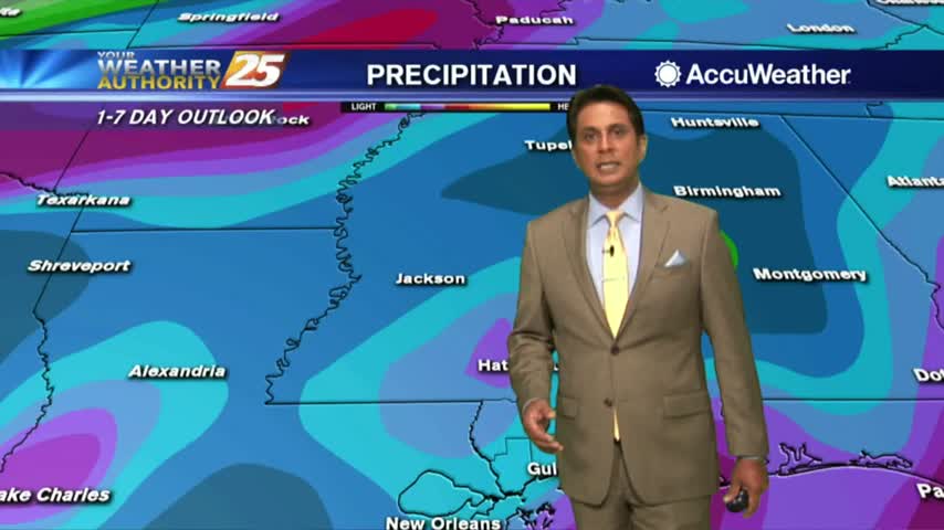
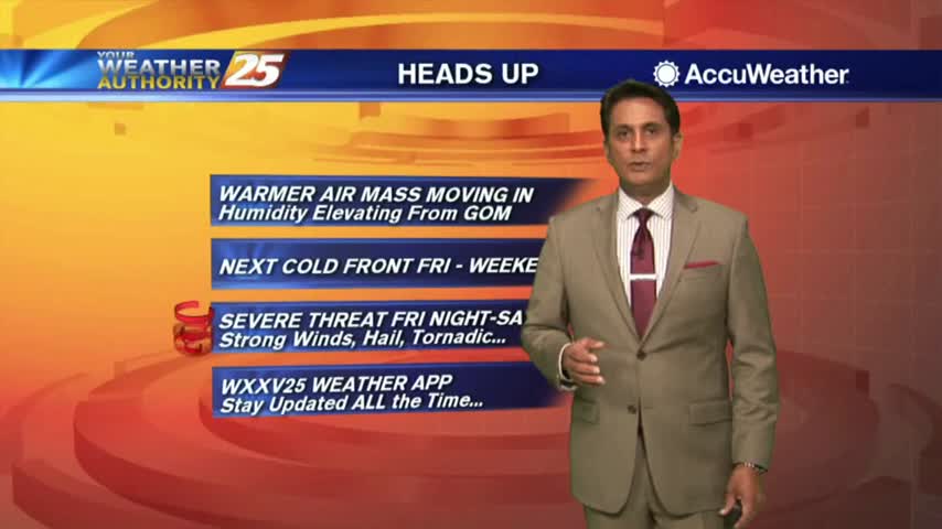
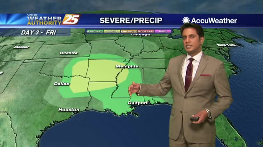
A warm/humid air mass is affecting the viewing area in advance of a low-pressure which will move in Saturday...
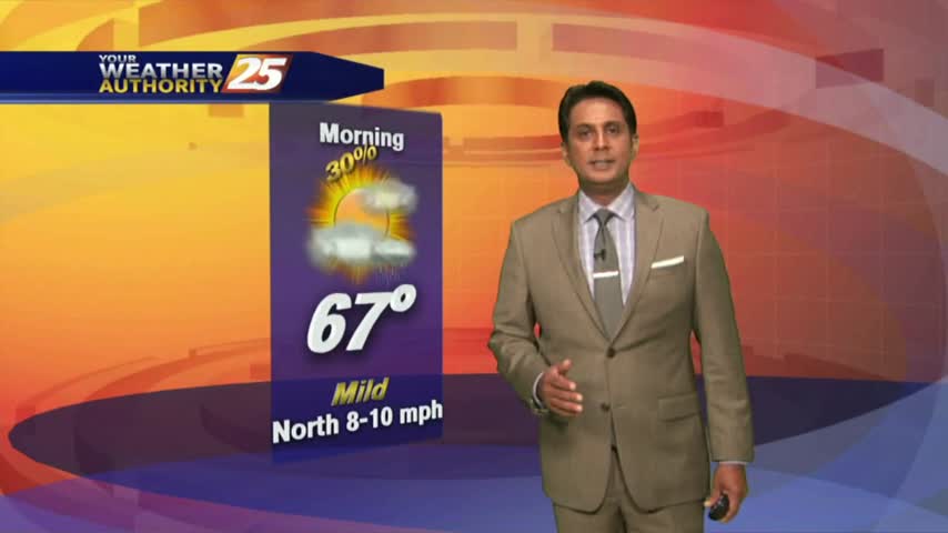
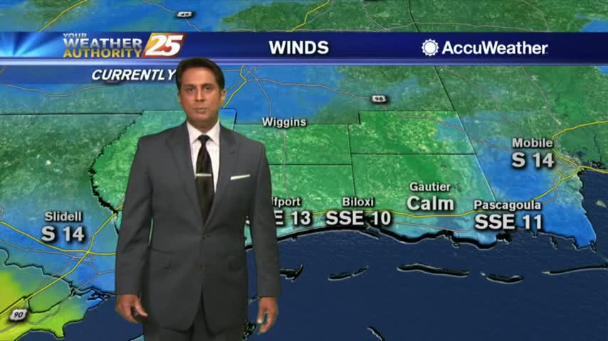
It's a MUCH WARMER start to the day as the moisture flow from the Gulf is increasing temperature and humidity...
After a FRIGID start to the day, the return flow has begun with warming temps ahead...
Another FRIGID start to the day but the warmer air mass will begin to move in later today...

After a FRIGID start to the day, the slow warm up will begin this afternoon...
Another cold start to the day as high-pressure to the NW moves closer to our area...

High-pressure building to our NW is providing for a colder start to the day...
The cold front to our east is bringing a few morning showers to our area...
Much warmer temperatures this afternoon in advance of an approaching warm front later this evening...
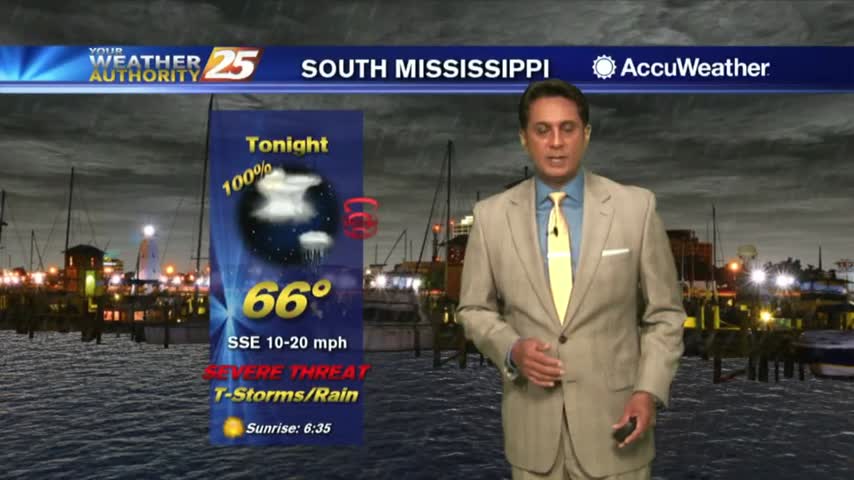
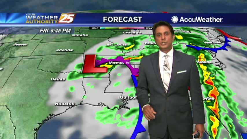
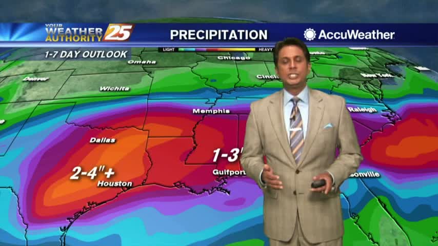
This morning we have showers to our west as the threat for SEVERITY tonight continues...
After a warmer and cloudy start to the day, a few light showers are developing along south Mississippi...
After another COLD start to the day, the wind flow has switched with the warming trend beginning...
It's another FRIGID start to the day but MAJOR changes are ahead in the forecast...
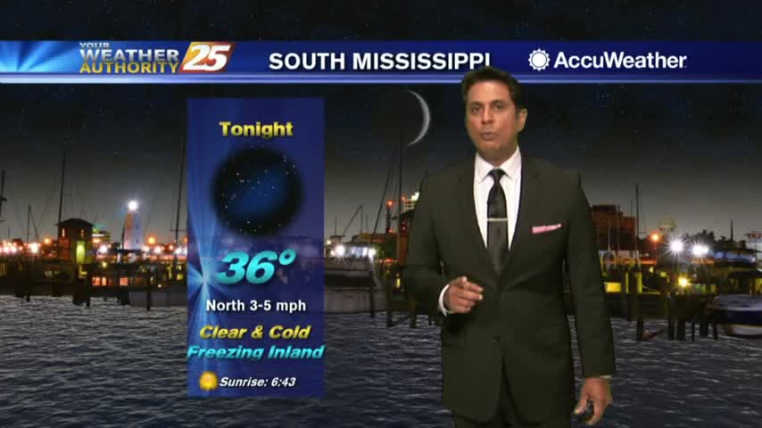
Under clear skies and a northerly flow last night, it's a FRIGID start with a FREEZE WARNING in effect through 8 a.m...