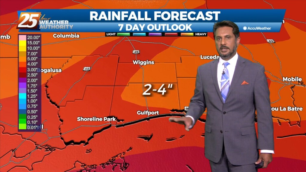
12/29 - The Chief's "Threat For Heavy Rain Ahead" Thursday Afternoon Forecast
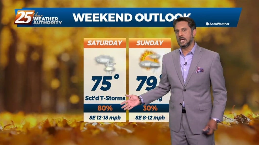
After today we will be heading into a much more active pattern. A Major disturbance will be digging down through the Central and Southern Plains…
After today we will be heading into a much more active pattern. A Major disturbance will be digging down through the Central and Southern Plains…
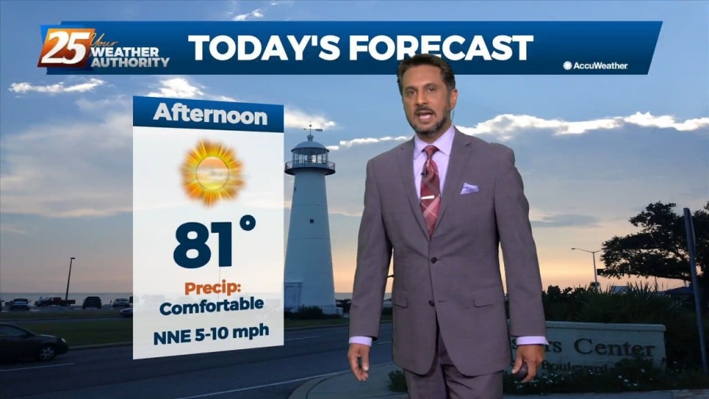
This afternoon will remain mostly quiet outside of a couple possible showers over the coastal waters. We see our first real warm-up day of the warming…
Surface high pressure will build into the region behind this front today bringing mostly sunny skies and calm winds. Heading into the late evening and…
The word for the next couple of days is moderation. As the high pressure shifts off to the east today, winds will come around to the…

This bitter cold Arctic air mass will continue through the Christmas weekend as an upper disturbance will move to New England by Saturday afternoon, but…
An Arctic front and a very cold air mass to the NW continues to move SE. Current expectation is that cold front will reach…
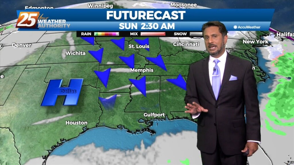
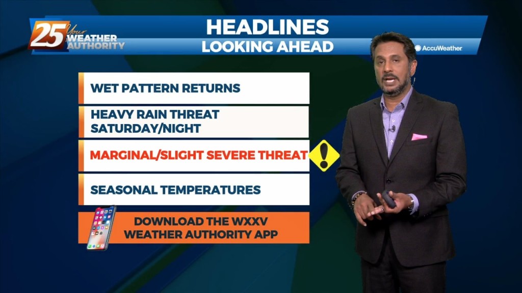
Significant severe weather and excessive rainfall threats can be expected this afternoon into mid-evening...especially from the Interstate 10 corridor northward. A vigorous system just to the…
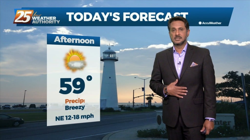
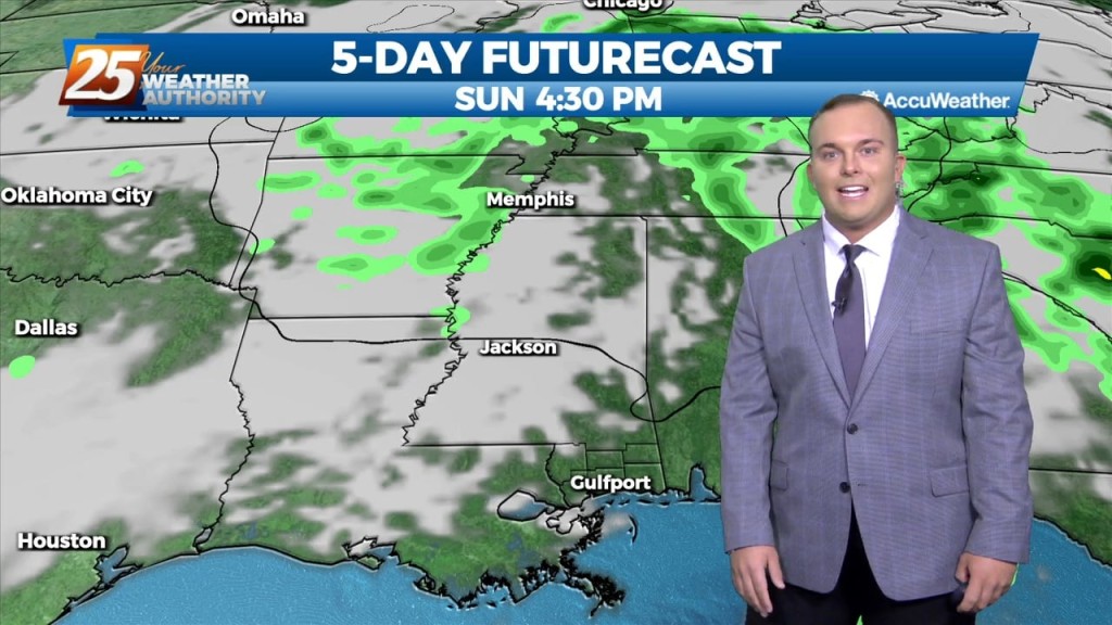
The beginning of the pattern change is underway across South Mississippi. Winds have increased and it will continue to be a breezy afternoon. A warm front associated with…
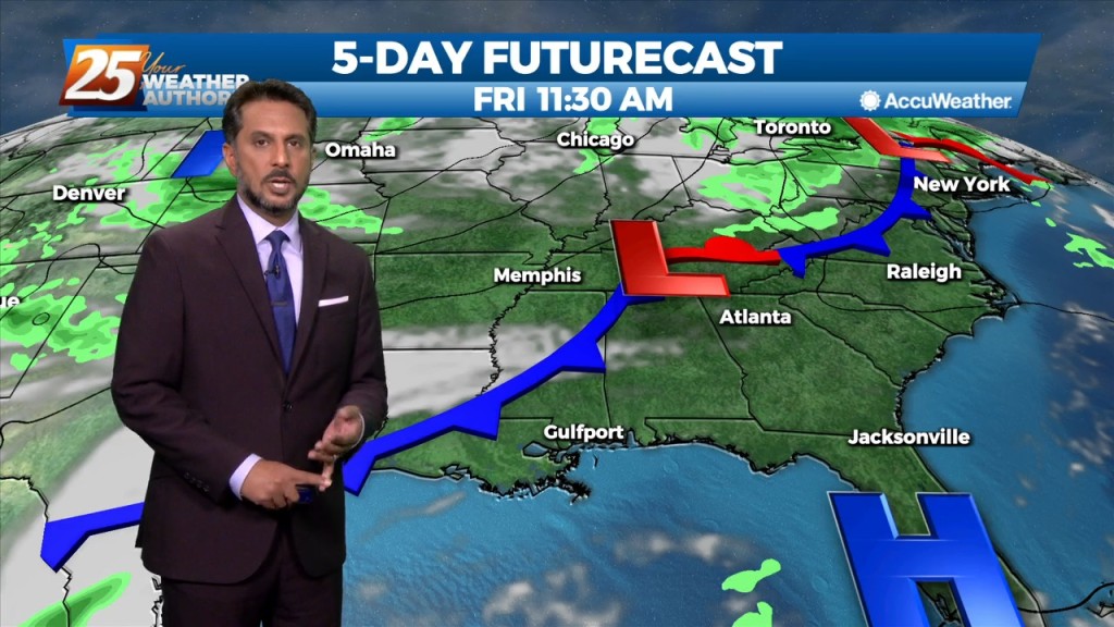
A mid latitude disturbance will be tracking east across the Central and High Plains Friday, crossing the upper/mid-Mississippi River Valley Friday night. As surface ridge north of the…
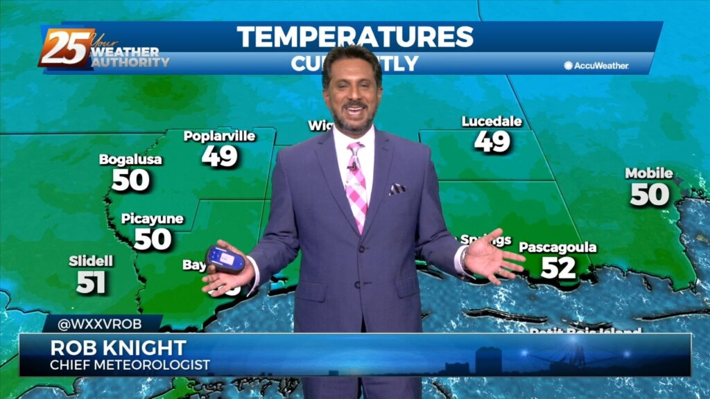
A drier/cooler northerly wind will develop across the region today behind the departing storm system. Temperatures will slowly cool back into the mid-60s this afternoon.…

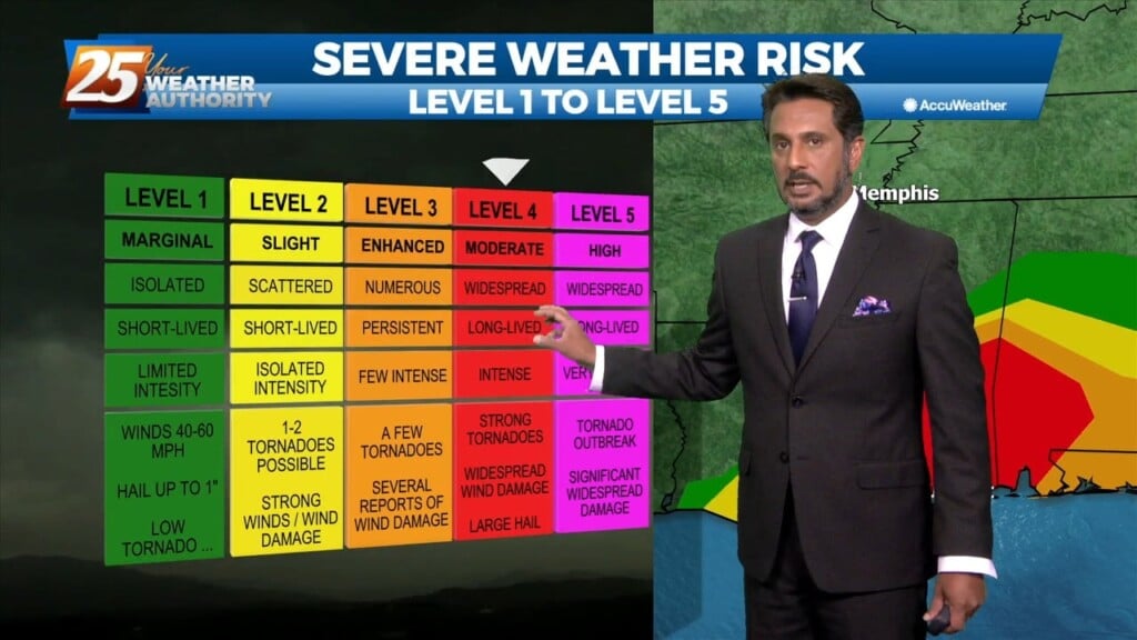
A SEVERE THREAT WILL BE IN THE AREA this afternoon and overnight... There is now a slight risk for severe storms capable of producing damaging winds,…
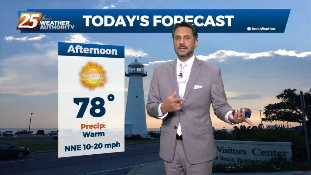
Cloudy skies will continue this afternoon with breezy conditions from the North at 10-20 mph. Tomorrow, a stronger system will move across the Southern Plains, finally…
Eyes begin to focus to our southwest this afternoon as a coastal disturbance just east of the lower Texas coast begins to sharpen. The…
All eyes begin to shift to the northwest later this afternoon and through the overnight tonight. The region will be situated between a high pressure over…

A moist air from the gulf continues to filter in this afternoon which could cause some fog issues tomorrow morning. Showers are expected to come in Friday…
High pressure to our north is in control of our weather pattern today. Winds have become easterly in South Mississippi as transition of the pattern is underway. The upper disturbance over…
A weak disturbance along the North/Central Gulf will continue to push upper level clouds across the area...at times putting south Mississippi under partly/mostly cloudy skies. the upper…
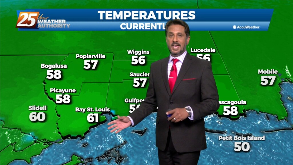
After a cool start, temperatures have warmed into the upper 70s/low-80s. A quiet weather pattern will continue through the workweek prior to the next frontal boundary…
Fall is in the air! No rainfall is expected for the next few days. We are still experiencing some impacts across the area from pressure gradient…
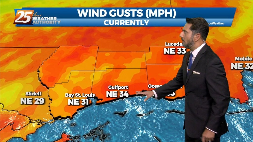
Strong northerly flow will be in place over the region for the next few days. While we are entering a Spring Tide, the new trends in the…
High pressure to the north moving closer will provide for lovely conditions through the rest of the workweek. A less humid flow and cooler temperatures will continue…

VERY HOT temperatures ahead this afternoon as a few locations will either tie or break a record high temp. High pressure will hold on one more…

Dry conditions will continue trough the rest of the workweek thanks to the high pressure to the NE. Consequently, temperatures will be fairly warm for…

Expect sunny and hot conditions this afternoon as summer is determined to hold on until the very last minute... A strong mid-level high pressure situated…