10/2 - Rob Knight's "1st Weekend of October" Midday News Forecast
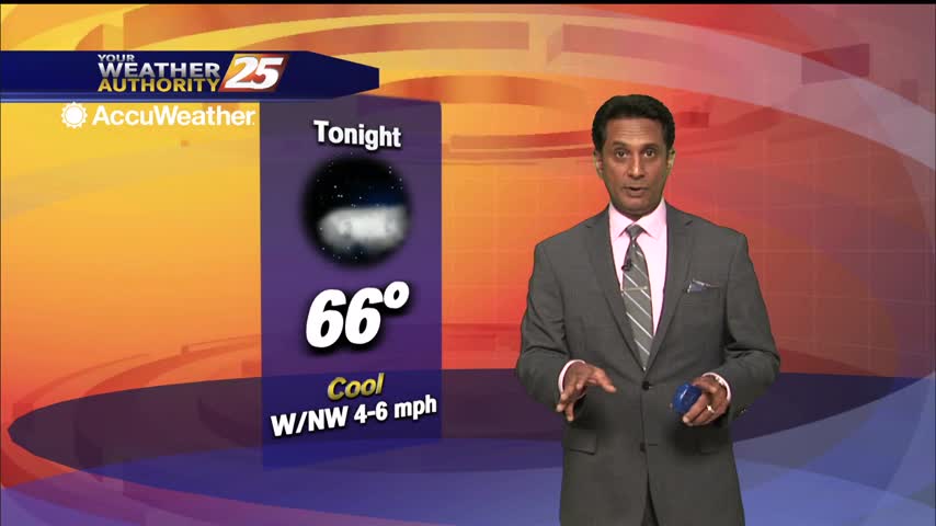
High-pressure to the NW will continue to bring in a cooler/drier air mass this afternoon through the weekend...
High-pressure to the NW will continue to bring in a cooler/drier air mass this afternoon through the weekend...
Warmer temperatures heading into this afternoon prior to a dry front approaching the area...

BEAUTIFUL autumn conditions heading into the afternoon...
Sunshine and nice temperatures with breezy conditions heading into this afternoon...
Warm and very humid conditions heading into this afternoon in advance of an approaching cold front...
Skies will continue to partially clear heading into the afternoon...
As the remnants of Beta moves across N'tern Mississippi, conditions in the viewing area will continue to improve...
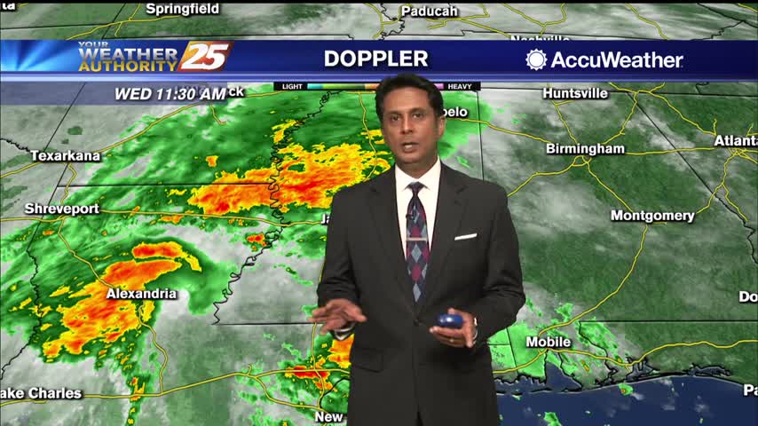
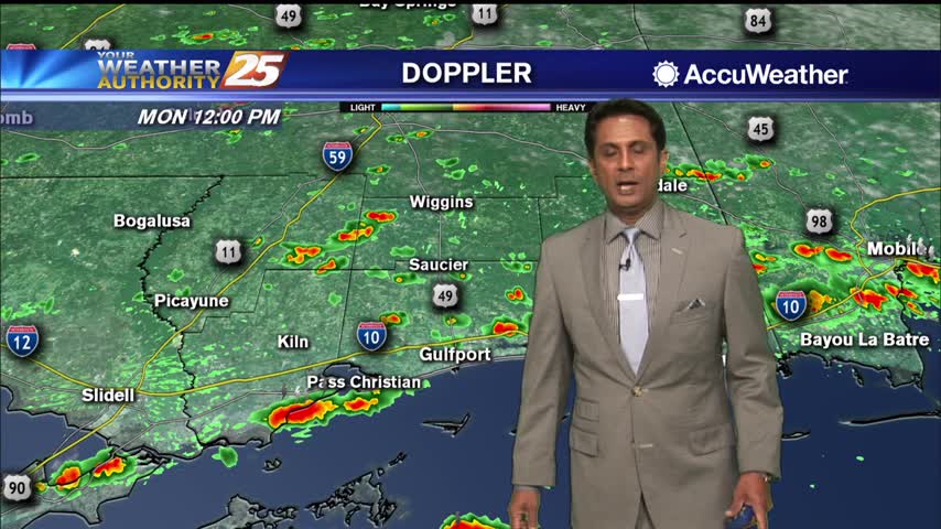
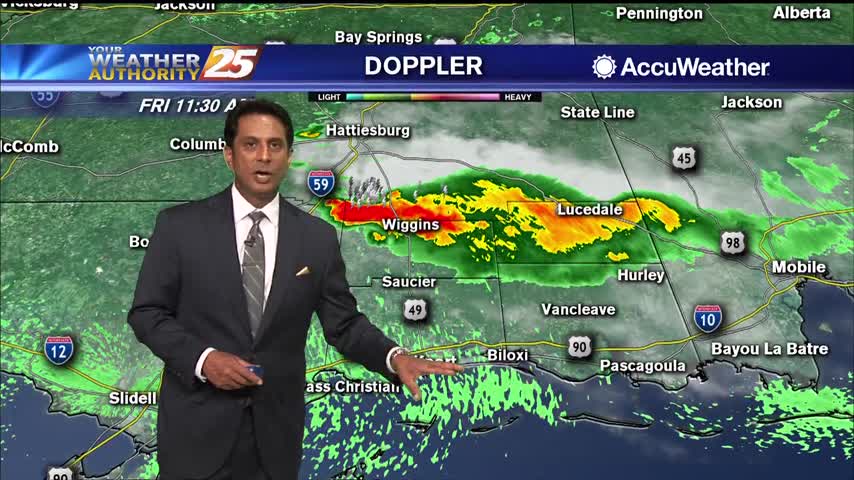
Showers and t-storms from the SW will continue to move NE into south Mississippi...
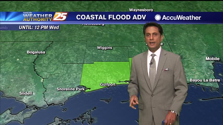
Cloud coverage continues in south Mississippi with scattered rain ahead this afternoon...
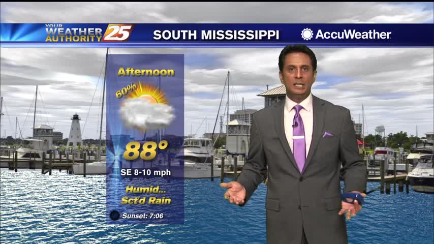
Extensive cloud coverage with light/moderate rain continues to move into the area from the SE...
Extensive upper-level clouds and a north wind will keep high temperatures in the manageable zone this weekend...

Mid/Upper level no rain producing clouds continue to move into the area...
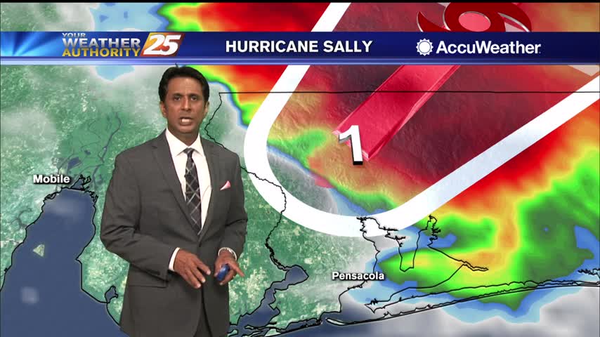
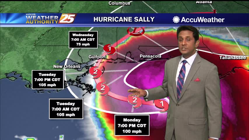
AS HURRICANE SALLY continues to move ashore east of our area, south Mississippi will find improving conditions...

SALLY continues to slowly move towards the Mississippi/Alabama coastline...
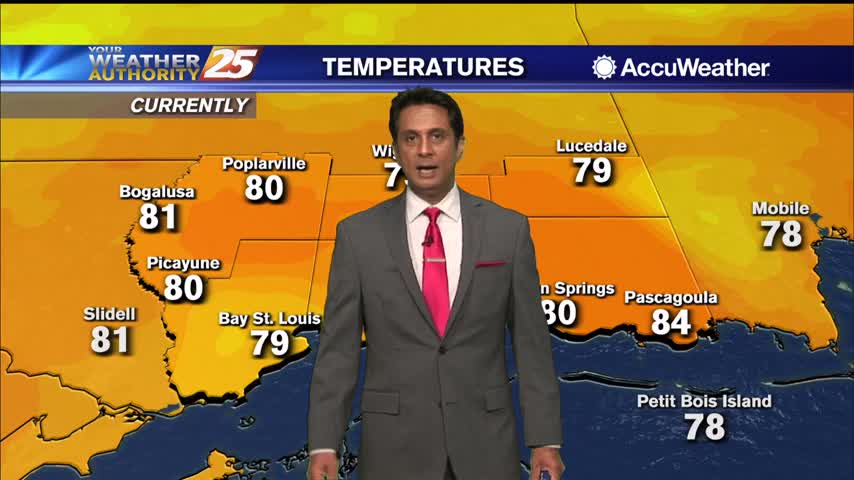
Clouds continue to move into the area as we are focused on HURRICANE SALLY in the Ne'tern GOM...
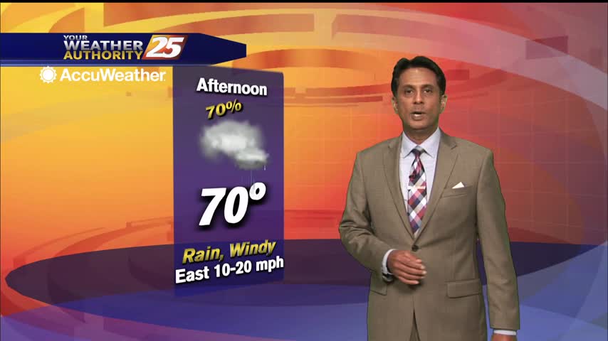
Rain will continue to move in this afternoon with embedded t-storms as well...
Hot temperatures heading into the afternoon won't feel to terribly bad as lower humidity continues...
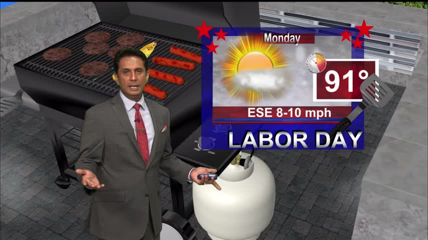
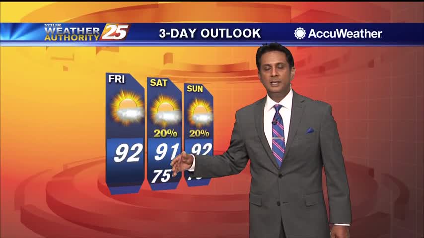
Hot conditions heading into the holiday weekend as the HEAT INDEX will top the 100 degree mark...
Hot temperatures heading into the final afternoon of August...
A feeder band linger along SE Louisiana, will slowly move east this afternoon into the area...
Hot temperatures heading into the afternoon won't feel as hot with lower humidity...
Hot temperatures heading into the afternoon as showers/t-storms are popping...
Hot temperatures expected this afternoon as the humidity begins to move back into the area...
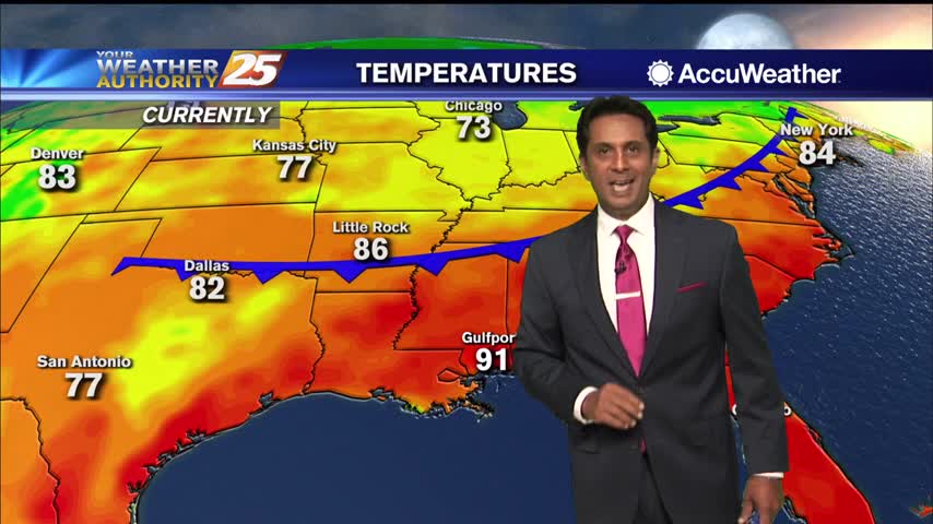
Temperatures continue to climb into the low/mid 90s with the HEAT INDICES topping the 100 degree mark...