6/26 - Payton's Monday Afternoon Forecast
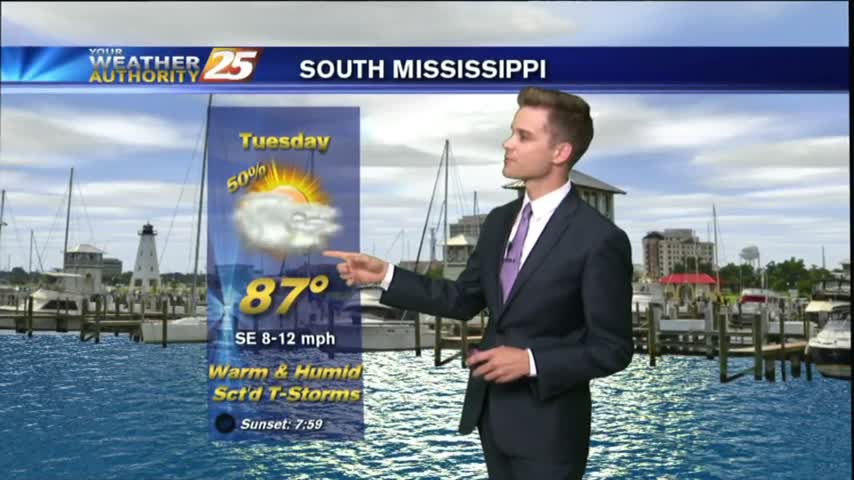
A beautiful day in store as drier air continues to filter into the area. With a weak cold front to the south, and high pressure to the north this will continue into Tuesday
A beautiful day in store as drier air continues to filter into the area. With a weak cold front to the south, and high pressure to the north this will continue into Tuesday
After a extremely soggy week last week, the forecast is looking better...at least for the next few days.
Happy Father's Day! After showers and thunderstorms in the area this afternoon, most of the activity has decreased and left us with warm and muggy conditions.
The tropical airmass that has been sitting over the area for the past week remains in place today through tomorrow, which will continue the rain chances for the afternoon hours.
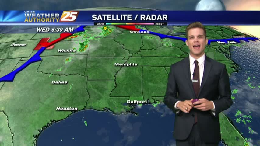
The tropical airmass that has been sitting over the area for the past week remains in place today through tomorrow, which will continue the rain chances for the morning and afternoon hours.
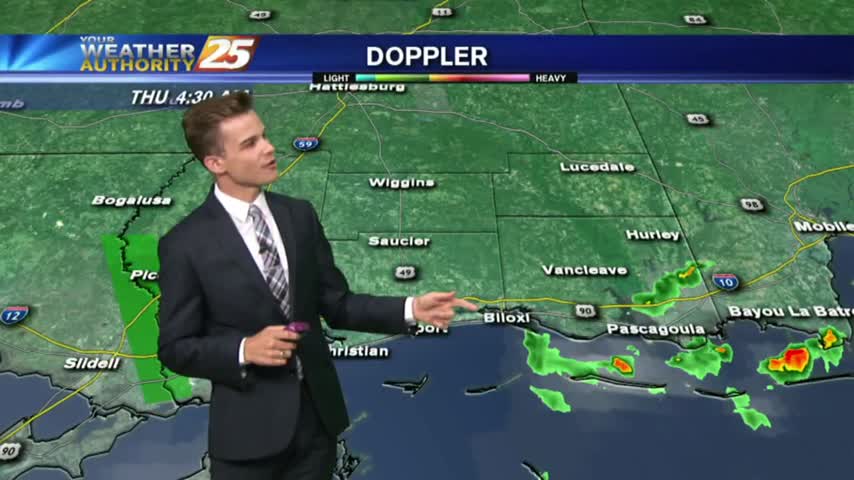
Another afternoon with popup showers and thunderstorms. The strongest storms will have lightning, heavy downpours and gusty winds.
Showers and thunderstorms continue in the forecast as the tropical airmass stays in the area.
Once again, another warm, muggy and wet day as a tropical airmass stays over the area.
Once again, another warm, muggy and wet day as a tropical airmass stays over the area.
The dry and clear weather pattern we saw for the end of last week has come to an end.
After 34 days with either clouds and/or rain in the area, high-pressure to the north will bring beautiful changes to the pattern.
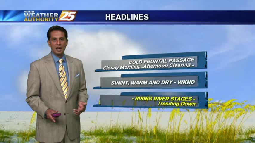
A cold front and low pressure will continue to move away from the area allowing for drying and clearing this evening. Watch the full forecast for details.

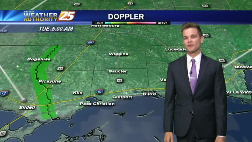
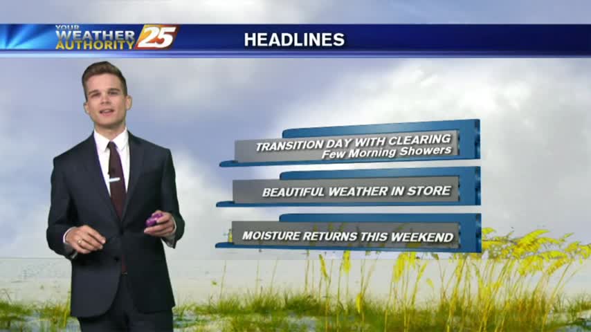
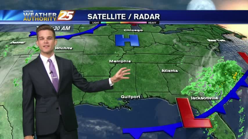
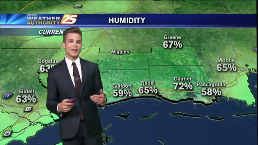
A few showers in the area this morning, but with a cold front passage last night and low pressure just off to our east, today will be a day of transition with clearing and drying.

Rain chances continue this afternoon and evening as low pressure moves overhead, but a cold front pushes through late tonight drying out the area for the end of the work week.
Rain is likely this afternoon and evening as low pressure moves overhead, but a cold front pushes through tonight drying out the area for the rest of the week.
Showers and thunderstorms this afternoon lead to a quiet evening with most of the activity being very light and off to the west. An upper level disturbance along with a surface trough off to the west will continue to increase…
Another day of showers and storms for South Mississippi as the tropical airmass stays in place.

On and off showers are possible this afternoon as we continue to get daytime heating. The strongest storms could have gusty winds, lightning and heavy downpours.
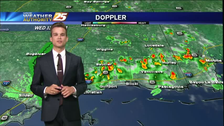
Showers and thunderstorms in the area this morning will lead to a cloudy and muggy day. On and off showers are possible this afternoon.
The stationary front that has been lingering over the area for the past few days will continue to bring rain chances for much of the region.
After showers and thunderstorms this morning, the afternoon and evening will be wet, cloudy and muggy.
Showers and thunderstorms across Louisiana will continue to move into Mississippi through the overnight hours. Showers are expected throughout your Memorial day. Be sure to check out the video for your full forecast.
With a front affecting the Gulf Coast, cloudy skies with activity through midday...then clearing skies.