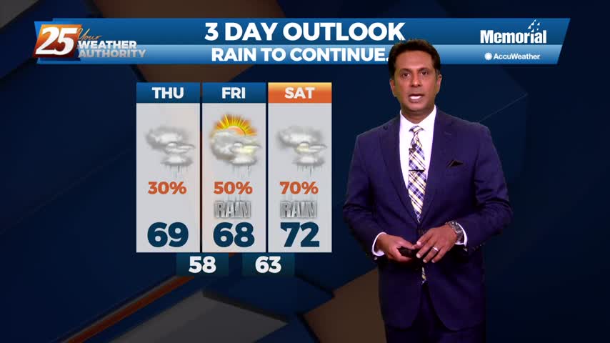
2/9 - The Chief's "More Rain Ahead" Thursday Afternoon Forecast
With the cold front east of the area and the upper level support moving north-northeast, the front won’t make a lot more progress much further eastward…
With the cold front east of the area and the upper level support moving north-northeast, the front won’t make a lot more progress much further eastward…
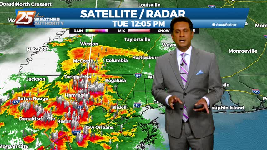
Areas of rain including a few t-storms will move in this afternoon as a low pressure and attendant cold front lifts NE. The low pressure will move…
Tonight through Wednesday Night, little change in the ongoing pattern is expected through Wednesday night as a broadly diffluent westerly upper level pattern, a weak shortwave trough, and favorable…
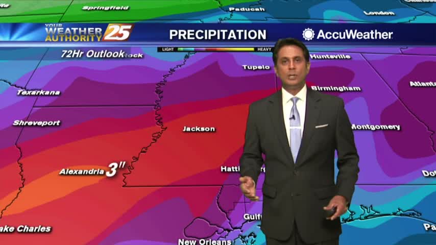
Deep moisture from the Gulf of Mexico continues to stream into the area with model soundings showing precipitable water values well above 2 inches, and as high as…
Winds will be variable in and around storms, then light southerly winds will prevail overnight. Another round of afternoon and evening thunderstorms is expected on Tuesday. Over…
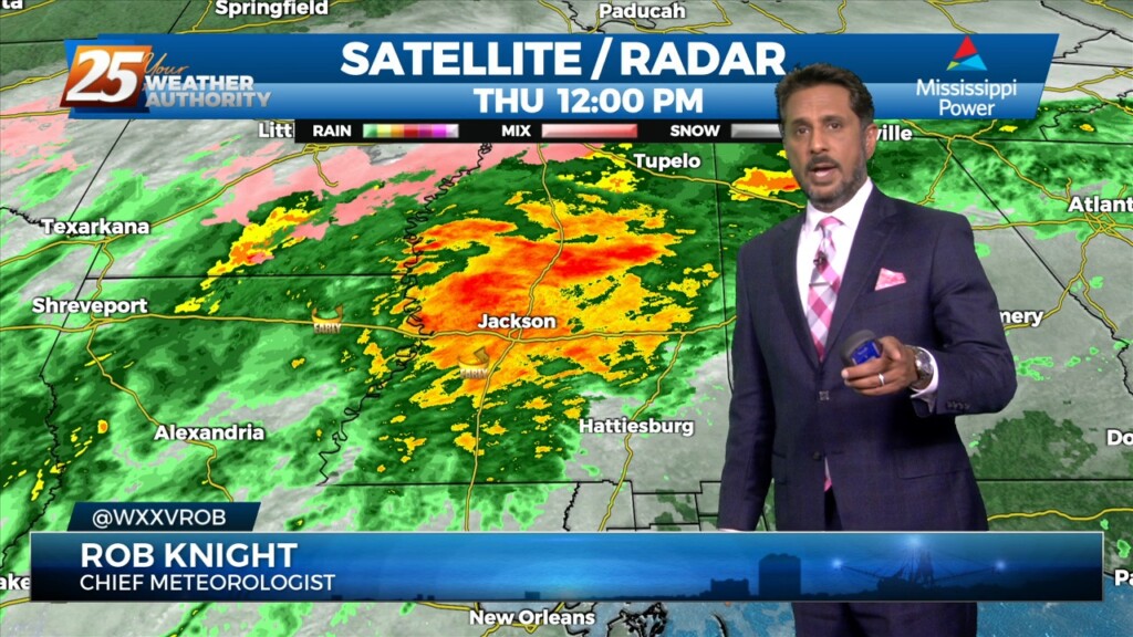
An easterly wave noted in the pattern will move westward across the area this afternoon/tonight, enhancing t-storm development. Areal coverage over land this afternoon/tonight should be fairly…
High-pressure is currently centered near the Texas-Louisiana border, with a north-south axis into the Dakotas early this morning with an easterly wave wrapping around the…
A northern stream has become somewhat more progressive with high-pressure moving east of the Rockies and disturbances along the west coast and moving across the…
The airmass remains very moist, with climatologically above the 90th percentile for this time of year. No real indications of any significant drying through Saturday, as even then, moisture levels remain elevated. A disturbance coming out of the base of…
An area of upper level weakness over New England will be in place through the early part of the week with a massive high-pressure system sitting over the western third of the country. A frontal boundary will continue to slowly…
The area will get a break from the torrential rainfall for the next 18 hours...
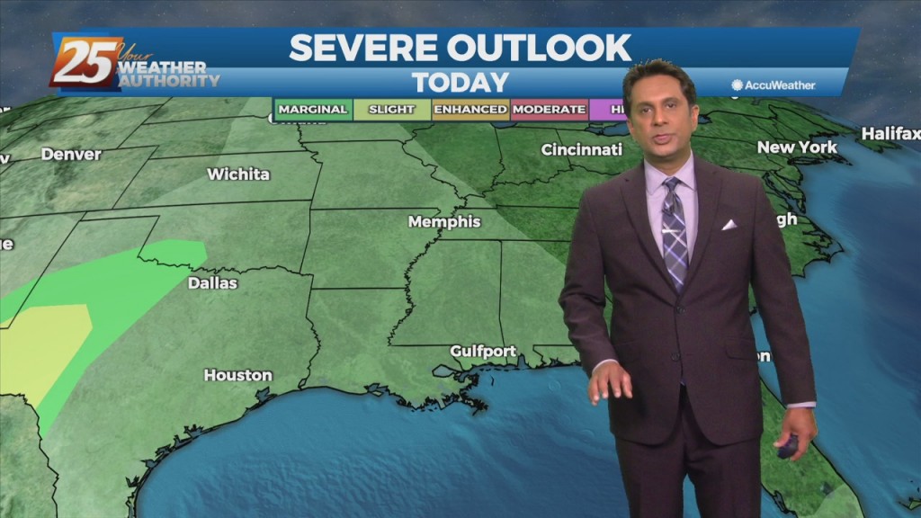
A complex of t-storms moving in from the west could provide for SEVERITY this afternoon...
A band of rain continues to affect the area heading into this afternoon...
A band of rain will continue to sag slow south through the area this morning...
Cloudy skies continue as rain with a few embedded t-storms possible this afternoon...
Cloud coverage continues in south Mississippi with scattered rain ahead this afternoon...
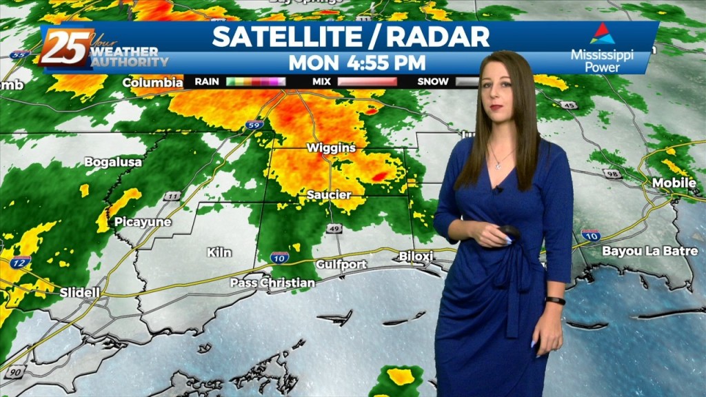
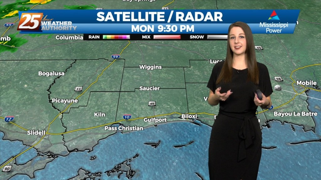
A wet start to the workweek with rain moving in from the SSE...
A cloudy and mild Presidents' Day afternoon...

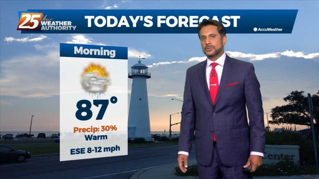
Another warm and humid start to the day under partly/mostly cloudy skies as showers/t-storms moving in from the SW...
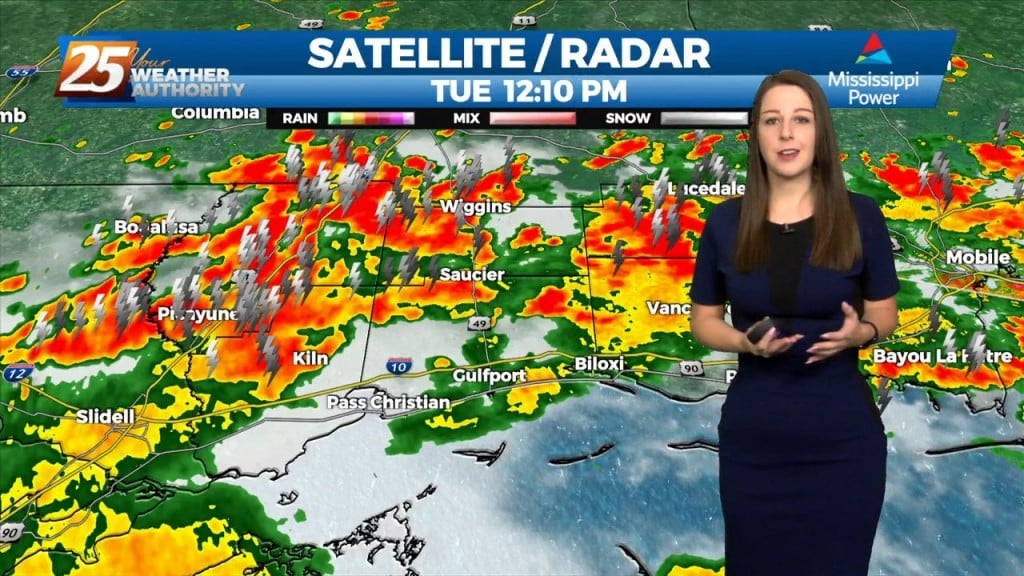
Another wet start to the day with HEAVIER RAIN expected later today...
Major changes have occurred with the pattern and this morning rain is moving in from the SW...
After rainy conditions last night, the rain is now moving off to our east...
With a warm and humid air mass affecting the area/region, areas of dense fog from this morning continues...

Another cloudy and gloomy start to the day with areas of patchy fog and light drizzle/mist...