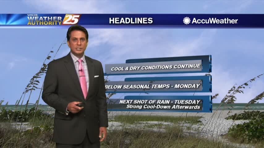
1/17 - Rob's "Cooler & Breezy" Friday Morning Forecast
A cooler start this morning as breezy conditions and lower humidity has kept fog away...

A cooler start this morning as breezy conditions and lower humidity has kept fog away...
Widespread dense fog is once again affecting the area. A weak cold front to the north will bring subtle changes for a brief period. Expect cloudy skies with scattered rain through this evening as the front pushes to the south.…
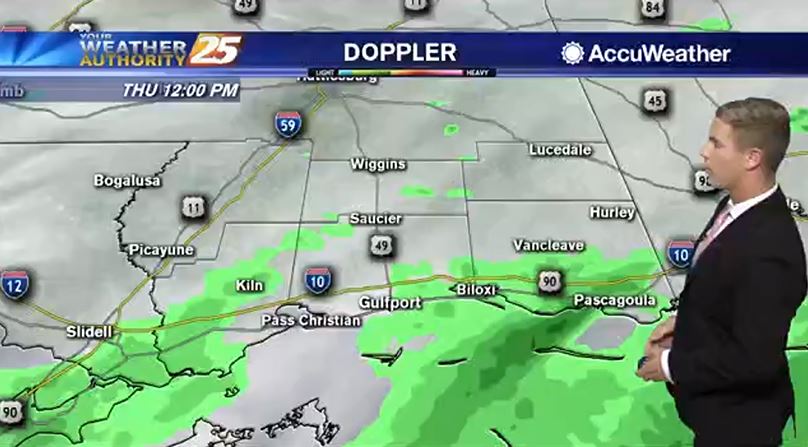
Rain continues to stream in from thew SW...
A humid start to the day with areas of patchy fog and rainfall through the region...
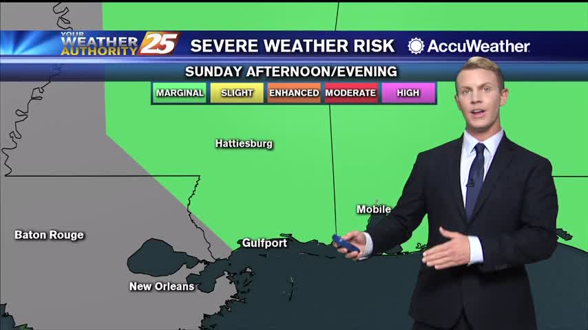
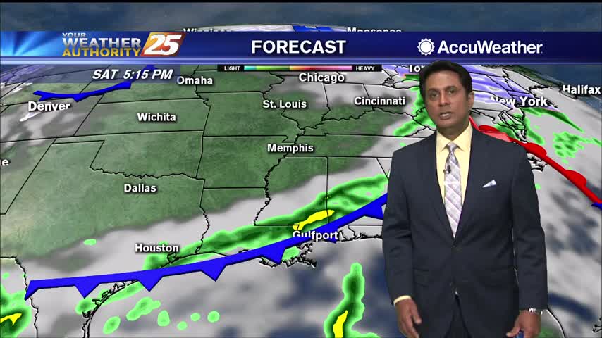
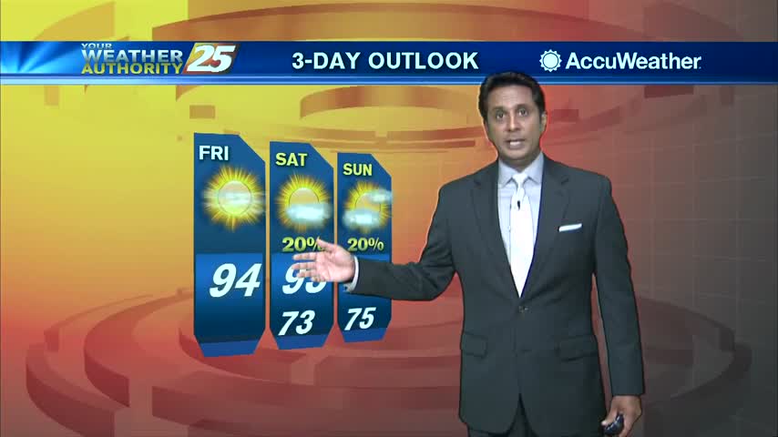
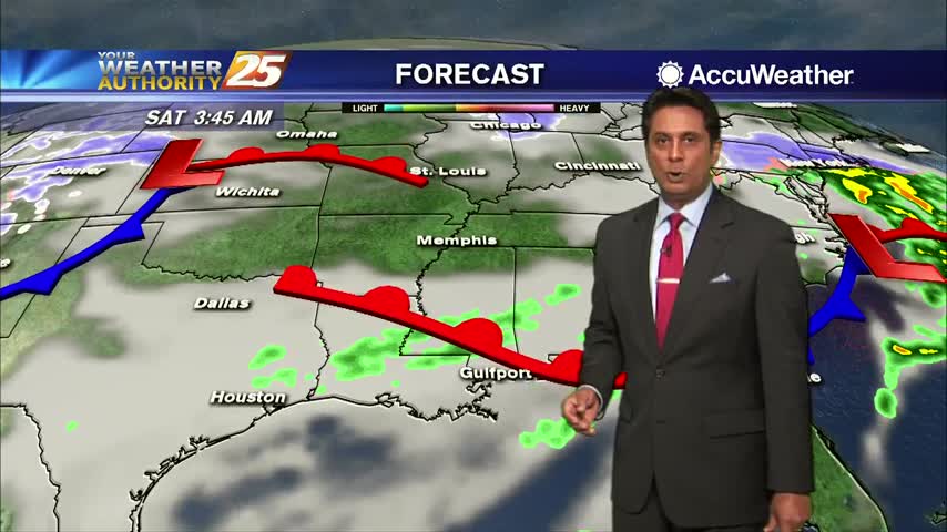
Cloudy skies are expected again on Saturday and scattered showers are likely in the afternoon and evening. Rain chances are running at around 60 percent. On Sunday, rain chances go up to around 70 percent as our next cold front…

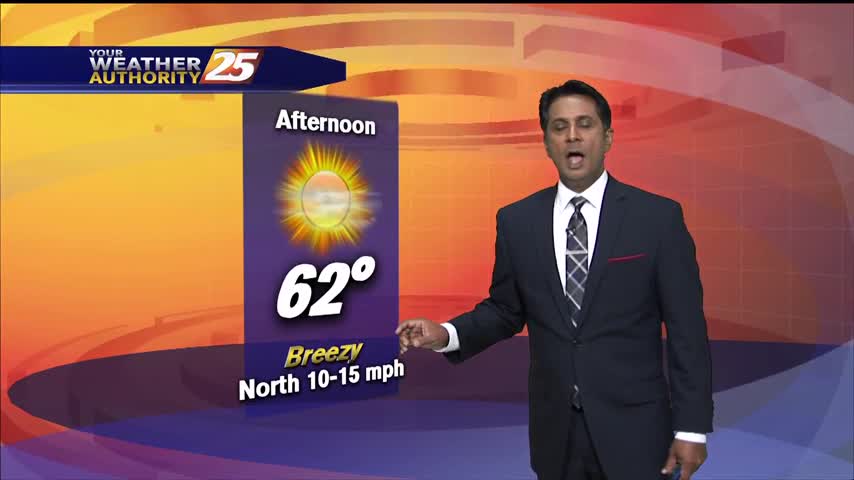
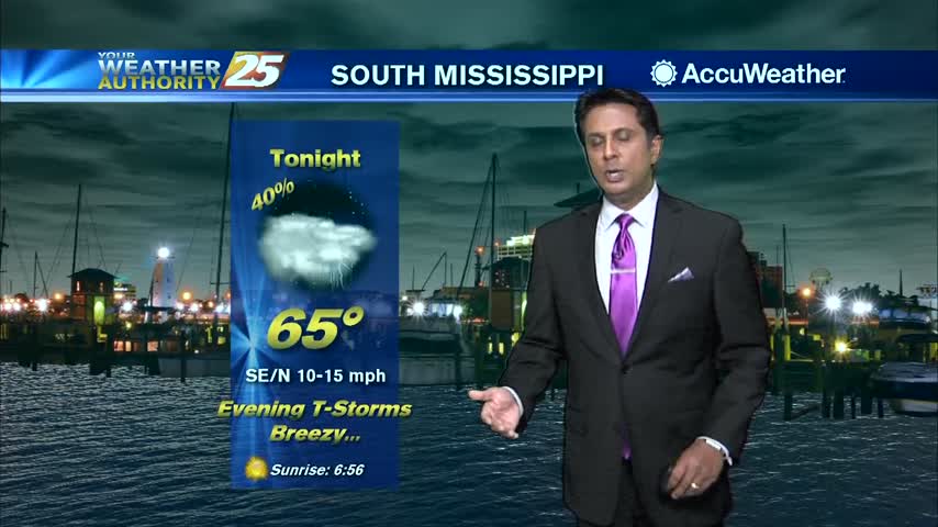
Tonight, clear skies and chilly again. Lows will be in the mid 30s along the coast, but inland areas (generally north of I-10) will dip into the lower 30s. Only a light freeze is expected for some areas tonight, but…

A damp start to the day with light rain and areas of patchy DENSE fog...
There is plenty of sunshine across the Gulf Coast this afternoon as temperatures warm up to the upper 60s. Some areas may even hit the 70 degree mark before the end of the day. Moisture will increase as flow off…
Light FOG is in the area this morning with a more humid start to the day...
A cool start with a few cloud lingering through the area...
Heavy cloud cover will keep us from heating up too much today… highs will top out at around 52 degrees. Overcast skies will likely continue throughout the day as on and off showers roll through the area. Rain chances will…
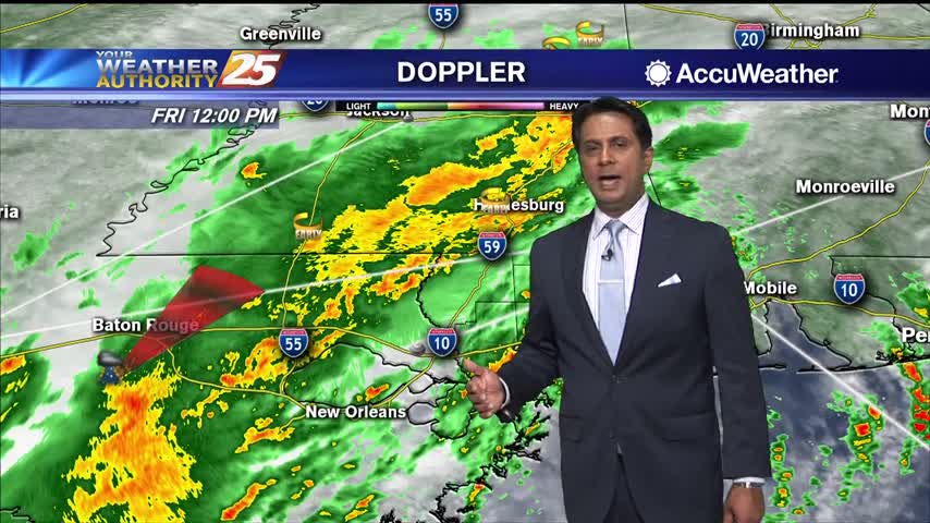
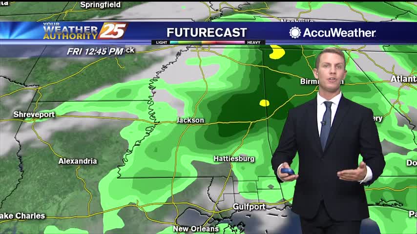
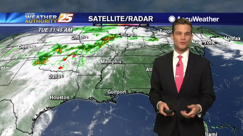
Showers and t-storms continue to develop as a cold front from the NW moves east towards the area...
A very warm and humid start in advance of an approaching cold front to our west...
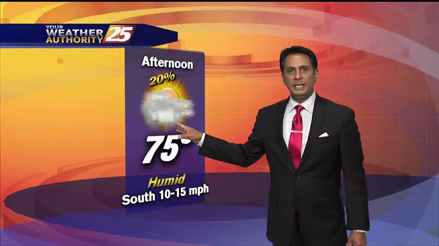
Temperatures warming into the 90s feel hotter with elevated humidity and sunny skies...
Another humid start to the day with areas of PATCHY FOG along south Mississippi...
Humidity building in...rain chances aren't far off.

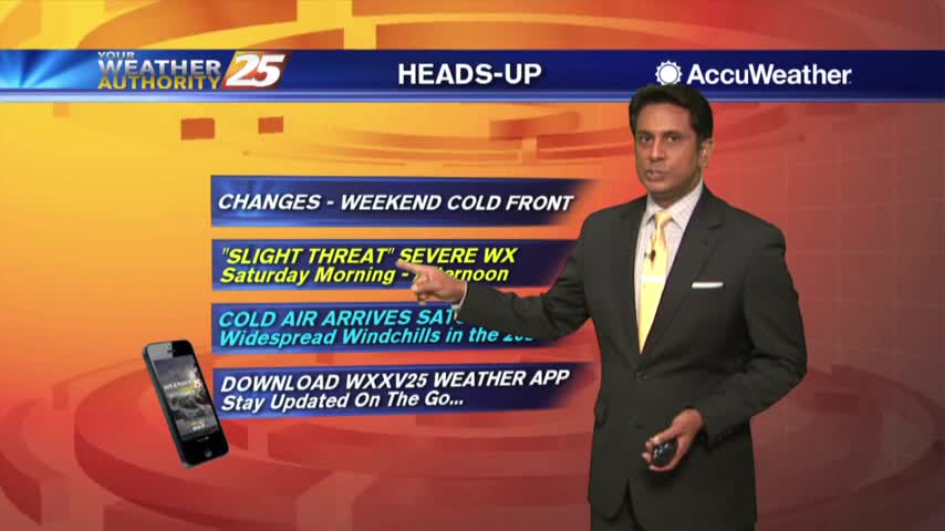
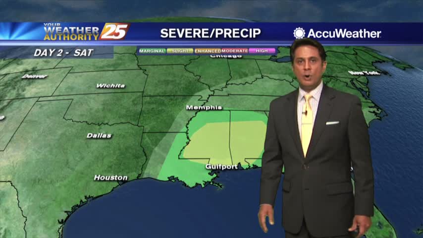
A warmer start this morning in advance of an approaching cold front which will affect the area this weekend...
A southerly flow has a warm and humid air mass moving in from the Gulf...
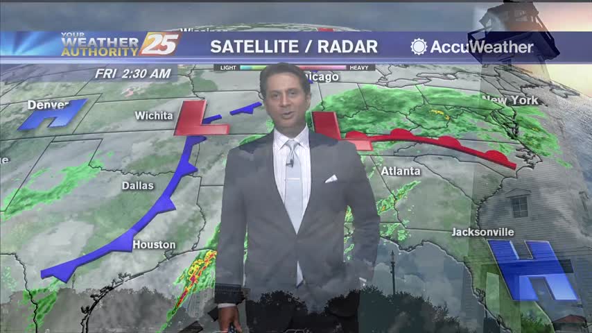
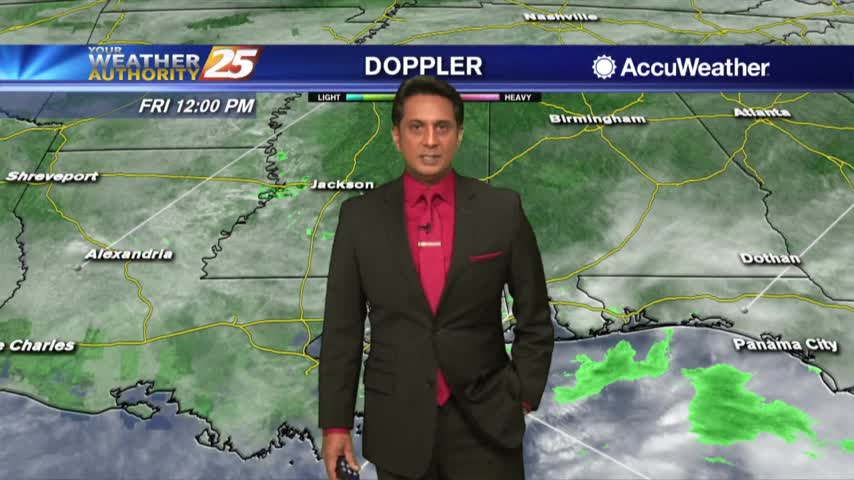
Activity from last night continues to move out of the area off to our east...
Light rain moved across the area earlier this morning with mainly cloud coverage this afternoon...

A MUCH WARMER start to the day with a rain shield to our south over the northern Gulf of Mexico...
A very cold start to the day under clear skies and light winds from the NNE...
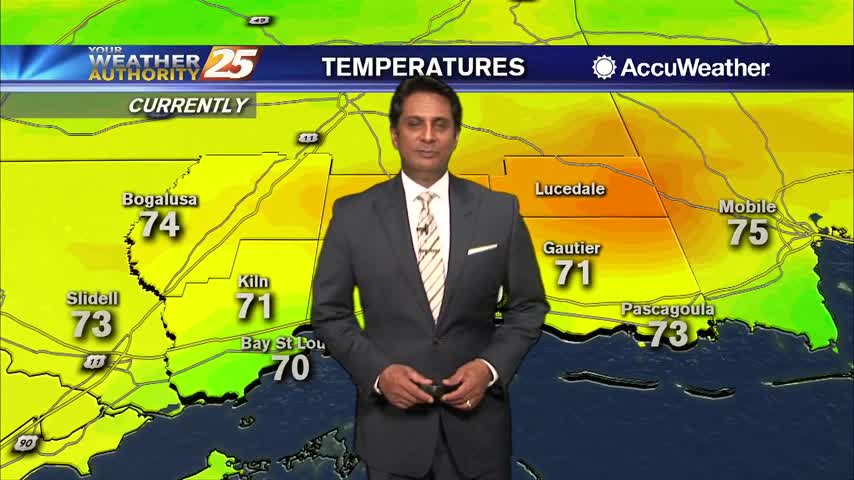
Very light fog remains in the area with elevated humidity as temperatures continue to warm into the upper 60s!
With a warm and humid air mass in advance of an approaching cold front, areas of DENSE FOG has developed this morning...