2/21 - Sam Parker's "Weekend Rain" Friday Night Forecast
With the cold weather in the rear view mirror going to get through some rain on Sunday. It'll be chilly again tonight down in the mid…
With the cold weather in the rear view mirror going to get through some rain on Sunday. It'll be chilly again tonight down in the mid…
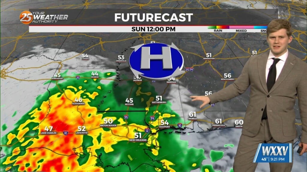
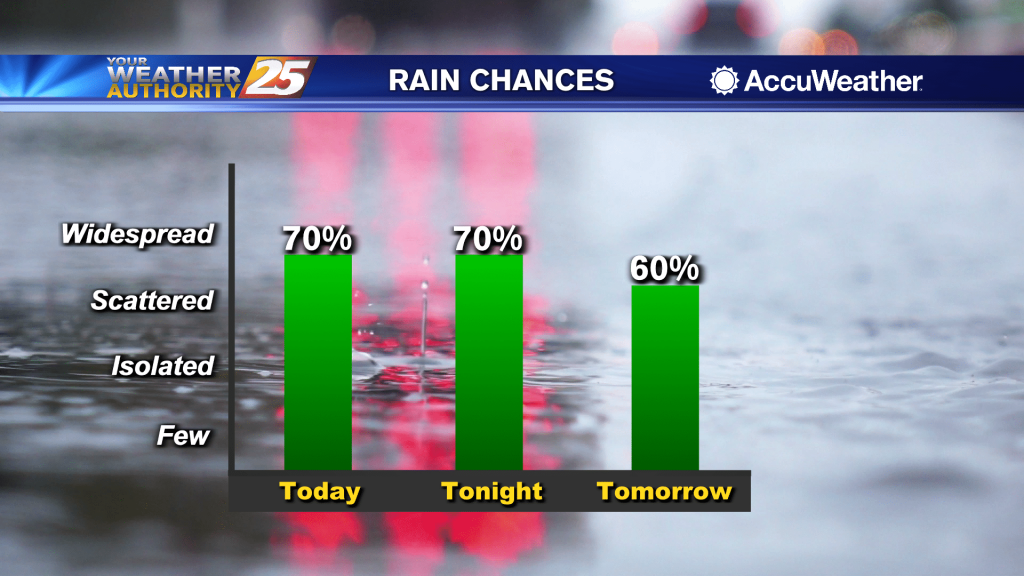
Rain all day and a cold night ahead with more rain chances Sunday. saw around 1.25" of rain recorded at GPT airport and most of…
Weak upper level high pressure is currently over the southern Gulf of Mexico with a weakness moving eastward through Kansas. A stronger disturbance was…
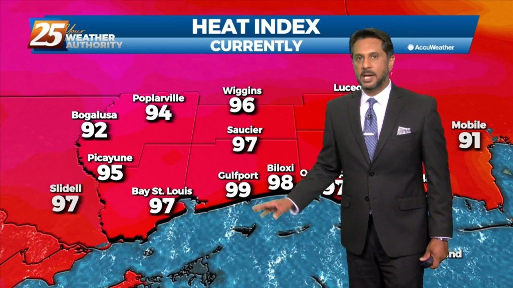
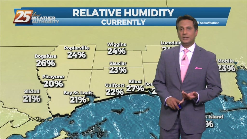
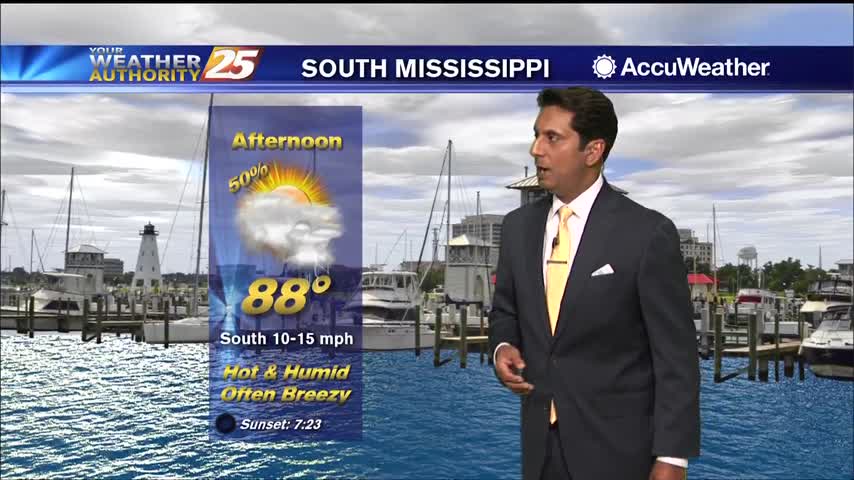
Hot temperatures heading into this afternoon with even higher heat indices values expected to max out closer to 100 degrees. High pressure across the…
Today we will be between two areas of high pressure that will try to merge across the entirety of the southern CONUS leaving us in a…
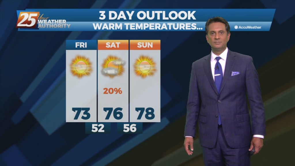
Surface high pressure that is edging into the Great Plains this morning will continue to shift eastward, crossing the local area on Saturday, and be centered over Florida…
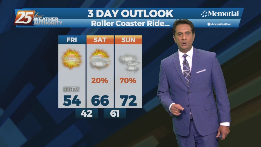
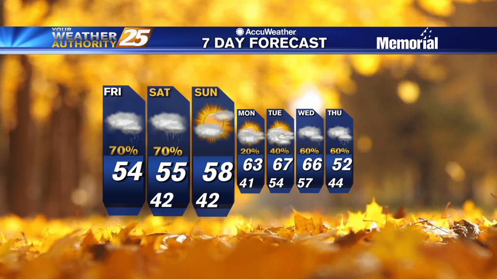
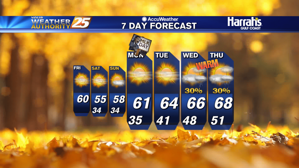
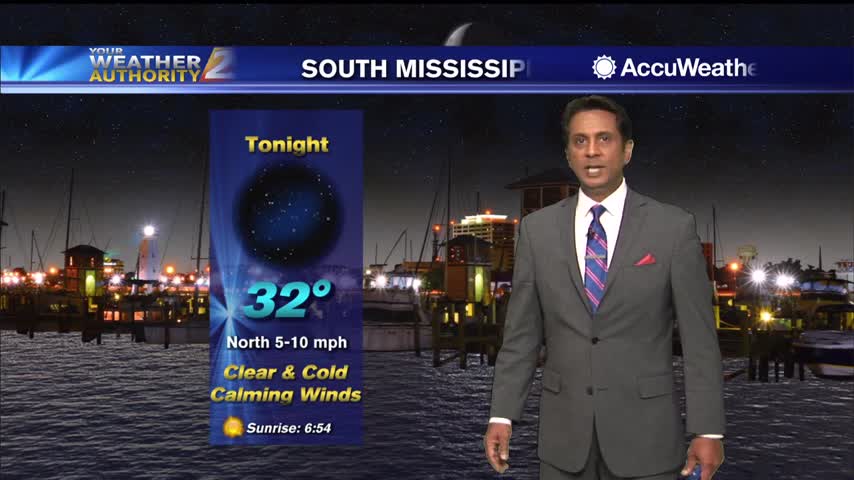
High pressure building in will bring a much drier air mass...a few degrees below our normal lows. Over the next 3 days there will be about a…
Tonight temperatures will be chilly once again with lows in the upper 30s to low 40s. Winds look to really lighten up tonight so wouldn't be surprised…
Isolated to scattered showers will then persist the rest of the evening and overnight hours as moisture remains in place but loss of daytime heating limits convective potential.…
An area of low-pressure over the NE'tern Gulf should reach Florida this evening, with most remaining cloud cover over the local area exiting by early/mid afternoon.…
A break from the rain this afternoon as organized activity will begin moving back into the area this evening...

A stalled weak front to the east will continue to bring low rain potential to the area...

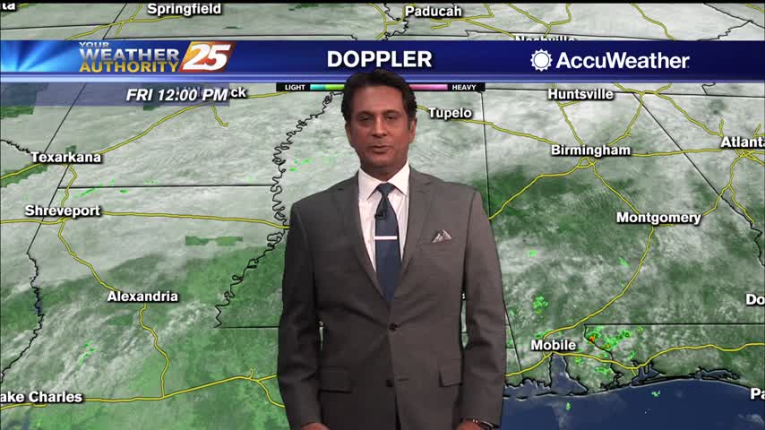
A beautiful sunny Friday afternoon ahead with a few upper-level clouds...
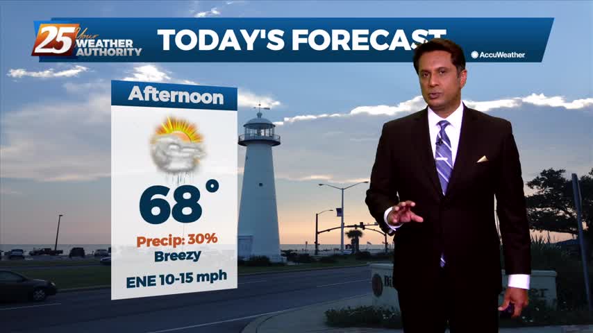
Sunshine beginning to poke through the clouds, with warm temperatures this afternoon...
Another very HUMID start to the day with widespread fog affecting south Mississippi...
Rainfall is moving east across south Mississippi with pockets of fog...
Rainfall is moving east across south Mississippi with pockets of fog...
A much warmer start to the day with the cold front now to the east...
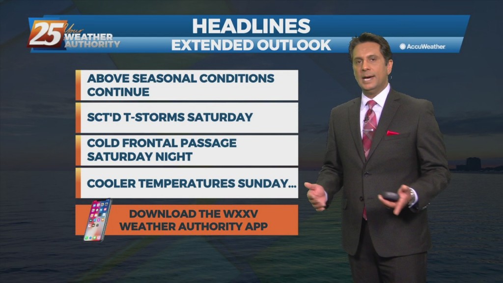
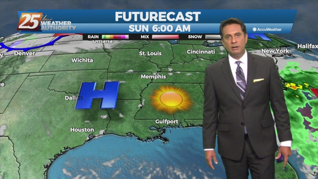
Clearings skies will begin this afternoon as below seasonal temperatures continue...
A warmer start to the day as the humidity is beginning to move back into the area...
Hot and humid conditions this afternoon with t-storms from the west moving in...
A rather pleasant start to the day as overnight t-storms have dissipated...
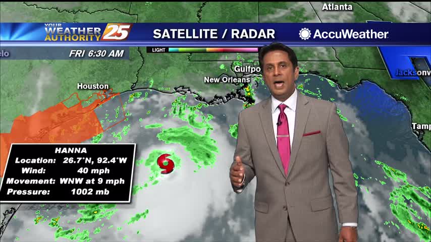
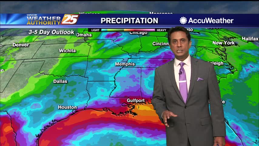
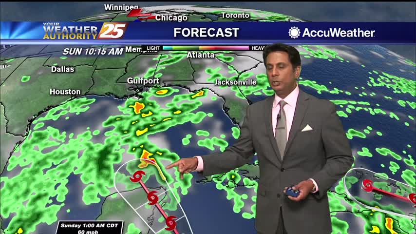
As TS Hanna moves towards the NW'tern GOM, rain continues to move in from the SE...
Today through Monday, we should see relatively dry conditions. Unfortunately, less cloud cover means the heat will be back but not as bad as several days ago. Heat index values will be in a 100-105 range. Most showers and thunderstorms…