1/4 - The Chief's "Roller-Coaster Weather Pattern" Thursday Morning Forecast
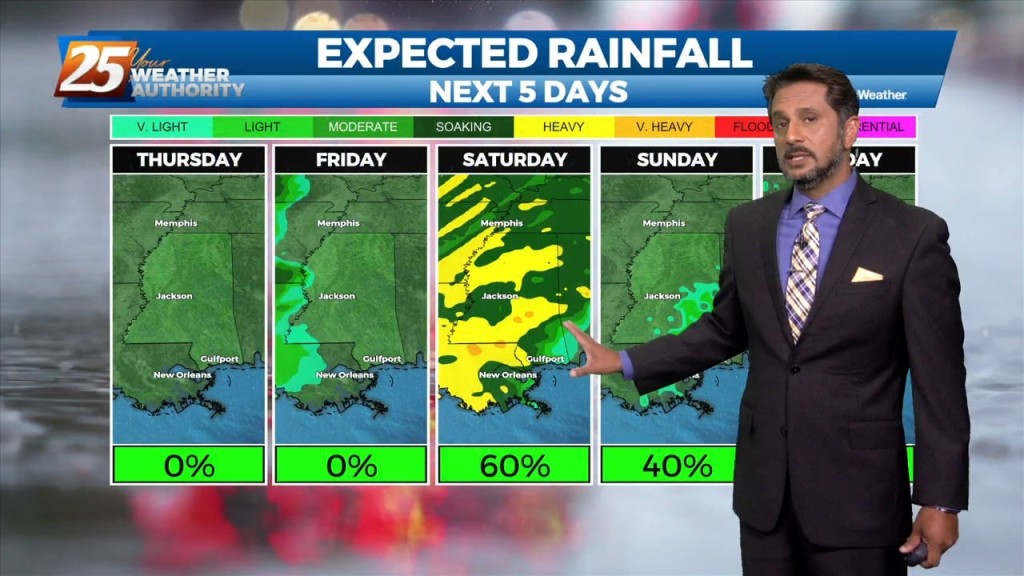
Out with one, in with the next. All these systems will continue in rapid succession for the next several days. Very nice conditions will remain behind…
Out with one, in with the next. All these systems will continue in rapid succession for the next several days. Very nice conditions will remain behind…
Some dry time will be around this afternoon and you may even find a few breaks in the cloud cover. Rain chances begin to come back…
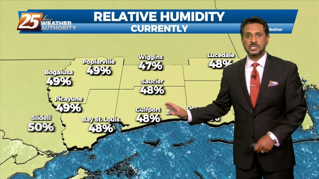
The pattern has change slightly as the cold front overhead dissipated overnight. The lower dew-points will remain with us as drier air will once again…
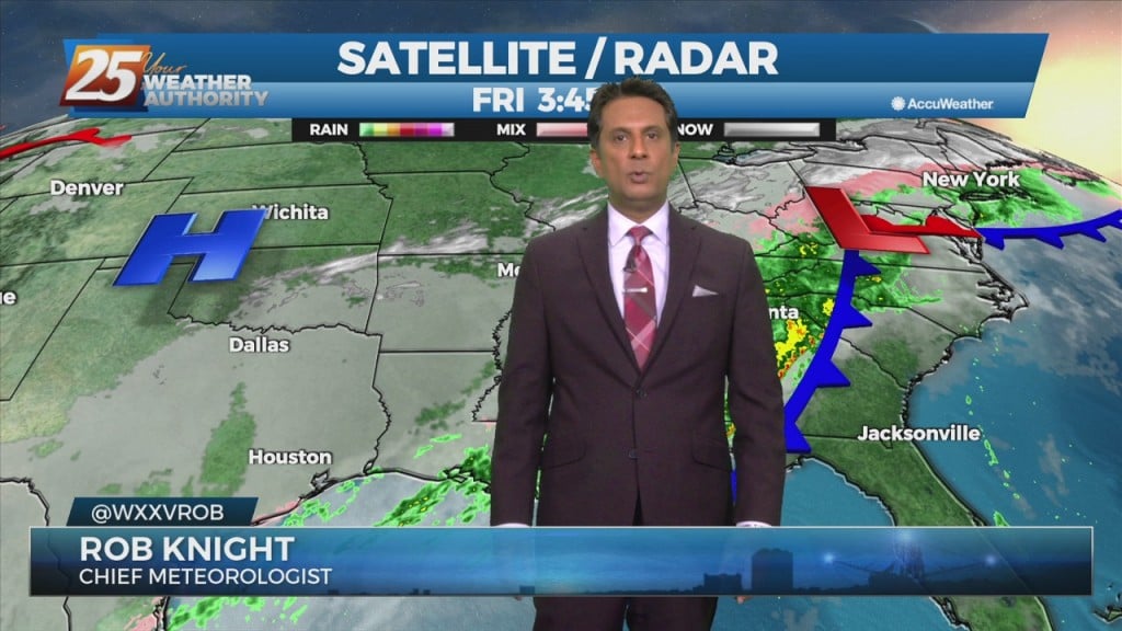
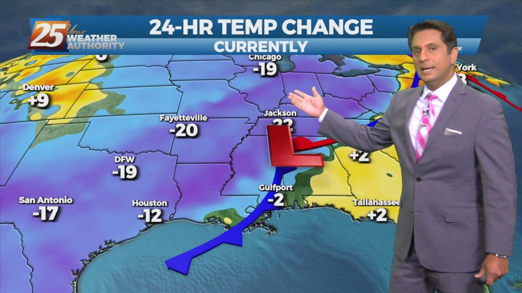
A closed mid-level low pressure system over TX is more of a double barrel low as the eastern portion of the low led to all of…
This pattern will be in place today through Sunday. This onshore flow regime will advect in a substantially more humid airmass into the area today and…
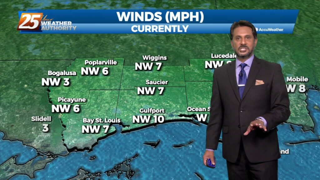
Surface high pressure will continue to spread into the region, which should limit surface winds keeping things light and variable through the short term period.…
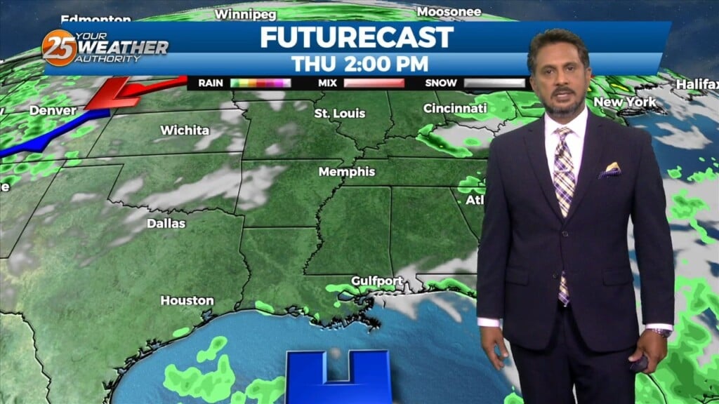
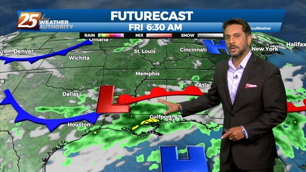
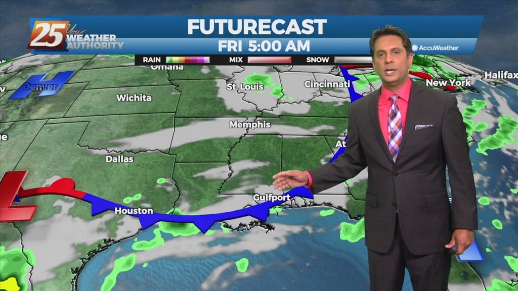
After today we will be heading into a much more active pattern. A Major disturbance will be digging down through the Central and Southern Plains…
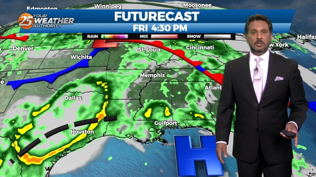
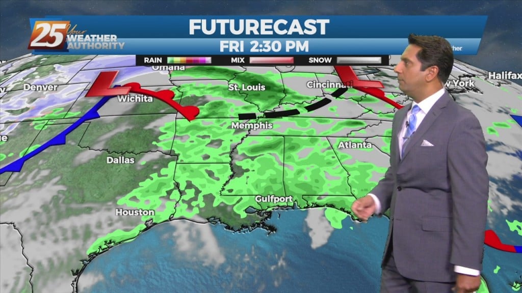
A mid latitude disturbance will be tracking east across the Central and High Plains Friday, crossing the upper/mid-Mississippi River Valley Friday night. As surface ridge north of the…
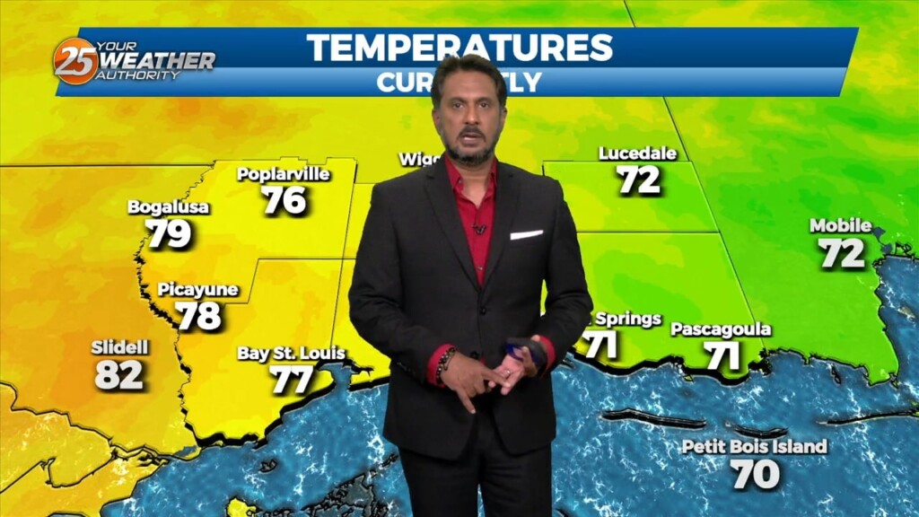
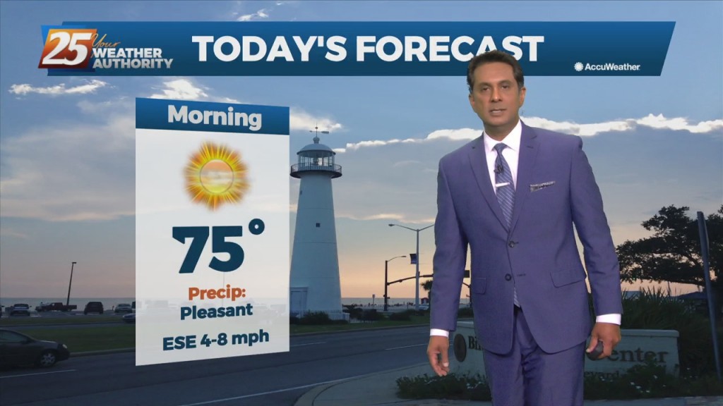
Another day of relatively quiet weather is expected as high pressure continues to sit over the northern gulf coast. Temperatures will remain about the same as…
After a lovely day with sunny skies and below seasonal temperatures...changes area ahead. An upper disturbance over the Inter-mountain West will continue to move eastward into West…
Fall is in the air! No rainfall is expected for the next few days. We are still experiencing some impacts across the area from pressure gradient…

VERY HOT temperatures ahead this afternoon as a few locations will either tie or break a record high temp. High pressure will hold on one more…
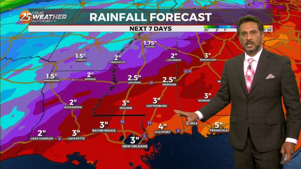
The best potential for rainfall, similar to Wednesday looks to be again along and west of the I-55 corridor later this afternoon. With the…
Multiple disturbances expected to move through the eastern US today. One is moving through Arkansas and east Texas into Louisiana, while a stronger one is dropping…
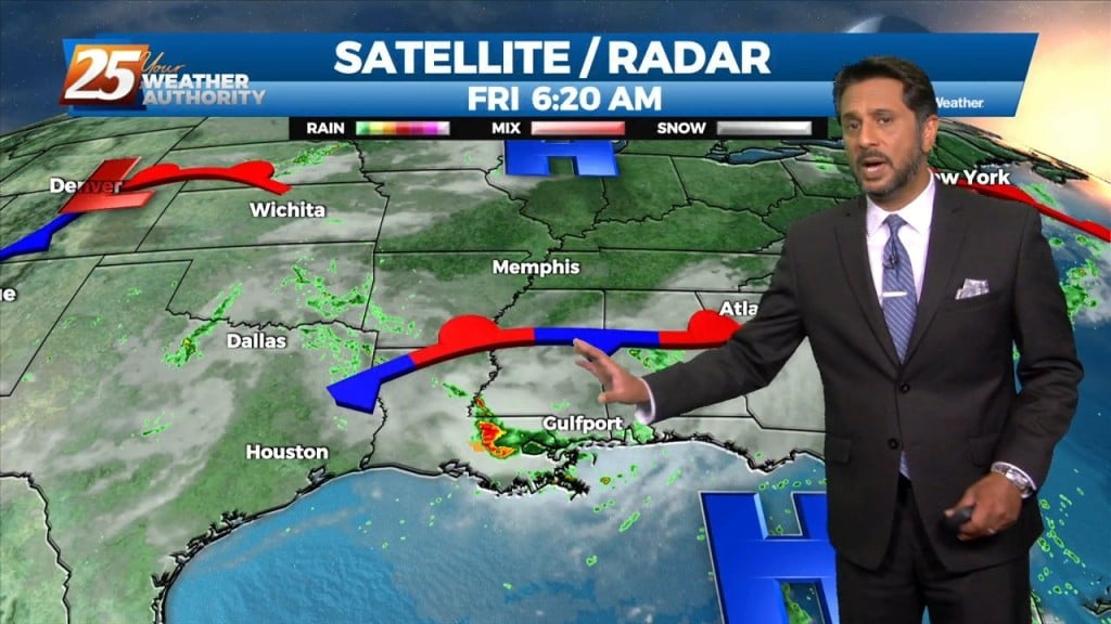
Today will be the most active day over the next 3 days. Today we will be between two areas of high pressure that will try to merge…
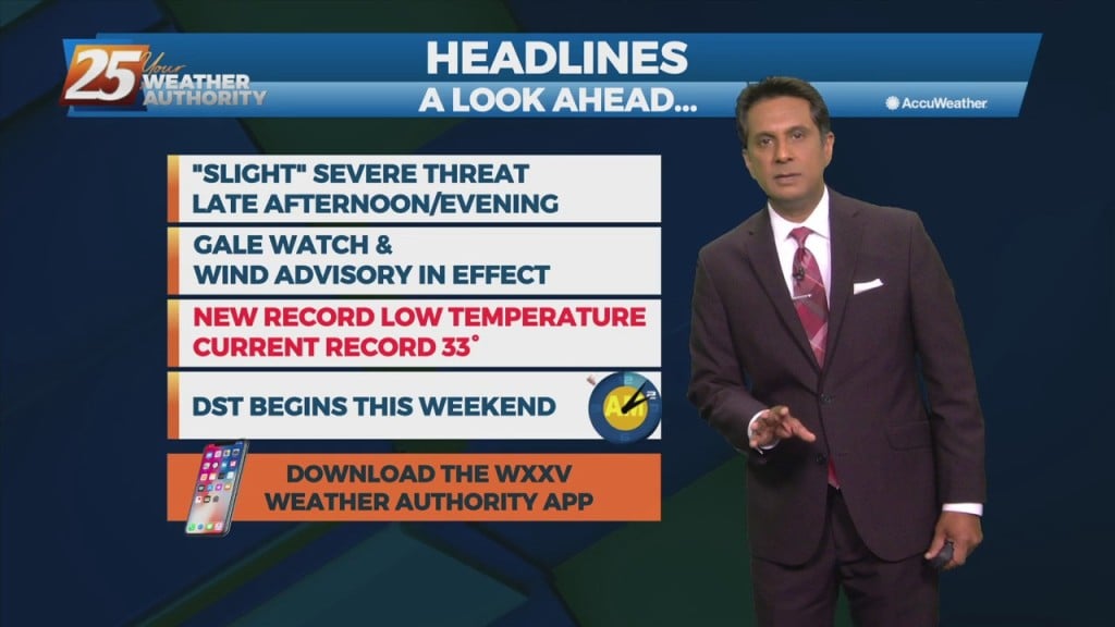
Scattered to numerous showers and storms will be possible this afternoon/tonight. Strong to possibly severe storms will be possible along the MS coastal areas and east.…
As the high pressure continues to shift east of the area today, winds will gradually come around to the southeast by this afternoon. Little in the…
Although the front is now east of the area, post frontal rain will continue this morning, spotty rain this afternoon. It will take most of the day for…
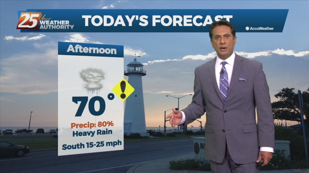
A cold front west will slowly move east and through the area this evening. This afternoon will bring the biggest potential for impactful weather to…
Surface high pressure remains in control of the northern Gulf coast, with a broad center/axis extending from across SE LA, northeast into MS/AL and central TN. The…
A warm front west will move east through the area this afternoon, providing for scattered showers and t-storms. Precip chances are generally in the 25-40% range this afternoon before…
Rain chances will gradually decrease through this afternoon as a cold front moves east. An increase in northeasterly flow will become breezy this evening through Friday evening. Much…
The upper level pattern shows a trough racing eastward through the upper Mississippi Valley towards the Great Lakes. It will be too shallow to bring the associated…
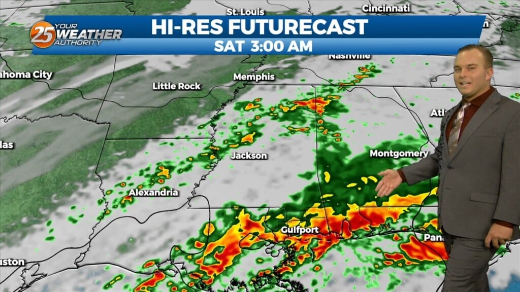
A few showers will affect the area this afternoon and Friday with the approaching cold front. The main effects from the front will come overnight Friday into Saturday morning prior to sunrise. As the upper-level support begins to outrun the…