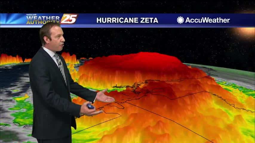
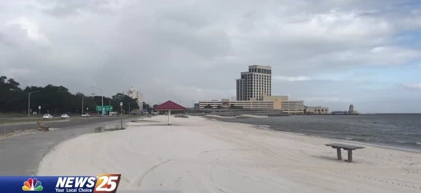
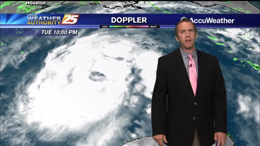
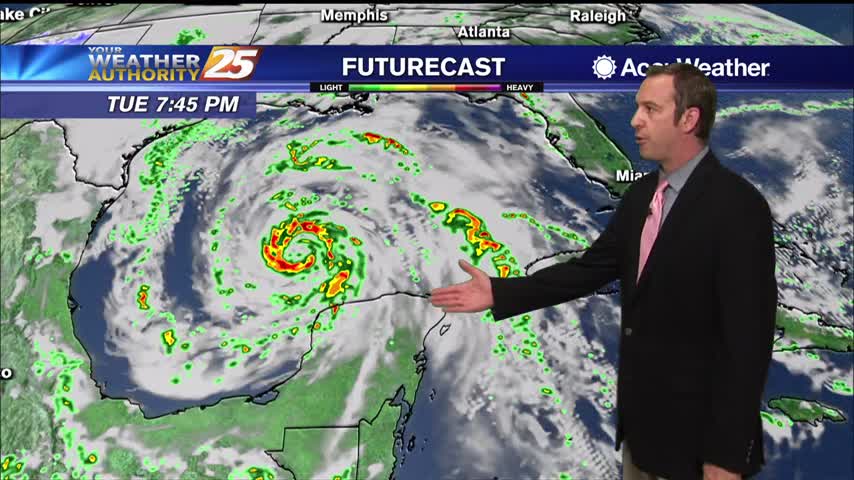
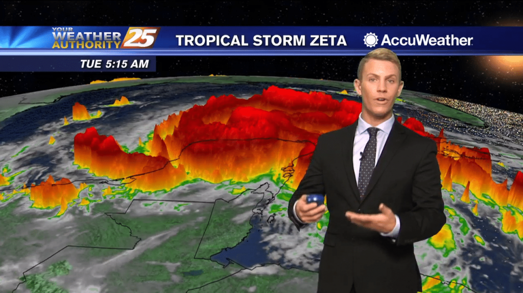
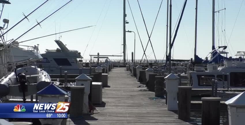
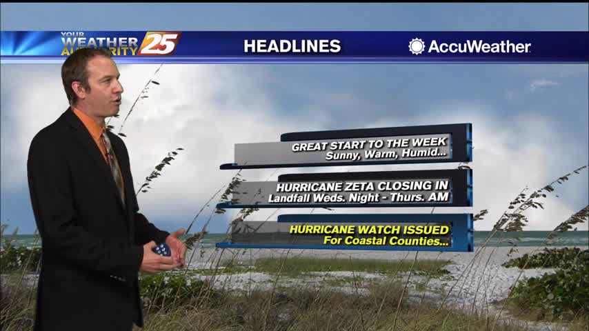
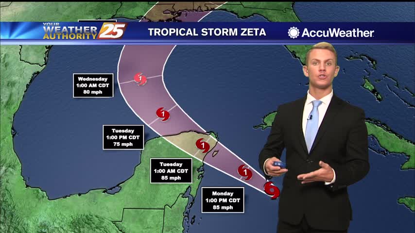
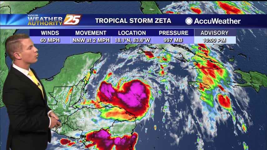
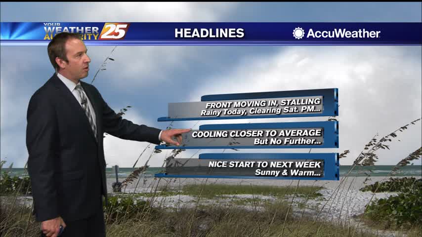
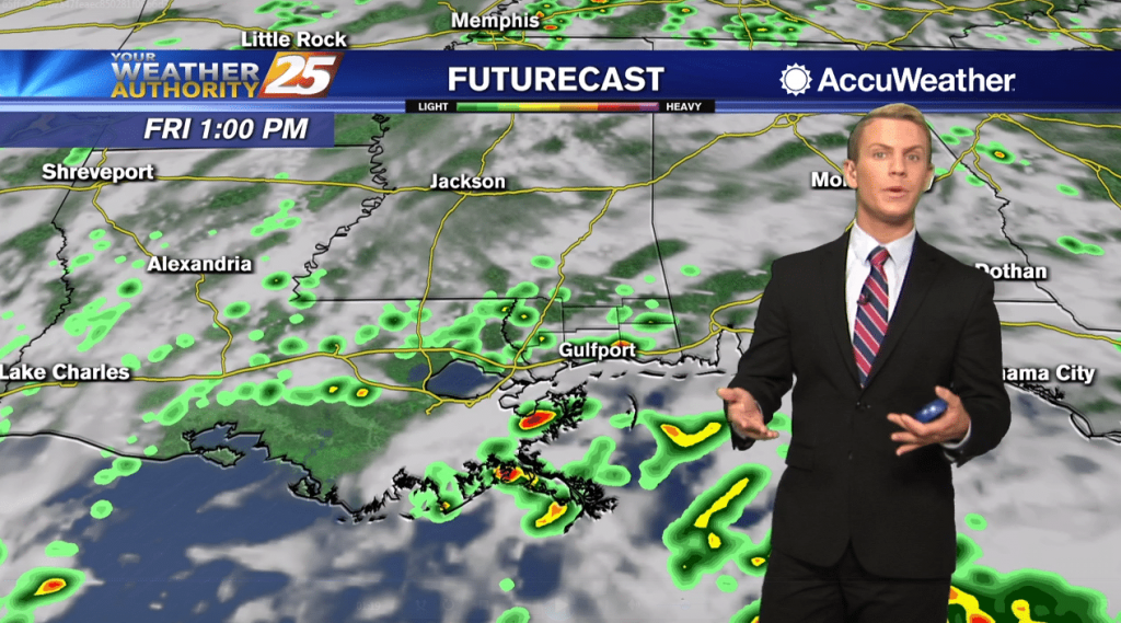
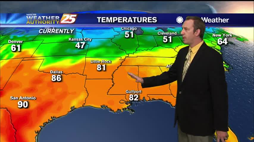
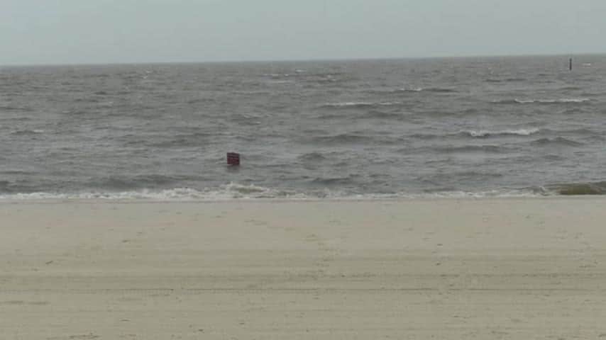
08/12 Ryan's "Wetter" Wednesday Night Forecast
Saw more rain today, though it largely stayed in the northern South MS counties. Expect it to spread out more tomorrow.
Primary Menu
About
Connect With Us
Saw more rain today, though it largely stayed in the northern South MS counties. Expect it to spread out more tomorrow.
Expect showers and thunderstorms again today during the afternoon hours. high temperatures will again reach lower to mid 90s with heat indices being in the upper 90s in some areas and other areas near 105. Thursday and Friday are trending…
Today will bring similar conditions from yesterday, with the trend of diurnally driven summer convective pattern. Expect brief showers and thunderstorms during the afternoon hours. Max temperatures will again reach low to mid 90s with heat indices being in the…
Not cooling far into the 70s each night for the rest of the week, and our afternoons will be just as hot and humid as the last few have been.
Another excessively hot and humid afternoon is in the books, with only a few afternoon showers coming to cool us down....
It's hazy, hot and humid along the Gulf Coast. High temperatures will likely top out in the mid 90s, but it will feel like it's between 100 and 108 degrees. Scattered showers and thunderstorms may help cool things down in…
The hot summertime pattern continues as the humid flow from the GOM dominates the region. The moisture flow will continue to saturate the atmosphere, thus leading to the sea-breeze interaction early afternoon. Isolated to scattered showers and t-storms will develop…
Hot and dry last week, but this week will be much more humid as deep moisture moves in....
The increased deep layer moisture combined daytime heating and convergence along the seabreeze will lead to increased thunderstorm coverage on Monday. Isolated showers will develop near the coast in the morning, gradually increasing in coverage and developing inland through the…
Our long, dry, and sunny week has come to an end, but we'll only see a few showers over the weekend.
Today was the last day without a rain percentage as our dry trend comes to an end, but it'll still be a while before we see any significant rainfall.
It's been dry for quite some time now, but that will begin to change very soon.
Our hot and dry streak continues, but at least one of those conditions will change in the days ahead....
Another hot, mostly sunny day is on tap for the Coast! High temperatures will top out in the lower to mid 90s. Humidity levels are lower today compared to the last week or two, but there will still be a…
Current overview early this morning shows the same subtle, nearly stationary front parked across the northern Gulf of Mexico. Not much changing today into the weekend as a weak surface high drifts off to the east. Isolated afternoon pop-up t-storm…
Sunny and beautiful during the day and clear and calm at night, but those drier conditions will begin to give before long.
Temperatures are above average, but the weather outside doesn't feel too bad thanks to slightly drier air. Doesn't last forever though....
Another hot, mostly sunny day is on tap for the Coast! High temperatures will top out in the lower to mid 90s. Humidity levels are lower today compared to the last week or two, but there will still be a…
A weak cold front overhead is beginning to make the transition to a stationary front which should drift back to the NW beginning Thursday morning. This will lead to slightly more coverage in storm development heading into the weekend. Going…
Not really any cooler, but it'll feel that way as slightly drier air makes its way to the surface.
Drier air has moved into the upper levels and is trickling down to the surface, meaning things will stay a bit cooler and drier for now.
A weak cold front overhead will provide for less humid air through the latter part of the work week as the mid/upper level flow from the NW will suppress activity. It is possible daytime heating could pop an isolated shower…
Continuing our beautiful weather from the weekend into the week, and drier air is going to keep things nice and sunny for a while!