5/17 - The Chief's "Summertime Heat" Tuesday Morning Forecast
Today and Wednesday, high-pressure will set up over the area. Conditions will be dry primarily, looking at the models. Today will mainly be a transitional day where…
Today and Wednesday, high-pressure will set up over the area. Conditions will be dry primarily, looking at the models. Today will mainly be a transitional day where…
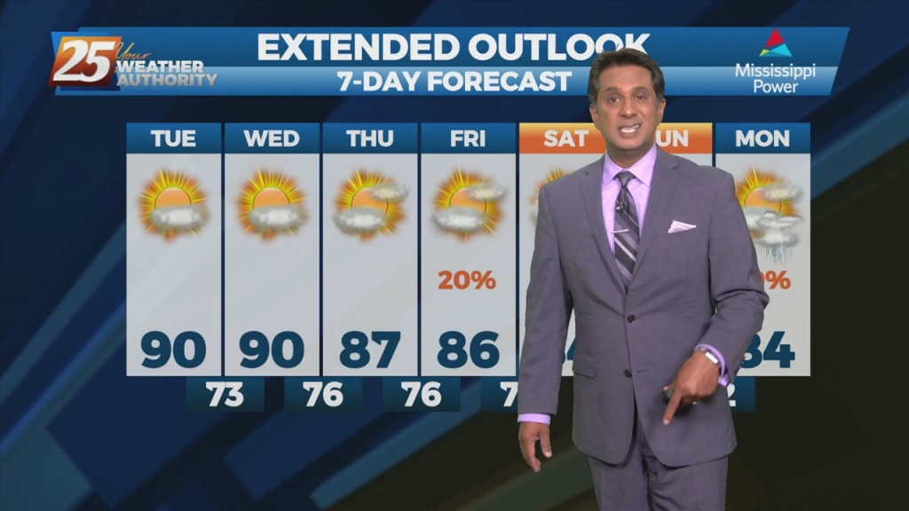
Quiet conditions will continue as the warm and humid flow dominates. A more unsettled weather pattern is expected to take hold on Thursday and continue through…
The front is now well east of the area after leaving extensive damage through the region including South Mississippi. Multiple areas were hit by damaging straight…
Main concern will be temperatures. Mid and high cloud cover should hang around a good bit of the day, but do expect to see some sunshine late…
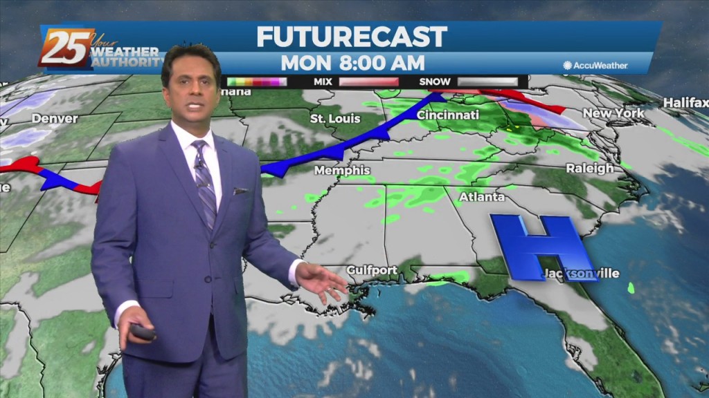
A weak cold front diving southward through the mid-west and lower Tennessee valley will move across the area during the day on Friday, with the upper…
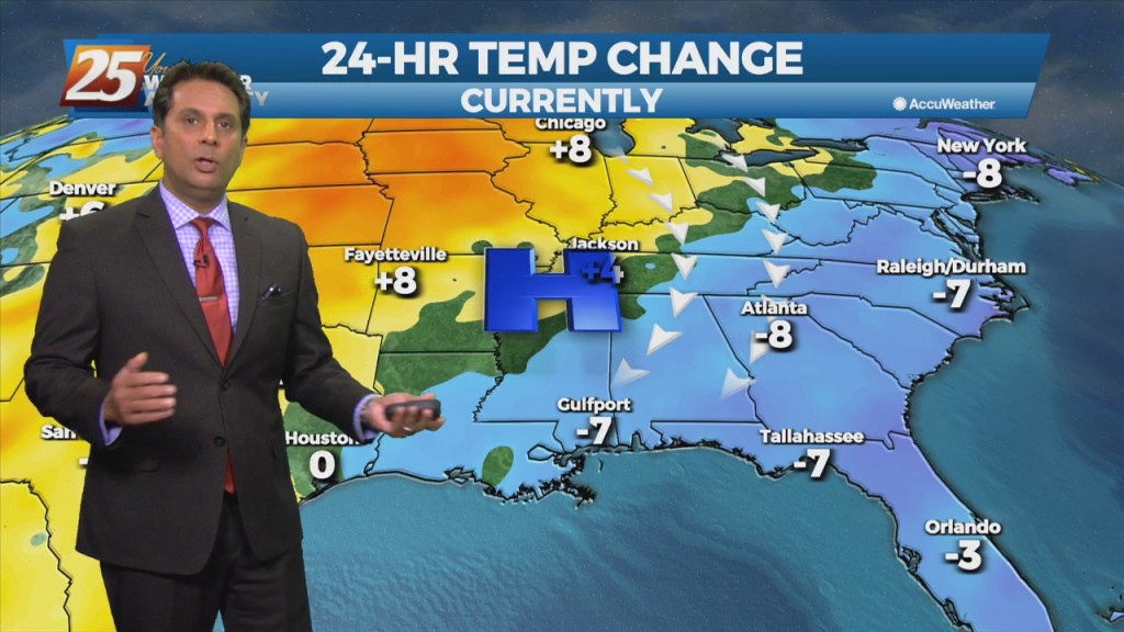
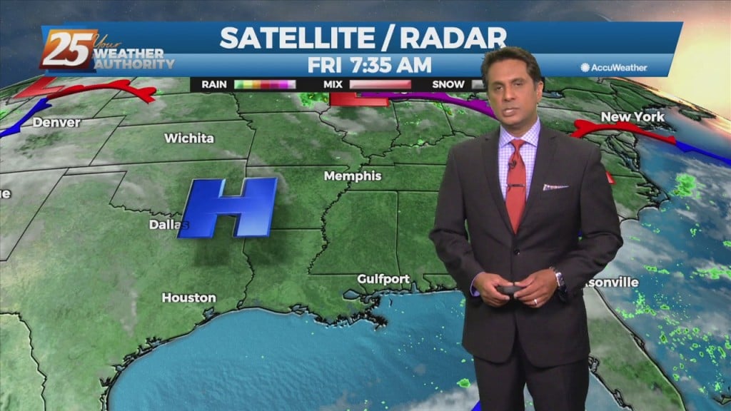
The first 24 hours of the forecast is rather benign, as the high pressure shifts eastward, with perhaps 5 degrees of warming of high temperatures today from…
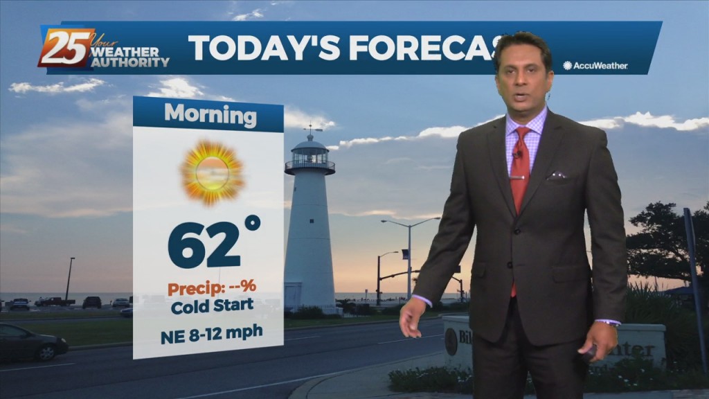
Clear & cold overnight with an abundance of sunshine tomorrow will allow temperatures to moderate fairly quickly...into the low 60s. As winds turn onshore by Tuesday afternoon, we'll…
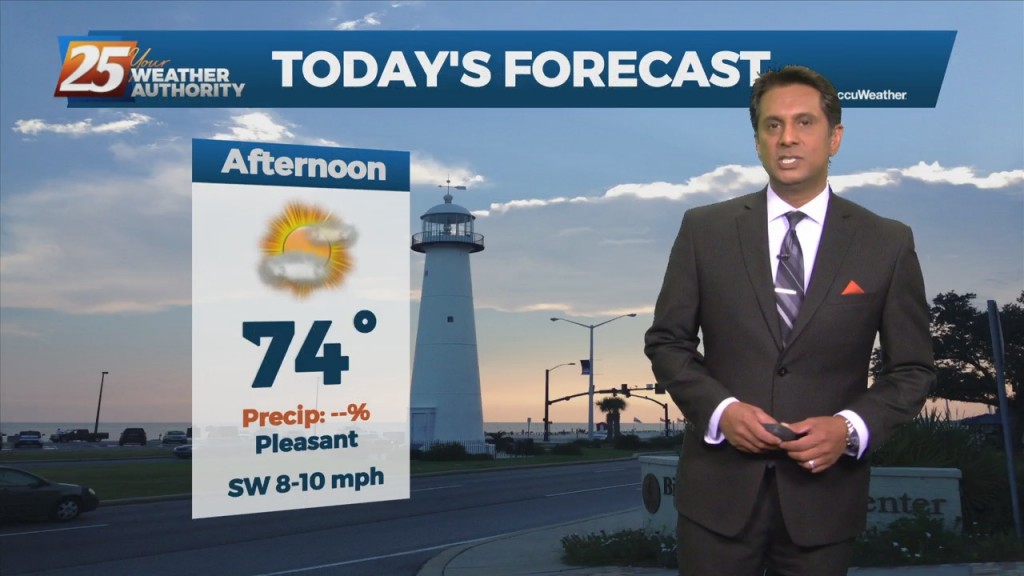
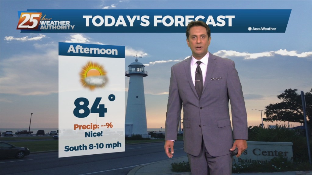
Today will bring continued warm and humid conditions with partly to mostly cloudy shies, a bit more sunshine this afternoon. The main impact for the weekend still comes…
The first 24 hours or so of the forecast will be more of the same that we've seen over the weekend with partly to mostly cloudy skies…
An upper level high-pressure centered near south Florida expands from east of the Bahamas to the western Gulf of Mexico. Models show a plume of moisture on the…
High pressure really doesn't give way over the next 24 hours as an upper-level disturbance will move from Texas across the area Saturday morning. There's…
Clear skies and high-pressure to the north will shape the forecast though Wednesday evening. Colder and drier air mass will begin to modify later today with the…
Clear skies and high-pressure to the north will shape the forecast though Wednesday evening. Colder and drier air mass will begin to modify later today with the high-pressure…
Breezy conditions behind last night's cold front will gradually diminish later in the evening. Low temperatures tonight into Saturday morning will be the coolest of the short term,…
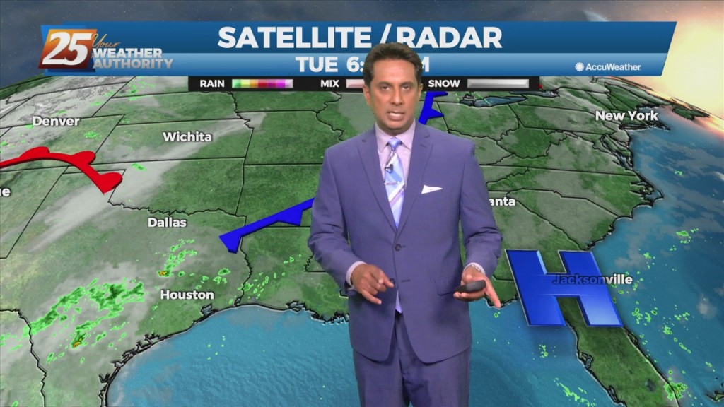
Surface moisture flow will gradually in advance of the next pressure system. Tonight, the area will see more in the way of DENSE FOG with potentially an…
An area of low-pressure over the NE'tern Gulf should reach Florida this evening, with most remaining cloud cover over the local area exiting by early/mid afternoon.…
A lovely afternoon ahead with plenty of sunshine. A cold front will move through the area Wednesday night into Thursday morning bringing a continuation of dry weather…
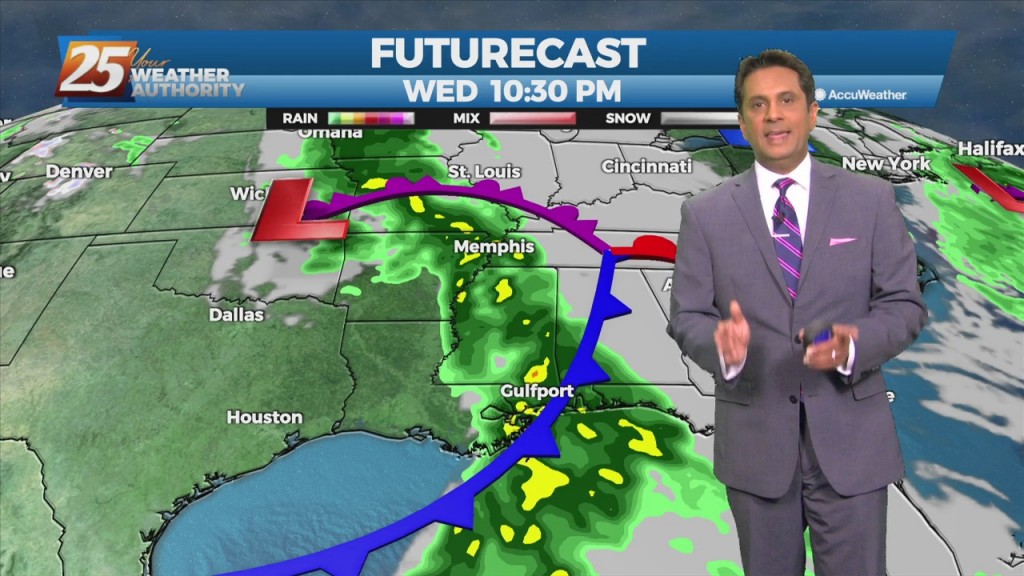
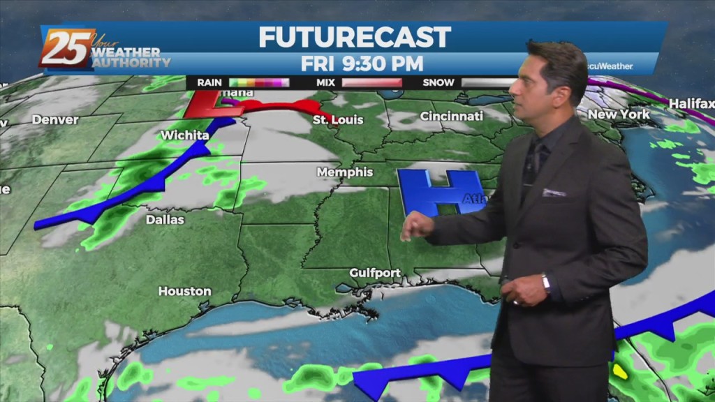
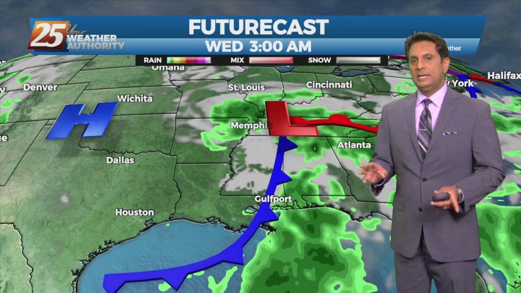
We continue to see a severe weather/heavy rain threat Wednesday afternoon and Wednesday night with much cooler weather to follow. An approaching cold front Wednesday will bring the…
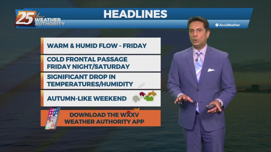
Warm & humid conditions will continue through the workweek as the return flow will yield a gradual increase in low-level moisture. Another front will make it into the Gulf south this weekend with Friday and Saturday to be the most…
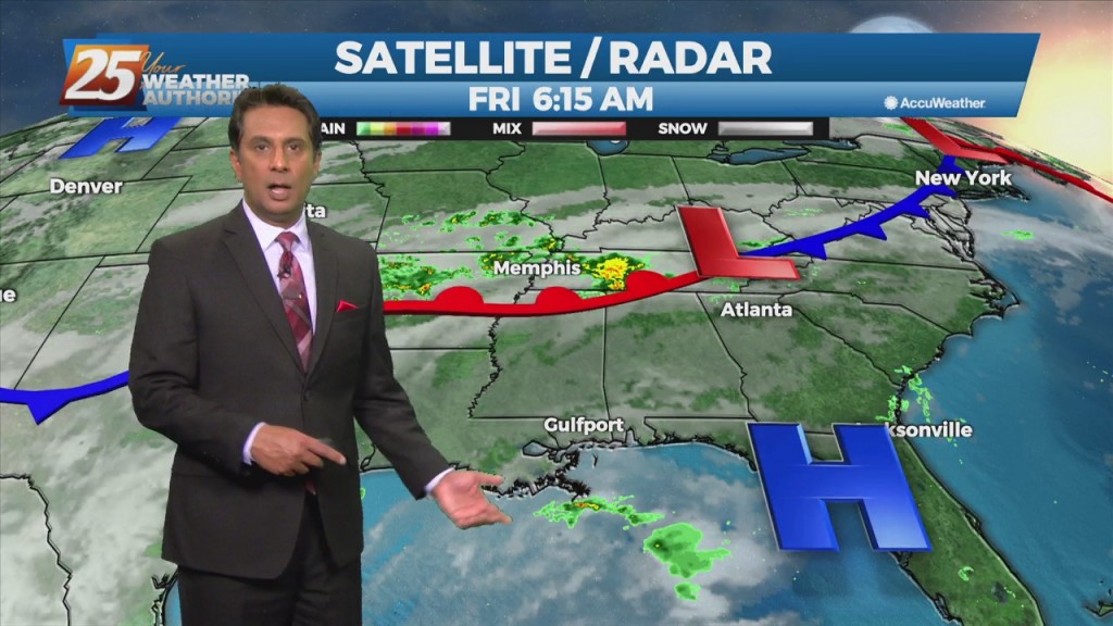
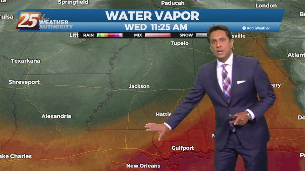
A cold front extended southward from an area of low-pressure across the Midwest, Mid-South, and then southwestward across central and southwestern LA. This will be about as close the front will make it to our area as southerly return flow…
The persistent mid/upper low-pressure over the mid-Mississippi Valley will finally lift northeast to the Great Lakes region through tonight. This will be replaced by an upper level high-pressure building in from the southern plains into the Gulf Coast region. Surface…
High-pressure moving into the region along with a much drier air mass will dominate the forecast through the weekend. This will bring skies clear, and winds on the light side. A change from yesterday with model guidance now showing the disturbance…
As we fall back into a drier regime, a more October like pattern should show itself. But with no good cold fronts moving through at least through Friday, conditions won't change much but also shouldn't be too uncomfortable. As the…
Moisture flow in advance of a cold front to the west will continue. The one positive that could keep us from seeing very heavy rain will be the instability, which is quite low. Rather thick cloud cover today should help…