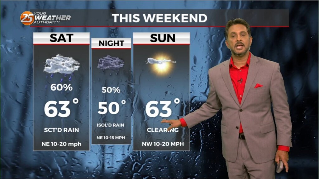
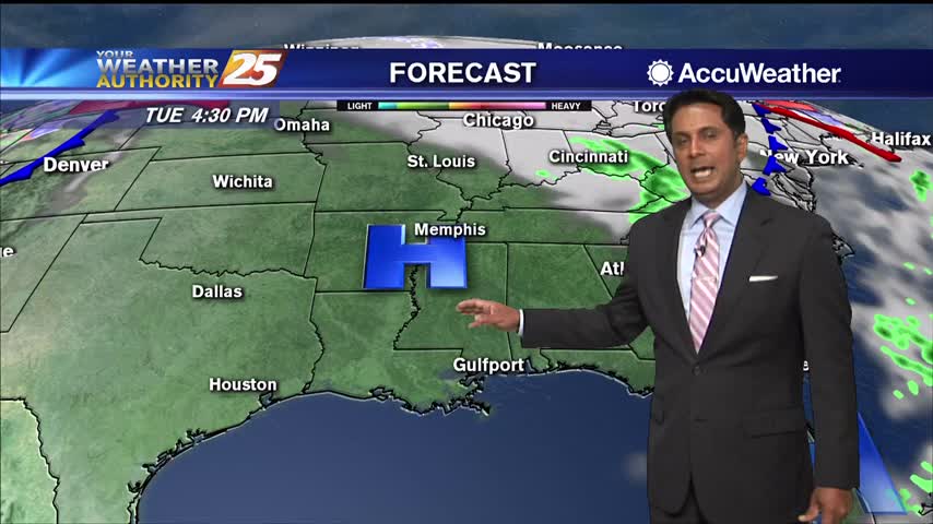
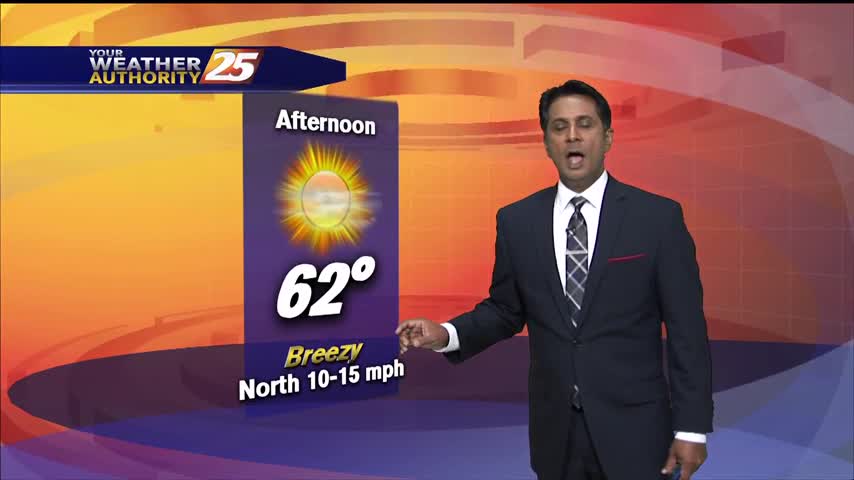
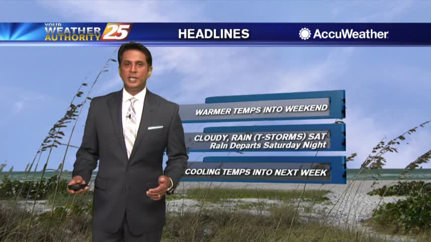
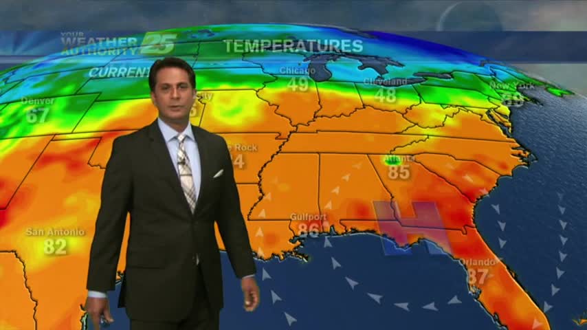
4/22 - The Chief's "Sunny & Mild" Monday Afternoon Forecast
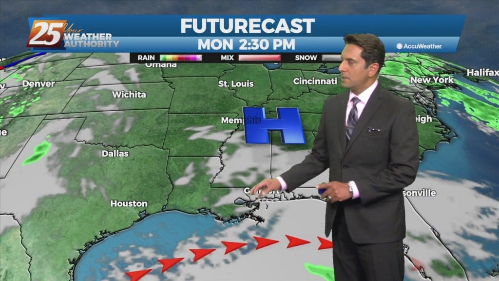
A MUCH DRIER air mass at the surface though the upper levels continue to flow into the region. This dry surge will move through and out…
A MUCH DRIER air mass at the surface though the upper levels continue to flow into the region. This dry surge will move through and out…
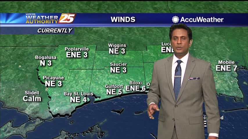
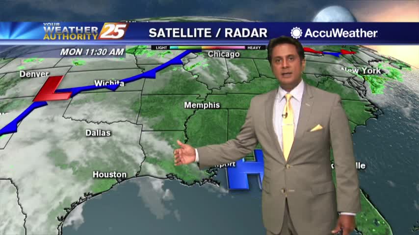
There has been somewhat of a delay in surface winds responding to the system moving southward over the front range of the Rockies, but they will…
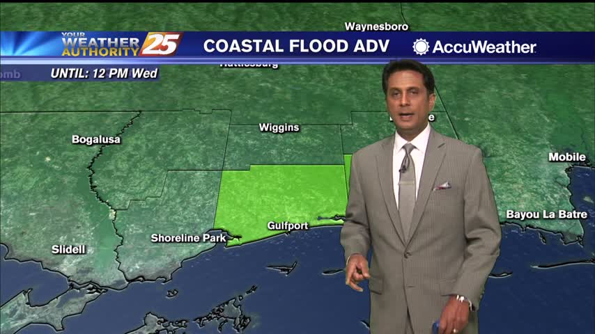
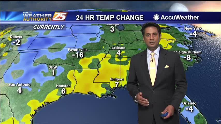
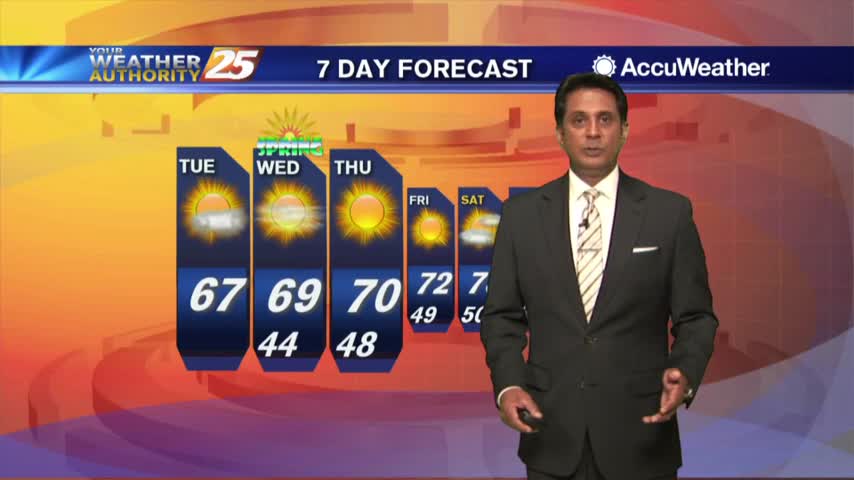
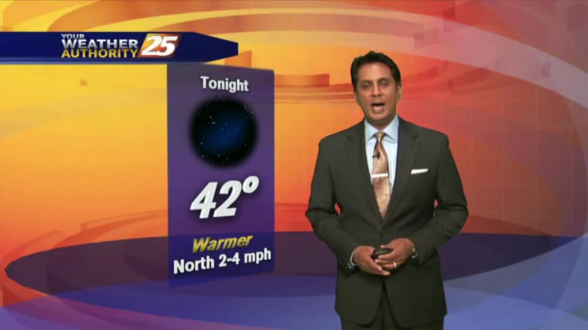
Weak high-pressure will track across the Mississippi Valley today and Tuesday. This will be the start of moderating temperatures. Highs to remain below normal this afternoon, reaching climatological normal tomorrow. Dew-points will be back in the 60s by the end…
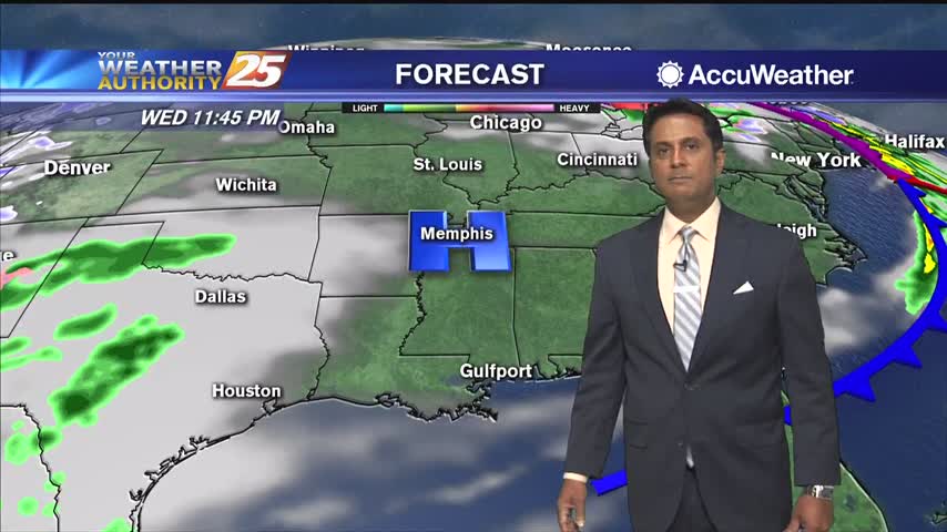
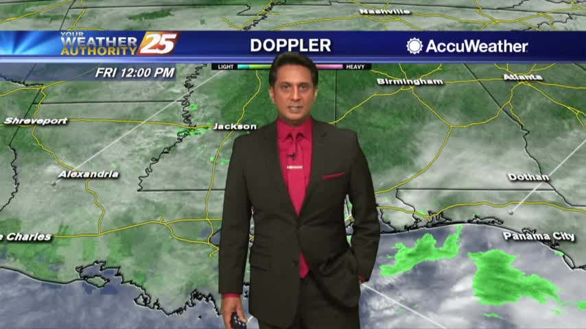
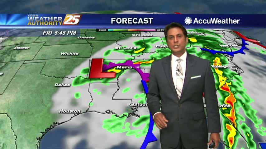
Cloud coverage continues in south Mississippi with scattered rain ahead this afternoon...
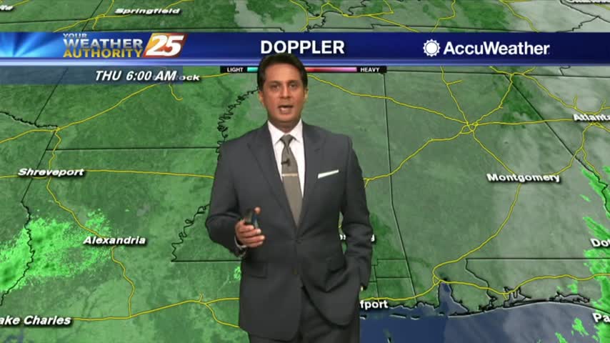
Another cool start to the day as temperatures will slowly warm back to above seasonal...
A cold start this morning with a weak cold front to affect the area tonight...

A damp start to the day with light rain and areas of patchy DENSE fog...
A cold start with a few upper clouds moving across south Mississippi and areas of light patchy fog inland...
It's getting very warm this afternoon in advance of a cold front...

A slightly warmer start to the day as the humid air is working its way back into the region prior to a cold front...
Another CHILLY start to the day but temperatures will modify through the workweek...
A cool start with a few cloud lingering through the area...
It is Monday but what a LOVELY start to the workweek...
A beautiful but chilly start to the workweek...
A DRY front moved through last night with very low humidity and chilly temps through the state this morning...
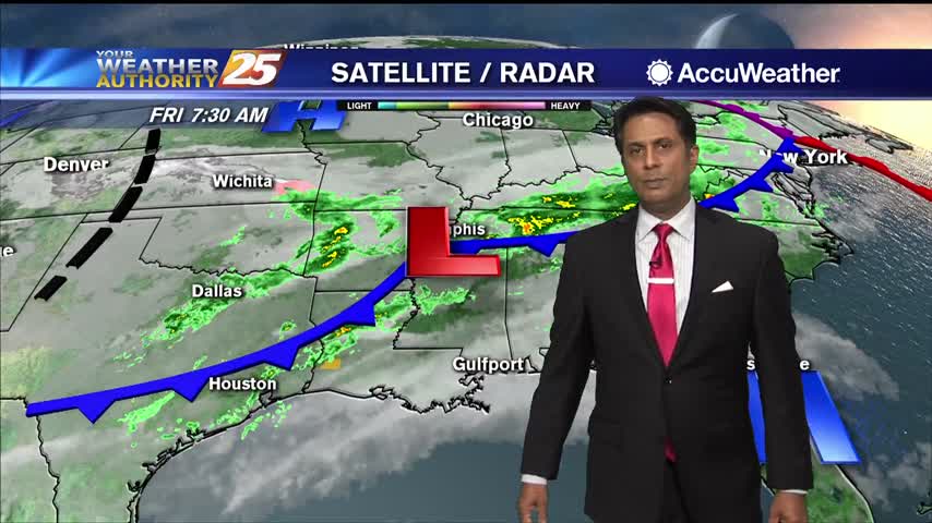
Light rain moved across the area earlier this morning with mainly cloud coverage this afternoon...
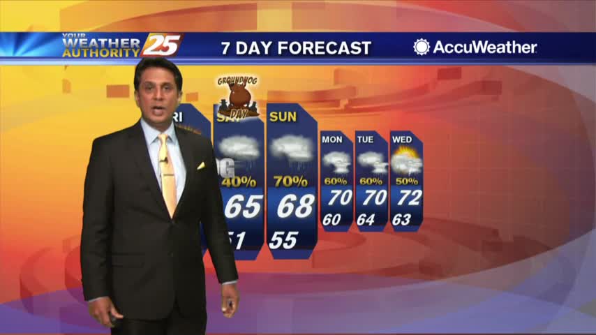
A FRIGID start but with an area of high-pressure now to our SE, MAJOR changes will occur heading into the weekend..
With a warmer/humid air mass moving in ahead of a weak cold front, spotty light rainfall is moving across the area...
Another FRIGID start to the day, but an approaching system to the west will bring changes...
Another FRIGID start but with an area of high-pressure to our east, the warming temps will begin moving in...
After a frigid start to the day, temperatures are warming nicely into the 60s...
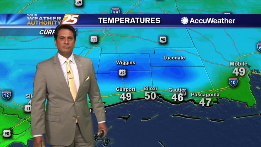
A FRIGID START to the day as a FREEZE WARNING is in effect through mi-morning...
Heading into the weekend, temperatures warming into the mid/upper 80s feels HOTTER with the elevated humidity...
Cloud coverage is moving in from the south and lowering in height, along with areas of patchy fog...