1/10 - "Midday News" Afternoon Forecast
After areas of PATCHY FOG earlier this morning, mostly cloudy skies with much more sunshine is on-tap this afternoon...

After areas of PATCHY FOG earlier this morning, mostly cloudy skies with much more sunshine is on-tap this afternoon...
After DENSE FOG overnight through this morning...improving conditions are occurring with isolated rain for this afternoon...
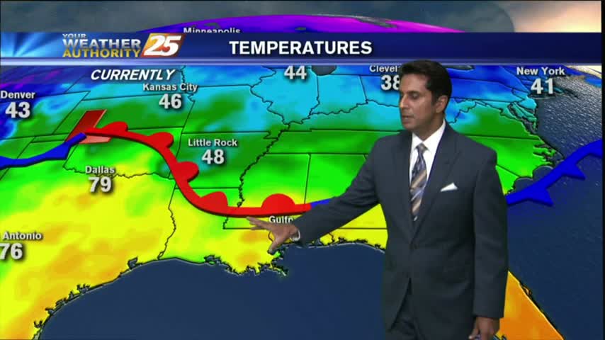
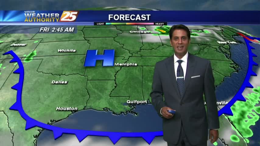
As a cold front approaches the area...the THREAT FOR SEVERITY continues...SLIGHT/MARGINAL...
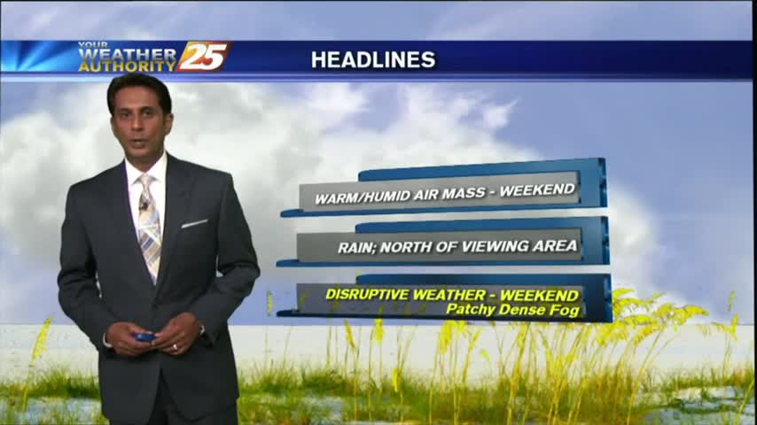
A VERY WARM/HUMID start to the workweek with rain and DENSE FOG, along with an ADVISORY in effect through mid-morning...
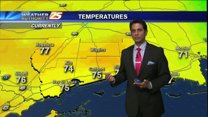
The warm temps continue this morning with areas of patchy fog in advance of an approaching cold front...
With a VERY warm/humid air mass in place in advance of a cold front, DENSE FOG has developed with an advisory in effect through mid-morning...
It feels like SPRING again as the warmer, more humid air air mass continues to move in from the Gulf of Mexico...
Clear skies last night led to cooling, coupled radiational with a more humid air mass, areas of PATCHY DENSE FOG has developed...
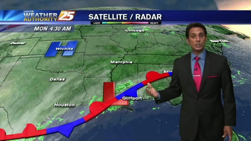
As a zonal flow continues, warm/humid conditions along the Mississippi Gulf Coast continues to provide areas of PATCHY DENSE FOG...
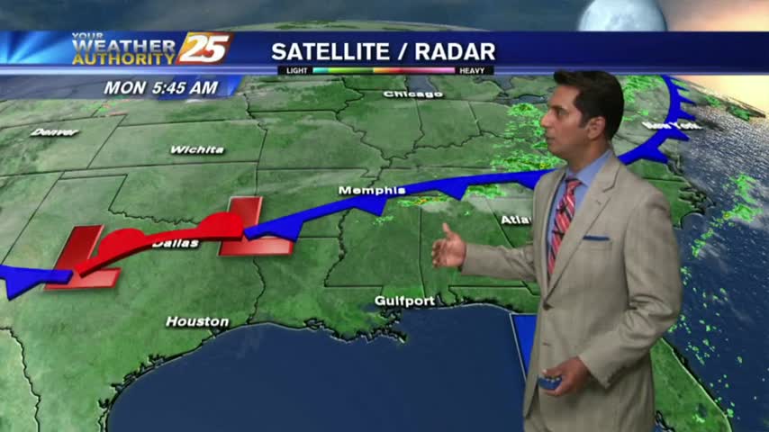
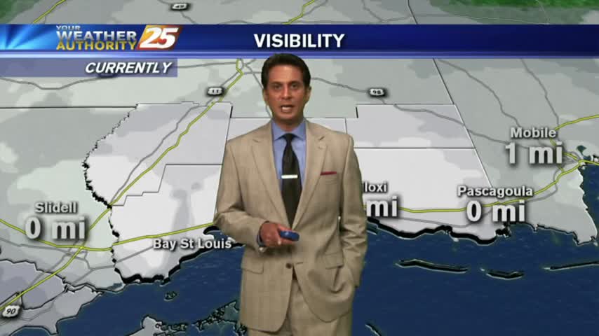
Disruptive weather to start off the work week...DENSE FOG has developed with an ADVISORY in effect through mi-morning...

Another warm & humid start with above seasonal conditions and areas of DENSE FOG. A DENSE FOG ADVISORY is in effect through mid-morning...
After a warm/humid start to the day, above seasonal temperatures continue with mostly cloudy skies along the viewing area...
A WARM/HUMID start to the day has developed areas of PATCHY DENSE fog along the coastal counties...
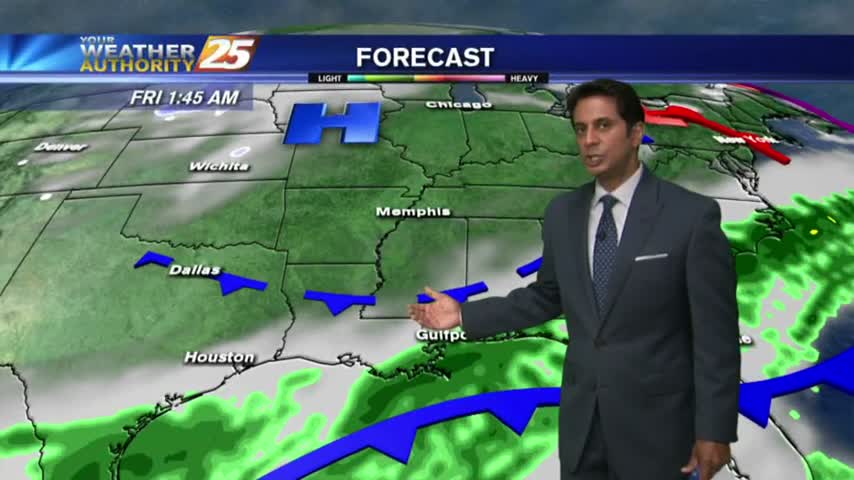
After a mostly clear start to the day, clouds continue to increase in advance of an approaching cold front along with warm & humid conditions...
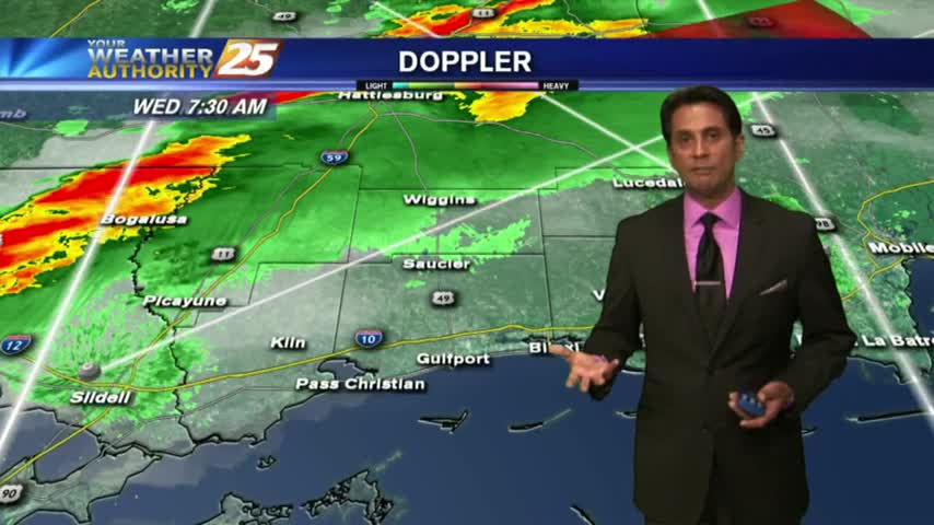
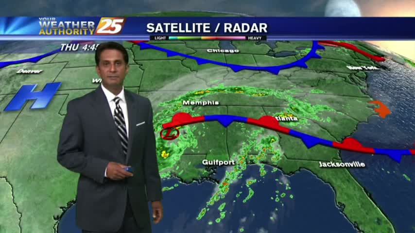
After a foggy start to the day, a cold front overhead slowly moving east will bring a few showers/t-storms to the viewing area this afternoon...

A mild and humid start to the day with rain moving in from the south and areas of PATCHY DENSE fog...

With an approaching cold front from the west, it's a warm/humid start to the day with areas of patchy fog...
A mild start with areas of light patchy fog and very isolated showers moving in from the south...
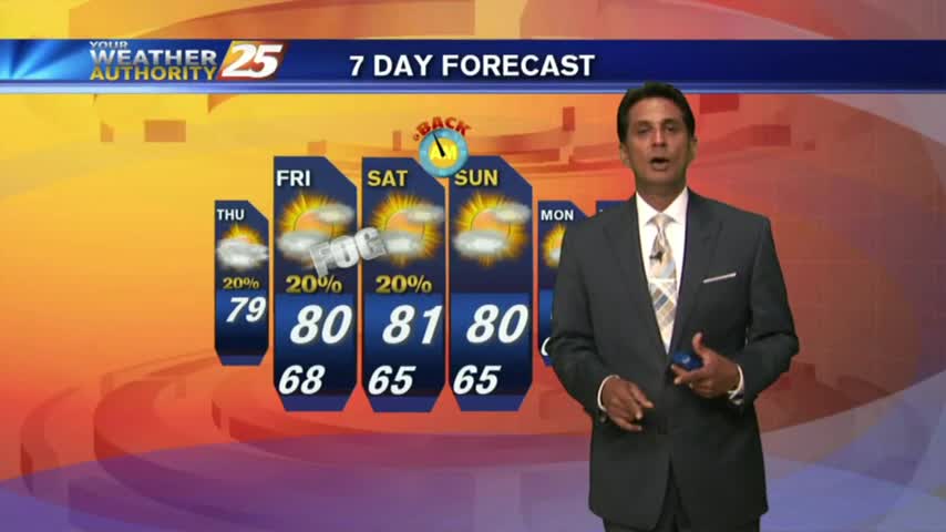
The humidity is on the decrease as temps warm, BUT it is still a very HOT & HUMID afternoon for this final full day of Summer...
A warm start to the day with areas of light patchy fog. Today will once again bring above seasonal temperatures as the mercury will climb into the 90s...
With an approaching cold front to our NW...this morning is a bit more HUMID under a good bit of mid/upper level clouds...
A warm/humid start to the day with very BREEZY conditions and bands of rain moving in from the west...
As TS Harvey continues to move NE after landfall this morning...rain continues to move in from the south with HEAVY ACTIVITY at times with a TORNADO WATCH in effect...

Rain overnight has continued this morning as TS Harvey has make landfall yet again in extreme SW Louisiana...