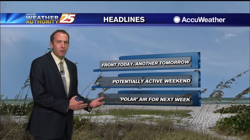
5/3 - Jeff's "Changing Pattern Coming" Wednesday Night Forecast
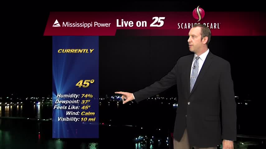
Temperatures will be cool again overnight with mainly clear skies for the area. Dry air remains in place as high pressure has remained in control of the…
Temperatures will be cool again overnight with mainly clear skies for the area. Dry air remains in place as high pressure has remained in control of the…
Splendid conditions continued for the area today with warm temperatures, low humidity content, and a light breeze. Expect a few clouds tonight and temperatures to…
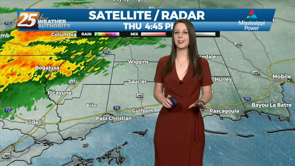
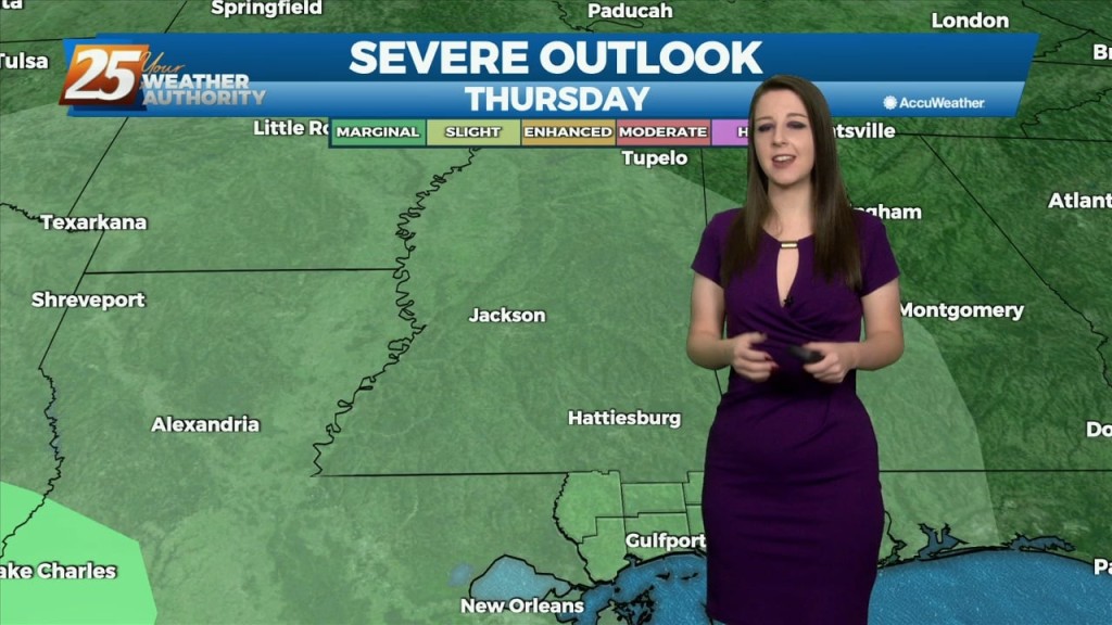
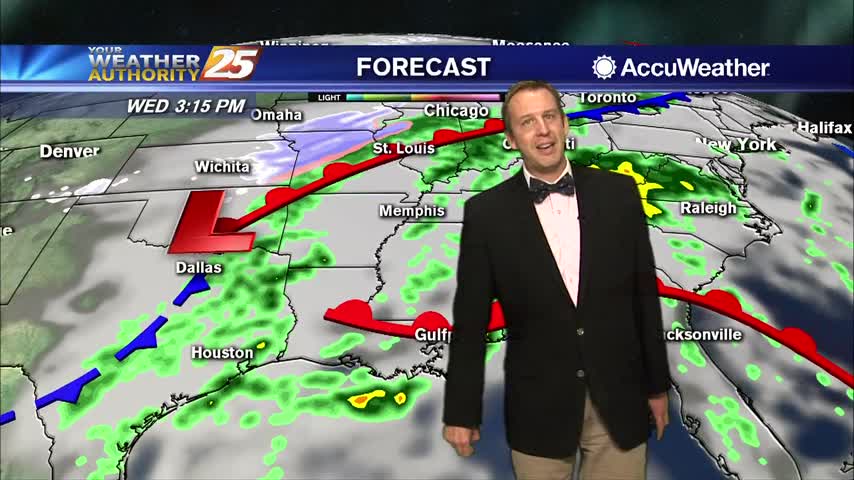
This afternoon will bring pleasant conditions as sky condition will vary between partly/mostly cloudy skies. Much of the focus is on Thursday as severe weather seems…
Today will bring a fairly quiet weather pattern with cloud coverage varying through this evening with slightly warmer as low-level winds start turning more onshore flow. The…
Late Friday into Saturday morning, a shortwave system will move through the area. Strong warm air advection due to southerly winds ahead of the system will help…
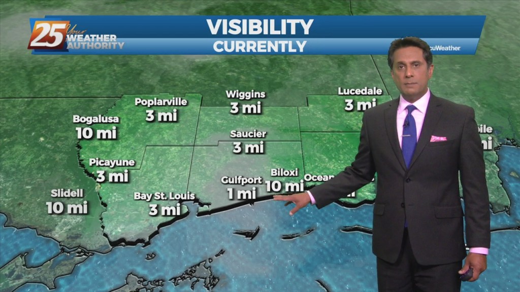
For the short term, like the last few days the primary forecast issue is fog potential tonight. We'll be under a DENSE FOG ADVISORY tonight, beginning at 10pm,…
Low clouds and even some haze/light fog has been impacting the region outside of the light rain. The warm front retreated quickly and even by this morning…
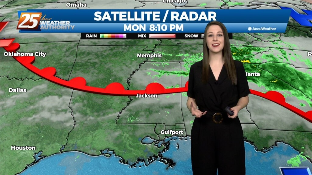
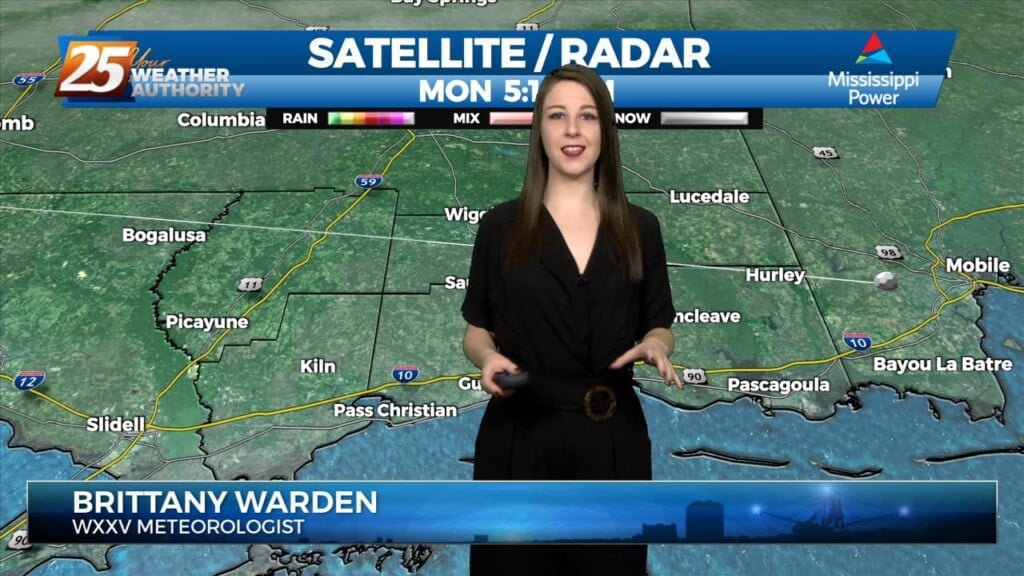
Tonight will be mild but there will be a major issue for the morning commute. Reduced visibility is already affecting the coast and more fog will settle…
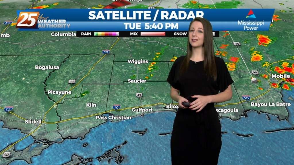
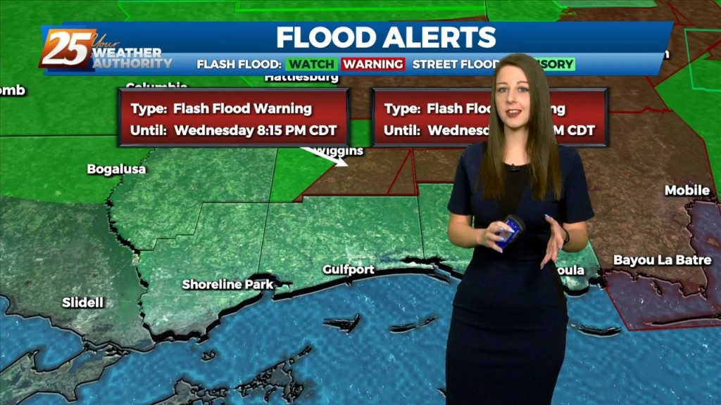
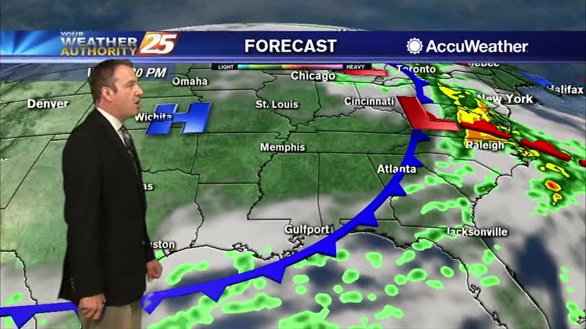
The main focus of the forecast will be the activity we'll see tonight. Tonight will hold a 90-100% chance for showers and thunderstorms in advance of an approaching…
Tonight will be a wet one. We'll see an 80% chance for scattered to numerous showers and thunderstorms as convection over Texas/West LA moves east, with a surface low…
The system today has progressed slightly slower this afternoon. For tonight, convection over Texas/West LA will move east, with a surface low developing. A warm frontal boundary…
We're on tap for a cool, quiet, and overall mild night, with the exception of morning fog. The quiet and dry conditions will be short lived though because beginning…
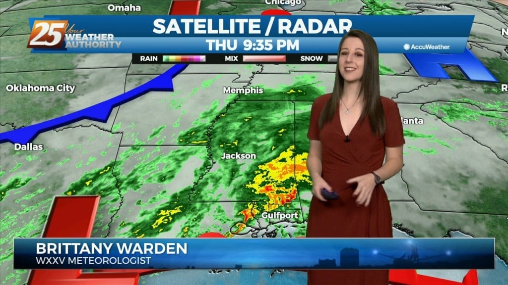
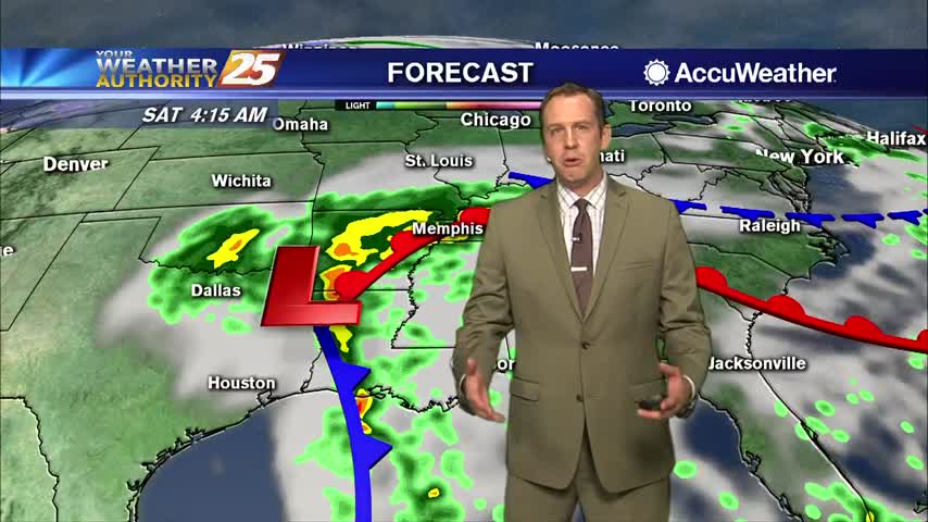
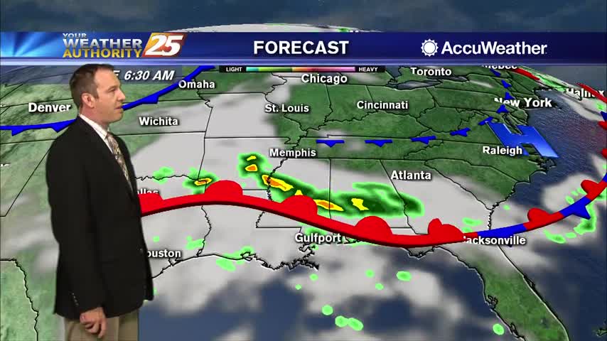
A stalled surface low and trough north of the coast will keep a higher risk of showers and thunderstorms in place through Friday. The low should slowly dissipate…
The warm front is now to the NE placing the area under the warm/moist unstable sector of this system. The synoptic and mesoscale pattern continues to support…
Expect a big difference between last night and tonight as warm, moist air moves in; leading to a cloudy and wet end to the week.
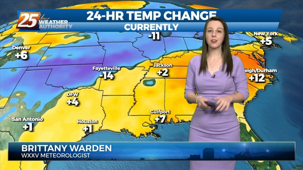
It's much warmer than it was last night, but still going to be quite chilly out there....
Today ended a nice streak of sunny and pleasant weather, and the dreary weather will linger for a little while longer....
The weather was off to a nice start this week, but rain moves in pretty quickly....
Our perfect weather is finally changing, and sadly not for the better.
Two fronts have moved into the area, meaning rain will remain until they've moved on....
Two fronts are in the area and that means we're in for a rainy night, but drier and cooler days lie ahead!
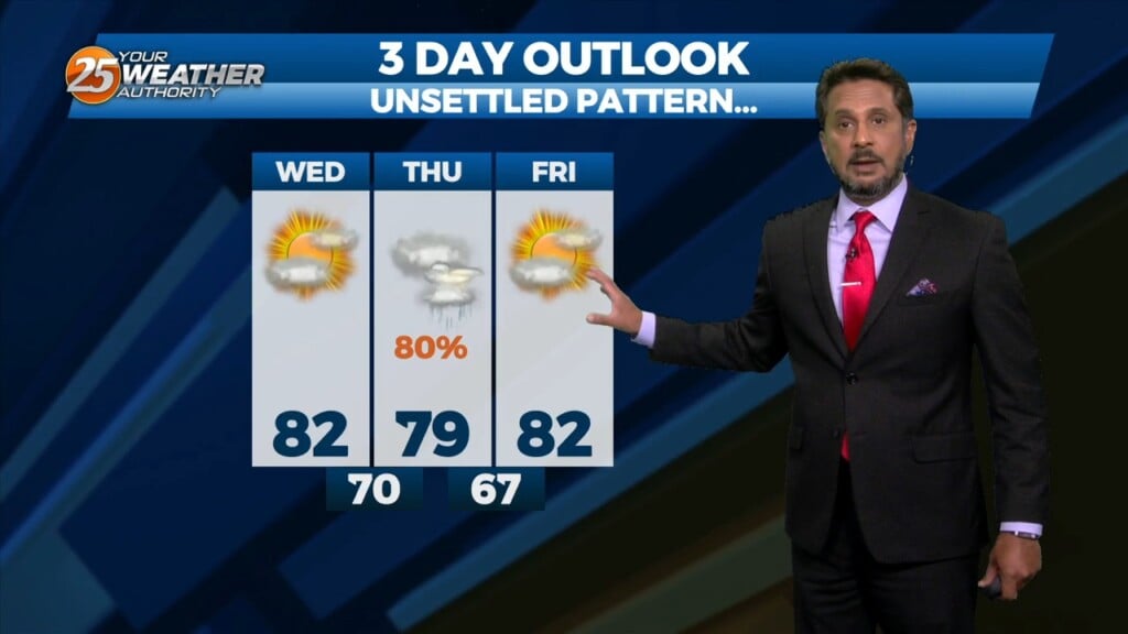
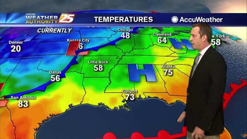
Warm, damp air is in place over South Mississippi this afternoon. High temperatures will be in the mid 80s, slightly warmer than yesterday. This additional heat and moisture will help to destabilize the atmosphere and produce some showers and thunderstorms.…
Warm front in the area is going to keep skies cloudy and wet for a little longer.....
We were cooling as last week ended but are now warming as another front closes in....