
03/03 Ryan's "Foggy & Warmer" Tuesday Morning Forecast
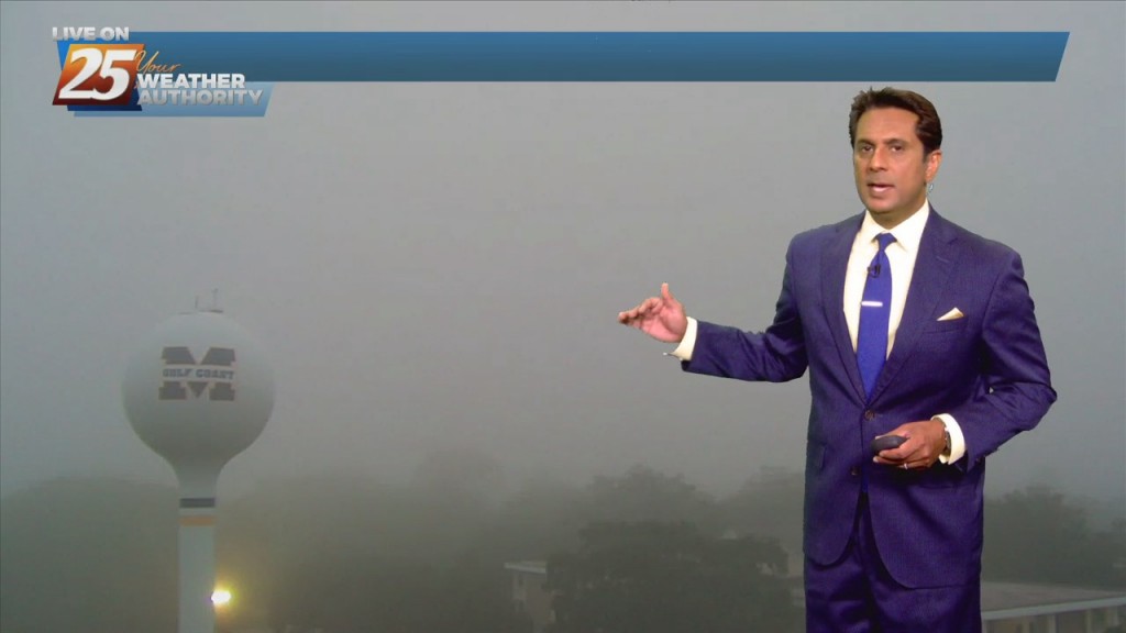
It was foggy & warmer across South Mississippi this morning as continued southerly winds ahead of a series of nearby fronts lead to more such mornings ahead.…
It was foggy & warmer across South Mississippi this morning as continued southerly winds ahead of a series of nearby fronts lead to more such mornings ahead.…
This morning brought some of the coldest weather we've seen in the last handful of weeks, with lows falling below freezing across South MS, but a warming trend…
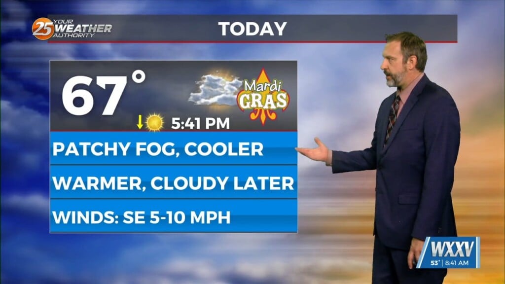
Mardi Gras 2026 is here and the weather is cooperating nicely! It might not be the prettiest out there as we wrap up carnival season today thanks…

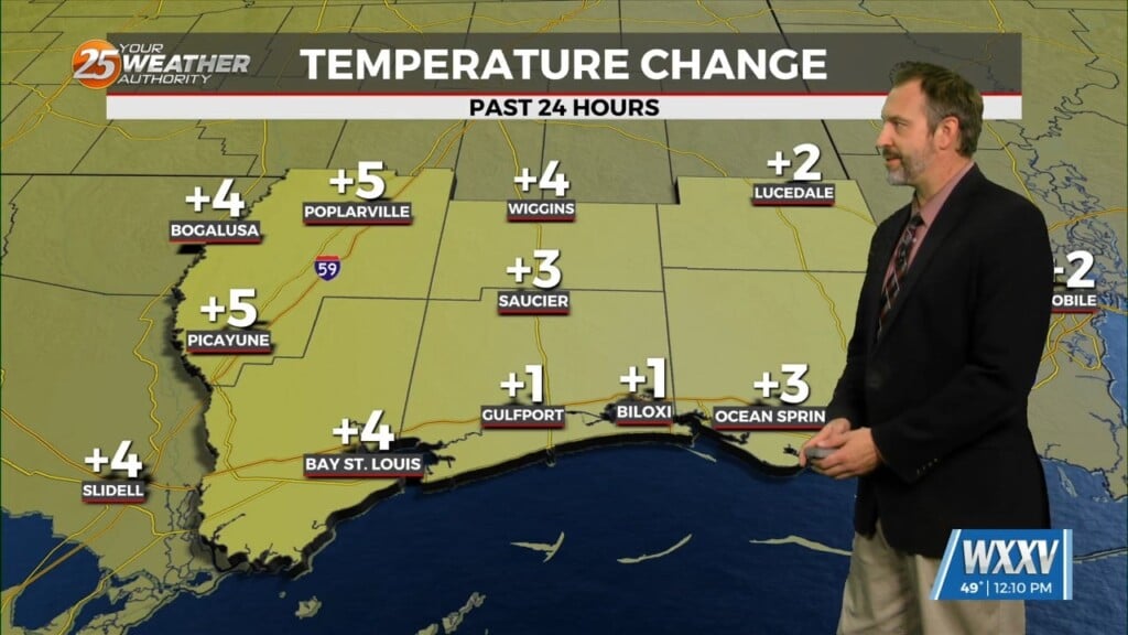
It's even warmer than yesterday and the warm, humid air is leading to foggy conditions across South Mississippi. Dense Fog developed in every coastal and inland city, with visibilities…
Old Man Winter is here in South Mississippi, despite not seeing any of the nearby winter weather we're seeing our coldest weather yet...for now. That's because another front…
There were still some frosty areas out there this morning despite a slight warm-up, but don't expect to see any more such mornings for the rest of the…
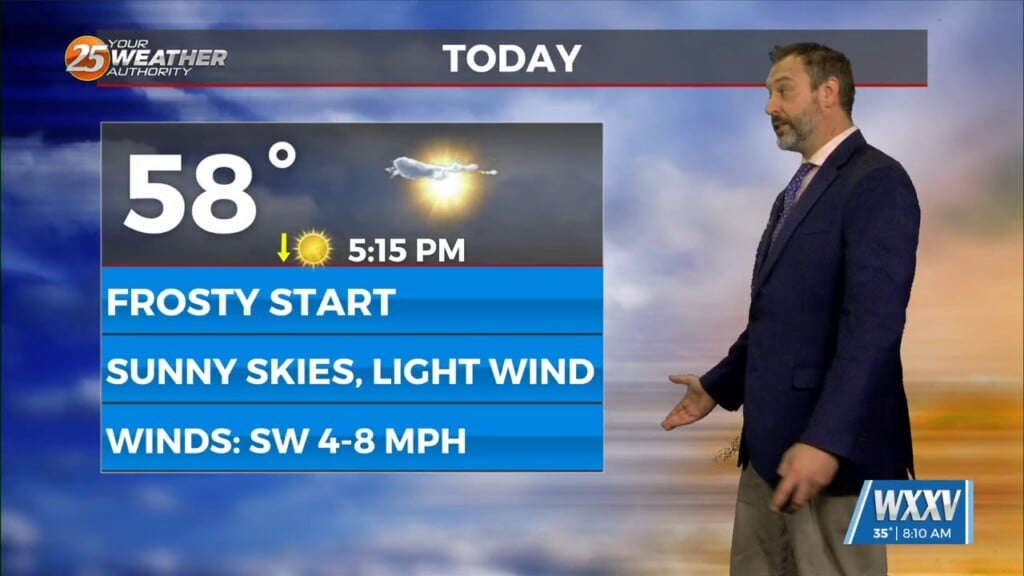
We hit the bottom of the temperature barrel we'll see with this cold front with this morning's frosty weather, but things will warm sharply over the next 24 hours.…

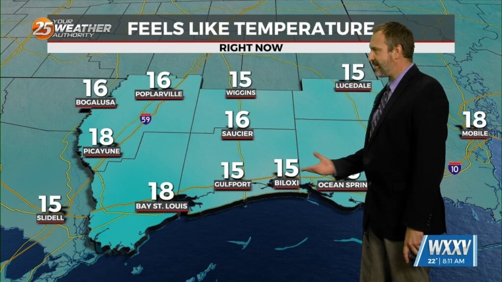
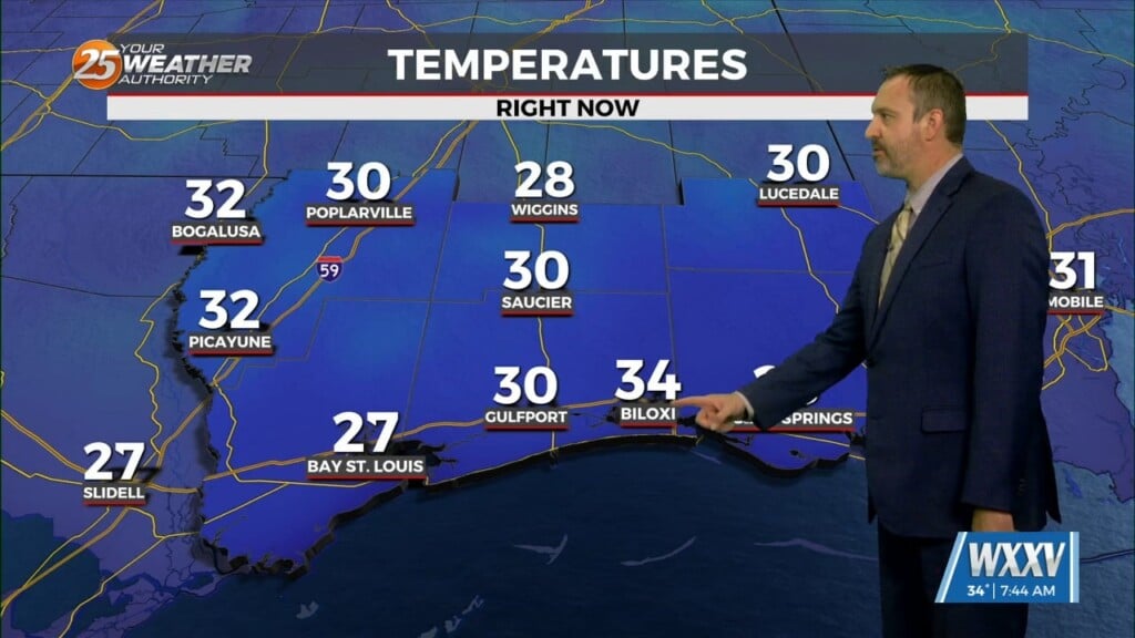
Hope you are ready for the coldest & coolest weather we'll see for the next week today! This morning fell into the mid 30s on the coastline,…
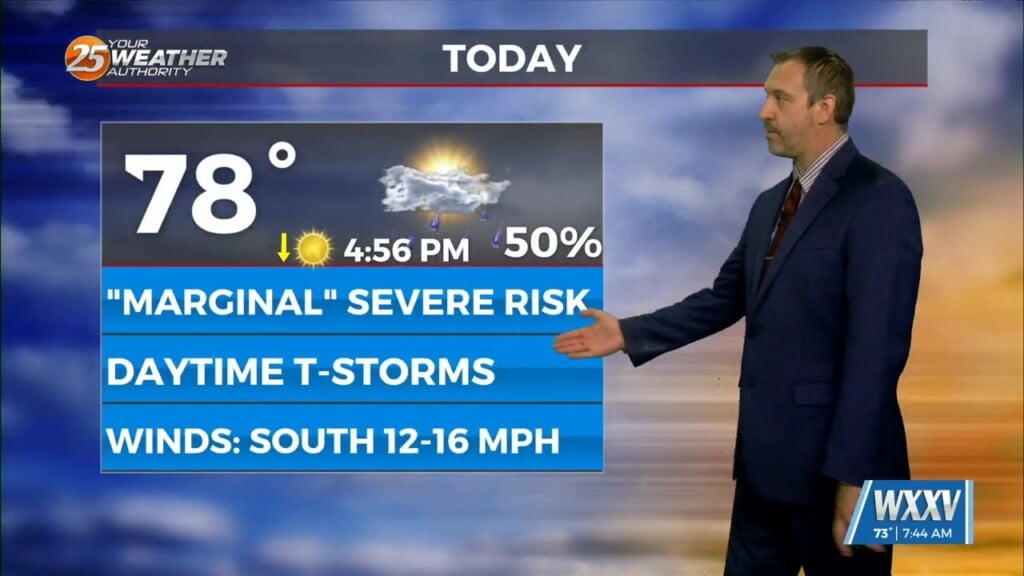
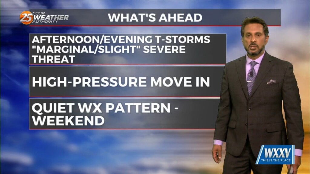
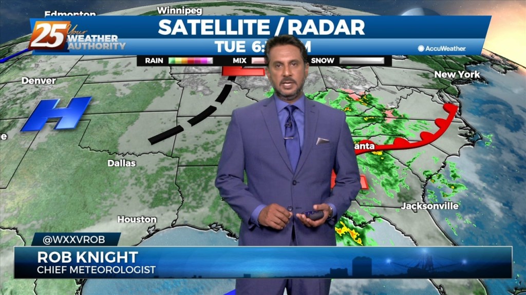
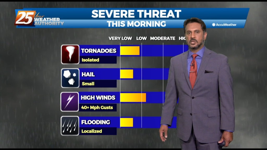
A few South Mississippi locations woke up to stormy skies, something we'll see more of as we head into the afternoon. We're currently under a "marginal" risk…
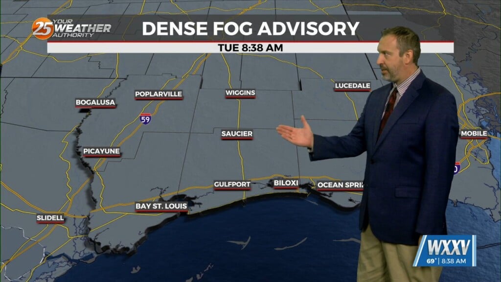
We've been on the edge of some foggy weather for the last few days, but earlier today visibility became an issue as Dense Fog formed over South…
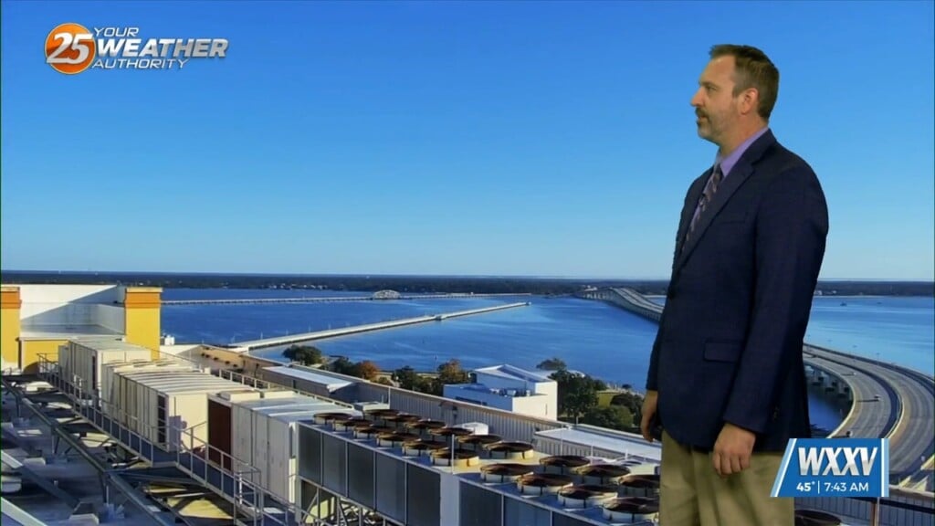
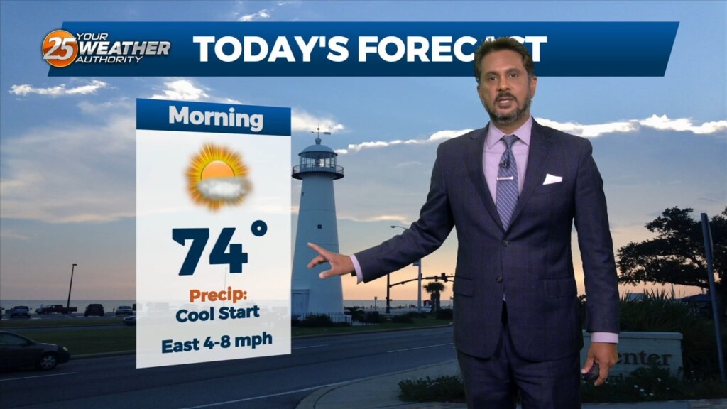
It warmed nicely out there this morning, but it's still chilly and dry in South Mississippi today. We'll warm quickly through the 50s and 60s, eventually…
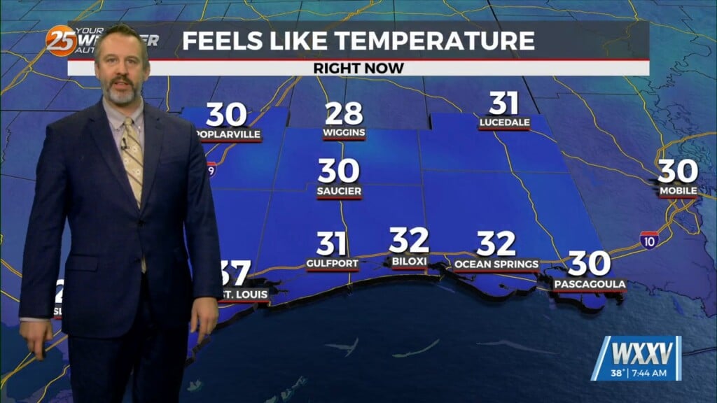
This morning was the coldest we'll get this week, and the coldest we've been since winter earlier this year! Lows in Gulfport tied the record at 28 degrees, a…
This morning's skies were off to a clear and sunny start, but cloud cover will slowly build in ahead of a potentially rainy afternoon. Not looking…
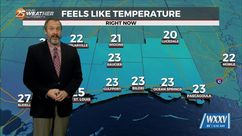
Arctic air is in place and temperatures are below freezing this morning in South Mississippi. In fact, morning lows will remain upwards of several degrees below freezing for most of…
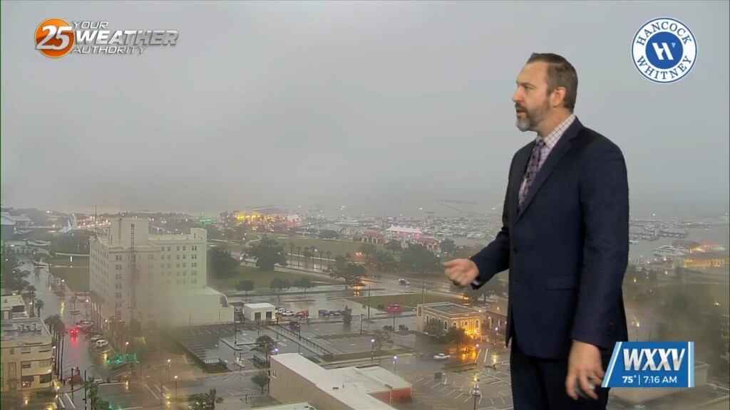
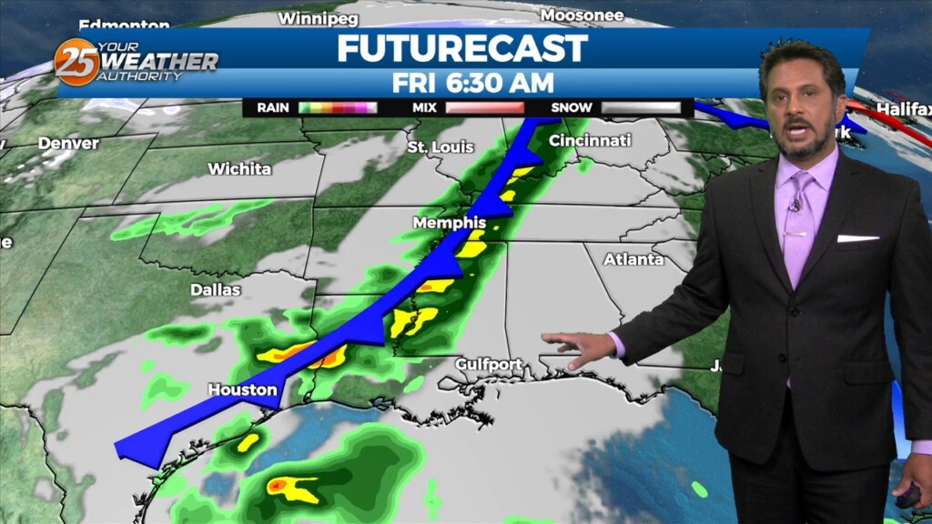
The rain started last night, but we're just now getting our heavy rain as showers and thunderstorms pop up along this morning's cold front. We're still under a level…
High pressure is moving eastward as a trough of low-pressure is progressing into the area, extending from the Great Lakes down through Texas. At…
With a disturbance over the Great Lakes, and another disturbance over the northwest, we look to stay in zonal flow for the next couple of days, keeping…
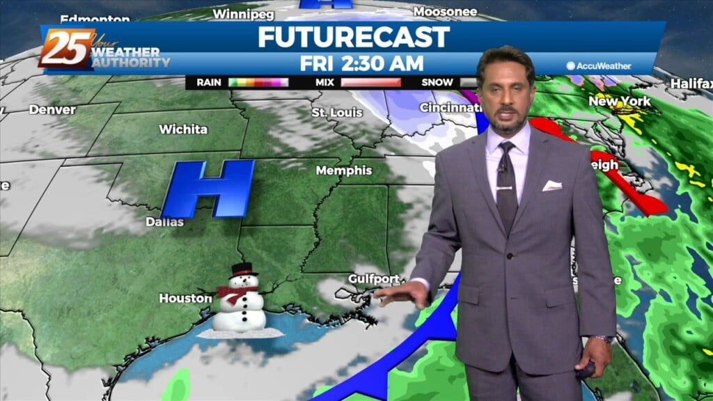
The upper troughs are located north of the Great Lakes and off the British Columbia coast this morning with high pressure over the center of the…
A warm front will lift out of the gulf and move over the area around noon today. This front will allow some showers/t-storms to develop by…
The surface low-pressure south will approach the LA coast and ride along it as it progresses eastward. This brings a second round of showers, more to…
A deepening low pressure system which moved through the area overnight is now racing east along the northern Gulf Coast early this morning. The speed of…
While isolated showers are streaming north across the local area, the activity will ramp up through midday. The upper disturbance is becoming somewhat negatively tilted early this morning,…
Today looks to remain quiet for the first half of the day but storms could begin to fire just to the west and southwest during the early…
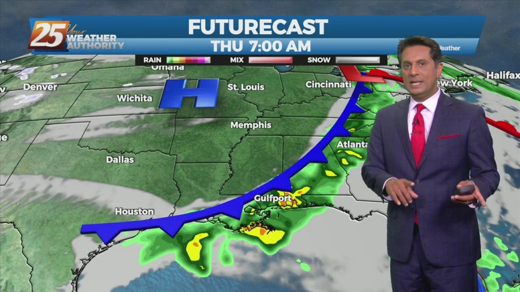
A frontal boundary will remain nearly stationary across the forecast area, while gradually dissipating. Showers and t-storms will affect the area with the potential for pockets of more heavy rainfall will exist. The Weather Prediction Center continues to outlook most…