01/18 Ryan's "Foggy" Wednesday Night Forecast
More fog ahead tonight, but we'll finally see a pattern change tomorrow. Unfortunately, it's because some strong and potentially severe storms are moving through. Details within.
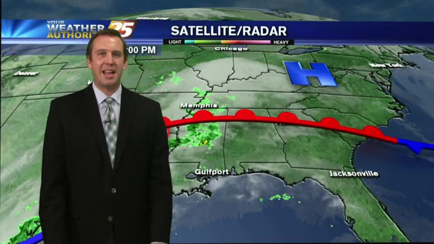
More fog ahead tonight, but we'll finally see a pattern change tomorrow. Unfortunately, it's because some strong and potentially severe storms are moving through. Details within.
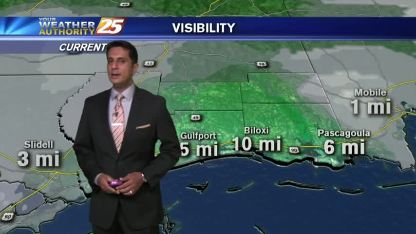
After a rainy weekend, light rain, fog and humid conditions continue for your morning commute...

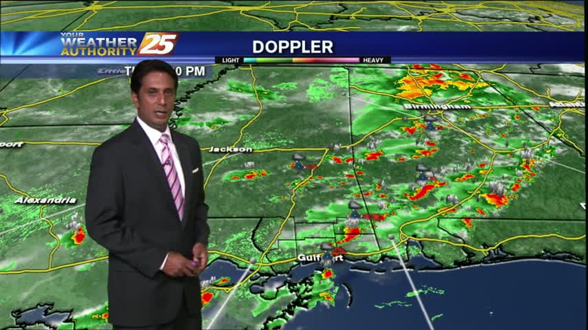
A line of INTENSE t-storms associated with a slow moving cold front will affect the viewing area this morning...
T-storms from last night continues as the energy begins to move to our east...
We started off this week rainy, but how long will it last? Look inside for details.
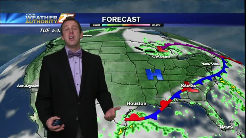
After a cloudy ending to a dry and sunny week, we're poised to see some Fall-like conditions all week long! Details inside.

Showers have been in the area since prior to sunrise, daytime heating now developing them into T-Storms...

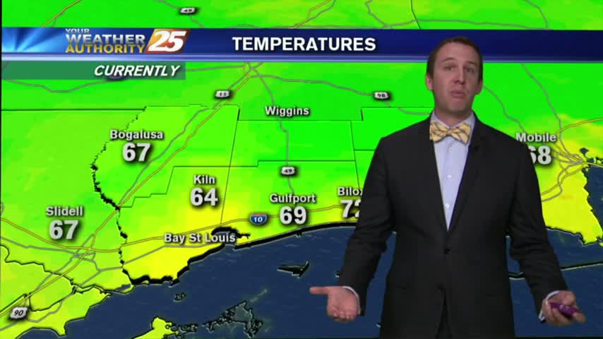
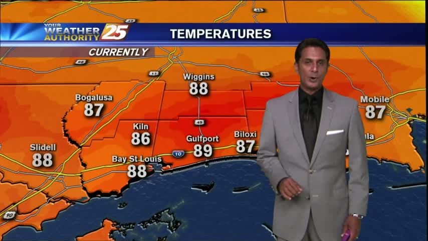
Slightly cooler start this morning as temps are in the low 70s with a pleasant NW wind, BUT hot & humid will continue...

A HOT & STEAMY day as we head into the weekend, with showers and t-storms continuing...
A humid start with isolated showers moving in from the sound has brought areas of fog...
Moisture coming in from the gulf is being heated, with a low-level deck of clouds now in the area...
After a quiet morning, showers and thunderstorms have moved into the area and will continue through this afternoon...
After a night with WARM & HUMID conditions, early morning showers and t-storms have already developed...

It's a WET start as t-storms moving in from the NE continues to develop/linger along south Mississippi...
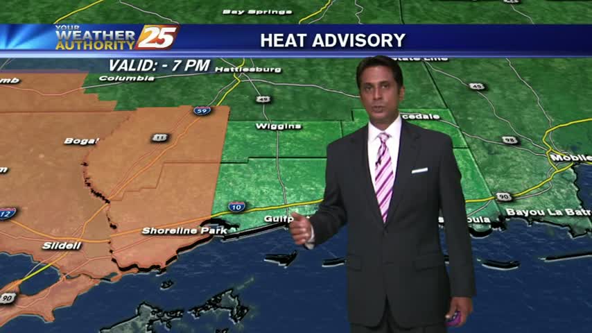
Very isolated showers along with hot and humid conditions as the HEAT INDEX climbs into the mid/upper 90s...
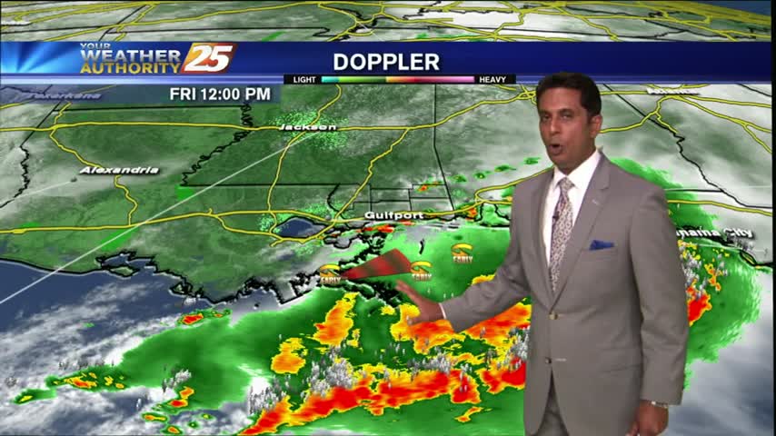
Showers & T-Storms continue as the cold front moves closer to south Mississippi...

Showers and T-Storms moving in from the west...