
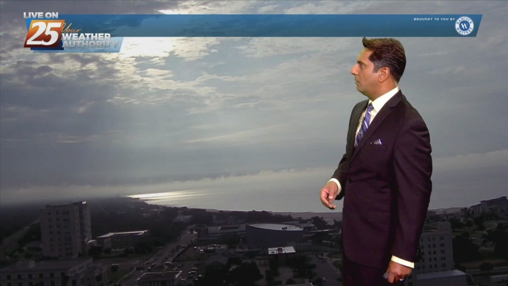
5/17 - The Chief's "Heavy Rain Potential" Wednesday Afternoon Forecast
Light westerly flow ahead of the weak surface front will favor initiation of thunderstorm activity on the eastern side of Lake Pontchartrain and coastal MS earlier…
Light westerly flow ahead of the weak surface front will favor initiation of thunderstorm activity on the eastern side of Lake Pontchartrain and coastal MS earlier…

A frontal boundary will remain nearly stationary across the forecast area, while gradually dissipating. Showers and t-storms will affect the area with the potential for pockets of more heavy rainfall will exist. The Weather Prediction Center continues to outlook most…
Now that we've broken the back of the heat wave, our concern returns to thunderstorms and heavy rain. The frontal boundary currently along the interior counties will gradually work its way southward over the sound by tonight. The potential for another…

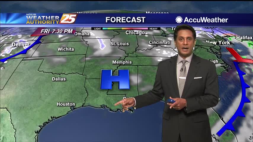
With daytime heating, afternoon showers/t-storms will affect the area with the activity diminishing around sunset. By Tuesday, the upper-level dynamics supporting showers/t-storms upstream of the zonal deep-layer flow exits towards our north, as we settle into overall weaker moisture flow.…
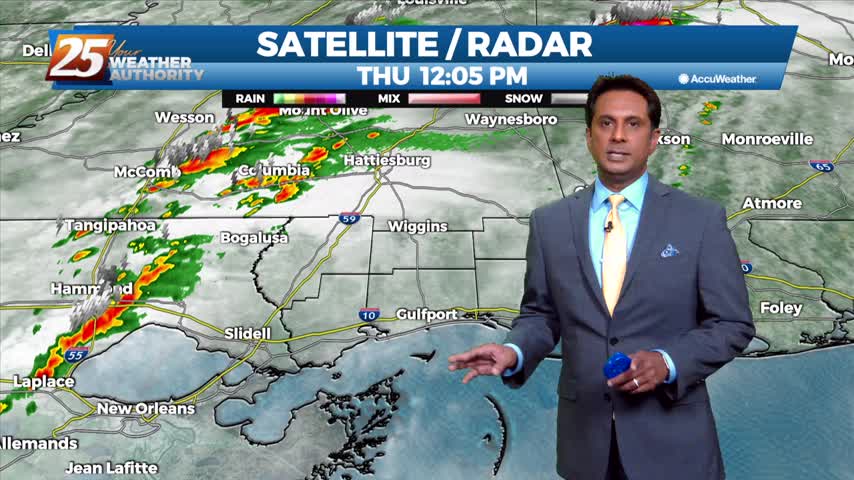
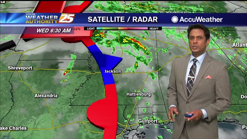
T-storms beginning to pop west of the area, moving NE...

The area has already seen heavy rainfall this morning, with more to come this afternoon...
A fairly nice start to the day with light fog and mild temperatures...
Hot and humid conditions this afternoon with t-storms from the west moving in...
Ares of patchy fog this morning then another round of showers and t-storms...
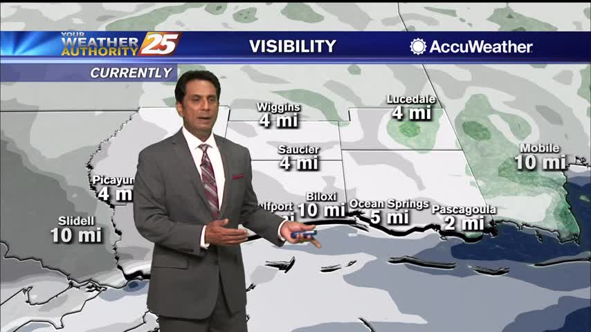
Another wet start to the day with t-storms and rain along with areas of DENSE fog...
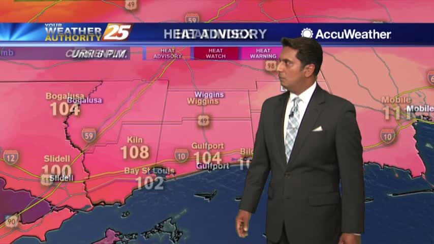
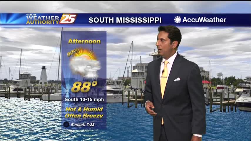
As the mercury climbs into the low 90s, the HEAT INDEX makes it feel so much hotter....

It's a cloudy start this morning as a cold front will move through south Mississippi later today...

After a SOGGY morning, the activity has taper-offed but will flare back up this afternoon...